close
-
Layers w
- Weather Layers
- Pro
- Pro
- Pro
- Pro
- Pro
- Pro
- More Layers
- Pro
- Pro
- Pro
- Pro
-
Upgrade to

3D
Trail Conditions
- Unknown
- Snow Groomed
- Snow Packed
- Snow Covered
- Snow Cover Partial
- Freeze/thaw Cycle
- Icy
- Prevalent Mud
- Wet
- Variable
- Ideal
- Dry
- Very Dry
Trail Flow (Ridden Direction)
Trailforks scans users ridelogs to determine the most popular direction each trail is ridden. A good flowing trail network will have most trails flowing in a single direction according to their intension.
The colour categories are based on what percentage of riders are riding a trail in its intended direction.
The colour categories are based on what percentage of riders are riding a trail in its intended direction.
- > 96%
- > 90%
- > 80%
- > 70%
- > 50%
- < 50%
- bi-directional trail
- no data
Trail Last Ridden
Trailforks scans ridelogs to determine the last time a trail was ridden.
- < 2 days
- < 1 week
- < 2 weeks
- < 1 month
- < 6 months
- > 6 months
Trail Ridden Direction
The intended direction a trail should be ridden.
- Downhill Only
- Downhill Primary
- Both Directions
- Uphill Primary
- Uphill Only
- One Direction
Contribute Details
Colors indicate trail is missing specified detail.
- Description
- Photos
- Description & Photos
- Videos
Trail Popularity ?
Trailforks scans ridelogs to determine which trails are ridden the most in the last 9 months.
Trails are compared with nearby trails in the same city region with a possible 25 colour shades.
Think of this as a heatmap, more rides = more kinetic energy = warmer colors.
- most popular
- popular
- less popular
- not popular
ATV/ORV/OHV Filter
Max Vehicle Width
inches
US Cell Coverage
Legend

Radar Time
Activity Recordings
Trailforks uses anonymized public activity data.
?
Activity Recordings
Trailforks uses anonymized public activity data.
?
Personal Heatmap
▶
Activity Types
all
/
none
▶
Options
2
Date range
month
–
Winter Trails
Warning
A routing network for winter maps does not exist. Selecting trails using the winter trails layer has been disabled.
Missing Trails
Most Popular
Least Popular
Trails are colored based on popularity. The more popular a trail is, the more red. Less popular trails trend towards green.
Jump Magnitude Heatmap
Heatmap of where riders jump on trails. Zoom in to see individual jumps, click circles to view jump details.
BC Backroad Status
![map legend]()
Service Road Atlas is a free to use, community-driven service for viewing and creating reports on the numerous back-country service roads around B.C. and Alberta.

Slope Aspect
Direction the slope faces
Trails Deemphasized
Trails are shown in grey.
Only show trails with no bike usage.
Suggested Layers
Based on selected activity type
Save the current map location and zoom level as your default home location whenever this page is loaded.
SaveThis region is Unsanctioned, Ride at your own Risk!
No description for Liberec has been added yet! Login or register to submit one.This region uses the Uk/Euro style trail grading system.
Activities Click to view
- Mountain Bike
16 trails
- E-Bike
1 trails
- Gravel Bike
0 trails
- Adaptive Bike
0 trails
- Winter Fat Bike
0 trails
- Hike
11 trails
- Trail Running
11 trails
- Downhill Ski
0 trails
- Nordic Ski
0 trails
Region Details
- 2
- 9
- 3
- 2
Region Status
Open as of 2 daysStats
- Avg Trail Rating
- Trails (view details)
- 17
- Trails Mountain Bike
- 16
- Trails E-Bike
- 1
- Trails Hike
- 11
- Trails Trail Running
- 11
- Total Distance
- 40 miles
- Total Descent
- 7,165 ft
- Total Vertical
- 1,462 ft
- Highest Trailhead
- 2,878 ft
- Reports
- 502
- Photos
- 99
- Ridden Counter
- 12,252
Sub Regions
-
Bikepark Ještěd
- 2
- 1
-
Singltrek Pod Smrkem
- 7
- 2
-
Žulový vrch
Popular Liberec Mountain Biking Trails
• 90 ★ 4.0 • 2 miles • 198 ft • 1,242 •
Popular green difficulty mixed. This mountain bike primary trail can be used one direction and has a easy overall physical rating with a 198 ft green climb. On average it takes 28 minutes to complete this trail.
• 85 ★ 4.2 • 4 miles • 680 ft • 1,188 •
Highly rated popular green difficulty mixed. This mountain bike primary trail can be used one direction. On average it takes 49 minutes to complete this trail.
• 90 ★ 4.9 • 7 miles • 988 ft • 1,164 •
Highly rated popular green difficulty machine groomed. This mountain bike primary trail can be used one direction. It features drop. On average it takes 1 hour6 minutes to complete this trail.
• 95 ★ 4.9 • 5,190 ft • 53 ft • 1,156 •
Easy, flowy and actionfull trail with little jumps and stuntable doubles!
• 75 ★ 4.7 • 2 miles • 287 ft • 1,044 •
Highly rated popular blue difficulty singletrack. This mountain bike primary trail can be used one direction. Trail visibility is always easy to follow. On average it takes 13 minutes to complete this trail.
• 65 ★ 4.7 • 2 miles • 103 ft • 953 •
Highly rated moderately popular green difficulty singletrack. This mountain bike primary trail can be used one direction. Trail visibility is always easy to follow. On average it takes 18 minutes to complete this trail.
• 70 ★ 3.8 • 6 miles • 431 ft • 760 •
Popular green difficulty singletrack. This mountain bike primary trail can be used one direction. On average it takes 46 minutes to complete this trail.
• 65 ★ 3.4 • 4 miles • 332 ft • 566 •
Moderately popular green difficulty singletrack. This mountain bike primary trail can be used one direction. On average it takes 37 minutes to complete this trail.
Liberec Mountain Bike Routes
★ 4.0 • 34 miles • 3,221 ft • 0 • Loop •
Dieses ausgeklügelte Netz von Wanderwegen (kreiert in Kooperation mit Daffyd Davis, einem der...
• 29 miles • 5,031 ft • 9 •
• 9 miles • 3,724 ft • 0 •
• 23 miles • 4,419 ft • 7 •
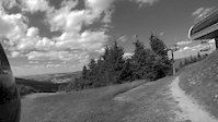
Photos of Liberec Mountain Bike
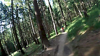
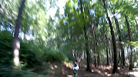
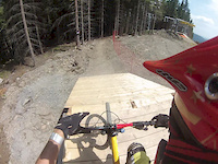
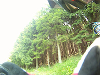
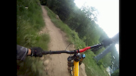
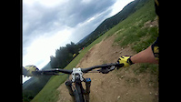
Videos of Liberec Mountain Bike
trail: La Spaghetta
5:11 |
96 |
Jul 11, 2016
trail: Libverdská Strana
3:34 |
206 |
Jun 26, 2016
trail: Libverdská Strana
3:41 |
168 |
Jun 26, 2016
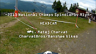
trail: El Masacre Downhill
3:53 |
397 |
Jul 16, 2013
trail: El Masacre Downhill
3:14 |
379 |
Jul 8, 2013
trail: El Masacre Downhill
2:03 |
172 |
Jul 6, 2012
trail: El Masacre Downhill
3:32 |
263 |
May 29, 2012
trail: El Masacre Downhill
3:30 |
336 |
May 28, 2012
Current Trail Warnings
| status | trail | date | condition | user | info |
|---|---|---|---|---|---|
| Okolo Měděnce | Jun 23, 2026 @ 7:30am (Europe/Prague) 2 days | Unknown | mawa | Yesterday they were cutting woods.... |
Recent Trail Reports
| status | trail | date | condition | info | user |
|---|---|---|---|---|---|
| Novoměstská Strana | Jun 6, 2026 @ 10:33am (Europe/Prague) Jun 6, 2026 | Variable | WaxOnWheels | ||
| Hejnický Hřeben | Jun 6, 2026 @ 10:33am (Europe/Prague) Jun 6, 2026 | Variable | WaxOnWheels | ||
| K Hubertce | Jun 6, 2026 @ 10:33am (Europe/Prague) Jun 6, 2026 | Variable | WaxOnWheels | ||
| Nástupní | May 22, 2026 @ 9:24am (Europe/Prague) May 22, 2026 | Ideal | Bart13 | ||
| Obora | May 22, 2026 @ 9:24am (Europe/Prague) May 22, 2026 | Ideal | Bart13 | ||
| Hřebenáč | May 22, 2026 @ 9:24am (Europe/Prague) May 22, 2026 | Ideal | Bart13 | ||
| Drtírna | May 22, 2026 @ 9:24am (Europe/Prague) May 22, 2026 | Ideal | Bart13 | ||
| Rapický Okruh | May 22, 2026 @ 9:24am (Europe/Prague) May 22, 2026 | Ideal | Bart13 | ||
| Ludvíkovský Traverz | May 21, 2026 @ 9:19am (Europe/Prague) May 21, 2026 | Ideal | Bart13 | ||
| Libverdská Strana | May 21, 2026 @ 9:19am (Europe/Prague) May 21, 2026 | Ideal | Bart13 |
Activity Feed
| username | action | type | title | date |
|---|---|---|---|---|
| mawa | add | report | activity #97605948 | Jun 22, 2026 @ 10:30pm 2 days |
| MichapQXRJ7 | wishlist | route | activity #97550812 | Jun 22, 2026 @ 3:14am Jun 22, 2026 |
| WaxOnWheels | add | report | activity #96522665 and 2 more | Jun 7, 2026 @ 11:11pm Jun 7, 2026 |
| ViktoriePc6pZB | wishlist | trail | activity #96061950 | Jun 1, 2026 @ 9:36pm Jun 1, 2026 |
| Pia-Olym | ridden | trail | activity #95557448 and 9 more | May 26, 2026 @ 5:20am May 26, 2026 |
Recent Comments
| username | type | title | comment | date |
|---|---|---|---|---|
| trail | Second downhill section is blocked by trees... | Jun 6, 2025 @ 12:42am Jun 6, 2025 | ||
| trail | Section closed on top of first climb. | Apr 19, 2025 @ 2:11am Apr 19, 2025 | ||
| trail | Zamknięte | Aug 27, 2024 @ 1:51am Aug 27, 2024 | ||
| trail | Trasa zamknięta. Niby można przejechać ale... | Aug 26, 2024 @ 12:57pm Aug 26, 2024 | ||
| trail | Wjazd na trasę zamknięty z powodu wycinek... | Aug 16, 2024 @ 9:12am Aug 16, 2024 |
Local Badges
-

10 Blue Trails184 awarded -

Epic Ride Climb 2k495 awarded -

Climbing 10k Badge95 awarded -

Climbing 100k Badge6 awarded -

Epic Ride Descent 2k669 awarded -

Descent 10k Badge108 awarded
Bike & Skill Parks
| name | type | city | rating |
|---|---|---|---|
| Bikepark Ještěd | bike park | Liberec |
Activity Type Stats
| activitytype | trails | distance | descent | descent distance | total vertical | rating | global rank | state rank | photos | reports | routes | ridelogs |
|---|---|---|---|---|---|---|---|---|---|---|---|---|
| Mountain Bike | 16 | 37 miles | 6,155 ft | 18 miles | 1,463 ft | #1,199 | #8 | 99 | 502 | 3 | 12,315 | |
| E-Bike | 1 | 2 miles | 249 ft | 5,089 ft | 213 ft | 435 | 2 | 862 | ||||
| Hike | 11 | 36 miles | 5,089 ft | 17 miles | 1,263 ft | #1,820 | #11 | 492 | 504 | |||
| Trail Running | 11 | 36 miles | 5,089 ft | 17 miles | 1,263 ft | #1,362 | #10 | 492 | 168 |
Frequently Asked Questions About Liberec
▼
What are the best places to ride in Liberec?
Liberec has 4 areas to explore for mountain biking. The top rated areas are:
▼
What are the highest rated mountain biking trails in Liberec?
The highest rated mountain biking trails in Liberec are:
- Hejnický Hřeben (4.7/5)
- K Hubertce (4.6/5)
- Libverdská Strana (4.5/5)
- Rapický Okruh (4.5/5)
- El Masacre Downhill (4.2/5)
▼
What is the best time of the year to ride in Liberec?
Based on ride log data, the most popular months to ride in Liberec are:
- August (86 activities)
- July (82 activities)
- September (78 activities)
▼
Where can I park to ride in Liberec?
Trails
Points of Interest
- By brenthillier
 NSMBA TRAILFORKS & contributors
 - Admins: ČeMBA, ČeMBA, ČeMBA, ČeMBA, ČeMBA, ČeMBA, ČeMBA, ČeMBA, ČeMBA, ČeMBA
- #3520 - 10,064 views
- liberec activity log | embed map of Liberec mountain bike trails | liberec mountain biking points of interest
Downloading of trail gps tracks in kml & gpx formats is enabled for Liberec.
You must login to download files.