close
-
Layers w
- Weather Layers
- Pro
- Pro
- Pro
- Pro
- Pro
- Pro
- More Layers
- Pro
- Pro
- Pro
- Pro
-
Upgrade to

3D
Trail Conditions
- Unknown
- Snow Groomed
- Snow Packed
- Snow Covered
- Snow Cover Partial
- Freeze/thaw Cycle
- Icy
- Prevalent Mud
- Wet
- Variable
- Ideal
- Dry
- Very Dry
Trail Flow (Ridden Direction)
Trailforks scans users ridelogs to determine the most popular direction each trail is ridden. A good flowing trail network will have most trails flowing in a single direction according to their intension.
The colour categories are based on what percentage of riders are riding a trail in its intended direction.
The colour categories are based on what percentage of riders are riding a trail in its intended direction.
- > 96%
- > 90%
- > 80%
- > 70%
- > 50%
- < 50%
- bi-directional trail
- no data
Trail Last Ridden
Trailforks scans ridelogs to determine the last time a trail was ridden.
- < 2 days
- < 1 week
- < 2 weeks
- < 1 month
- < 6 months
- > 6 months
Trail Ridden Direction
The intended direction a trail should be ridden.
- Downhill Only
- Downhill Primary
- Both Directions
- Uphill Primary
- Uphill Only
- One Direction
Contribute Details
Colors indicate trail is missing specified detail.
- Description
- Photos
- Description & Photos
- Videos
Trail Popularity ?
Trailforks scans ridelogs to determine which trails are ridden the most in the last 9 months.
Trails are compared with nearby trails in the same city region with a possible 25 colour shades.
Think of this as a heatmap, more rides = more kinetic energy = warmer colors.
- most popular
- popular
- less popular
- not popular
ATV/ORV/OHV Filter
Max Vehicle Width
inches
US Cell Coverage
Legend

Radar Time
Activity Recordings
Trailforks uses anonymized public activity data.
?
Activity Recordings
Trailforks uses anonymized public activity data.
?
Personal Heatmap
▶
Activity Types
all
/
none
▶
Options
2
Date range
month
–
Winter Trails
Warning
A routing network for winter maps does not exist. Selecting trails using the winter trails layer has been disabled.
Missing Trails
Most Popular
Least Popular
Trails are colored based on popularity. The more popular a trail is, the more red. Less popular trails trend towards green.
Jump Magnitude Heatmap
Heatmap of where riders jump on trails. Zoom in to see individual jumps, click circles to view jump details.
BC Backroad Status
![map legend]()
Service Road Atlas is a free to use, community-driven service for viewing and creating reports on the numerous back-country service roads around B.C. and Alberta.

Slope Aspect
Direction the slope faces
Trails Deemphasized
Trails are shown in grey.
Only show trails with no bike usage.
Suggested Layers
Based on selected activity type
Save the current map location and zoom level as your default home location whenever this page is loaded.
SaveThe Lifecycle Trust is a registered charity mountain bike specific outdoor centre between Balfron and Drymen with around 5km of mountain bike trails and skills area.
The Trust works with a wide variety of schools and charity organisations with a focus on additional support needs or those who face challenges accessing outdoor activities.
Access by prior arrangement, for registered groups.
Email [email protected]
The Trust works with a wide variety of schools and charity organisations with a focus on additional support needs or those who face challenges accessing outdoor activities.
Access by prior arrangement, for registered groups.
Email [email protected]
source: Lifecycle Trust
Primary Trail Type: Cross-Country
Land Status: Private Property
 google parking directions
Links
This region uses the Uk/Euro style trail grading system.
Activities Click to view
- Mountain Bike
10 trails
- E-Bike
0 trails
Region Details
- 5
- 1
- 4
Region Status
Closed as of Jul 25, 2023Stats
- Global Ranking
- #14,616
- State Ranking
- #525
- Trails (view details)
- 10
- Trails Mountain Bike
- 10
- Total Distance
- 2 miles
- Total Descent Distance
- 4,449 ft
- Total Descent
- 222 ft
- Total Vertical
- 73 ft
- Highest Trailhead
- 431 ft
- Reports
- 52
- Ridden Counter
- 393
Popular Lifecycle Charitable Trust Trails
• 70 ★ 0.0 • 2,808 ft • 43 ft • 50 •
Popular blue difficulty singletrack. This mountain bike primary trail can be used one direction. On average it takes 34 minutes to complete this trail.
• 80 ★ 0.0 • 3,550 ft • 75 ft • 49 •
Popular blue difficulty singletrack. This mountain bike primary trail can be used one direction. Trail visibility is always easy to follow. On average it takes 9 minutes to complete this trail.
• 100 ★ 0.0 • 407 ft • 0 ft • 48 •
Popular proline difficulty singletrack. This mountain bike primary trail can be used one direction. On average it takes 7 minutes to complete this trail.
• 90 ★ 0.0 • 1,273 ft • 47 ft • 45 •
Popular blue difficulty singletrack. This mountain bike primary trail can be used one direction. On average it takes 6 minutes to complete this trail.
• 50 ★ 0.0 • 1,168 ft • 0 ft • 44 •
Moderately popular blue difficulty singletrack. This mountain bike primary trail can be used one direction. On average it takes 3 minutes to complete this trail.
• 60 ★ 0.0 • 358 ft • 0 ft • 41 •
Moderately popular proline difficulty singletrack. This mountain bike primary trail can be used one direction. On average it takes 2 minutes to complete this trail.
• 40 ★ 0.0 • 1,890 ft • 48 ft • 37 •
Moderately popular red difficulty singletrack. This mountain bike primary trail can be used one direction. On average it takes 10 minutes to complete this trail.
• 20 ★ 0.0 • 246 ft • 5 ft • 25 •
Less popular proline difficulty singletrack. This mountain bike primary trail can be used one direction. On average it takes 9 minutes to complete this trail.
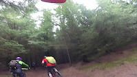
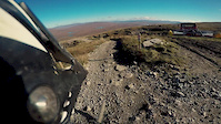
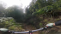
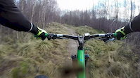
Videos of Lifecycle Charitable Trust Mountain Bike


Recent Trail Reports
no previous reports, add one now!
Activity Feed
| username | action | type | title | date |
|---|---|---|---|---|
| trailforks | add | video | activity #91280629 | Mar 25, 2026 @ 1:00pm Mar 25, 2026 |
| trailforks | add | video | activity #89157084 | Feb 18, 2026 @ 7:00pm Feb 18, 2026 |
| trailforks | add | video | activity #86804601 | Jan 7, 2026 @ 10:24am Jan 7, 2026 |
| martysavalas | update | region | activity #73377666 | Jun 8, 2025 @ 1:37pm Jun 8, 2025 |
| BenHPpHeb | wishlist | region | activity #59154422 | Sep 19, 2024 @ 3:27pm Sep 19, 2024 |
Nearby Areas
| name | distance | ||||
|---|---|---|---|---|---|
| Conic Hill | 4 | 1 | 5 km | ||
| Loch Ard Forest | 16 | 6 | 5.5 km | ||
| The Whangie | 1 | 5.8 km | |||
| Achray Forest | 13 | 20 | 8 km | ||
| Mugdock Park | 5 | 30 | 8.4 km |
Bike & Skill Parks
| name | type | city | rating |
|---|---|---|---|
| Pumptrack | skill park | Balfron Station |
Frequently Asked Questions About Lifecycle Charitable Trust
▼
What are the highest rated mountain biking trails in Lifecycle Charitable Trust?
The highest rated mountain biking trails in Lifecycle Charitable Trust are:
- Dual Slalom (0/5)
- Blue + (0/5)
- Blue (0/5)
- Blue (0/5)
- Jumps (0/5)
▼
What is the best time of the year to ride in Lifecycle Charitable Trust?
Based on ride log data, the most popular months to ride in Lifecycle Charitable Trust are:
- June (2 activities)
▼
Where can I park to ride in Lifecycle Charitable Trust?
There are 1 parking locations listed in Lifecycle Charitable Trust. The most popular parking spots are:
▼
What is the longest trail in Lifecycle Charitable Trust?
The longest trail in Lifecycle Charitable Trust is Blue at 1.1 km. View all trails sorted by distance.
- By gav-s
 & contributors
 - Admins: OTA
- #35506 - 3,541 views
- lifecycle charitable trust activity log | embed map of Lifecycle Charitable Trust mountain bike trails | lifecycle charitable trust mountain biking points of interest
Downloading of trail gps tracks in kml & gpx formats is enabled for Lifecycle Charitable Trust.
You must login to download files.