close
-
Layers w
- Weather Layers
- Pro
- Pro
- Pro
- Pro
- Pro
- Pro
- More Layers
- Pro
- Pro
- Pro
- Pro
-
Upgrade to

3D
Trail Conditions
- Unknown
- Snow Groomed
- Snow Packed
- Snow Covered
- Snow Cover Partial
- Freeze/thaw Cycle
- Icy
- Prevalent Mud
- Wet
- Variable
- Ideal
- Dry
- Very Dry
Trail Flow (Ridden Direction)
Trailforks scans users ridelogs to determine the most popular direction each trail is ridden. A good flowing trail network will have most trails flowing in a single direction according to their intension.
The colour categories are based on what percentage of riders are riding a trail in its intended direction.
The colour categories are based on what percentage of riders are riding a trail in its intended direction.
- > 96%
- > 90%
- > 80%
- > 70%
- > 50%
- < 50%
- bi-directional trail
- no data
Trail Last Ridden
Trailforks scans ridelogs to determine the last time a trail was ridden.
- < 2 days
- < 1 week
- < 2 weeks
- < 1 month
- < 6 months
- > 6 months
Trail Ridden Direction
The intended direction a trail should be ridden.
- Downhill Only
- Downhill Primary
- Both Directions
- Uphill Primary
- Uphill Only
- One Direction
Contribute Details
Colors indicate trail is missing specified detail.
- Description
- Photos
- Description & Photos
- Videos
Trail Popularity ?
Trailforks scans ridelogs to determine which trails are ridden the most in the last 9 months.
Trails are compared with nearby trails in the same city region with a possible 25 colour shades.
Think of this as a heatmap, more rides = more kinetic energy = warmer colors.
- most popular
- popular
- less popular
- not popular
ATV/ORV/OHV Filter
Max Vehicle Width
inches
US Cell Coverage
Legend

Radar Time
Activity Recordings
Trailforks uses anonymized public activity data.
?
Activity Recordings
Trailforks uses anonymized public activity data.
?
Personal Heatmap
▶
Activity Types
all
/
none
▶
Options
2
Date range
month
–
Winter Trails
Warning
A routing network for winter maps does not exist. Selecting trails using the winter trails layer has been disabled.
Missing Trails
Most Popular
Least Popular
Trails are colored based on popularity. The more popular a trail is, the more red. Less popular trails trend towards green.
Jump Magnitude Heatmap
Heatmap of where riders jump on trails. Zoom in to see individual jumps, click circles to view jump details.
BC Backroad Status
![map legend]()
Service Road Atlas is a free to use, community-driven service for viewing and creating reports on the numerous back-country service roads around B.C. and Alberta.

Slope Aspect
Direction the slope faces
Trails Deemphasized
Trails are shown in grey.
Only show trails with no bike usage.
Suggested Layers
Based on selected activity type
Save the current map location and zoom level as your default home location whenever this page is loaded.
Save
No description for Lillooet has been added yet!
Login or register to submit one.
Activities Click to view
- Mountain Bike
14 trails
- Gravel Bike
0 trails
- Adaptive Bike
0 trails
- Hike
32 trails
- Trail Running
32 trails
- Snowshoe
11 trails
Region Details
- 4
- 4
- 1
- 3
- 1
Region Status
Caution as of 3 daysStats
- Avg Trail Rating
- Trails (view details)
- 27
- Trails Mountain Bike
- 14
- Trails E-Bike
- 1
- Trails Hike
- 32
- Trails Trail Running
- 32
- Trails Snowshoe
- 11
- Trails Backcountry Ski
- 3
- Total Distance
- 76 miles
- Total Descent
- 14,353 ft
- Total Vertical
- 7,864 ft
- Highest Trailhead
- 8,525 ft
- Reports
- 50
- Photos
- 260
- Ridden Counter
- 604
Popular Lillooet Mountain Biking Trails
• 90 ★ 4.8 • 3 miles • 0 ft • 217 •
The trail has three distinct portions. The top portion (hike-a-bike access) starts at 2553m (8,376 ft.) in the alpine and descends to 1500m (4,960 ft.). The middle portion (pedal access) starts in subalpine at 1500m (4,960 ft.). The...
• 60 ★ 3.4 • 4,981 ft • 87 ft • 93 •
Pedal access only due to rock slide on the access road above 1300m. The road gets steeper but is manageable & is line with lots of nice mountain flowers. The trail is nice single track through the forest with lots of flat corners. It...
• 5 ★ 4.7 • 3 miles • 120 ft • 42 •
Loose, rocky, shaly single track descent from the top of Askom Mountain. Only the most committed riders will make it up there with their bike on their back, scrambling up loose shale. And only the most expert riders (Danny Hart sized...
• 100 ★ 0.0 • 2 miles • 80 ft • 10 •
Popular green difficulty doubletrack. This multi-use trail can be used both directions.
• 70 ★ 0.0 • 1 mile • 153 ft • 3 •
Popular green difficulty mixed. This multi-use trail can be used both directions.
• 5 ★ 0.0 • 919 ft • 94 ft • 2 •
Less popular green difficulty mixed. This multi-use trail can be used both directions.
• 5 ★ 0.0 • 1,234 ft • 4 ft • 1 •
Less popular green difficulty singletrack. This multi-use trail can be used both directions.
Lillooet Mountain Bike Routes
★ 2.5 • 98 miles • 16,578 ft • 1 •
There’s an unusually long and gentle alpine ridge making a stripe across the Camelsfoot Range – Nine...
• 10 miles • 3,493 ft • 2 •
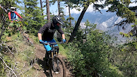
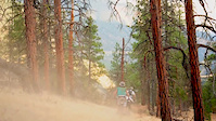
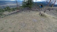
Photos of Lillooet Mountain Bike
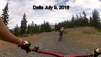
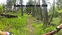
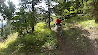
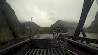
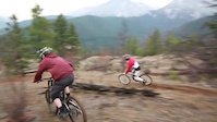
Videos of Lillooet Mountain Bike
trail: Upper Della
0:41 |
188 |
Sep 18, 2018
trail: Della Creek
2:46 |
330 |
Oct 23, 2016
trail: Della Creek
0:09 |
523 |
Sep 14, 2016
trail: Della Creek
9:03 |
501 |
Jul 11, 2016
trail: Della Creek
2:04 |
190 |
Jul 10, 2016
trail: Della Creek
0:35 |
80 |
Jul 9, 2016
trail: Della Creek
3:56 |
501 |
Apr 29, 2015
trail: Della Creek
3:30 |
1118 |
Dec 28, 2014
Recent Trail Reports
| status | trail | date | condition | info | user |
|---|---|---|---|---|---|
| Seton Ridge | Jun 16, 2026 @ 8:20am (America/Vancouver) 3 days | Variable | Caribou14 | ||
| Upper Della | Jun 16, 2026 @ 8:18am (America/Vancouver) 3 days | Dry | Caribou14 | ||
| Della Creek | Jul 23, 2025 @ 1:43pm Jul 23, 2025 | Ideal | woodsrippas | ||
| Della Creek Access | Oct 5, 2024 @ 12:01pm Oct 5, 2024 | Dry | Deanobruce | ||
| Middle Della | Sep 16, 2024 @ 4:55pm Sep 16, 2024 | Ideal | HpSauce |
Activity Feed
| username | action | type | title | date |
|---|---|---|---|---|
| Caribou14 | add | report | activity #97111939 and 1 more | Jun 16, 2026 @ 8:19am 3 days |
| JordanLJAzWv | wishlist | trail | activity #95090850 | May 19, 2026 @ 11:52pm May 19, 2026 |
| ocoatta | wishlist | region | activity #94447869 | May 10, 2026 @ 11:55am May 10, 2026 |
| bodland | wishlist | trail | activity #94446384 | May 10, 2026 @ 11:36am May 10, 2026 |
| D-lz | wishlist | trail | activity #87342274 | Jan 17, 2026 @ 8:30am Jan 17, 2026 |
Recent Comments
| username | type | title | comment | date |
|---|---|---|---|---|
| report | We rode it this weekend. 5 dogs came tearing... | Jul 14, 2025 @ 7:44am Jul 14, 2025 | ||
| report | I wanted to ebike it. Will the dogs eat me? | Dec 6, 2024 @ 11:33pm Dec 6, 2024 | ||
| trail | This is a hike or a bike ride??? All the pics... | Jul 3, 2024 @ 3:31pm Jul 3, 2024 | ||
| report | Did you happen to ride it despite the signs?... | Jul 27, 2023 @ 6:58pm Jul 27, 2023 | ||
| trail | Not sure if this is old news but there’s a... | Jun 16, 2023 @ 11:38am Jun 16, 2023 |
Local Badges
-

Epic Ride Climb 2k24 awarded -

Climbing 10k Badge1 awarded -

Climbing 100k Badge0 awarded -

Epic Ride Descent 2k48 awarded -

Descent 10k Badge2 awarded -

Descent 100k Badge0 awarded
Activity Type Stats
| activitytype | trails | distance | descent | descent distance | total vertical | rating | global rank | state rank | photos | reports | routes | ridelogs |
|---|---|---|---|---|---|---|---|---|---|---|---|---|
| Mountain Bike | 14 | 38 miles | 9,072 ft | 12 miles | 7,864 ft | #3,885 | #94 | 254 | 49 | 1 | 830 | |
| E-Bike | 1 | 26 | 33 | |||||||||
| Hike | 32 | 76 miles | 14,354 ft | 22 miles | 7,864 ft | #3,102 | #90 | 4 | 50 | 302 | ||
| Trail Running | 32 | 76 miles | 14,354 ft | 22 miles | 7,864 ft | #2,860 | #76 | 50 | 27 | |||
| Snowshoe | 11 | 24 miles | 3,038 ft | 6 miles | 5,420 ft | #600 | #48 | |||||
| Backcountry Ski | 3 | 2 miles | 243 ft | 1,365 ft | 1,467 ft | 26 |
Frequently Asked Questions About Lillooet
▼
What are the best places to ride in Lillooet?
Lillooet has 2 areas to explore for mountain biking.
▼
What are the highest rated mountain biking trails in Lillooet?
The highest rated mountain biking trails in Lillooet are:
- Della Creek (4.5/5)
- Upper Della (4.2/5)
- Seton Ridge (4.1/5)
- Middle Della (3.8/5)
- Canal Walk Trail (0/5)
▼
What is the best time of the year to ride in Lillooet?
Based on ride log data, the most popular months to ride in Lillooet are:
- June (12 activities)
- July (11 activities)
- September (9 activities)
▼
Where can I park to ride in Lillooet?
Activities
Trails
- By canadaka
 Trailforks & contributors
 - Admins: BCBR, TrailsBC, BCORMA, DSBC, wheelmaniac3, bcpunk, canadianenduro, RSTBC, LORCA
- #4777 - 23,009 views
- lillooet activity log | embed map of Lillooet mountain bike trails | lillooet mountain biking points of interest polygons
Downloading of trail gps tracks in kml & gpx formats is enabled for Lillooet.
You must login to download files.