close
-
Layers w
- Weather Layers
- Pro
- Pro
- Pro
- Pro
- Pro
- Pro
- More Layers
- Pro
- Pro
- Pro
- Pro
-
Upgrade to

3D
Trail Conditions
- Unknown
- Snow Groomed
- Snow Packed
- Snow Covered
- Snow Cover Partial
- Freeze/thaw Cycle
- Icy
- Prevalent Mud
- Wet
- Variable
- Ideal
- Dry
- Very Dry
Trail Flow (Ridden Direction)
Trailforks scans users ridelogs to determine the most popular direction each trail is ridden. A good flowing trail network will have most trails flowing in a single direction according to their intension.
The colour categories are based on what percentage of riders are riding a trail in its intended direction.
The colour categories are based on what percentage of riders are riding a trail in its intended direction.
- > 96%
- > 90%
- > 80%
- > 70%
- > 50%
- < 50%
- bi-directional trail
- no data
Trail Last Ridden
Trailforks scans ridelogs to determine the last time a trail was ridden.
- < 2 days
- < 1 week
- < 2 weeks
- < 1 month
- < 6 months
- > 6 months
Trail Ridden Direction
The intended direction a trail should be ridden.
- Downhill Only
- Downhill Primary
- Both Directions
- Uphill Primary
- Uphill Only
- One Direction
Contribute Details
Colors indicate trail is missing specified detail.
- Description
- Photos
- Description & Photos
- Videos
Trail Popularity ?
Trailforks scans ridelogs to determine which trails are ridden the most in the last 9 months.
Trails are compared with nearby trails in the same city region with a possible 25 colour shades.
Think of this as a heatmap, more rides = more kinetic energy = warmer colors.
- most popular
- popular
- less popular
- not popular
ATV/ORV/OHV Filter
Max Vehicle Width
inches
US Cell Coverage
Legend

Radar Time
Activity Recordings
Trailforks uses anonymized public activity data.
?
Activity Recordings
Trailforks uses anonymized public activity data.
?
Personal Heatmap
▶
Activity Types
all
/
none
▶
Options
2
Date range
month
–
Winter Trails
Warning
A routing network for winter maps does not exist. Selecting trails using the winter trails layer has been disabled.
Missing Trails
Most Popular
Least Popular
Trails are colored based on popularity. The more popular a trail is, the more red. Less popular trails trend towards green.
Jump Magnitude Heatmap
Heatmap of where riders jump on trails. Zoom in to see individual jumps, click circles to view jump details.
BC Backroad Status
![map legend]()
Service Road Atlas is a free to use, community-driven service for viewing and creating reports on the numerous back-country service roads around B.C. and Alberta.

Slope Aspect
Direction the slope faces
Trails Deemphasized
Trails are shown in grey.
Only show trails with no bike usage.
Suggested Layers
Based on selected activity type
Save the current map location and zoom level as your default home location whenever this page is loaded.
Save
No description for Limburg has been added yet!
Login or register to submit one.
Stats
- Avg Trail Rating
- Trails (view details)
- 83
- Trails Mountain Bike
- 90
- Trails E-Bike
- 34
- Trails Hike
- 58
- Trails Trail Running
- 59
- Total Distance
- 57 miles
- Total Descent
- 7,030 ft
- Total Vertical
- 694 ft
- Highest Trailhead
- 715 ft
- Reports
- 640
- Photos
- 134
- Ridden Counter
- 9,772
Sub Regions
- Afferden (7)
- Broedersbos (6)
- Daniken (1)
- Eijsden (2)
- Epen (1)
- Horst (5)
- Landgraaf (5)
- Maastricht (10)
- Meerssen (8)
- Meijel (2)
- Montfort Roerdalen (9)
- Mook (10)
- Bikepark Mook (6)
- Nuth (1)
- Overloon (3)
- Sittard (2)
- Spaubeek (4)
- Swolgen (2)
- Valkenburg (2)
- Venray (1)
- Waterop (2)
Popular Limburg Mountain Biking Trails
• 95 ★ 3.8 • 1,260 ft • 0 ft • 600 •
. Easy line with berms, rollers, and small tabletops.
• 65 ★ 4.4 • 853 ft • 0 ft • 595 •
don't forget to brake when you're down at the bottom
• 85 ★ 4.7 • 1,102 ft • 0 ft • 590 •
with small tables, rollers, and berms in thge beginning, and two bigger tables and berms in the last section, ending with a nice stepup jump and a smooth wooden drop off if desired. All jumps are rollable for beginners.
• 100 ★ 3.5 • 3,026 ft • 0 ft • 376 •
Really fun descent, lots of rocks. Gravel and rocks make it really tricky. Rideable with a hardtail but i prefer a fully for the comfort. Pedastrians and horseriders can also use this path so adjust your speed to them. Part of the...
• 100 ★ 4.5 • 978 ft • 0 ft • 362 •
Mook's black line starts out with two small tables, then a small gap jump followed by a set of rollers, then onto a platform where the line splits. Right goes into a wooden banana followed by a berm and a rockgarden. Left contains two...
• 100 ★ 3.6 • 5 miles • 391 ft • 323 •
Easy Xc track Brunssumer Heide with options to other local trails at the START of the trail (way goes left and right) AND END of the trail!
• ★ 5.0 • 2 miles • 206 ft • 314 •
Connection trail Eijkhagen van/naar snowworld / brunssumer heide. Flowy trail met technische klimmen en leuke downhills. Laatste stuk bevat kleine (niet noodzakelijke) roadgap/ wat sprongetjes. 90% single track free of use. Made and...
• 80 ★ 4.0 • 4,067 ft • 60 ft • 309 •
Connection trail to Brunssummer Heide. Easy sandy trail with several decents and one climb.
Limburg Mountain Bike Routes
★ 4.0 • 13 miles • 1,136 ft • 2 • Loop •
Mixed Trails,inclines,downhill sections, roots,stones,wooden elements
16 miles • 1,656 ft • 1 • Loop •
Gulpen is a small city in the Netherlands. There is a pool, a brewery and a hotel. The surrounding...
46 miles • 3,266 ft • 4 •
This combined consist of the 5 seperate Parkstad routes: 1. Parkstad Landgraaf - Strijthagen 2. Parkstad...
46 miles • 3,266 ft • 4 •
This combined route consists of the 5 seperate Parkstad MTB-Routes: 1. Parkstad Landgraaf - Strijthagen 2....
★ 4.5 • 7 miles • 388 ft • 0 • Loop •
Rode Beek, 10.9 kilometers, 150 vertical meters This route runs through the river basin of the Roode Beek,...
★ 5.0 • 12 miles • 450 ft • 0 • Loop •
You can start the mountain bike route Montfort at parking lot 't Sweeltje. You are then immediately on the...
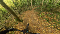
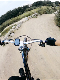
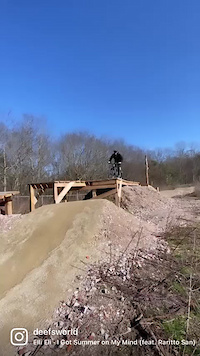
Photos of Limburg Mountain Bike
Videos of Limburg Mountain Bike
trail: Covid
2:29 |
49 |
Nov 2, 2025
trail: Bikepark Mook Black Line
0:18 |
91 |
Jul 22, 2024
trail: Bikepark Mook Black Line
0:13 |
586 |
Feb 24, 2022
youtuber
![De meest Uitdagende MTB route van Nederland //...]()

trail: Watersley Sittard
5:13 |
97 |
Nov 23, 2025 , Sittard
youtuber
![Een nieuwe rollercoaster trail in Limburg //...]()
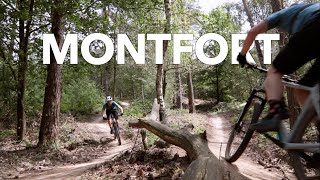
trail: XC Lap Montfort
7:39 |
128 |
Nov 23, 2025 , Montfort Roerdalen
trail: Ham
14:32 |
243 |
Nov 13, 2011
youtuber
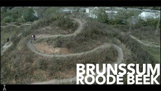
![MTB Challenge // Roode beek // Brunssum]()
trail: Hendriks Park Trail
6:57 |
162 |
Jan 2, 2024 , Brunssum
youtuber
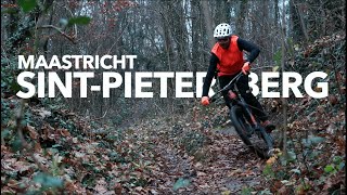
![MTB Challenge // Sint-Pietersberg]()
trail: Rondje D'n Observant
6:36 |
219 |
Jan 2, 2024 , Maastricht
Recent Trail Reports
Activity Feed
| username | action | type | title | date |
|---|---|---|---|---|
| rakker | difficultyvote | trail | activity #96171748 | Jun 3, 2026 @ 11:55am Jun 3, 2026 |
| AlexDownhill92 | wishlist | region | activity #96162286 | Jun 3, 2026 @ 9:44am Jun 3, 2026 |
| kroontje81 | checkin | trail | activity #96003698 | Jun 1, 2026 @ 1:15am Jun 1, 2026 |
| kroontje81 | add | report | activity #95386319 | May 24, 2026 @ 2:03am May 24, 2026 |
| kroontje81 | add | report | activity #95260184 | May 22, 2026 @ 12:14pm May 22, 2026 |
Recent Comments
| username | type | title | comment | date |
|---|---|---|---|---|
| trail | It is not a XC track, it more all mountain,... | Jan 21, 2026 @ 10:18am Jan 21, 2026 | ||
| trail | C’est la Covid 😉, Corona c’est... | Mar 27, 2025 @ 12:06am Mar 27, 2025 | ||
| trail | The name of the trail is "Corona". :) | Jul 5, 2024 @ 3:12pm Jul 5, 2024 | ||
| report | This was cleared within a few days. We ride... | Sep 1, 2023 @ 10:33am Sep 1, 2023 | ||
| trail | Dikke boom over pas bij afdaling | Aug 5, 2023 @ 3:48am Aug 5, 2023 |
Bike & Skill Parks
| name | type | city | rating |
|---|---|---|---|
| Bikepark Mook | skill park | mook | |
| Skill Park Landgraaf | skill park | Landgraaf | |
| Landgraaf motocross | skill park | Landgraaf | |
| Venlo motocross | skill park | Swolgen | |
| Boxmeer-Haps motocross | skill park | Overloon |
Local Trail Supporters
- Mtb club Discovery
- mountainbike club Discovery
Activity Type Stats
| activitytype | trails | distance | descent | descent distance | total vertical | rating | global rank | state rank | photos | reports | routes | ridelogs |
|---|---|---|---|---|---|---|---|---|---|---|---|---|
| Mountain Bike | 90 | 57 miles | 7,031 ft | 23 miles | 692 ft | 130 | 640 | 32 | 53,815 | |||
| E-Bike | 34 | 27 miles | 3,307 ft | 12 miles | 692 ft | 593 | 5 | 2,866 | ||||
| Hike | 58 | 39 miles | 5,249 ft | 15 miles | 620 ft | 620 | 1,092 | |||||
| Trail Running | 59 | 39 miles | 5,249 ft | 15 miles | 620 ft | 620 | 902 |
Activities
Trails
Points of Interest
- By brenthillier
 NSMBA TRAILFORKS & contributors
 - Admins: apply
- #10813 - 8,464 views
- limburg activity log | embed map of Limburg mountain bike trails | limburg mountain biking points of interest
Downloading of trail gps tracks in kml & gpx formats is enabled for Limburg.
You must login to download files.