close
-
Layers w
- Weather Layers
- Pro
- Pro
- Pro
- Pro
- Pro
- Pro
- More Layers
- Pro
- Pro
- Pro
- Pro
-
Upgrade to

3D
Trail Conditions
- Unknown
- Snow Groomed
- Snow Packed
- Snow Covered
- Snow Cover Partial
- Freeze/thaw Cycle
- Icy
- Prevalent Mud
- Wet
- Variable
- Ideal
- Dry
- Very Dry
Trail Flow (Ridden Direction)
Trailforks scans users ridelogs to determine the most popular direction each trail is ridden. A good flowing trail network will have most trails flowing in a single direction according to their intension.
The colour categories are based on what percentage of riders are riding a trail in its intended direction.
The colour categories are based on what percentage of riders are riding a trail in its intended direction.
- > 96%
- > 90%
- > 80%
- > 70%
- > 50%
- < 50%
- bi-directional trail
- no data
Trail Last Ridden
Trailforks scans ridelogs to determine the last time a trail was ridden.
- < 2 days
- < 1 week
- < 2 weeks
- < 1 month
- < 6 months
- > 6 months
Trail Ridden Direction
The intended direction a trail should be ridden.
- Downhill Only
- Downhill Primary
- Both Directions
- Uphill Primary
- Uphill Only
- One Direction
Contribute Details
Colors indicate trail is missing specified detail.
- Description
- Photos
- Description & Photos
- Videos
Trail Popularity ?
Trailforks scans ridelogs to determine which trails are ridden the most in the last 9 months.
Trails are compared with nearby trails in the same city region with a possible 25 colour shades.
Think of this as a heatmap, more rides = more kinetic energy = warmer colors.
- most popular
- popular
- less popular
- not popular
ATV/ORV/OHV Filter
Max Vehicle Width
inches
US Cell Coverage
Legend

Radar Time
Activity Recordings
Trailforks uses anonymized public activity data.
?
Activity Recordings
Trailforks uses anonymized public activity data.
?
Personal Heatmap
▶
Activity Types
all
/
none
▶
Options
2
Date range
month
–
Winter Trails
Warning
A routing network for winter maps does not exist. Selecting trails using the winter trails layer has been disabled.
Missing Trails
Most Popular
Least Popular
Trails are colored based on popularity. The more popular a trail is, the more red. Less popular trails trend towards green.
Jump Magnitude Heatmap
Heatmap of where riders jump on trails. Zoom in to see individual jumps, click circles to view jump details.
BC Backroad Status
![map legend]()
Service Road Atlas is a free to use, community-driven service for viewing and creating reports on the numerous back-country service roads around B.C. and Alberta.

Slope Aspect
Direction the slope faces
Trails Deemphasized
Trails are shown in grey.
Only show trails with no bike usage.
Suggested Layers
Based on selected activity type
Save the current map location and zoom level as your default home location whenever this page is loaded.
Save
No description for Litchfield has been added yet!
Login or register to submit one.
Activities Click to view
- Mountain Bike
17 trails
- E-Bike
5 trails
- Horse
4 trails
- Hike
23 trails
- Trail Running
21 trails
Region Details
- 3
- 3
- 8
- 3
Region Status
Open as of May 30, 2026Stats
- Avg Trail Rating
- Trails (view details)
- 23
- Trails Mountain Bike
- 17
- Trails E-Bike
- 5
- Trails Horse
- 4
- Trails Hike
- 23
- Trails Trail Running
- 21
- Total Distance
- 10 miles
- Total Descent Distance
- 3 miles
- Total Descent
- 897 ft
- Total Vertical
- 117 ft
- Highest Trailhead
- 693 ft
- Reports
- 46
- Photos
- 33
- Ridden Counter
- 867
Sub Regions
-
Lake Lou Yaeger Recreation Area
- 3
- 8
- 3
Popular Litchfield Mountain Biking Trails
• 55 ★ 4.0 • 2,703 ft • 96 ft • 75 •
New Mexico Trail is part of the Route 66 Hike and Bike trail system. is rated as easy difficulty. The Litchfield, tourism trail map also indicates the trail difficulty rating as easy. The Lake Lou Yaeger trail map PDF can be found here:...
• 65 ★ 4.2 • 1,207 ft • 6 ft • 74 •
Missouri trail is rated hard and is part of a loop that circles back to the Missouri, Kansas, Oklahoma, Texas trail. The Litchfield tourism trail map shows this as intermediate difficult. The trail map is located here:...
• 60 ★ 4.2 • 2,005 ft • 39 ft • 73 •
is an out and back to return to the main trail system. According to the Litchfield, tourism trail map, this is rated as Intermediate. The trail map can be found online at:...
• 100 ★ 4.0 • 886 ft • 17 ft • 73 •
is rated intermediate and is part of a loop that circles back to the , , , . The Litchfield tourism trail map shows this as intermediate. The trail map is located here:...
• 95 ★ 4.0 • 840 ft • 0 ft • 71 •
Kansas trail is rated hard and is part of a loop that circles back to the Missouri, Kansas, Oklahoma, Texas trail. The Litchfield tourism trail map shows this as Intermediate difficult. The trail map is located here:...
• 80 ★ 4.0 • 1,319 ft • 21 ft • 70 •
Texas Trail is part of the Route 66 Hike and Bike trail system. Texas Trail is rated as intermediate difficulty. The Litchfield, tourism trail map also indicates the trail difficulty rating as intermediate. The Lake Lou Yaeger trail map...
• 90 ★ 4.0 • 2,110 ft • 2 ft • 65 •
is rated hard and is part of a loop that circles back to the , , , . The Litchfield tourism trail map shows this as difficult. The trail map is located here:...
Litchfield Mountain Bike Routes
2,562 ft • 8 ft • 0 • Point to Point •
Illinois trail is part of a loop (with the Chicago loop, which is more difficult) but is also what...
2,759 ft • 65 ft • 0 • Point to Point •
New Mexico is rated Easy as part of the Lake Lou Yaeger trail system per the Litchfield tourism tral...
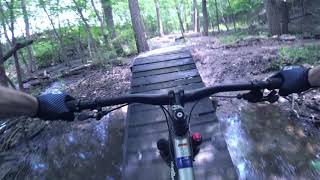
Photos of Litchfield Mountain Bike
Videos of Litchfield Mountain Bike

trail: Illinois Trail
2:12 |
265 |
Jul 28, 2009
11:26 |
597 |
Jun 11, 2021
Current Trail Warnings
| status | trail | date | condition | user | info |
|---|---|---|---|---|---|
| California Trail | May 30, 2026 @ 5:32pm (America/Indiana/Vincennes) May 30, 2026 | Dry | Colinb5ov1J | Mostly overgrown with grass, some... | |
| Kansas Trail | May 30, 2026 @ 5:32pm (America/Indiana/Vincennes) May 30, 2026 | Variable | Colinb5ov1J | Mostly overgrown with grass, some... | |
| Missouri Trail | May 30, 2026 @ 5:32pm (America/Indiana/Vincennes) May 30, 2026 | Ideal | Colinb5ov1J | Mostly overgrown with grass, some... |
Recent Trail Reports
| status | trail | date | condition | info | user |
|---|---|---|---|---|---|
| Texas Trail | May 30, 2026 @ 5:32pm (America/Indiana/Vincennes) May 30, 2026 | Dry | Colinb5ov1J | ||
| New Mexico Trail | May 30, 2026 @ 5:32pm (America/Indiana/Vincennes) May 30, 2026 | Ideal | Colinb5ov1J | ||
| Oklahoma Trail | May 30, 2026 @ 5:32pm (America/Indiana/Vincennes) May 30, 2026 | Variable | Colinb5ov1J | ||
| Illinois Trail | May 30, 2026 @ 5:32pm (America/Indiana/Vincennes) May 30, 2026 | Dry | Colinb5ov1J | ||
| Lake Front Trail S | May 30, 2026 @ 5:32pm (America/Indiana/Vincennes) May 30, 2026 | Unknown | Colinb5ov1J | ||
| Galena Loop | Sep 2, 2025 @ 12:43pm Sep 2, 2025 | Unknown | xNlER6 | ||
| Santa Monica Trail | Jul 8, 2025 @ 1:40pm Jul 8, 2025 | Ideal | dvroberts411 | ||
| Chicago Trail | May 2, 2021 @ 9:28am May 2, 2021 | Ideal | Jccorde |
Activity Feed
| username | action | type | title | date |
|---|---|---|---|---|
| Colinb5ov1J | add | report | activity #95910570 and 9 more | May 30, 2026 @ 10:36pm May 30, 2026 |
| 300lbmtnbiker | difficultyvote | trail | activity #81580294 and 1 more | Oct 2, 2025 @ 6:03pm Oct 2, 2025 |
| 300lbmtnbiker | add | photo | activity #81580253 | Oct 2, 2025 @ 6:02pm Oct 2, 2025 |
| xNlER6 | add | report | activity #79507888 | Sep 2, 2025 @ 12:43pm Sep 2, 2025 |
| RyanHipkins | comment | report | activity #79454405 | Sep 1, 2025 @ 4:09pm Sep 1, 2025 |
Recent Comments
| username | type | title | comment | date |
|---|---|---|---|---|
| report | Still pretty rough | Sep 1, 2025 @ 4:09pm Sep 1, 2025 | ||
| trail | Someone recently added three sendy little... | Jun 12, 2021 @ 2:26pm Jun 12, 2021 | ||
| trail | Very nice bench-cut trail. I rode it in both... | May 14, 2021 @ 8:02pm May 14, 2021 |
Local Badges
-

Epic Mountain Bike Climb 2k0 awarded -

Climbing 10k Badge2 awarded -

Mountain Biking 100k Badge0 awarded -

Epic Ride Descent 2k0 awarded -

Descent 10k Badge2 awarded -

Descent 100k Badge0 awarded
Activity Type Stats
| activitytype | trails | distance | descent | descent distance | total vertical | rating | global rank | state rank | photos | reports | routes | ridelogs |
|---|---|---|---|---|---|---|---|---|---|---|---|---|
| Mountain Bike | 17 | 6 miles | 486 ft | 2 miles | 98 ft | #5,435 | #1,827 | 33 | 46 | 1 | 631 | |
| E-Bike | 5 | 1 mile | 98 ft | 2,113 ft | 95 ft | #10,043 | #3,151 | 40 | 15 | |||
| Horse | 4 | 3 miles | 338 ft | 1 mile | 115 ft | #3,112 | #1,770 | |||||
| Hike | 23 | 10 miles | 896 ft | 3 miles | 118 ft | #10,225 | #3,634 | 46 | 1 | 29 | ||
| Trail Running | 21 | 9 miles | 820 ft | 3 miles | 118 ft | #10,319 | #3,528 | 46 | 1 | 15 |
Frequently Asked Questions About Litchfield
▼
What are the best places to ride in Litchfield?
Litchfield has 2 areas to explore for mountain biking. The top rated areas are:
▼
What are the highest rated mountain biking trails in Litchfield?
The highest rated mountain biking trails in Litchfield are:
- Galena Loop (4.1/5)
- Missouri Trail (4.1/5)
- Chicago Trail (4.1/5)
- California Trail (4.1/5)
- Santa Monica Trail (4/5)
▼
What is the best time of the year to ride in Litchfield?
Based on ride log data, the most popular months to ride in Litchfield are:
- September (4 activities)
- November (2 activities)
- August (2 activities)
▼
Where can I park to ride in Litchfield?
There are 5 parking locations listed in Litchfield. The most popular parking spots are:
- Parking near Marina Ln
- Parking by boat docks
- Parking mid point
- Small Parking lot near Milnot Beach
- Parking
Activities
Trails
- By Akinraze & contributors
- Admins: apply
- #37094 - 3,612 views
- litchfield activity log | embed map of Litchfield mountain bike trails | litchfield mountain biking points of interest
Downloading of trail gps tracks in kml & gpx formats is enabled for Litchfield.
You must login to download files.