close
-
Layers w
- Weather Layers
- Pro
- Pro
- Pro
- Pro
- Pro
- Pro
- More Layers
- Pro
- Pro
- Pro
- Pro
-
Upgrade to

3D
Trail Conditions
- Unknown
- Snow Groomed
- Snow Packed
- Snow Covered
- Snow Cover Partial
- Freeze/thaw Cycle
- Icy
- Prevalent Mud
- Wet
- Variable
- Ideal
- Dry
- Very Dry
Trail Flow (Ridden Direction)
Trailforks scans users ridelogs to determine the most popular direction each trail is ridden. A good flowing trail network will have most trails flowing in a single direction according to their intension.
The colour categories are based on what percentage of riders are riding a trail in its intended direction.
The colour categories are based on what percentage of riders are riding a trail in its intended direction.
- > 96%
- > 90%
- > 80%
- > 70%
- > 50%
- < 50%
- bi-directional trail
- no data
Trail Last Ridden
Trailforks scans ridelogs to determine the last time a trail was ridden.
- < 2 days
- < 1 week
- < 2 weeks
- < 1 month
- < 6 months
- > 6 months
Trail Ridden Direction
The intended direction a trail should be ridden.
- Downhill Only
- Downhill Primary
- Both Directions
- Uphill Primary
- Uphill Only
- One Direction
Contribute Details
Colors indicate trail is missing specified detail.
- Description
- Photos
- Description & Photos
- Videos
Trail Popularity ?
Trailforks scans ridelogs to determine which trails are ridden the most in the last 9 months.
Trails are compared with nearby trails in the same city region with a possible 25 colour shades.
Think of this as a heatmap, more rides = more kinetic energy = warmer colors.
- most popular
- popular
- less popular
- not popular
ATV/ORV/OHV Filter
Max Vehicle Width
inches
US Cell Coverage
Legend

Radar Time
Activity Recordings
Trailforks uses anonymized public activity data.
?
Activity Recordings
Trailforks uses anonymized public activity data.
?
Personal Heatmap
▶
Activity Types
all
/
none
▶
Options
2
Date range
month
–
Winter Trails
Warning
A routing network for winter maps does not exist. Selecting trails using the winter trails layer has been disabled.
Missing Trails
Most Popular
Least Popular
Trails are colored based on popularity. The more popular a trail is, the more red. Less popular trails trend towards green.
Jump Magnitude Heatmap
Heatmap of where riders jump on trails. Zoom in to see individual jumps, click circles to view jump details.
BC Backroad Status
![map legend]()
Service Road Atlas is a free to use, community-driven service for viewing and creating reports on the numerous back-country service roads around B.C. and Alberta.

Slope Aspect
Direction the slope faces
Trails Deemphasized
Trails are shown in grey.
Only show trails with no bike usage.
Suggested Layers
Based on selected activity type
Save the current map location and zoom level as your default home location whenever this page is loaded.
SavePopular Trail Networks
view all areas »
No description for Litchfield County has been added yet!
Login or register to submit one.
Stats
- Avg Trail Rating
- Trails (view details)
- 1,208
- Trails Mountain Bike
- 402
- Trails E-Bike
- 152
- Trails Gravel Bike
- 8
- Trails Adaptive Bike
- 11
- Trails Winter Fat Bike
- 33
- Trails Horse
- 153
- Trails Hike
- 1,147
- Trails Trail Running
- 875
- Trails Snowmobile
- 34
- Trails Snowshoe
- 381
- Trails Downhill Ski
- 41
- Trails Nordic Ski
- 333
- Total Distance
- 637 miles
- Total Descent
- 93,858 ft
- Total Vertical
- 2,146 ft
- Highest Trailhead
- 2,317 ft
- Reports
- 1,695
- Photos
- 908
- Ridden Counter
- 60,240
Sub Regions
- Barkhamsted (11)
- Bethlehem (0)
- Bridgewater (14)
- Canaan (7)
- Colebrook (40)
- Cornwall (43)
- Goshen (1)
- Harwinton (28)
- Kent (34)
- Litchfield (47)
- Morris (12)
- New Hartford (37)
- Nepaug State Forest (21)
- Satan's Ridge (9)
- New Milford (1)
- Clatter Valley (1)
- Norfolk (11)
- Plymouth (11)
- Roxbury (15)
- Salisbury (5)
- Sharon (1)
- Thomaston (15)
- Torrington (25)
- Warren (7)
- Washington (23)
- Watertown (6)
- Woodbury (13)
- Trolley Preserve (13)
Popular Litchfield County Mountain Biking Trails
• 100 ★ 5.0 • 2,808 ft • 0 ft • 1,361 •
• 65 ★ 4.3 • 4,334 ft • 14 ft • 1,066 •
- Easiest singletrack climb back to top of trail network
• 70 ★ 4.8 • 3,097 ft • 0 ft • 1,021 •
• 95 ★ 4.8 • 4,846 ft • 218 ft • 1,018 •
Highly rated popular green difficulty family friendly singletrack. This multi-use trail can be used both directions and has a easy overall physical rating with a 218 ft green climb. Trail visibility is always easy to follow. On average it takes 10 minutes to complete this trail.
• 90 ★ 4.8 • 2,602 ft • 41 ft • 998 •
Popular green difficulty singletrack. This multi-use trail can be used both directions with a 41 ft green climb. Trail visibility is always easy to follow. On average it takes 5 minutes to complete this trail.
• 70 ★ 4.7 • 942 ft • 36 ft • 876 •
Climb trail to get to top of . Connects with double track at top.
Litchfield County Mountain Bike Routes
Satan's Ridge from 202 Featured
11 miles • 1,788 ft • 15 • Loop •
Fastest route from 202 to Satan';s Ridge. Please ensure that you follow the correct direction of the...
★ 5.0 • 13 miles • 2,430 ft • 16 • Out & Back •
This is a 13 mile out and back route that features some of the best trails Nepaug State Forest has to...
★ 3.0 • 4 miles • 749 ft • 3 • Loop •
★ 3.0 • 5 miles • 709 ft • 2 • Loop •
Intermediate route with a good mix of climbing, swooning, singletrack and carriage road.
6 miles • 989 ft • 4 • Loop •
Advanced loop starting at the Ramp Rd parking area. This loop features natural tech including rolls,...
4 miles • 415 ft • 4 •
Potential race course for Housatonic Mountain Biking League championship. Starts from upper lot, goes to...
Photos of Litchfield County Mountain Bike
Videos of Litchfield County Mountain Bike
0:27 |
419 |
Jul 4, 2024

trail: Steve Quinn Memorial Trail
0:05 |
99 |
Mar 7, 2021
trail: Silica Mine Hill - Red Trail
0:57 |
243 |
Dec 13, 2020
trail: Dirt Sessions
0:07 |
383 |
Sep 3, 2020
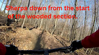
trail: Sherpa
4:39 |
498 |
Nov 15, 2019
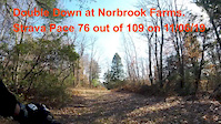
trail: Double Down
3:48 |
331 |
Nov 14, 2019
trail: Old Oak
3:41 |
586 |
Nov 12, 2019

trail: El Jefe
3:39 |
93 |
Oct 6, 2025 , New Hartford
Recent Trail Reports
Activity Feed
| username | action | type | title | date |
|---|---|---|---|---|
| rastrickland | wishlist | trail | activity #97257130 and 1 more | Jun 18, 2026 @ 9:20am 2 days |
| rastrickland | wishlist | region | activity #97255686 | Jun 18, 2026 @ 8:55am 2 days |
| Foodee | ridden | trail | activity #97180305 | Jun 17, 2026 @ 6:58am Jun 17, 2026 |
| Enforcer504 | wishlist | trail | activity #97153404 | Jun 16, 2026 @ 6:21pm Jun 16, 2026 |
| ShadowBeast | add | photo | activity #97152852 and 1 more | Jun 16, 2026 @ 6:11pm Jun 16, 2026 |
Recent Comments
| username | type | title | comment | date |
|---|---|---|---|---|
| trail | This is NOT a green trail. Lots of sketchy... | Apr 26, 2026 @ 4:46pm Apr 26, 2026 | ||
| trail | This is probably my favorite trail at... | Dec 9, 2025 @ 11:28am Dec 9, 2025 | ||
| trail | Currently great condition of the trail and not... | Sep 24, 2025 @ 12:45pm Sep 24, 2025 | ||
| trail | Nice climbing trail, fun! | Sep 24, 2025 @ 12:44pm Sep 24, 2025 | ||
| trail | I’m | Jul 6, 2025 @ 9:51am Jul 6, 2025 |
Local Badges
-

Epic Ride Descent 2k0 awarded -
Epic Ride Descent 2k1 awarded -
Epic Ride Descent 2k1 awarded -
Epic Ride Descent 2k0 awarded -
Epic Ride Descent 2k2 awarded -

Descent 10k Badge6 awarded
Activity Type Stats
| activitytype | trails | distance | descent | descent distance | total vertical | rating | global rank | state rank | photos | reports | routes | ridelogs |
|---|---|---|---|---|---|---|---|---|---|---|---|---|
| Mountain Bike | 402 | 208 miles | 21,558 ft | 75 miles | 1,998 ft | 520 | 1,675 | 16 | 32,208 | |||
| E-Bike | 152 | 84 miles | 9,596 ft | 30 miles | 1,342 ft | 1,387 | 3 | 1,502 | ||||
| Gravel Bike | 8 | 7 miles | 269 ft | 2 miles | 1,083 ft | 16 | 1 | 257 | ||||
| Adaptive Bike | 11 | 16 miles | 1,070 ft | 5 miles | 1,145 ft | 14 | 1 | |||||
| Winter Fat Bike | 33 | 24 miles | 2,844 ft | 11 miles | 1,296 ft | 40 | 2 | |||||
| Horse | 153 | 74 miles | 5,791 ft | 26 miles | 1,345 ft | 90 | 11 | |||||
| Hike | 1,147 | 613 miles | 84,721 ft | 237 miles | 2,146 ft | 388 | 1,619 | 15 | 5,299 | |||
| Trail Running | 875 | 501 miles | 68,323 ft | 190 miles | 2,146 ft | 1,615 | 1 | 1,388 | ||||
| Snowmobile | 34 | 19 miles | 1,555 ft | 7 miles | 1,017 ft | 1 | ||||||
| Snowshoe | 381 | 150 miles | 17,106 ft | 59 miles | 1,572 ft | 6 | 5 | 163 | ||||
| Downhill Ski | 41 | 8 miles | 5,482 ft | 7 miles | 978 ft | 858 | ||||||
| Nordic Ski | 333 | 139 miles | 14,462 ft | 54 miles | 1,427 ft | 7 | 2 | 179 |
Activities
- Litchfield County Mountain Biking Trails
- Litchfield County E-Biking Trails
- Litchfield County Gravel Biking Trails
- Litchfield County Adaptive Biking Trails
- Litchfield County Winter Fat Biking Trails
- Litchfield County Horseback Trails
- Litchfield County Hiking Trails
- Litchfield County Trail Running Trails
- Litchfield County Snowmobiling Trails
- Litchfield County Snowshoeing Trails
- Litchfield County Skiing Trails
- Litchfield County Nordic Skiing Trails
Trails
- By WillieJacobsz
 Trailforks SBP SWW & contributors
 - Admins: HCH, NEMBAEXEC
- #14166 - 8,822 views
- litchfield county activity log | embed map of Litchfield County mountain bike trails | litchfield county mountain biking points of interest polygons
Downloading of trail gps tracks in kml & gpx formats is enabled for Litchfield County.
You must login to download files.