close
-
Layers w
- Weather Layers
- Pro
- Pro
- Pro
- Pro
- Pro
- Pro
- More Layers
- Pro
- Pro
- Pro
- Pro
-
Upgrade to

3D
Trail Conditions
- Unknown
- Snow Groomed
- Snow Packed
- Snow Covered
- Snow Cover Partial
- Freeze/thaw Cycle
- Icy
- Prevalent Mud
- Wet
- Variable
- Ideal
- Dry
- Very Dry
Trail Flow (Ridden Direction)
Trailforks scans users ridelogs to determine the most popular direction each trail is ridden. A good flowing trail network will have most trails flowing in a single direction according to their intension.
The colour categories are based on what percentage of riders are riding a trail in its intended direction.
The colour categories are based on what percentage of riders are riding a trail in its intended direction.
- > 96%
- > 90%
- > 80%
- > 70%
- > 50%
- < 50%
- bi-directional trail
- no data
Trail Last Ridden
Trailforks scans ridelogs to determine the last time a trail was ridden.
- < 2 days
- < 1 week
- < 2 weeks
- < 1 month
- < 6 months
- > 6 months
Trail Ridden Direction
The intended direction a trail should be ridden.
- Downhill Only
- Downhill Primary
- Both Directions
- Uphill Primary
- Uphill Only
- One Direction
Contribute Details
Colors indicate trail is missing specified detail.
- Description
- Photos
- Description & Photos
- Videos
Trail Popularity ?
Trailforks scans ridelogs to determine which trails are ridden the most in the last 9 months.
Trails are compared with nearby trails in the same city region with a possible 25 colour shades.
Think of this as a heatmap, more rides = more kinetic energy = warmer colors.
- most popular
- popular
- less popular
- not popular
ATV/ORV/OHV Filter
Max Vehicle Width
inches
US Cell Coverage
Legend

Radar Time
Activity Recordings
Trailforks uses anonymized public activity data.
?
Activity Recordings
Trailforks uses anonymized public activity data.
?
Personal Heatmap
▶
Activity Types
all
/
none
▶
Options
2
Date range
month
–
Winter Trails
Warning
A routing network for winter maps does not exist. Selecting trails using the winter trails layer has been disabled.
Missing Trails
Most Popular
Least Popular
Trails are colored based on popularity. The more popular a trail is, the more red. Less popular trails trend towards green.
Jump Magnitude Heatmap
Heatmap of where riders jump on trails. Zoom in to see individual jumps, click circles to view jump details.
BC Backroad Status
![map legend]()
Service Road Atlas is a free to use, community-driven service for viewing and creating reports on the numerous back-country service roads around B.C. and Alberta.

Slope Aspect
Direction the slope faces
Trails Deemphasized
Trails are shown in grey.
Only show trails with no bike usage.
Suggested Layers
Based on selected activity type
Save the current map location and zoom level as your default home location whenever this page is loaded.
SavePopular Trail Networks
view all areas »
No description for Lithuania has been added yet!
Login or register to submit one.
Stats
- Avg Trail Rating
- Trails (view details)
- 243
- Trails Mountain Bike
- 253
- Trails E-Bike
- 197
- Trails Horse
- 10
- Trails Hike
- 233
- Trails Trail Running
- 227
- Trails Dirtbike/Moto
- 3
- Trails Snowmobile
- 1
- Trails Snowshoe
- 62
- Trails Downhill Ski
- 41
- Trails Backcountry Ski
- 64
- Trails Nordic Ski
- 64
- Total Distance
- 153 miles
- Total Descent
- 14,714 ft
- Total Vertical
- 885 ft
- Highest Trailhead
- 919 ft
- Reports
- 274
- Photos
- 108
- Ridden Counter
- 2,945
Sub Regions
- Akmenė region (0)
- Alytus region (1)
- Alytus (1)
- Punios šilas (1)
- Alytus (1)
- Anykščiai region (0)
- Birštonas region (0)
- Biržai region (0)
- Druskininkai region (0)
- Elektrėnai region (0)
- Ignalina region (80)
- Ignalina (80)
- Ignalina (80)
- Jonava region (0)
- Jurbarkas region (0)
- Kaišiadorys region (0)
- Kalvarija region (0)
- Kaunas region (8)
- Kazlų Rūda region (0)
- Kėdainiai region (0)
- Kelmė region (0)
- Klaipėda region (0)
- Kretinga region (0)
- Lazdijai region (0)
- Marijampolė region (0)
- Mažeikiai region (0)
- Molėtai region (0)
- Neringa region (3)
- Pagėgiai region (0)
- Pakruojis region (0)
- Palanga region (0)
- Panevėžys region (0)
- Pasvalys region (0)
- Plungė region (0)
- Prienai region (0)
- Radviliškis region (0)
- Raseiniai region (0)
- Rietavas region (0)
- Riga (0)
- Rokiškis region (0)
- Šakiai region (0)
- Šalčininkai region (0)
- Šiauliai region (0)
- Šilalė region (0)
- Šilutė region (0)
- Širvintos region (0)
- Skuodas region (0)
- Švenčionys region (0)
- Tauragė region (0)
- Telšiai region (0)
- Trakai region (0)
- Ukmergė region (0)
- Utena region (0)
- Varėna region (0)
- Vilkaviškis region (0)
- Vilnius region (156)
- Vilnius (156)
- Antakalnio šilas (2)
- Aukštagirio miškas (0)
- Belmontas-Pūčkoriai (1)
- Bukčių miško parkas (3)
- Buktos miško parkas (5)
- Dvarčionių-Piliakalnio miškas (0)
- Fabijoniškių parkas (2)
- Griovių geomorfologinis draustinis (1)
- Jomanto parkas (0)
- Kairėnų-Antavilio miškai (1)
- Kalnų parkas (1)
- Karoliniškių parkas (5)
- Molynė Bike Park (2)
- Paneriai (0)
- Pasakų parkas (0)
- Pavilniai-Markučiai (0)
- Ribiškės (0)
- Rokantiškės (8)
- Salotė (2)
- Sapieginė (2)
- Šeškinės parkas (1)
- Šveicarijos parkas (0)
- Valakampių miškas (0)
- Vanaginės geomorfologinis draustinis (30)
- Verkių parkas (49)
- Vingio parkas (1)
- Visorių-Bajorų miško parkas (28)
- Vilnius (156)
- Visaginas region (1)
- Zarasai region (1)
Popular Lithuania Mountain Biking Trails
• 80 ★ 5.0 • 1,972 ft • 0 ft • 67 •
One of the easiest trails in Vilnius, with lots of features. Really good for beginners and you can improve all your skills. Lots pf options and lines
• 100 ★ 0.0 • 2 miles • 54 ft • 52 •
Popular white difficulty family friendly mixed. This multi-use trail can be used both directions and has a easy overall physical rating with a 54 ft green climb. Trail visibility is always easy to follow. On average it takes 6 minutes to complete this trail.
• 100 ★ 4.0 • 2,208 ft • 3 ft • 50 •
Popular blue difficulty singletrack. This mountain bike primary trail can be used both directions and has a moderate overall physical rating with a 3 ft blue climb. On average it takes 1 minutes to complete this trail.
• 100 ★ 0.0 • 2,365 ft • 0 ft • 49 •
Popular blue difficulty singletrack. This mountain bike primary trail can be used both directions and has a easy overall physical rating with a 0 ft green climb. Trail visibility is always easy to follow. On average it takes 2 minutes to complete this trail.
• 100 ★ 0.0 • 2 miles • 223 ft • 47 •
Popular green difficulty gravel path. This mountain bike primary trail can be used both directions and has a easy overall physical rating with a 223 ft green climb. Trail visibility is always easy to follow. On average it takes 13 minutes to complete this trail.
• 100 ★ 0.0 • 5 miles • 159 ft • 46 •
Popular white difficulty family friendly paved path. This multi-use trail can be used both directions and has a easy overall physical rating with a 159 ft green climb. Adaptive MTB rating: amtb green. Trail visibility is always easy to follow. On average it takes 24 minutes to complete this trail.
• 95 ★ 5.0 • 1,655 ft • 0 ft • 41 •
Popular blue difficulty singletrack. This multi-use trail can be used downhill primary. It features rock face and rock garden. On average it takes 1 minutes to complete this trail.
Lithuania Mountain Bike Routes
★ 5.0 • 7 miles • 228 ft • 0 •
Panemunė MTB Red is a green singletrack route located near Kaunas region. This mountain bike primary...
18 miles • 1,672 ft • 15 • Loop •
MTB route with 2,5km of nonstop descending. For MTB enthusiasts! not for familly rides :)
★ 5.0 • 68 miles • 6,143 ft • 0 •
An integral 100 KM route is suitable for everyone who enjoys running, walking and exploring undiscovered...
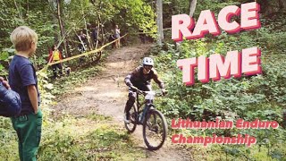
5 miles • 783 ft • 0 •
ILGAI LAUKTAS ENDURO MTB ČEMPIONATAS PRASIDEDA!!! Nesvarbu koks tavo važiavimo lygis, šios varžybos...
25 miles • 792 ft • 0 •
Pavadinimas Medumi -Zelta kalns 40 km / 303 m / Latgale Aprašas ✅ 40,1 km ✅ 303 m ↗ 301 m ↘ ✅...
Photos of Lithuania Mountain Bike
Videos of Lithuania Mountain Bike
trail: Jump Line MOLYNĖ
0:05 |
955 |
Jun 5, 2021
trail: 2x
0:38 |
|
Jul 15, 2020
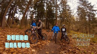
trail: Bunda kalvos
2:11 |
246 |
Sep 26, 2018
trail: Perliukas
0:49 |
436 |
Dec 30, 2017
trail: Karačiūnai
0:03 |
380 |
Nov 14, 2015
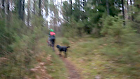
trail: Bunda kalvos
6:54 |
385 |
Jan 12, 2021 , Alytus
trail: Vecekrugo kopa DH
454 |
Dec 28, 2020 , Neringa
trail: Perliukas
8:37 |
638 |
Nov 26, 2020 , Vilnius
Recent Comments
| username | type | title | comment | date |
|---|---|---|---|---|
| trail | Nepravažiuojama. Užvirte medžiai.... | Mar 22, 2026 @ 5:20am Mar 22, 2026 | ||
| trail | this one is just a normal down hill nothin too... | Aug 23, 2025 @ 8:04am Aug 23, 2025 | ||
| trail | Nevaziuokit, trasa isgriauta. | May 8, 2024 @ 8:42am May 8, 2024 | ||
| trail | Važiavau su invalido vežimėliu, nieko įdomaus | Mar 24, 2024 @ 7:50am Mar 24, 2024 | ||
| trail | jau atstatytas ;) | Oct 26, 2022 @ 11:42pm Oct 26, 2022 |
Bike & Skill Parks
| name | type | city | rating |
|---|---|---|---|
| Molynė Pumptrack | skill park | Vilnius | |
| Siauliai MX | skill park | Siauliai | |
| Akropolis dirt jumps | skill park | Vilnius | |
| Molynė Skill Park | skill park | Vilnius | |
| MOLYNĖ air bag jump | skill park | Vilnius |
Activity Type Stats
| activitytype | trails | distance | descent | descent distance | total vertical | rating | global rank | state rank | photos | reports | routes | ridelogs |
|---|---|---|---|---|---|---|---|---|---|---|---|---|
| Mountain Bike | 250 | 153 miles | 14,715 ft | 68 miles | 886 ft | #69 | 108 | 274 | 23 | 32,260 | ||
| E-Bike | 197 | 95 miles | 9,452 ft | 42 miles | 823 ft | #65 | 243 | 10 | 1,019 | |||
| Horse | 10 | 5 miles | 476 ft | 2 miles | 374 ft | #65 | 11 | |||||
| Hike | 233 | 108 miles | 11,903 ft | 48 miles | 886 ft | #75 | 240 | 2 | 900 | |||
| Trail Running | 227 | 105 miles | 11,444 ft | 47 miles | 886 ft | #75 | 240 | 2 | 480 | |||
| Dirtbike/Moto | 3 | 1 mile | 135 ft | 2,254 ft | 348 ft | #63 | 9 | 1 | 3 | |||
| Snowmobile | 1 | 3,343 ft | 7 ft | 328 ft | 85 ft | #33 | ||||||
| Snowshoe | 62 | 19 miles | 2,385 ft | 8 miles | 374 ft | #40 | 9 | 4 | ||||
| Downhill Ski | 41 | 15 miles | 1,864 ft | 6 miles | 374 ft | #39 | 7 | 62 | ||||
| Backcountry Ski | 64 | 21 miles | 2,615 ft | 9 miles | 492 ft | #39 | 9 | 10 | ||||
| Nordic Ski | 64 | 21 miles | 2,490 ft | 9 miles | 374 ft | #38 | 9 | 870 |
Activities
- By canadaka
 Trailforks & contributors
 - Admins: LRL, Kestosas, Balduras
- #3229 - 24,011 views
- lithuania activity log | embed map of Lithuania mountain bike trails | lithuania mountain biking points of interest
Downloading of trail gps tracks in kml & gpx formats is enabled for Lithuania.
You must login to download files.