close
-
Layers w
- Weather Layers
- Pro
- Pro
- Pro
- Pro
- Pro
- Pro
- More Layers
- Pro
- Pro
- Pro
- Pro
-
Upgrade to

3D
Trail Conditions
- Unknown
- Snow Groomed
- Snow Packed
- Snow Covered
- Snow Cover Partial
- Freeze/thaw Cycle
- Icy
- Prevalent Mud
- Wet
- Variable
- Ideal
- Dry
- Very Dry
Trail Flow (Ridden Direction)
Trailforks scans users ridelogs to determine the most popular direction each trail is ridden. A good flowing trail network will have most trails flowing in a single direction according to their intension.
The colour categories are based on what percentage of riders are riding a trail in its intended direction.
The colour categories are based on what percentage of riders are riding a trail in its intended direction.
- > 96%
- > 90%
- > 80%
- > 70%
- > 50%
- < 50%
- bi-directional trail
- no data
Trail Last Ridden
Trailforks scans ridelogs to determine the last time a trail was ridden.
- < 2 days
- < 1 week
- < 2 weeks
- < 1 month
- < 6 months
- > 6 months
Trail Ridden Direction
The intended direction a trail should be ridden.
- Downhill Only
- Downhill Primary
- Both Directions
- Uphill Primary
- Uphill Only
- One Direction
Contribute Details
Colors indicate trail is missing specified detail.
- Description
- Photos
- Description & Photos
- Videos
Trail Popularity ?
Trailforks scans ridelogs to determine which trails are ridden the most in the last 9 months.
Trails are compared with nearby trails in the same city region with a possible 25 colour shades.
Think of this as a heatmap, more rides = more kinetic energy = warmer colors.
- most popular
- popular
- less popular
- not popular
ATV/ORV/OHV Filter
Max Vehicle Width
inches
US Cell Coverage
Legend

Radar Time
Activity Recordings
Trailforks uses anonymized public activity data.
?
Activity Recordings
Trailforks uses anonymized public activity data.
?
Personal Heatmap
▶
Activity Types
all
/
none
▶
Options
2
Date range
month
–
Winter Trails
Warning
A routing network for winter maps does not exist. Selecting trails using the winter trails layer has been disabled.
Missing Trails
Most Popular
Least Popular
Trails are colored based on popularity. The more popular a trail is, the more red. Less popular trails trend towards green.
Jump Magnitude Heatmap
Heatmap of where riders jump on trails. Zoom in to see individual jumps, click circles to view jump details.
BC Backroad Status
![map legend]()
Service Road Atlas is a free to use, community-driven service for viewing and creating reports on the numerous back-country service roads around B.C. and Alberta.

Slope Aspect
Direction the slope faces
Trails Deemphasized
Trails are shown in grey.
Only show trails with no bike usage.
Suggested Layers
Based on selected activity type
Save the current map location and zoom level as your default home location whenever this page is loaded.
SaveThe area has an iceage sand ridge going through it where majority of riding in the area happens. Very developed very easy trails. An official mtb route does a loop to the south of the sports ground.
Activities Click to view
- Mountain Bike
87 trails
- E-Bike
81 trails
- Winter Fat Bike
0 trails
- Hike
73 trails
- Trail Running
77 trails
Region Details
- 25
- 3
- 44
- 13
- 2
Region Status
Open as of May 4, 2025Stats
- Avg Trail Rating
- Trails (view details)
- 87
- Trails Mountain Bike
- 87
- Trails E-Bike
- 81
- Trails Hike
- 73
- Trails Trail Running
- 77
- Total Distance
- 24 miles
- Total Descent
- 1,570 ft
- Total Vertical
- 261 ft
- Highest Trailhead
- 430 ft
- Reports
- 37
- Photos
- 14
- Ridden Counter
- 947
Popular Lohja Mountain Biking Trails
• 95 ★ 0.0 • 2,884 ft • 10 ft • 51 •
Lohjanharjun MTB reitin viimeinen osuus. Hauskaa mutkittelevaa kangaspolkua hyvällä flowlla, kaikenkaikkiaan noin 50 mutkaa verrattain lyhyellä matkalla.
• 85 ★ 0.0 • 1 mile • 25 ft • 50 •
Lohjanharju MTB reitin kolmas osuus. Tynnäri on vauhdikkaampi ja avoimempi osuus. Reitillä on mm. kiviä, puun ylitys ja mutkaista ja vauhdikasta polkua päättyen syherön jälkeen hiihtoreitin kääntöpaikalle. Tästä reitti...
• 80 ★ 0.0 • 3,678 ft • 52 ft • 49 •
Lohjanharju MTB reitin viides osuus. Ylämäkeen mutkittelevaa neulaspolkua
• 90 ★ 0.0 • 3,809 ft • 24 ft • 49 •
Lohjanharju MTB reitin kuudes osuus. Alaspäin viettävää neulaspolkua hyvällä flowlla.
• 85 ★ 4.0 • 945 ft • 0 ft • 48 •
Lohjanharjun MTB reitin neljäs osuus. Vauhdikas neulaspolku lasku. Lopussa kääntyy hieman yllättäen puskan jälkeen vasemmalle, seuraa kylttejä...
• 80 ★ 0.0 • 2,707 ft • 81 ft • 48 •
Lohjanharjun MTB reitin seitsemäs osuus. Ylöspäin viettävä neulaspolku...
• 80 ★ 0.0 • 4,518 ft • 84 ft • 48 •
Lohjanharjun MTB reitin toinen osuus. Pienen helpomman jakson jälkeen lasketaan jyrkkä alamäki ja kaarretaan toiselle tekniselle metsäosuudelle. Pääosin neulaspolkua, mutta mukana on kivikkoisempia ja juurakkoisempia mutkittelevia...
• 85 ★ 0.0 • 2,503 ft • 39 ft • 44 •
Lohjanharjun MTB reitin ensimmäinen osuus. Helpohko osuus alkaa jäähallin kulmalta. Näkö-alalta avautuu hieno maisema Lohjanjärvelle ja kaupungin keskustaan.
Lohja Mountain Bike Routes
17 miles • 1,149 ft • 8 • Loop •
Helpohkoa hiekkapohjaista harjupolkua Lohjanharjua pitkin. Tämä reitti sisältää maastoon merkityn...
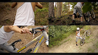
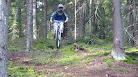
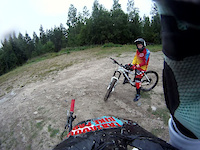
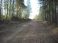
Photos of Lohja Mountain Bike

Recent Trail Reports
| status | trail | date | condition | info | user |
|---|---|---|---|---|---|
| Lohjanharju Access3 | May 4, 2025 @ 9:04am May 4, 2025 | Ideal | jayaykay | ||
| Lohjanharju Access4 | May 4, 2025 @ 9:04am May 4, 2025 | Ideal | jayaykay | ||
| Lohjanharju Hiekka | May 4, 2025 @ 9:04am May 4, 2025 | Ideal | jayaykay | ||
| Lohjanharju Access2 | May 4, 2025 @ 9:04am May 4, 2025 | Ideal | jayaykay | ||
| Lohjanharju PaulinVauhtipolku | May 4, 2025 @ 9:04am May 4, 2025 | Ideal | jayaykay | ||
| Ylösnousemus | Jun 10, 2024 @ 1:22pm Jun 10, 2024 | Dry | mboye | ||
| Korpi | Oct 10, 2021 @ 1:18am Oct 10, 2021 | Ideal | mstendah | ||
| Moisionharju Loop | Aug 31, 2021 @ 6:43am Aug 31, 2021 | Ideal | mstendah | ||
| Turvasyherö | Apr 22, 2021 @ 7:51am Apr 22, 2021 | Dry | abiotic | ||
| Vienosen Vääntö | Apr 22, 2021 @ 7:51am Apr 22, 2021 | Dry | abiotic |
Activity Feed
| username | action | type | title | date |
|---|---|---|---|---|
| jayaykay | add | report | activity #70970126 and 4 more | May 4, 2025 @ 4:19am May 4, 2025 |
| puustinen | wishlist | route | activity #58783834 | Sep 13, 2024 @ 3:32am Sep 13, 2024 |
| mboye | add | report | activity #53920032 | Jun 10, 2024 @ 1:22pm Jun 10, 2024 |
| mboye | ridden | trail | activity #53920010 | Jun 10, 2024 @ 1:21pm Jun 10, 2024 |
| mtJd8G | wishlist | route | activity #53121633 | May 25, 2024 @ 9:47am May 25, 2024 |
Recent Comments
| username | type | title | comment | date |
|---|---|---|---|---|
| trail | Bike: Norco Fluid 7.2ht+ size medium Rider... | Jun 16, 2019 @ 8:20am Jun 16, 2019 |
Local Badges
-

Epic Mountain Bike Climb 2k4 awarded -

Climbing 10k Badge1 awarded -

Mountain Biking 100k Badge0 awarded -

Epic Ride Descent 2k4 awarded -

Descent 10k Badge1 awarded -

Descent 100k Badge0 awarded
Activity Type Stats
| activitytype | trails | distance | descent | descent distance | total vertical | rating | global rank | state rank | photos | reports | routes | ridelogs |
|---|---|---|---|---|---|---|---|---|---|---|---|---|
| Mountain Bike | 87 | 24 miles | 1,572 ft | 10 miles | 262 ft | #2,596 | #19 | 14 | 37 | 1 | 939 | |
| E-Bike | 81 | 23 miles | 1,257 ft | 10 miles | 262 ft | #1,475 | #22 | 36 | 1 | 213 | ||
| Hike | 73 | 15 miles | 984 ft | 6 miles | 262 ft | #3,275 | #32 | 36 | 23 | |||
| Trail Running | 77 | 18 miles | 1,207 ft | 8 miles | 262 ft | #2,580 | #28 | 36 | 13 |
Frequently Asked Questions About Lohja
▼
What are the highest rated mountain biking trails in Lohja?
The highest rated mountain biking trails in Lohja are:
- Anna palaa (4/5)
- Tanhuhovi DH (4/5)
- Mummo (3.7/5)
- Lohjanharju MarjaKikkare (0/5)
- Lohjanharju MartinLakuMaku (0/5)
▼
What is the best time of the year to ride in Lohja?
Based on ride log data, the most popular months to ride in Lohja are:
- October (5 activities)
- June (3 activities)
- April (3 activities)
▼
Where can I park to ride in Lohja?
There are 1 parking locations listed in Lohja. The most popular parking spots are:
▼
What is the longest trail in Lohja?
The longest trail in Lohja is Gråberget Megatrail at 2.5 miles. View all trails sorted by distance.
Activities
Trails
- By VulpesLago & contributors
- Admins: Bunabe
- #13799 - 3,154 views
- lohja activity log | embed map of Lohja mountain bike trails | lohja mountain biking points of interest
Downloading of trail gps tracks in kml & gpx formats is enabled for Lohja.
You must login to download files.