close
-
Layers w
- Weather Layers
- Pro
- Pro
- Pro
- Pro
- Pro
- Pro
- More Layers
- Pro
- Pro
- Pro
- Pro
-
Upgrade to

3D
Trail Conditions
- Unknown
- Snow Groomed
- Snow Packed
- Snow Covered
- Snow Cover Partial
- Freeze/thaw Cycle
- Icy
- Prevalent Mud
- Wet
- Variable
- Ideal
- Dry
- Very Dry
Trail Flow (Ridden Direction)
Trailforks scans users ridelogs to determine the most popular direction each trail is ridden. A good flowing trail network will have most trails flowing in a single direction according to their intension.
The colour categories are based on what percentage of riders are riding a trail in its intended direction.
The colour categories are based on what percentage of riders are riding a trail in its intended direction.
- > 96%
- > 90%
- > 80%
- > 70%
- > 50%
- < 50%
- bi-directional trail
- no data
Trail Last Ridden
Trailforks scans ridelogs to determine the last time a trail was ridden.
- < 2 days
- < 1 week
- < 2 weeks
- < 1 month
- < 6 months
- > 6 months
Trail Ridden Direction
The intended direction a trail should be ridden.
- Downhill Only
- Downhill Primary
- Both Directions
- Uphill Primary
- Uphill Only
- One Direction
Contribute Details
Colors indicate trail is missing specified detail.
- Description
- Photos
- Description & Photos
- Videos
Trail Popularity ?
Trailforks scans ridelogs to determine which trails are ridden the most in the last 9 months.
Trails are compared with nearby trails in the same city region with a possible 25 colour shades.
Think of this as a heatmap, more rides = more kinetic energy = warmer colors.
- most popular
- popular
- less popular
- not popular
ATV/ORV/OHV Filter
Max Vehicle Width
inches
US Cell Coverage
Legend

Radar Time
Activity Recordings
Trailforks uses anonymized public activity data.
?
Activity Recordings
Trailforks uses anonymized public activity data.
?
Personal Heatmap
▶
Activity Types
all
/
none
▶
Options
2
Date range
month
–
Winter Trails
Warning
A routing network for winter maps does not exist. Selecting trails using the winter trails layer has been disabled.
Missing Trails
Most Popular
Least Popular
Trails are colored based on popularity. The more popular a trail is, the more red. Less popular trails trend towards green.
Jump Magnitude Heatmap
Heatmap of where riders jump on trails. Zoom in to see individual jumps, click circles to view jump details.
BC Backroad Status
![map legend]()
Service Road Atlas is a free to use, community-driven service for viewing and creating reports on the numerous back-country service roads around B.C. and Alberta.

Slope Aspect
Direction the slope faces
Trails Deemphasized
Trails are shown in grey.
Only show trails with no bike usage.
Suggested Layers
Based on selected activity type
Save the current map location and zoom level as your default home location whenever this page is loaded.
Save[ITALIAN]
Regione Lombardia con legge regionale del 27 febbraio 2017, n. 5, ha istituito la Rete Escursionistica della Lombardia – REL.
La legge attraverso la realizzazione della REL, si propone di promuovere la conoscenza del patrimonio ambientale, paesaggistico e storico-culturale, sviluppare l’attrattività delle aree rurali in pianura, collina e montagna, valorizzare le attività escursionistiche e alpinistiche, diffondere forme di turismo eco-compatibili e sostenere interventi di manutenzione dei percorsi escursionistici.
Fondamentale per la realizzazione della REL è l’istituzione del Catasto regionale della Rete escursionistica della Lombardia, strumento informatico di conoscenza dello stato dei percorsi, di classificazione e di monitoraggio.
[ENGLISH]
with regional law of 27 February 2017, n. 5, Lombardy Region established the Lombardy Hiking Network - LHN.
Through the implementation of the LHN, the law aims to promote knowledge of the environmental, landscape and historical-cultural heritage, develop the attractiveness of rural areas in the plains, hills and mountains, enhance the hiking and mountaineering activities, spread forms of eco tourism -compatible and support maintenance of hiking trails.
Fundamental for the realization of the LHN is the establishment of a regional land register, an IT tool developed to have a clear knowledge of routes status, classification and monitoring [Trailforks would help in this job, editor's note]
Links
This region uses the Uk/Euro style trail grading system.
Region Details
- 915
- 875
- 1,923
- 1,757
- 811
- 324
- 39
Stats
- Avg Trail Rating
- Trails (view details)
- 7,209
- Trails Mountain Bike
- 6,650
- Trails E-Bike
- 5,413
- Trails Gravel Bike
- 227
- Trails Adaptive Bike
- 1,230
- Trails Winter Fat Bike
- 1,657
- Trails Horse
- 575
- Trails Hike
- 6,074
- Trails Trail Running
- 6,033
- Trails Dirtbike/Moto
- 1
- Trails Observed Trials
- 1
- Trails ATV/ORV/OHV
- 1
- Trails Snowmobile
- 1
- Trails Snowshoe
- 180
- Trails Downhill Ski
- 261
- Trails Backcountry Ski
- 105
- Trails Nordic Ski
- 16
- Total Distance
- 7,497 miles
- Total Descent
- 2,934,957 ft
- Total Vertical
- 10,616 ft
- Highest Trailhead
- 10,663 ft
- Reports
- 48,561
- Photos
- 8,567
- Ridden Counter
- 299,977
Articles
Course Preview: Evan Medcalf & Camden Rutherford Ride the iXS EDC #4 in Aprica, Italy
Jun 27, 2025 from pinkbike.com
A lap down the brand new track in Aprica.
Details Announced for Great Days Festival 2022 in Livigno
Jun 2, 2022 from pinkbike.com
The schedule includes lots of riding, parties with live music, the Tutti Frutti Challenge, and the Tk Avalanche descent.

Video: Ali Clarkson Ignites The New Bomb Enduro Trail in Livigno
Aug 2, 2019 from pinkbike.com
Ali Clarkson gets a sneak peak at the new 3km enduro trail
Event Report: Riding, Partying and More at Great Days 2019
Jul 24, 2019 from pinkbike.com
A mountain biking event that's a bit out of the ordinary in Livigno.
Popular Trail Networks
view all areas »Sub Regions
- Bergamo (1,565)
- Adrara San Martino (11)
- Valcavallina (5)
- Albano Sant Alessandro (2)
- Albino (8)
- almè (8)
- Almenno San Bartolomeo (8)
- Almenno San Salvatore (4)
- Alzano Lombardo (4)
- Aviatico (26)
- Barzana (6)
- Bergamo (57)
- CYHT (26)
- Berzo San Fermo (10)
- Bianzano (4)
- Bolgare (6)
- Bonate Sotto (33)
- Bossico (28)
- Bottanuco (18)
- Bracca (8)
- Branzi (15)
- Brembilla (21)
- Val Brembilla (7)
- Calusco D'Adda (22)
- Capriate San Gervasio (16)
- Carobbio degli Angeli (12)
- Carona (36)
- Casazza (24)
- Casnigo (10)
- Cassiglio (2)
- Castione Della Presolana (54)
- Cenate Sopra (5)
- Cene (8)
- Monte Altino (2)
- Chiuduno (7)
- Clusone (19)
- Cologno Al Serio (1)
- Cornalba (8)
- Cortefranca (1)
- Crema (6)
- Dalmine (5)
- dossena (11)
- Endine Gaiano (10)
- Entratico (4)
- Filago (9)
- Fino Del Monte (10)
- Fiorano Al Serio (12)
- Foppolo (17)
- Foresto Sparso (2)
- Gandino (73)
- Gandosso (2)
- Gaverina Terme (17)
- Gazzaniga (31)
- Ghisalba (3)
- Gorlago (5)
- Gorno (3)
- Gromo (10)
- Spiazzi di Gromo (8)
- Grone (bg) (1)
- Grumello Del Monte (2)
- Iseo (23)
- Iseo Enduro Area (15)
- Lizzola (8)
- Locate (1)
- Lovere (10)
- Luzzana (5)
- Mapello (5)
- Medolago (9)
- Mezzoldo (23)
- Monte Di Nese (4)
- Mozzo (11)
- Nembro (6)
- Olera (11)
- Oltre il Colle (16)
- Oneta (6)
- Onore (2)
- Ornica (19)
- Paladina (5)
- Palazzago (40)
- Piangaiano (3)
- Piazza Brembana (4)
- Piazzatorre (10)
- Love BikePark (4)
- Ponte Nossa (28)
- Pontida (8)
- Pradalunga (7)
- predore (5)
- Ranica (5)
- Ranzanico (22)
- Roncobello (54)
- San Giovanni Bianco (35)
- San Paolo D'Argon (10)
- San Pellegrino Terme (44)
- Santa Brigida (18)
- Sarnico (18)
- Scanzorosciate (5)
- Schilpario (22)
- Sedrina (7)
- Serina (8)
- Solto Collina (15)
- Sorisole (50)
- Petosino-Maresana (47)
- Sotto il Monte (1)
- Sovere (17)
- Spinone Al Lago (2)
- Suisio (8)
- Taleggio (21)
- Tavernola Bergamasca (6)
- Torre De Roveri (2)
- Trate (4)
- Trescore Balneario (3)
- Treviolo (7)
- Tribulina (1)
- Ubiale (10)
- Urgnano (2)
- Valbondione (14)
- Valcanale (10)
- Valgoglio (22)
- Vaprio D'Adda (14)
- Vertova (32)
- Bike Park Honio (21)
- Viadanica (7)
- Vigano San Martino (4)
- Vigolo (4)
- Villa D'Adda (6)
- Villa Di Serio (2)
- Zandobbio (6)
- Zogno (78)
- Ganda - Selvino (33)
- Monte Canto (76)
- Parco del Serio (3)
- Sebino Bike Resort (62)
- Adrara San Martino (11)
- Brescia (645)
- Adro (7)
- Bagolino (12)
- Bedizzole (1)
- Berzo Demo (23)
- Bienno (7)
- Brescia (83)
- Campiani (20)
- Gussago (0)
- Monte Maddalena (43)
- Val Trompia (13)
- Darfo Boario (110)
- Argai (3)
- Borno (16)
- Cerreto Bienno (10)
- Lago Moro (20)
- Edolo (33)
- Eno (2)
- Erbusco (4)
- Gardone Riviera (9)
- Gargnano (14)
- Gavardo (7)
- Idro (16)
- Lago d'Idro (16)
- Lonato (1)
- Lozio (3)
- Lumezzane (10)
- Montecampione (6)
- Nuvolento (4)
- Paitone (8)
- Pisogne (5)
- Ponte di Legno (14)
- Rezzato (7)
- Sale Marasino (22)
- Salò (13)
- Corna di Salò (11)
- Sarezzo (2)
- Serle (8)
- Sulzano (15)
- Tignale (8)
- Toscolano (21)
- Tremosine (84)
- Vestone (5)
- Villa Carcina (10)
- Villanuova Sul Clisi (18)
- Zone (32)
- Monte Guglielmo (12)
- Franciacorta (15)
- Valtenesi (0)
- Adro (7)
- Como (868)
- Albavilla (24)
- Albese Con Cassano (12)
- Alserio (6)
- Alzate Brianza (2)
- Asso (1)
- Barni (25)
- Bregnano (9)
- Brenna (9)
- Brunate (10)
- Bulgarograsso (9)
- Cabiate (2)
- Cadorago (2)
- Caglio (12)
- Cagno (29)
- Cantù (5)
- Canzo (44)
- Capiago Intimiano (30)
- Carimate (9)
- Carlazzo (21)
- Monte Pidaggia (21)
- Caslino d'Erba (6)
- Casnate con Bernate (2)
- Cermenate (3)
- Como (64)
- Monte Bisbino (22)
- Spina Verde (30)
- Triangolo Lariano (15)
- Cucciago (20)
- Domaso (31)
- Dongo (1)
- Drezzo (1)
- Erba (45)
- Erbonne (29)
- Eupilio (1)
- Figino Serenza (4)
- Gera Lario (35)
- Alto Lario (31)
- Lanzo D'Intelvi (22)
- Limido Comasco (3)
- Lomazzo (27)
- Parco del Lura (21)
- Mariano Comense (8)
- Menaggio (44)
- Rogeno (3)
- Rovellasca (1)
- Rovello Porro (4)
- San Bartolomeo VC (11)
- San Fedele Intelvi (30)
- Valle Intelvi (3)
- San Fermo Della Battaglia (8)
- Sormano (4)
- Tavernerio (57)
- Monte Boletto (36)
- Turate (4)
- Valbrona (1)
- Valsolda (11)
- Valsolda (11)
- Vertemate Con Minoprio (42)
- Parco Sorgenti del Lura (86)
- Parco Valle del Lanza (85)
- Albavilla (24)
- Cremona (21)
- Casaletto Ceredano (5)
- Credera (2)
- Moscazzano (2)
- Oglio Po (4)
- Casaletto Ceredano (5)
- Lecco (794)
- Abbadia Lariana (65)
- Grigna Meridionale (61)
- Ballabio (26)
- Monte Due Mani (22)
- Barzago (2)
- Barzanò (1)
- Barzio (22)
- Piani di Bobbio (20)
- Bellano (25)
- Alpe Giumello (16)
- Brivio (4)
- Carenno (6)
- Casatenovo (8)
- Cernusco Lombardone (2)
- Civate (35)
- Monte Cornizzolo (33)
- Colico (41)
- Monte Legnone (39)
- Dervio (3)
- Dolzago (161)
- Monte di Brianza (126)
- Galbiate (16)
- Monte Barro (14)
- Gravedona (4)
- Imbersago (2)
- Introbio (14)
- Val Biandino (13)
- Lecco (97)
- Monte Melma (14)
- Monte Resegone (64)
- Lierna (20)
- Mandello Del Lario (56)
- Merate (21)
- Meratese (21)
- Missaglia (11)
- Moggio (28)
- Piani di Artavaggio (25)
- Monte Marenzo (9)
- Montevecchia (22)
- Oggiono (1)
- Oliveto Lario (1)
- Pasturo (46)
- Robbiate (5)
- Santa Maria Hoè (2)
- Sirone (2)
- Sirtori (14)
- Taceno (13)
- Piani delle Betulle (12)
- Torre De Busi (6)
- Unione Dei Comuni Della Valvarrone (16)
- Val Varrone (16)
- Valgreghentino (4)
- Valmadrera (14)
- Varenna (21)
- Abbadia Lariana (65)
- Lodi (33)
- Cavenago (1)
- Lodi (20)
- San Colombano al Lambro (7)
- Turano Lodigiano (1)
- Cavenago (1)
- Mantova (5)
- Milano (560)
- Abbiategrasso (5)
- Albairate (1)
- Arese (24)
- Baranzate (10)
- Boffalora Sopra Ticino (1)
- Bollate (30)
- Bussero (4)
- Busto Garolfo (3)
- Cambiago (5)
- Carugate (9)
- Casnate (4)
- Cassano d'Adda (7)
- Castano Primo (1)
- Cernusco Sul Naviglio (6)
- Copreno (2)
- Cormano (9)
- cornaredo (13)
- Cuggiono (11)
- Gessate (7)
- Inzago (9)
- Lainate (22)
- Legnano (3)
- Magenta (1)
- Masate (11)
- Milano (163)
- Boscoincittà (19)
- Nerviano (6)
- Nosate (2)
- Novate Milanese (29)
- Paderno Dugnano (1)
- Parabiago (3)
- Pero (16)
- Peschiera Borromeo (3)
- Pessano Con Bornago (4)
- Pregnana Milanese (10)
- Rho (16)
- San Donato Milanese (3)
- San Giuliano Milanese (1)
- San Vittore Olona (8)
- Senago (5)
- Settimo Milanese (16)
- Solaro (7)
- Trezzano sul Naviglio (2)
- Trezzo Sull'Adda (11)
- Turbigo (7)
- vanzago (9)
- Parco Nord Milano (11)
- Abbiategrasso (5)
- Monza and Brianza (162)
- Agrate Brianza (4)
- Basiano (5)
- Bellusco (7)
- Bernareggio (5)
- Besana Brianza (11)
- Cassago Brianza (1)
- Cavenago Brianza (7)
- Ceriano Laghetto (3)
- Cogliate (1)
- Cornate D'Adda (13)
- Desio (1)
- Giussano (8)
- Lazzate (6)
- Lentate sul Seveso (15)
- Limbiate (2)
- Lomagna (3)
- Meda (3)
- Mezzago (6)
- Montesiro (3)
- Monza (33)
- Ornago (18)
- Seveso (3)
- Agrate Brianza (4)
- Pavia (141)
- Borgo Priolo (21)
- Costa Pelata (3)
- Montalto Pavese (15)
- Brallo Di Pregola (9)
- Nibbiano (2)
- Pavia (3)
- Ponte Nizza (3)
- Rivanazzano Terme (17)
- Nazzano Trail Area (16)
- San Ponzo Semola (22)
- Val di Nizza (53)
- Varzi (9)
- Vigevano (2)
- Borgo Priolo (21)
- Sondrio (772)
- Aprica (41)
- Ardenno (16)
- Berbenno Di Valtellina (1)
- Bianzone (2)
- Bormio (41)
- Oga Natural Trails (13)
- Buglio In Monte (20)
- Caspoggio (33)
- Trail Zone Caspoggio (28)
- Chiareggio (8)
- Chiavenna (37)
- Chiesa in Valmalenco (59)
- Trail zone Palù Park (19)
- Delebio (1)
- Fusine (3)
- Gerola Alta (10)
- Grosio (12)
- Grosotto (1)
- Lanzada (20)
- Campo Moro (11)
- Livigno (68)
- Madesimo (11)
- MADE BIKE (7)
- Mantello (3)
- Mello (7)
- Morbegno (101)
- Bassa Valtellina (82)
- Piantedo (1)
- Piateda (10)
- Postalesio (20)
- Prata Camportaccio (15)
- San Martino (2)
- Santa Caterina Valfurva (42)
- Sondalo (24)
- Sondrio (42)
- Tartano (2)
- Teglio (31)
- Tirano (27)
- Torre Santa Maria (7)
- Valdidentro (72)
- Valdisotto (9)
- Valfurva (4)
- Verceia (3)
- Chiuro (1)
- Aprica (41)
- Varese (1,178)
- Agra - Dumenza (24)
- Monte Bedea (6)
- Albizzate (1)
- Angera (25)
- San Quirico (25)
- Arsago Seprio (14)
- Besnate (23)
- Bisuschio (46)
- Buguggiate (1)
- Busto Arsizio (19)
- Caidate (23)
- Cairate (6)
- Canegrate (3)
- Castellanza (3)
- Castelseprio (2)
- Castiglione Olona (17)
- Castronno (6)
- Cislago (7)
- Cittiglio (18)
- Monte Nudo (10)
- Cuasso al Monte (40)
- Valceresio (32)
- Cugliate-Fabiasco (25)
- Duno (24)
- Monte San Martino (23)
- Fagnano Olona (13)
- Gallarate (13)
- Gavirate (4)
- Golasecca (9)
- Gorla Minore (1)
- Induno Olona (13)
- Monte Monarco (13)
- Ispra (4)
- Laveno Mombello (17)
- Sangiano - Picuz (8)
- Sasso del Ferro (8)
- Leggiuno (8)
- Lentate Verbano (69)
- Verbano Sud (70)
- Lonate Pozzolo (12)
- Maccagno Con Pino E Veddasca (29)
- Mondonico (20)
- Mondonico-Scerrè (16)
- Montegrino Valtravaglia (17)
- Sette Termini (25)
- Monvalle (10)
- Mornago (5)
- Olgiate Olona (2)
- Porto Valtravaglia (16)
- Monte Pian Nave (15)
- Rescaldina (2)
- Saronno (13)
- Solbiate Olona (7)
- Somma Lombardo (10)
- Tradate (87)
- Varese (181)
- Vedano Olona (13)
- Vergiate (7)
- Vizzola Ticino (13)
- Clivio (4)
- Parco Naturale Regionale Campo dei Fiori (117)
- Parco PLIS del Medio Olona (24)
- Parco PLIS del Rile Tenore Olona (RTO) (149)
- Parco Regionale della Pineta di Tradate e Appiano Gentile (166)
- Parco Valle della Bevera (23)
- Agra - Dumenza (24)
- Parco Regionale delle Groane e della Brughiera Briantea (48)
Popular Lombardia Mountain Biking Trails
• 100 ★ 4.4 • 1 mile • 0 ft • 1,330 •
Highly rated popular red difficulty singletrack. This mountain bike primary trail can be used downhill only and has a moderate overall physical rating. It features jump. On average it takes 9 minutes to complete this trail.
• 100 ★ 4.5 • 1 mile • 0 ft • 1,278 •
The creators of the more technical « » propose a more simple path but with some narrow transitions.
• 95 ★ 4.4 • 1 mile • 14 ft • 1,243 •
The creators of the more technical « » propose a more simple path but with some narrow transitions.
• 100 ★ 5.0 • 1,531 ft • 4 ft • 1,118 •
Breve, ma stretto ed esposto single track che corre sopra la SS38 dello Stelvio
• 80 ★ 4.3 • 1 mile • 19 ft • 1,053 •
A hybrid trail that combines the smooth riding style typical of flow with technical sections and a rapid succession of parabolic turns. A trail that passes through picturesque clearings and woodland. A treasure hidden among the trees...
• 30 ★ 4.2 • 1 mile • 0 ft • 1,026 •
Highly rated less popular red difficulty singletrack. This mountain bike primary trail can be used downhill only and has a moderate overall physical rating. It features jump. On average it takes 4 minutes to complete this trail.
• 85 ★ 4.3 • 2 miles • 18 ft • 965 •
A trail with real flowcountry features: a sequence of bends, parabolic turns and leaps with a slope always below 10° and a pace that allows you to almost never touch the pedals and brakes. A real with breathtaking views at the top and...
Lombardia Mountain Bike Routes
★ 3.0 • 55 miles • 682 ft • 22 • Point to Point •
La traccia completa del Canale Villoresi che collega le dighe del Panperduto a Somma Lombardo con la...
Abbadia - Parco Valentino - Enduro Featured
14 miles • 4,300 ft • 6 • Loop •
From Abbadia to Piani dei Resinelli throught Campelli. It is a very steep climb a with cemented surface....
Anello Parco Groane e Parco Lura Featured
36 miles • 886 ft • 9 • Loop •
Giro ad anello che copre strade bianche e sentieri del Parco delle Groane e del Parco del Lura, minimizza...
★ 4.7 • 13 miles • 3,631 ft • 2 • Point to Point •
Si sale alla Capanna Mara dallo evitando il più possible l'asfalto. La discesa ha un primo tratto in...
★ 5.0 • 16 miles • 3,099 ft • 4 • Loop •
Giro di media durata e intensità che affronta una delle più belle discese del Parco di Campo dei Fiori,...
★ 5.0 • 6 miles • 1,961 ft • 2 • Out & Back •
Bel tracciato che si snoda in cresta tra Biandino e Varrone. Il collegamento con il Rifugio Santa Rita non...
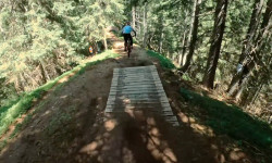
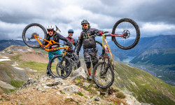
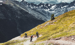
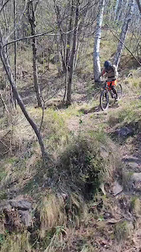
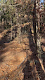
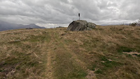
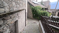
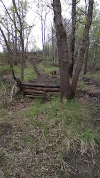
Photos of Lombardia Mountain Bike
Videos of Lombardia Mountain Bike
trail: Frasnadello
0:27 |
9 |
Apr 8, 2026
trail: Tabellone
0:54 |
7 |
Feb 14, 2026
trail: Tabellone
0:44 |
4 |
Feb 14, 2026
trail: Tabellone
2:38 |
7 |
Feb 14, 2026
0:10 |
5 |
Jan 3, 2026
trail: Zocca
2:24 |
5 |
Nov 2, 2025
trail: Mula
2:03 |
29 |
Oct 31, 2025
trail: Valhalla Trail
0:09 |
17 |
Apr 24, 2025
Current Trail Warnings
| status | trail | date | condition | user | info |
|---|---|---|---|---|---|
| Pian della Rovere - Vallone Albese Albese Con Cassano | Jun 30, 2026 @ 9:27am (Europe/Rome) 4 hours | Dry | schett | Canyon sporco con pietre smosse. La... | |
| Pinera Tavernerio | Jun 30, 2026 @ 1:19am (Europe/Rome) 12 hours | Very Dry | Mirk8kk | Conciata molto male, diversi alberi... | |
| Muse - Prá del Bis Edolo | Jun 28, 2026 @ 12:48pm (Europe/Rome) 2 days | Unknown | gabrieleplona | Molte piante grosse cadute |
Recent Trail Reports
National Scenic Trails & Official Routes
-
Trans-Altarezia Bike #32
- Mountain Bike
- E-Bike

Activity Feed
| username | action | type | title | date |
|---|---|---|---|---|
| pit907 | add | report | activity #98116078 | Jun 30, 2026 @ 2:23am 2 hours |
| pit907 | add | report | activity #98116064 | Jun 30, 2026 @ 2:23am 2 hours |
| dadob | add | report | activity #98114552 and 3 more | Jun 30, 2026 @ 1:12am 3 hours |
| dadob | add | report | activity #98114550 and 1 more | Jun 30, 2026 @ 1:12am 3 hours |
| alephzer0 | wishlist | trail | activity #98113167 | Jun 30, 2026 @ 12:48am 3 hours |
Recent Comments
| username | type | title | comment | date |
|---|---|---|---|---|
| trail | Si, fattibile praticamente tutto, ma con... | Jun 28, 2026 @ 10:06am 2 days | ||
| report | Thank you Marco | Jun 28, 2026 @ 9:17am 2 days | ||
| report | @gabrieleplona ho modificato il trail report... | Jun 28, 2026 @ 7:11am 2 days | ||
| report | So I edited in “all good”. Thank you | Jun 28, 2026 @ 12:35am 2 days | ||
| trail | Ho aggiunto un paio di foto che testimoniano... | Jun 27, 2026 @ 7:23am 3 days |
Local Badges
-

Top 10 Trails0 awarded -

Epic Ride 50k5 awarded -
Top 10 Trails0 awarded -

Completionist0 awarded -
Top 10 Trails0 awarded -
Epic Ride 50k23 awarded
Bike & Skill Parks
| name | type | city | rating |
|---|---|---|---|
| Carosello 3000 Mountain Park | bike park | Livigno | |
| Mottolino Bike Park | bike park | Livigno | |
| Spiazzi di Gromo | bike park | Gromo | |
| Monte Poieto Bike Park | bike park | Aviatico | |
| Love BikePark | bike park | Piazzatorre |
Local Products
Activity Type Stats
| activitytype | trails | distance | descent | descent distance | total vertical | rating | global rank | state rank | photos | reports | routes | ridelogs |
|---|---|---|---|---|---|---|---|---|---|---|---|---|
| Mountain Bike | 6,650 | 7,116 miles | 2,673,917 ft | 3,806 miles | 10,617 ft | 8,050 | 48,340 | 385 | 396,913 | |||
| E-Bike | 5,413 | 5,839 miles | 2,078,419 ft | 3,047 miles | 9,797 ft | 247 | 45,891 | 227 | 61,047 | |||
| Gravel Bike | 227 | 350 miles | 66,759 ft | 133 miles | 9,590 ft | 67 | 3,836 | 60 | 6,229 | |||
| Adaptive Bike | 1,230 | 1,710 miles | 192,887 ft | 604 miles | 9,770 ft | 1 | 10,119 | 5 | 3 | |||
| Winter Fat Bike | 1,657 | 1,724 miles | 319,196 ft | 714 miles | 9,442 ft | 5,343 | 9 | 1 | ||||
| Horse | 575 | 773 miles | 182,474 ft | 330 miles | 9,747 ft | 3,682 | 17 | |||||
| Hike | 6,074 | 6,560 miles | 2,462,575 ft | 3,447 miles | 10,607 ft | 155 | 47,079 | 67 | 25,240 | |||
| Trail Running | 6,033 | 6,568 miles | 2,435,571 ft | 3,434 miles | 9,797 ft | 15 | 47,039 | 62 | 25,725 | |||
| Dirtbike/Moto | 1 | 2 miles | 522 ft | 5,059 ft | 551 ft | 4 | 2,650 | 2 | 40 | |||
| Observed Trials | 1 | 1,325 ft | 85 ft | 1 | 400 | 2 | ||||||
| ATV/ORV/OHV | 1 | 2 miles | 522 ft | 5,059 ft | 551 ft | 2,645 | 17 | |||||
| Snowmobile | 1 | 1,142 ft | 194 ft | 1,142 ft | 194 ft | 5 | ||||||
| Snowshoe | 180 | 301 miles | 98,458 ft | 130 miles | 8,278 ft | 316 | 3 | 230 | ||||
| Downhill Ski | 261 | 162 miles | 177,549 ft | 156 miles | 8,937 ft | 196 | 5,293 | |||||
| Backcountry Ski | 105 | 146 miles | 52,608 ft | 65 miles | 9,239 ft | 130 | 2 | 3,197 | ||||
| Nordic Ski | 16 | 27 miles | 8,356 ft | 9 miles | 6,093 ft | 55 | 1 | 2,403 |
Activities
- Lombardia Mountain Biking Trails
- Lombardia E-Biking Trails
- Lombardia Gravel Biking Trails
- Lombardia Adaptive Biking Trails
- Lombardia Winter Fat Biking Trails
- Lombardia Horseback Trails
- Lombardia Hiking Trails
- Lombardia Trail Running Trails
- Lombardia Snowshoeing Trails
- Lombardia Skiing Trails
- Lombardia Backcountry Skiing Trails
- Lombardia Nordic Skiing Trails
Trails
Points of Interest
- Madonon Viewpoint
- [City Park] Parco Don Giussani Other
- TTF - Rocky & steep section
- Orrido di Cà del Monte Viewpoint
- Agriturismo Ca' del Monte Viewpoint
- Balze di Guardamonte Viewpoint
- Best view on Livigno's Lake Viewpoint
- Ticket office Information
- Ticket office Information
- Viewpoint Bocca Di Nansesa
- Bellavista Hauptgipfel (12,707 ft)
- Piz Zupò (12,648 ft)
- Schneekuppe (12,536 ft)
- By brenthillier
 NSMBA TRAILFORKS & contributors
 - Admins: denitopia, marcoangeletti, cemoorelife, marcoangeletti, adessoomaipiu, micheletraversi
- #9484 - 45,389 views
- lombardia activity log | embed map of Lombardia mountain bike trails | lombardia mountain biking points of interest polygons
Downloading of trail gps tracks in kml & gpx formats is enabled for Lombardia.
You must login to download files.