close
-
Layers w
- Weather Layers
- Pro
- Pro
- Pro
- Pro
- Pro
- Pro
- More Layers
- Pro
- Pro
- Pro
- Pro
-
Upgrade to

3D
Trail Conditions
- Unknown
- Snow Groomed
- Snow Packed
- Snow Covered
- Snow Cover Partial
- Freeze/thaw Cycle
- Icy
- Prevalent Mud
- Wet
- Variable
- Ideal
- Dry
- Very Dry
Trail Flow (Ridden Direction)
Trailforks scans users ridelogs to determine the most popular direction each trail is ridden. A good flowing trail network will have most trails flowing in a single direction according to their intension.
The colour categories are based on what percentage of riders are riding a trail in its intended direction.
The colour categories are based on what percentage of riders are riding a trail in its intended direction.
- > 96%
- > 90%
- > 80%
- > 70%
- > 50%
- < 50%
- bi-directional trail
- no data
Trail Last Ridden
Trailforks scans ridelogs to determine the last time a trail was ridden.
- < 2 days
- < 1 week
- < 2 weeks
- < 1 month
- < 6 months
- > 6 months
Trail Ridden Direction
The intended direction a trail should be ridden.
- Downhill Only
- Downhill Primary
- Both Directions
- Uphill Primary
- Uphill Only
- One Direction
Contribute Details
Colors indicate trail is missing specified detail.
- Description
- Photos
- Description & Photos
- Videos
Trail Popularity ?
Trailforks scans ridelogs to determine which trails are ridden the most in the last 9 months.
Trails are compared with nearby trails in the same city region with a possible 25 colour shades.
Think of this as a heatmap, more rides = more kinetic energy = warmer colors.
- most popular
- popular
- less popular
- not popular
ATV/ORV/OHV Filter
Max Vehicle Width
inches
US Cell Coverage
Legend

Radar Time
Activity Recordings
Trailforks uses anonymized public activity data.
?
Activity Recordings
Trailforks uses anonymized public activity data.
?
Personal Heatmap
▶
Activity Types
all
/
none
▶
Options
2
Date range
month
–
Winter Trails
Warning
A routing network for winter maps does not exist. Selecting trails using the winter trails layer has been disabled.
Missing Trails
Most Popular
Least Popular
Trails are colored based on popularity. The more popular a trail is, the more red. Less popular trails trend towards green.
Jump Magnitude Heatmap
Heatmap of where riders jump on trails. Zoom in to see individual jumps, click circles to view jump details.
BC Backroad Status
![map legend]()
Service Road Atlas is a free to use, community-driven service for viewing and creating reports on the numerous back-country service roads around B.C. and Alberta.

Slope Aspect
Direction the slope faces
Trails Deemphasized
Trails are shown in grey.
Only show trails with no bike usage.
Suggested Layers
Based on selected activity type
Save the current map location and zoom level as your default home location whenever this page is loaded.
SaveRéseau de traces très bien entretenues et indiquées, parking possible au lycée du Nivot avec un accès aux différentes zones (Nivot, Squiriou) ainsi qu'à des boucles plus typées XC/gravel. La boucle balisée Brasparts - St Rivoal passe à proximité.
This region uses the Uk/Euro style trail grading system.
Activities Click to view
- Mountain Bike
9 trails
- E-Bike
1 trails
- Adaptive Bike
- Horse
0 trails
- Hike
1 trails
- Trail Running
0 trails
- Dirtbike/Moto
0 trails
- Observed Trials
0 trails
- ATV/ORV/OHV
0 trails
Region Details
- 1
- 4
- 2
- 2
Region Status
Open as of Oct 6, 2024Stats
- Avg Trail Rating
- Trails (view details)
- 9
- Trails Mountain Bike
- 9
- Trails E-Bike
- 1
- Trails Hike
- 1
- Total Distance
- 8 miles
- Total Descent Distance
- 5 miles
- Total Descent
- 2,775 ft
- Total Vertical
- 583 ft
- Highest Trailhead
- 820 ft
- Reports
- 42
- Photos
- 5
- Ridden Counter
- 82
Sub Regions
-
Le Nivot
- 4
- 2
- 2
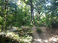
Popular Lopérec Mountain Biking Trails
• 5 ★ 5.0 • 4,390 ft • 0 ft • 12 •
"95" track starting at the gravity zone (wooden departure tower) in Le Nivot bikepark area.
• 100 ★ 5.0 • 2,493 ft • 0 ft • 7 •
Liaison entre le parking du lycée du Nivot et le bas du Squiriou. Petite descente sympa en douceur avant de basculer côté Squiriou (Canyon, Montana, boucles 1, 2, 3 et 4).
• 5 ★ 3.0 • 2,205 ft • 3 ft • 7 •
Bouc blanc track, a nice enduro singletrack with a couple of drops (that can be avoided).
• 5 ★ 5.0 • 1 mile • 26 ft • 7 •
Canyon track on the Squiriou hill near Le Nivot high school. The top of the track resembles a small half pipe (hence the name) and you ride along the stream at the bottom of it. Some wooden features.
• 5 ★ 5.0 • 1 mile • 197 ft • 4 •
Boucle numéro 8 au départ et à l'arrivée du parking du lycée. Première partie typée trail/enduro et dernière partie facile avec une remontée par un chemin de tracteur. Possibilité d'accéder côté Squiriou depuis le milieu de...
• 5 ★ 0.0 • 1,516 ft • 0 ft • 1 •
Descente technique avec du devers, quelques virages serrés dans la pente.
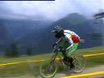
Videos of Lopérec Mountain Bike

trail: Canyon (Squiriou)
6:13 |
211 |
May 22, 2016

trail: Bouc Blanc
2:40 |
173 |
Apr 19, 2016

trail: Bouc Blanc
2:35 |
118 |
Jan 25, 2016

trail: Canyon (Squiriou)
0:06 |
288 |
Jan 30, 2015

trail: Canyon (Squiriou)
0:14 |
337 |
Sep 2, 2013
trail: Canyon (Squiriou)
0:10 |
360 |
Sep 2, 2013

trail: Canyon (Squiriou)
0:45 |
316 |
Jan 28, 2010
trail: Canyon (Squiriou)
4:48 |
1938 |
Aug 5, 2008
Recent Trail Reports
| status | trail | date | condition | info | user |
|---|---|---|---|---|---|
| Bouc Blanc | Oct 6, 2024 @ 12:57pm Oct 6, 2024 | Wet | ronan29 | ||
| Quatre-vingt-quinze (95) | Oct 6, 2024 @ 12:57pm Oct 6, 2024 | Wet | ronan29 | ||
| Route d'accès Le Nivot | Oct 6, 2024 @ 12:57pm Oct 6, 2024 | Wet | ronan29 | ||
| Liaison Parking Nivot - Squiriou | Oct 6, 2024 @ 12:57pm Oct 6, 2024 | Wet | ronan29 | ||
| Numéro Huit (8) | Jun 3, 2024 @ 10:31am Jun 3, 2024 | Ideal | ronan29 | ||
| Canyon (Squiriou) | Mar 5, 2023 @ 10:20am Mar 5, 2023 | Variable | ronan29 |
Activity Feed
| username | action | type | title | date |
|---|---|---|---|---|
| Jeremyou3OTE | wishlist | region | activity #94581770 | May 12, 2026 @ 1:44pm May 12, 2026 |
| Gozi | wishlist | trail | activity #79484820 and 1 more | Sep 2, 2025 @ 6:59am Sep 2, 2025 |
| Gozi | wishlist | region | activity #79475290 | Sep 2, 2025 @ 2:39am Sep 2, 2025 |
| ronan29 | add | report | activity #60099324 and 3 more | Oct 7, 2024 @ 1:43am Oct 7, 2024 |
| whalex | add | report | activity #56431774 and 2 more | Jul 30, 2024 @ 4:16am Jul 30, 2024 |
Activity Type Stats
| activitytype | trails | distance | descent | descent distance | total vertical | rating | global rank | state rank | photos | reports | routes | ridelogs |
|---|---|---|---|---|---|---|---|---|---|---|---|---|
| Mountain Bike | 9 | 8 miles | 2,776 ft | 5 miles | 584 ft | #7,691 | #387 | 5 | 42 | 182 | ||
| E-Bike | 1 | 4,390 ft | 413 ft | 4,150 ft | 413 ft | #9,631 | #957 | 15 | 13 | |||
| Hike | 1 | 1 mile | 72 ft | 948 ft | 423 ft | #14,171 | #972 | 24 | 8 |
Frequently Asked Questions About Lopérec
▼
What are the best places to ride in Lopérec?
Lopérec has 1 areas to explore for mountain biking. The top rated areas are:
▼
What are the highest rated mountain biking trails in Lopérec?
The highest rated mountain biking trails in Lopérec are:
- Liaison Parking Nivot - Squiriou (4.1/5)
- Numéro Huit (8) (4.1/5)
- Quatre-vingt-quinze (95) (4.1/5)
- Canyon (Squiriou) (4.1/5)
- Numéro Quatre (4) (4/5)
▼
What is the best time of the year to ride in Lopérec?
Based on ride log data, the most popular months to ride in Lopérec are:
- June (4 activities)
- September (3 activities)
- March (1 activities)
▼
Where can I park to ride in Lopérec?
Check the Lopérec trail map for trailhead and parking information. Community members regularly update access and parking details for trails in the area.
- By ronan29 & contributors
- Admins: apply
- #33374 - 1,002 views
- lopérec activity log | embed map of Lopérec mountain bike trails |
Downloading of trail gps tracks in kml & gpx formats is enabled for Lopérec.
You must login to download files.