close
-
Layers w
- Weather Layers
- Pro
- Pro
- Pro
- Pro
- Pro
- Pro
- More Layers
- Pro
- Pro
- Pro
- Pro
-
Upgrade to

3D
Trail Conditions
- Unknown
- Snow Groomed
- Snow Packed
- Snow Covered
- Snow Cover Partial
- Freeze/thaw Cycle
- Icy
- Prevalent Mud
- Wet
- Variable
- Ideal
- Dry
- Very Dry
Trail Flow (Ridden Direction)
Trailforks scans users ridelogs to determine the most popular direction each trail is ridden. A good flowing trail network will have most trails flowing in a single direction according to their intension.
The colour categories are based on what percentage of riders are riding a trail in its intended direction.
The colour categories are based on what percentage of riders are riding a trail in its intended direction.
- > 96%
- > 90%
- > 80%
- > 70%
- > 50%
- < 50%
- bi-directional trail
- no data
Trail Last Ridden
Trailforks scans ridelogs to determine the last time a trail was ridden.
- < 2 days
- < 1 week
- < 2 weeks
- < 1 month
- < 6 months
- > 6 months
Trail Ridden Direction
The intended direction a trail should be ridden.
- Downhill Only
- Downhill Primary
- Both Directions
- Uphill Primary
- Uphill Only
- One Direction
Contribute Details
Colors indicate trail is missing specified detail.
- Description
- Photos
- Description & Photos
- Videos
Trail Popularity ?
Trailforks scans ridelogs to determine which trails are ridden the most in the last 9 months.
Trails are compared with nearby trails in the same city region with a possible 25 colour shades.
Think of this as a heatmap, more rides = more kinetic energy = warmer colors.
- most popular
- popular
- less popular
- not popular
ATV/ORV/OHV Filter
Max Vehicle Width
inches
US Cell Coverage
Legend

Radar Time
Activity Recordings
Trailforks uses anonymized public activity data.
?
Activity Recordings
Trailforks uses anonymized public activity data.
?
Personal Heatmap
▶
Activity Types
all
/
none
▶
Options
2
Date range
month
–
Winter Trails
Warning
A routing network for winter maps does not exist. Selecting trails using the winter trails layer has been disabled.
Missing Trails
Most Popular
Least Popular
Trails are colored based on popularity. The more popular a trail is, the more red. Less popular trails trend towards green.
Jump Magnitude Heatmap
Heatmap of where riders jump on trails. Zoom in to see individual jumps, click circles to view jump details.
BC Backroad Status
![map legend]()
Service Road Atlas is a free to use, community-driven service for viewing and creating reports on the numerous back-country service roads around B.C. and Alberta.

Slope Aspect
Direction the slope faces
Trails Deemphasized
Trails are shown in grey.
Only show trails with no bike usage.
Suggested Layers
Based on selected activity type
Save the current map location and zoom level as your default home location whenever this page is loaded.
SaveLos Barriles is a town in La Paz Municipality, Baja California Sur, Mexico. As 2020, the town had a population of 1,674 people.
It is situated along Highway 1, 40 miles (64 km) north of San José del Cabo and 65 miles (105 km) south of La Paz. Punta Pescadero Airstrip is 9 miles (14 km) to the north; Rancho Leonero, a vacation resort, is to the south. Adjacent to Buenavista, the rural towns straddle the head of Bahía las Palmas on the Gulf of California, where winter westerlies average 20–25 knots (37–46 km/h; 23–29 mph). Los Barriles is within the transition area of the Baja California peninsula's Sierra de la Laguna where the hills become sandy flats.
It is situated along Highway 1, 40 miles (64 km) north of San José del Cabo and 65 miles (105 km) south of La Paz. Punta Pescadero Airstrip is 9 miles (14 km) to the north; Rancho Leonero, a vacation resort, is to the south. Adjacent to Buenavista, the rural towns straddle the head of Bahía las Palmas on the Gulf of California, where winter westerlies average 20–25 knots (37–46 km/h; 23–29 mph). Los Barriles is within the transition area of the Baja California peninsula's Sierra de la Laguna where the hills become sandy flats.
source: Los Barriles - Wikipedia
Activities Click to view
- Mountain Bike
65 trails
- E-Bike
65 trails
- Gravel Bike
4 trails
- Adaptive Bike
19 trails
- Winter Fat Bike
29 trails
- Hike
65 trails
- Trail Running
65 trails
Region Details
- 4
- 9
- 44
- 8
Region Status
Open as of Mar 31, 2026Stats
- Avg Trail Rating
- Trails (view details)
- 66
- Trails Mountain Bike
- 65
- Trails E-Bike
- 65
- Trails Gravel Bike
- 4
- Trails Adaptive Bike
- 19
- Trails Winter Fat Bike
- 29
- Trails Hike
- 65
- Trails Trail Running
- 65
- Trails Dirtbike/Moto
- 1
- Total Distance
- 70 miles
- Total Descent Distance
- 29 miles
- Total Descent
- 11,788 ft
- Total Vertical
- 1,302 ft
- Highest Trailhead
- 1,368 ft
- Reports
- 685
- Photos
- 88
- Ridden Counter
- 7,725
Popular Los Barriles Mountain Biking Trails
• 75 ★ 3.8 • 1 mile • 105 ft • 272 •
Best ridden down. There are 3 quite technical parts of the trail which can be bypassed by riding s in either direction. Overall though it is a fun ride down for the experienced rider.
• 100 ★ 2.5 • 1,050 ft • 0 ft • 253 •
One word. SAND. A trail made by Todd to help get Beans the dog to the other trail heads avoiding the highway. Downhill or South only to try and keep the sand from getting too loose. A fun challenge to make it up the two little ramps.
• 100 ★ 3.0 • 1,824 ft • 24 ft • 242 •
A connector to avoid riding the highway to other trail heads. A good test trail for the area. If you find the rocks and slippery dirt a challenge here don't go further.
• 90 ★ 4.0 • 1 mile • 209 ft • 217 •
The easiest way up into the trail system. Nothing technical, good for beginners and those working on fitness.
• 95 ★ 3.8 • 5,020 ft • 225 ft • 184 •
Access is near the Barrels Fountain off hwy 1. Initial climb from trail head at highway 1 is moderately difficult then the trail is green to . Nice views and good climbing access to via or to loop. has three climbing bypasses making...
• 95 ★ 3.7 • 430 ft • 49 ft • 178 •
a less technical lower grade climb than the main ridge section of going from East to West
• 95 ★ 0.0 • 3,399 ft • 143 ft • 175 •
Popular blue difficulty singletrack. This mountain bike primary trail can be used both directions and has a moderate overall physical rating with a 143 ft blue climb. On average it takes 10 minutes to complete this trail.
Los Barriles Mountain Bike Routes
★ 3.4 • 7 miles • 1,361 ft • 15 • Out & Back •
Out and back, notice the ,2,3 bypasses they are intended as climbs going east to west. Ride the original...
★ 3.4 • 7 miles • 1,068 ft • 10 • Loop •
Scotties Cielo and Gummy are three of the original trails that have seen major repairs/enhancements over...
★ 3.0 • 17 miles • 1,843 ft • 0 •
.........................................................................................
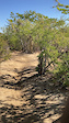
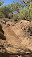
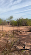
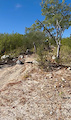
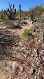
Photos of Los Barriles Mountain Bike
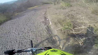
Videos of Los Barriles Mountain Bike
trail: Ochito
0:06 |
22 |
Dec 2, 2024
trail: Ochito
0:05 |
20 |
Dec 2, 2024
trail: Scottys
0:09 |
24 |
Nov 30, 2024
trail: Buenos Aires Trail
0:06 |
43 |
Nov 27, 2024
trail: Buenos Aires Trail
0:06 |
32 |
Nov 27, 2024
trail: La Cumbre
5:19 |
445 |
May 21, 2014

youtuber
![Looking For Dolphins! | Snorkeling &...]()

trail: Gummy Bear
22:37 |
312 |
Jun 28, 2022 , Los Barriles
Recent Trail Reports
Activity Feed
| username | action | type | title | date |
|---|---|---|---|---|
| antgvaz | ridden | trail | activity #95254896 | May 22, 2026 @ 10:56am May 22, 2026 |
| LF12 | wishlist | region | activity #94385535 | May 9, 2026 @ 4:07pm May 9, 2026 |
| MrNacho | add | karma | activity #93865640 and 1 more | May 2, 2026 @ 8:53am May 2, 2026 |
| Gammo | add | karma | activity #93361022 | Apr 25, 2026 @ 8:50am Apr 25, 2026 |
| MarkoYmMiqa | wishlist | trail | activity #93001659 | Apr 19, 2026 @ 10:26pm Apr 19, 2026 |
Recent Comments
| username | type | title | comment | date |
|---|---|---|---|---|
| trail | Flowing great right now. A lot of work has... | Mar 8, 2026 @ 2:26pm Mar 8, 2026 | ||
| report | Firñaof fq uy uy yeyr iñhbdgHay | Dec 19, 2025 @ 10:41am Dec 19, 2025 | ||
| report | Mx x | Dec 19, 2025 @ 10:37am Dec 19, 2025 | ||
| trail | So much fun! Thought it would be a connecting... | May 6, 2025 @ 1:59pm May 6, 2025 | ||
| trail | This is a great trail! Epic views at sunset as... | Apr 5, 2025 @ 9:08pm Apr 5, 2025 |
Local Badges
-

10 Green Trails77 awarded -

10 Blue Trails115 awarded -

Epic Ride Climb 2k8 awarded -

Climbing 10k Badge30 awarded -

Climbing 100k Badge3 awarded -

Epic Ride Descent 2k8 awarded
Local Trail Supporters
- Teresa's Tours
Activity Type Stats
| activitytype | trails | distance | descent | descent distance | total vertical | rating | global rank | state rank | photos | reports | routes | ridelogs |
|---|---|---|---|---|---|---|---|---|---|---|---|---|
| Mountain Bike | 65 | 59 miles | 10,640 ft | 26 miles | 1,302 ft | #984 | #9 | 57 | 685 | 3 | 7,994 | |
| E-Bike | 65 | 59 miles | 10,640 ft | 26 miles | 1,302 ft | #856 | #17 | 8 | 574 | 1,061 | ||
| Gravel Bike | 4 | 4 miles | 190 ft | 3,698 ft | 1,050 ft | #177 | #15 | 17 | 5 | |||
| Adaptive Bike | 19 | 18 miles | 2,274 ft | 6 miles | 1,050 ft | #84 | #25 | 209 | 1 | |||
| Winter Fat Bike | 29 | 30 miles | 4,035 ft | 11 miles | 1,302 ft | #61 | #14 | 328 | ||||
| Hike | 65 | 59 miles | 10,640 ft | 26 miles | 1,302 ft | #1,001 | #9 | 23 | 681 | 1,412 | ||
| Trail Running | 65 | 59 miles | 10,640 ft | 26 miles | 1,302 ft | #1,092 | #14 | 681 | 287 | |||
| Dirtbike/Moto | 1 | 10 miles | 1,148 ft | 4 miles | 984 ft | 164 | 21 |
Frequently Asked Questions About Los Barriles
▼
What are the highest rated mountain biking trails in Los Barriles?
The highest rated mountain biking trails in Los Barriles are:
- Ochito (4.2/5)
- Burro (upper) (4.2/5)
- Cha Cha (4.2/5)
- La Cumbre (4.2/5)
- Green Horn (4.2/5)
▼
What is the best time of the year to ride in Los Barriles?
Based on ride log data, the most popular months to ride in Los Barriles are:
- December (275 activities)
- January (267 activities)
- February (212 activities)
▼
Where can I park to ride in Los Barriles?
Check the Los Barriles trail map for trailhead and parking information. Community members regularly update access and parking details for trails in the area.
▼
What is the longest trail in Los Barriles?
The longest trail in Los Barriles is Pemex Ridge at 4.6 km. View all trails sorted by distance.
Activities
Trails
Points of Interest
- By bnelson234 & contributors
- Admins: BATS
- #17254 - 29,711 views
- los barriles activity log | embed map of Los Barriles mountain bike trails |
Downloading of trail gps tracks in kml & gpx formats is enabled for Los Barriles.
You must login to download files.