close
-
Layers w
- Weather Layers
- Pro
- Pro
- Pro
- Pro
- Pro
- Pro
- More Layers
- Pro
- Pro
- Pro
- Pro
-
Upgrade to

3D
Trail Conditions
- Unknown
- Snow Groomed
- Snow Packed
- Snow Covered
- Snow Cover Partial
- Freeze/thaw Cycle
- Icy
- Prevalent Mud
- Wet
- Variable
- Ideal
- Dry
- Very Dry
Trail Flow (Ridden Direction)
Trailforks scans users ridelogs to determine the most popular direction each trail is ridden. A good flowing trail network will have most trails flowing in a single direction according to their intension.
The colour categories are based on what percentage of riders are riding a trail in its intended direction.
The colour categories are based on what percentage of riders are riding a trail in its intended direction.
- > 96%
- > 90%
- > 80%
- > 70%
- > 50%
- < 50%
- bi-directional trail
- no data
Trail Last Ridden
Trailforks scans ridelogs to determine the last time a trail was ridden.
- < 2 days
- < 1 week
- < 2 weeks
- < 1 month
- < 6 months
- > 6 months
Trail Ridden Direction
The intended direction a trail should be ridden.
- Downhill Only
- Downhill Primary
- Both Directions
- Uphill Primary
- Uphill Only
- One Direction
Contribute Details
Colors indicate trail is missing specified detail.
- Description
- Photos
- Description & Photos
- Videos
Trail Popularity ?
Trailforks scans ridelogs to determine which trails are ridden the most in the last 9 months.
Trails are compared with nearby trails in the same city region with a possible 25 colour shades.
Think of this as a heatmap, more rides = more kinetic energy = warmer colors.
- most popular
- popular
- less popular
- not popular
ATV/ORV/OHV Filter
Max Vehicle Width
inches
US Cell Coverage
Legend

Radar Time
Activity Recordings
Trailforks uses anonymized public activity data.
?
Activity Recordings
Trailforks uses anonymized public activity data.
?
Personal Heatmap
▶
Activity Types
all
/
none
▶
Options
2
Date range
month
–
Winter Trails
Warning
A routing network for winter maps does not exist. Selecting trails using the winter trails layer has been disabled.
Missing Trails
Most Popular
Least Popular
Trails are colored based on popularity. The more popular a trail is, the more red. Less popular trails trend towards green.
Jump Magnitude Heatmap
Heatmap of where riders jump on trails. Zoom in to see individual jumps, click circles to view jump details.
BC Backroad Status
![map legend]()
Service Road Atlas is a free to use, community-driven service for viewing and creating reports on the numerous back-country service roads around B.C. and Alberta.

Slope Aspect
Direction the slope faces
Trails Deemphasized
Trails are shown in grey.
Only show trails with no bike usage.
Suggested Layers
Based on selected activity type
Save the current map location and zoom level as your default home location whenever this page is loaded.
Save
No description for Los Osos has been added yet!
Login or register to submit one.
Activities Click to view
- Mountain Bike
41 trails
- E-Bike
15 trails
- Gravel Bike
0 trails
- Adaptive Bike
- Horse
41 trails
- Hike
69 trails
- Trail Running
69 trails
Region Details
- 6
- 6
- 20
Region Status
Open as of Feb 8, 2026Stats
- Avg Trail Rating
- Trails (view details)
- 36
- Trails Mountain Bike
- 42
- Trails E-Bike
- 15
- Trails Horse
- 41
- Trails Hike
- 69
- Trails Trail Running
- 69
- Total Distance
- 45 miles
- Total Descent
- 8,724 ft
- Total Vertical
- 1,643 ft
- Highest Trailhead
- 1,651 ft
- Reports
- 599
- Photos
- 352
- Ridden Counter
- 6,336
Sub Regions
-
Montana de Oro State Park
- 5
- 14
- 1
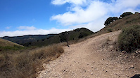
Popular Los Osos Mountain Biking Trails
• 90 ★ 4.4 • 4 miles • 394 ft • 1,224 •
A good trail to get newer riders hooked on single track, yet fun enough to keep you coming back. Just under 6 miles round trip. Great way to enter the MdO trail network to do larger loops or through rides. Lower 1/3 can be quite loose...
• 100 ★ 4.2 • 2,923 ft • 0 ft • 964 •
can be a FAST downhill comprised of hardpack sandstone that tends to have a bit of kitty litter on top. On the downhill, there is a very significant exposure in the form of a severely steep drop-off down into a canyon. The majority of...
• 95 ★ 3.6 • 2 miles • 510 ft • 938 •
The Trail is MdO's newest connector trail. After an approximately 2.5 year process from inception, it was opened to public multi-use on Saturday, February 23, 2019. Designed and built by CCCMB.org volunteers teamed with a machine...
• 80 ★ 4.2 • 1 mile • 7 ft • 896 •
Compared to other trails in the area, is relatively new. The top of the trail starts off of Oaks Peak Trail before the switchbacks, and the bottom reconnects just over a mile further down. It's a fun alternative and a way to bypass the...
• 70 ★ 3.6 • 4,285 ft • 175 ft • 789 •
Popular blue difficulty singletrack. This multi-use trail can be used both directions. On average it takes 8 minutes to complete this trail.
• 75 ★ 4.0 • 1 mile • 124 ft • 776 •
starts from East Boundary with a short climb with several short switchbacks. Beware of poison oak in this section. The top (mile 0.3) provides good views to the South side of Montana de Oro SP. Right off the top, begins a steep twisty...
• 85 ★ 4.3 • 5 miles • 1,406 ft • 748 •
Newest trail opened to MTB in the Montana de Oro. One of four trails south of Islay Creek open to biking.(Others include Beebee trail, and the ) Approx 11 miles round trip, be prepared for some pedaling and a fun descent. Last .5 mile...
• 70 ★ 4.0 • 2 miles • 202 ft • 673 •
begins with a moderate climb through thick vegetation. The microclimate changes soon to sandy chaparral, and about half way up this climb (mile 0.4), turn left at the Hazard Peak Trail junction to stay on . The junction at mile 0.9 just...
Los Osos Mountain Bike Routes
★ 4.0 • 6 miles • 805 ft • 6 • Point to Point •
A very common route to ride at Montana De Oro. For a good warm-up, park at the end of the trail and then...
★ 4.0 • 10 miles • 1,763 ft • 5 • Loop •
The Figure 8 Route is a double loop that starts/ends at the trail parking lot. From there, ride up Pecho...
11 miles • 1,501 ft • 1 • Loop •
A fun intermediate route with some tech and flow.
25 miles • 3,531 ft • 8 • Loop •
Created a route I will ride this week. Let's see how much of it makes sense. Will report back
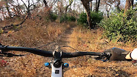
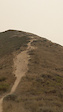
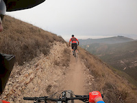
Photos of Los Osos Mountain Bike
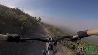
Videos of Los Osos Mountain Bike
trail: East Boundary Trail - South
0:46 |
126 |
Oct 25, 2021

trail: Islay Creek Road
0:18 |
4 |
Sep 18, 2020
trail: Oats Peak
0:42 |
68 |
Sep 16, 2020
trail: Canyon View
8:35 |
231 |
Sep 15, 2020
trail: Hazard's Peak Trail
4:41 |
114 |
Sep 15, 2020

trail: Oats Peak
0:29 |
60 |
Sep 13, 2020

trail: Oats Peak
0:12 |
84 |
Sep 13, 2020
trail: Oats Peak
7:55 |
63 |
Jul 18, 2020
Recent Trail Reports
Activity Feed
| username | action | type | title | date |
|---|---|---|---|---|
| Tracyallen678 | wishlist | trail | activity #97152477 | Jun 16, 2026 @ 6:06pm 3 days |
| jdbrickhouse | wishlist | route | activity #97076892 | Jun 15, 2026 @ 5:29pm Jun 15, 2026 |
| RacerGDLvXM | wishlist | trail | activity #96536554 | Jun 8, 2026 @ 6:55am Jun 8, 2026 |
| Braap1ife | ridden | trail | activity #96501649 | Jun 7, 2026 @ 3:19pm Jun 7, 2026 |
| agoura-biker | wishlist | region | activity #96180156 | Jun 3, 2026 @ 2:15pm Jun 3, 2026 |
Recent Comments
| username | type | title | comment | date |
|---|---|---|---|---|
| trail | This is my favorite Trail in the area. Five... | May 23, 2025 @ 6:13pm May 23, 2025 | ||
| trail | Came down Barranca (fun challenge) hoping to... | Apr 17, 2025 @ 8:21pm Apr 17, 2025 | ||
| trail | Not a black but tricky blue territory! Fairly... | Apr 17, 2025 @ 8:11pm Apr 17, 2025 | ||
| trail | Fast, flowy descent w/ some fun little... | Apr 13, 2025 @ 10:30pm Apr 13, 2025 | ||
| trail | Fun singletrack descent. Correctly classified... | Apr 13, 2025 @ 10:23pm Apr 13, 2025 |
Local Badges
-

Descent 10k Badge5 awarded -

Epic Mountain Bike Climb 2k1 awarded -

Climbing 10k Badge4 awarded -

Mountain Biking 100k Badge0 awarded -

Epic Ride Descent 2k1 awarded -

Big Ride 30k66 awarded
Activity Type Stats
| activitytype | trails | distance | descent | descent distance | total vertical | rating | global rank | state rank | photos | reports | routes | ridelogs |
|---|---|---|---|---|---|---|---|---|---|---|---|---|
| Mountain Bike | 41 | 41 miles | 7,897 ft | 19 miles | 1,644 ft | #2,369 | #846 | 358 | 597 | 9 | 16,032 | |
| E-Bike | 15 | 5 miles | 1,362 ft | 3 miles | 1,152 ft | #5,675 | #1,754 | 475 | 1 | 1,148 | ||
| Horse | 41 | 8 miles | 1,467 ft | 4 miles | 945 ft | #1,760 | #995 | 259 | 4 | |||
| Hike | 69 | 45 miles | 8,724 ft | 22 miles | 1,644 ft | #4,197 | #1,480 | 2 | 596 | 952 | ||
| Trail Running | 69 | 45 miles | 8,724 ft | 22 miles | 1,644 ft | #4,009 | #1,214 | 596 | 576 |
Frequently Asked Questions About Los Osos
▼
What are the best places to ride in Los Osos?
Los Osos has 1 areas to explore for mountain biking. The top rated areas are:
▼
What are the highest rated mountain biking trails in Los Osos?
The highest rated mountain biking trails in Los Osos are:
- Hazard's Peak Trail (4.3/5)
- Oats Peak (4.2/5)
- Beebe Trail (4.1/5)
- Manzanita Trail (4.1/5)
- East Boundary Trail - North (4.1/5)
▼
What is the best time of the year to ride in Los Osos?
Based on ride log data, the most popular months to ride in Los Osos are:
- December (140 activities)
- February (118 activities)
- November (107 activities)
▼
Where can I park to ride in Los Osos?
There are 6 parking locations listed in Los Osos. The most popular parking spots are: View all parking and trailhead locations on the map to plan your visit.
Activities
Trails
- By maddy03
 & contributors
 - Admins: CCCMB
- #56088 - 2,250 views
- los osos activity log | embed map of Los Osos mountain bike trails | los osos mountain biking points of interest
Downloading of trail gps tracks in kml & gpx formats is enabled for Los Osos.
You must login to download files.