close
-
Layers w
- Weather Layers
- Pro
- Pro
- Pro
- Pro
- Pro
- Pro
- More Layers
- Pro
- Pro
- Pro
- Pro
-
Upgrade to

3D
Trail Conditions
- Unknown
- Snow Groomed
- Snow Packed
- Snow Covered
- Snow Cover Partial
- Freeze/thaw Cycle
- Icy
- Prevalent Mud
- Wet
- Variable
- Ideal
- Dry
- Very Dry
Trail Flow (Ridden Direction)
Trailforks scans users ridelogs to determine the most popular direction each trail is ridden. A good flowing trail network will have most trails flowing in a single direction according to their intension.
The colour categories are based on what percentage of riders are riding a trail in its intended direction.
The colour categories are based on what percentage of riders are riding a trail in its intended direction.
- > 96%
- > 90%
- > 80%
- > 70%
- > 50%
- < 50%
- bi-directional trail
- no data
Trail Last Ridden
Trailforks scans ridelogs to determine the last time a trail was ridden.
- < 2 days
- < 1 week
- < 2 weeks
- < 1 month
- < 6 months
- > 6 months
Trail Ridden Direction
The intended direction a trail should be ridden.
- Downhill Only
- Downhill Primary
- Both Directions
- Uphill Primary
- Uphill Only
- One Direction
Contribute Details
Colors indicate trail is missing specified detail.
- Description
- Photos
- Description & Photos
- Videos
Trail Popularity ?
Trailforks scans ridelogs to determine which trails are ridden the most in the last 9 months.
Trails are compared with nearby trails in the same city region with a possible 25 colour shades.
Think of this as a heatmap, more rides = more kinetic energy = warmer colors.
- most popular
- popular
- less popular
- not popular
ATV/ORV/OHV Filter
Max Vehicle Width
inches
US Cell Coverage
Legend

Radar Time
Activity Recordings
Trailforks uses anonymized public activity data.
?
Activity Recordings
Trailforks uses anonymized public activity data.
?
Personal Heatmap
▶
Activity Types
all
/
none
▶
Options
2
Date range
month
–
Winter Trails
Warning
A routing network for winter maps does not exist. Selecting trails using the winter trails layer has been disabled.
Missing Trails
Most Popular
Least Popular
Trails are colored based on popularity. The more popular a trail is, the more red. Less popular trails trend towards green.
Jump Magnitude Heatmap
Heatmap of where riders jump on trails. Zoom in to see individual jumps, click circles to view jump details.
BC Backroad Status
![map legend]()
Service Road Atlas is a free to use, community-driven service for viewing and creating reports on the numerous back-country service roads around B.C. and Alberta.

Slope Aspect
Direction the slope faces
Trails Deemphasized
Trails are shown in grey.
Only show trails with no bike usage.
Suggested Layers
Based on selected activity type
Save the current map location and zoom level as your default home location whenever this page is loaded.
Save
No description for Lost Creek has been added yet!
Login or register to submit one.
 google parking directions
Primary Trail Type: All-Mountain & Downhill
google parking directions Activities Click to view
- Mountain Bike
36 trails
- Hike
36 trails
- Trail Running
36 trails
Region Details
- 9
- 2
- 6
- 16
Region Status
Open as of May 26, 2026Local Trail Association
Stats
- Avg Trail Rating
- Trails (view details)
- 33
- Trails Mountain Bike
- 36
- Trails Hike
- 36
- Trails Trail Running
- 36
- Total Distance
- 19 miles
- Total Descent
- 2,527 ft
- Total Vertical
- 894 ft
- Highest Trailhead
- 2,315 ft
- Reports
- 177
- Photos
- 65
- Ridden Counter
- 6,195
Popular Lost Creek Mountain Biking Trails
• 95 ★ 4.3 • 2 miles • 272 ft • 305 •
Highly rated popular blue difficulty singletrack. This multi-use trail can be used both directions and has a moderate overall physical rating with a 272 ft blue climb. On average it takes 14 minutes to complete this trail.
• 95 ★ 4.0 • 5,084 ft • 19 ft • 295 •
Highly rated popular blue difficulty singletrack. This multi-use trail can be used both directions and has a moderate overall physical rating with a 19 ft blue climb. On average it takes 8 minutes to complete this trail.
• 85 ★ 4.0 • 1,644 ft • 14 ft • 270 •
Popular blue difficulty singletrack. This multi-use trail can be used both directions and has a moderate overall physical rating with a 14 ft blue climb. On average it takes 2 minutes to complete this trail.
• 100 ★ 4.5 • 587 ft • 0 ft • 254 •
Popular blue difficulty singletrack. This multi-use trail can be used both directions and has a moderate overall physical rating with a 0 ft blue climb. On average it takes 3 minutes to complete this trail.
• 80 ★ 4.2 • 2,983 ft • 183 ft • 243 •
Highly rated popular black diamond difficulty singletrack. This multi-use trail can be used both directions. On average it takes 10 minutes to complete this trail.
• 85 ★ 3.9 • 4,724 ft • 8 ft • 239 •
Popular black diamond difficulty singletrack. This multi-use trail can be used downhill primary and has a hard overall physical rating with a 8 ft black diamond climb. On average it takes 9 minutes to complete this trail.
• 85 ★ 3.7 • 1,905 ft • 130 ft • 237 •
Popular black diamond difficulty singletrack. This multi-use trail can be used uphill primary and has a hard overall physical rating with a 130 ft black diamond climb. On average it takes 7 minutes to complete this trail.
Lost Creek Mountain Bike Routes
★ 3.0 • 8 miles • 1,046 ft • 10 • Loop •
Big loop through the Verrado trail system taking most of the challenging trails to create a big loop....
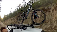
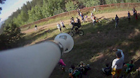
Photos of Lost Creek Mountain Bike

Recent Trail Reports
| status | trail | date | condition | info | user |
|---|---|---|---|---|---|
| Widow Maker | Nov 22, 2025 @ 5:31pm (America/Phoenix) Nov 22, 2025 | Ideal | rdcam | ||
| High Line | Nov 12, 2025 @ 1:42am (America/Phoenix) Nov 12, 2025 | Ideal | rdcam | ||
| Cholla | Nov 12, 2025 @ 1:38am (America/Phoenix) Nov 12, 2025 | Ideal | rdcam | ||
| Skyline d-track | Feb 17, 2024 @ 5:02am Feb 17, 2024 | Dry | williamaja | ||
| Lost Creek d-track | May 25, 2023 @ 7:57pm May 25, 2023 | Very Dry | CactusSlapper | ||
| Alternate | Mar 24, 2023 @ 1:43pm Mar 24, 2023 | Dry | Ampfrog | ||
| Justin's Trail | Mar 23, 2023 @ 6:41pm Mar 23, 2023 | Dry | Ampfrog | ||
| Lost Creek trail head | Mar 19, 2023 @ 2:11am Mar 19, 2023 | Ideal | jfrantz7281 | ||
| Petroglyph d-track | Mar 19, 2023 @ 2:11am Mar 19, 2023 | Very Dry | jfrantz7281 | ||
| Tecate | Mar 19, 2023 @ 9:11am Mar 19, 2023 | Dry | jfrantz7281 |
Activity Feed
| username | action | type | title | date |
|---|---|---|---|---|
| makohlmann236 | ridden | trail | activity #90365032 | Mar 10, 2026 @ 6:56pm Mar 10, 2026 |
| torque365 | wishlist | region | activity #89207889 | Feb 19, 2026 @ 8:19pm Feb 19, 2026 |
| rlhamlin3 | wishlist | route | activity #88385612 | Feb 5, 2026 @ 10:20am Feb 5, 2026 |
| EtEIDS | wishlist | route | activity #88177261 | Feb 1, 2026 @ 12:07pm Feb 1, 2026 |
| undefinedocelot | wishlist | route | activity #85849777 | Dec 21, 2025 @ 9:37am Dec 21, 2025 |
Recent Comments
| username | type | title | comment | date |
|---|---|---|---|---|
| trail | Trail is rowdy gooey chunky technical... | Nov 20, 2025 @ 5:41pm Nov 20, 2025 | ||
| trail | Trail is Currently being worked on and being... | Apr 16, 2024 @ 10:49am Apr 16, 2024 | ||
| trail | Located off of the West Side sidewalk of lost... | Apr 16, 2024 @ 10:16am Apr 16, 2024 | ||
| trail | An easy access trail. A little chunky in some... | May 25, 2023 @ 7:56pm May 25, 2023 | ||
| trail | The three 2020 photos, and 2019 report, are... | Mar 23, 2023 @ 6:52pm Mar 23, 2023 |
Nearby Areas
| name | distance | ||||
|---|---|---|---|---|---|
| Skyline Regional Park | 3 | 6 | 4 | 1.8 km | |
| White Tank Regional Park | 5 | 22 | 3 | 1 | 6.6 km |
| Lucero | 12 | 2 | 3 | 1 | 11.9 km |
| Estrella Mountain Regional Park | 4 | 15 | 1 | 12.7 km | |
| Dog Bone | 11 | 22 | 13.3 km |
Local Badges
-

Completionist4 awarded
Local Trail Supporters
- West Valley Trail Alliance
Activity Type Stats
| activitytype | trails | distance | descent | descent distance | total vertical | rating | global rank | state rank | photos | reports | routes | ridelogs |
|---|---|---|---|---|---|---|---|---|---|---|---|---|
| Mountain Bike | 36 | 19 miles | 2,526 ft | 7 miles | 896 ft | #2,995 | #1,039 | 65 | 177 | 4 | 8,849 | |
| Hike | 36 | 19 miles | 2,526 ft | 7 miles | 896 ft | #1,066 | #537 | 2 | 175 | 1 | 1,200 | |
| Trail Running | 36 | 19 miles | 2,526 ft | 7 miles | 896 ft | #7,303 | #2,420 | 175 | 1 | 321 |
Frequently Asked Questions About Lost Creek
▼
What are the highest rated mountain biking trails in Lost Creek?
The highest rated mountain biking trails in Lost Creek are:
- Upper Ridge (4.3/5)
- Spine to Split (4.3/5)
- Secret (4.2/5)
- Loosey Goosey (4.2/5)
- SOB (4.2/5)
▼
What is the best time of the year to ride in Lost Creek?
Based on ride log data, the most popular months to ride in Lost Creek are:
- February (141 activities)
- April (134 activities)
- October (131 activities)
▼
Where can I park to ride in Lost Creek?
There are 1 parking locations listed in Lost Creek. The most popular parking spots are:
▼
What is the longest trail in Lost Creek?
The longest trail in Lost Creek is SOB at 1.5 miles. View all trails sorted by distance.
- By voruxis & contributors
- Admins: WVTA, ccasanova108
- #11582 - 6,375 views
- lost creek activity log | embed map of Lost Creek mountain bike trails | lost creek mountain biking points of interest
Downloading of trail gps tracks in kml & gpx formats is enabled for Lost Creek.
You must login to download files.