close
-
Layers w
- Weather Layers
- Pro
- Pro
- Pro
- Pro
- Pro
- Pro
- More Layers
- Pro
- Pro
- Pro
- Pro
-
Upgrade to

3D
Trail Conditions
- Unknown
- Snow Groomed
- Snow Packed
- Snow Covered
- Snow Cover Partial
- Freeze/thaw Cycle
- Icy
- Prevalent Mud
- Wet
- Variable
- Ideal
- Dry
- Very Dry
Trail Flow (Ridden Direction)
Trailforks scans users ridelogs to determine the most popular direction each trail is ridden. A good flowing trail network will have most trails flowing in a single direction according to their intension.
The colour categories are based on what percentage of riders are riding a trail in its intended direction.
The colour categories are based on what percentage of riders are riding a trail in its intended direction.
- > 96%
- > 90%
- > 80%
- > 70%
- > 50%
- < 50%
- bi-directional trail
- no data
Trail Last Ridden
Trailforks scans ridelogs to determine the last time a trail was ridden.
- < 2 days
- < 1 week
- < 2 weeks
- < 1 month
- < 6 months
- > 6 months
Trail Ridden Direction
The intended direction a trail should be ridden.
- Downhill Only
- Downhill Primary
- Both Directions
- Uphill Primary
- Uphill Only
- One Direction
Contribute Details
Colors indicate trail is missing specified detail.
- Description
- Photos
- Description & Photos
- Videos
Trail Popularity ?
Trailforks scans ridelogs to determine which trails are ridden the most in the last 9 months.
Trails are compared with nearby trails in the same city region with a possible 25 colour shades.
Think of this as a heatmap, more rides = more kinetic energy = warmer colors.
- most popular
- popular
- less popular
- not popular
ATV/ORV/OHV Filter
Max Vehicle Width
inches
US Cell Coverage
Legend

Radar Time
Activity Recordings
Trailforks uses anonymized public activity data.
?
Activity Recordings
Trailforks uses anonymized public activity data.
?
Personal Heatmap
▶
Activity Types
all
/
none
▶
Options
2
Date range
month
–
Winter Trails
Warning
A routing network for winter maps does not exist. Selecting trails using the winter trails layer has been disabled.
Missing Trails
Most Popular
Least Popular
Trails are colored based on popularity. The more popular a trail is, the more red. Less popular trails trend towards green.
Jump Magnitude Heatmap
Heatmap of where riders jump on trails. Zoom in to see individual jumps, click circles to view jump details.
BC Backroad Status
![map legend]()
Service Road Atlas is a free to use, community-driven service for viewing and creating reports on the numerous back-country service roads around B.C. and Alberta.

Slope Aspect
Direction the slope faces
Trails Deemphasized
Trails are shown in grey.
Only show trails with no bike usage.
Suggested Layers
Based on selected activity type
Save the current map location and zoom level as your default home location whenever this page is loaded.
Save
No description for Lost Dog has been added yet!
Login or register to submit one.
 google parking directions
google parking directions Activities Click to view
- Mountain Bike
94 trails
- E-Bike
4 trails
- Hike
94 trails
- Trail Running
95 trails
Region Details
- 4
- 2
- 13
- 36
- 19
- 6
Region Status
Open as of Jun 4, 2026Stats
- Avg Trail Rating
- Trails (view details)
- 80
- Trails Mountain Bike
- 94
- Trails E-Bike
- 4
- Trails Horse
- 2
- Trails Hike
- 95
- Trails Trail Running
- 95
- Trails Dirtbike/Moto
- 1
- Trails Observed Trials
- 1
- Trails ATV/ORV/OHV
- 1
- Total Distance
- 50 miles
- Total Descent
- 7,397 ft
- Total Vertical
- 1,197 ft
- Highest Trailhead
- 5,114 ft
- Reports
- 290
- Photos
- 98
- Ridden Counter
- 5,832
Popular Lost Dog Mountain Biking Trails
• 100 ★ 4.5 • 2 miles • 375 ft • 305 •
Popular blue difficulty dirt/gravel road. This multi-use trail can be used both directions and has a easy overall physical rating with a 375 ft green climb. On average it takes 16 minutes to complete this trail.
• 50 ★ 3.0 • 5 miles • 959 ft • 296 •
Moderately popular blue difficulty singletrack. This multi-use trail can be used both directions. On average it takes 7 minutes to complete this trail.
• 100 ★ 4.5 • 1 mile • 103 ft • 243 •
Highly rated popular blue difficulty singletrack. This multi-use trail can be used both directions and has a moderate overall physical rating with a 103 ft blue climb. On average it takes 8 minutes to complete this trail.
• 95 ★ 4.6 • 2,159 ft • 109 ft • 139 •
Popular black diamond difficulty singletrack. This multi-use trail can be used both directions. On average it takes 11 minutes to complete this trail.
• 90 ★ 4.2 • 1 mile • 151 ft • 135 •
Popular black diamond difficulty singletrack. This multi-use trail and has a hard overall physical rating with a 151 ft black diamond climb. On average it takes 14 minutes to complete this trail.
• 85 ★ 5.0 • 1 mile • 128 ft • 132 •
Popular black diamond difficulty singletrack. This multi-use trail can be used both directions. On average it takes 14 minutes to complete this trail.
• 90 ★ 5.0 • 774 ft • 6 ft • 131 •
Popular black diamond difficulty singletrack. This multi-use trail can be used downhill primary. On average it takes 1 minutes to complete this trail.
• 85 ★ 4.0 • 2 miles • 0 ft • 130 •
Popular blue difficulty mixed. This multi-use trail can be used both directions and has a moderate overall physical rating with a 0 ft blue climb. On average it takes 9 minutes to complete this trail.
Lost Dog Mountain Bike Routes
12 miles • 1,779 ft • 43 • Loop •
A real fun loop at Lost Dog/Tom Mays Park that includes basically all of the techy goodness. This place...
• 13 miles • 1,685 ft • 0 •
• 5 miles • 384 ft • 3 •
• 3 miles • 333 ft • 6 •
• 6 miles • 788 ft • 1 •
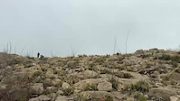
Videos of Lost Dog Mountain Bike
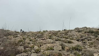
trail: Granola Bowl
0:17 |
26 |
Feb 19, 2025

trail: Granola Bowl
0:17 |
|
Feb 19, 2025
trail: Granola Bowl
0:17 |
|
Feb 19, 2025
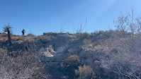
trail: Tin Mine Hill
0:12 |
28 |
Feb 19, 2025
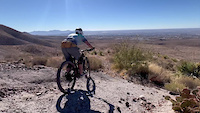
trail: Trans to Clydesdale (Part I)
0:12 |
40 |
Feb 19, 2025

trail: The Worm
0:00 |
18 |
Nov 11, 2024
trail: The Worm
0:19 |
34 |
Feb 25, 2024

trail: Granola Bowl
2:07 |
23 |
Dec 2, 2023
Recent Trail Reports
| status | trail | date | condition | info | user |
|---|---|---|---|---|---|
| Trans to Clydesdale (Part I) | Jan 15, 2026 @ 10:41pm (America/Denver) Jan 15, 2026 | Unknown | ABP04 | ||
| Cherokee Ridge Access | Aug 23, 2025 @ 8:17am Aug 23, 2025 | Unknown | lhamiltx | ||
| Del Sol | Aug 23, 2025 @ 8:17am Aug 23, 2025 | Ideal | lhamiltx | ||
| Grim Road | Aug 23, 2025 @ 8:17am Aug 23, 2025 | Ideal | lhamiltx | ||
| Rock Valley | Aug 23, 2025 @ 8:17am Aug 23, 2025 | Ideal | lhamiltx | ||
| Granola Bowl South | Jun 26, 2025 @ 4:20pm Jun 26, 2025 | Ideal | lhamiltx | ||
| Franklin Hills Connector | Jun 26, 2025 @ 4:20pm Jun 26, 2025 | Ideal | lhamiltx | ||
| Lost Dog | May 21, 2025 @ 11:49am May 21, 2025 | Unknown | periowilliam | ||
| Tin Mine Hill | May 5, 2025 @ 7:12pm May 5, 2025 | Dry | lhamiltx | ||
| Quail Run | May 5, 2025 @ 7:12pm May 5, 2025 | Ideal | lhamiltx |
Activity Feed
| username | action | type | title | date |
|---|---|---|---|---|
| Wiley2049 | vote | poi | activity #95291328 and 1 more | May 22, 2026 @ 11:08pm May 22, 2026 |
| gabe675 | wishlist | region | activity #94219771 | May 7, 2026 @ 8:44am May 7, 2026 |
| gabe675 | vote | trail | activity #94128462 | May 5, 2026 @ 6:09pm May 5, 2026 |
| gabe675 | comment | trail | activity #94128414 | May 5, 2026 @ 6:08pm May 5, 2026 |
| stephenBCWyuE | ridden | trail | activity #93880477 | May 2, 2026 @ 11:26am May 2, 2026 |
Recent Comments
| username | type | title | comment | date |
|---|---|---|---|---|
| trail | This trail is mostly for hiking. Tight turns,... | May 5, 2026 @ 6:08pm May 5, 2026 | ||
| trail | Nice downhill coming back from Grim. Good... | Apr 5, 2025 @ 5:25pm Apr 5, 2025 | ||
| trail | Just rode the segment from the Bruno’s... | Apr 5, 2025 @ 5:23pm Apr 5, 2025 | ||
| trail | We rode uphill from Lost Dog. Nothing tricky... | Apr 5, 2025 @ 5:18pm Apr 5, 2025 | ||
| trail | This is a good basic blue level trail - nice... | Apr 5, 2025 @ 5:16pm Apr 5, 2025 |
Nearby Areas
| name | distance | ||||
|---|---|---|---|---|---|
| Tom Mays Park | 3 | 13 | 2.4 km | ||
| Thunderbird / South Franklin | 7 | 4 | 1 | 2.4 km | |
| Westside Community Hike & Bike Area | 8 | 4 | 2.6 km | ||
| Knapp Land Nature Preserve | 4 km | ||||
| Rio Grande Valley Trail Network | 3 | 5.3 km |
Local Badges
-

Completionist0 awarded
Activity Type Stats
| activitytype | trails | distance | descent | descent distance | total vertical | rating | global rank | state rank | photos | reports | routes | ridelogs |
|---|---|---|---|---|---|---|---|---|---|---|---|---|
| Mountain Bike | 94 | 50 miles | 7,398 ft | 24 miles | 1,198 ft | #1,365 | #463 | 96 | 289 | 2 | 9,088 | |
| E-Bike | 4 | 10 miles | 223 ft | 5 miles | 545 ft | #7,329 | #2,133 | 214 | 324 | |||
| Horse | 2 | 8 miles | 348 ft | 4 miles | 417 ft | 59 | ||||||
| Hike | 94 | 50 miles | 7,398 ft | 24 miles | 1,198 ft | #3,755 | #1,316 | 360 | 1 | 384 | ||
| Trail Running | 95 | 50 miles | 7,398 ft | 24 miles | 1,198 ft | #2,967 | #767 | 2 | 360 | 2 | 325 | |
| Dirtbike/Moto | 1 | 8 miles | 177 ft | 4 miles | 144 ft | 59 | ||||||
| Observed Trials | 1 | 8 miles | 177 ft | 4 miles | 144 ft | |||||||
| ATV/ORV/OHV | 1 | 8 miles | 177 ft | 4 miles | 144 ft | 59 | 1 |
Frequently Asked Questions About Lost Dog
▼
What are the highest rated mountain biking trails in Lost Dog?
The highest rated mountain biking trails in Lost Dog are:
- Brujos Stairs (4.4/5)
- Tin Mine Hill (4.3/5)
- Wandering Dog (4.3/5)
- The Worm (4.3/5)
- Little Moab (4.2/5)
▼
What is the best time of the year to ride in Lost Dog?
Based on ride log data, the most popular months to ride in Lost Dog are:
- May (99 activities)
- September (97 activities)
- October (89 activities)
▼
Where can I park to ride in Lost Dog?
There are 8 parking locations listed in Lost Dog. The most popular parking spots are: View all parking and trailhead locations on the map to plan your visit.
▼
What is the longest trail in Lost Dog?
The longest trail in Lost Dog is Tom Mays Trail at 4.8 miles. View all trails sorted by distance.
Trails
- By brenthillier
 NSMBA TRAILFORKS & contributors
 - Admins: BMBA, BMBA
- #3713 - 9,154 views
- lost dog activity log | embed map of Lost Dog mountain bike trails | lost dog mountain biking points of interest
Downloading of trail gps tracks in kml & gpx formats is enabled for Lost Dog.
You must login to download files.