close
-
Layers w
- Weather Layers
- Pro
- Pro
- Pro
- Pro
- Pro
- Pro
- More Layers
- Pro
- Pro
- Pro
- Pro
-
Upgrade to

3D
Trail Conditions
- Unknown
- Snow Groomed
- Snow Packed
- Snow Covered
- Snow Cover Partial
- Freeze/thaw Cycle
- Icy
- Prevalent Mud
- Wet
- Variable
- Ideal
- Dry
- Very Dry
Trail Flow (Ridden Direction)
Trailforks scans users ridelogs to determine the most popular direction each trail is ridden. A good flowing trail network will have most trails flowing in a single direction according to their intension.
The colour categories are based on what percentage of riders are riding a trail in its intended direction.
The colour categories are based on what percentage of riders are riding a trail in its intended direction.
- > 96%
- > 90%
- > 80%
- > 70%
- > 50%
- < 50%
- bi-directional trail
- no data
Trail Last Ridden
Trailforks scans ridelogs to determine the last time a trail was ridden.
- < 2 days
- < 1 week
- < 2 weeks
- < 1 month
- < 6 months
- > 6 months
Trail Ridden Direction
The intended direction a trail should be ridden.
- Downhill Only
- Downhill Primary
- Both Directions
- Uphill Primary
- Uphill Only
- One Direction
Contribute Details
Colors indicate trail is missing specified detail.
- Description
- Photos
- Description & Photos
- Videos
Trail Popularity ?
Trailforks scans ridelogs to determine which trails are ridden the most in the last 9 months.
Trails are compared with nearby trails in the same city region with a possible 25 colour shades.
Think of this as a heatmap, more rides = more kinetic energy = warmer colors.
- most popular
- popular
- less popular
- not popular
ATV/ORV/OHV Filter
Max Vehicle Width
inches
US Cell Coverage
Legend

Radar Time
Activity Recordings
Trailforks uses anonymized public activity data.
?
Activity Recordings
Trailforks uses anonymized public activity data.
?
Personal Heatmap
▶
Activity Types
all
/
none
▶
Options
2
Date range
month
–
Winter Trails
Warning
A routing network for winter maps does not exist. Selecting trails using the winter trails layer has been disabled.
Missing Trails
Most Popular
Least Popular
Trails are colored based on popularity. The more popular a trail is, the more red. Less popular trails trend towards green.
Jump Magnitude Heatmap
Heatmap of where riders jump on trails. Zoom in to see individual jumps, click circles to view jump details.
BC Backroad Status
![map legend]()
Service Road Atlas is a free to use, community-driven service for viewing and creating reports on the numerous back-country service roads around B.C. and Alberta.

Slope Aspect
Direction the slope faces
Trails Deemphasized
Trails are shown in grey.
Only show trails with no bike usage.
Suggested Layers
Based on selected activity type
Save the current map location and zoom level as your default home location whenever this page is loaded.
Save
No description for Loudonville has been added yet!
Login or register to submit one.
Activities Click to view
- Mountain Bike
24 trails
- Horse
8 trails
- Hike
29 trails
- Trail Running
25 trails
Region Details
- 5
- 5
- 13
- 1
Region Status
Open as of May 20, 2026Stats
- Avg Trail Rating
- Trails (view details)
- 40
- Trails Mountain Bike
- 24
- Trails Horse
- 8
- Trails Hike
- 29
- Trails Trail Running
- 25
- Trails Nordic Ski
- 1
- Total Distance
- 61 miles
- Total Descent
- 9,447 ft
- Total Vertical
- 478 ft
- Highest Trailhead
- 1,383 ft
- Reports
- 1,153
- Photos
- 75
- Ridden Counter
- 4,834
Sub Regions
-
Mohican State Park
- 5
- 9
- 1
-
Mohican Wilderness Trails
- 4
Popular Loudonville Mountain Biking Trails
• 95 ★ 4.1 • 11 miles • 1,532 ft • 541 •
Highly rated popular blue difficulty singletrack. This multi-use trail can be used one direction. On average it takes 1 hour39 minutes to complete this trail.
• 100 ★ 4.8 • 11 miles • 1,490 ft • 407 •
Highly rated popular blue difficulty singletrack. This multi-use trail can be used one direction and has a moderate overall physical rating with a 1,490 ft blue climb. On average it takes 1 hour29 minutes to complete this trail.
• 90 ★ 0.0 • 4,413 ft • 100 ft • 399 •
The final stretch of the main Mohican MTB Trail. The also connects into this portion of the trail.
• 75 ★ 4.5 • 2,139 ft • 3 ft • 222 •
Take the from the Mohican MTB (Picnic Table as a Landmark) trail down to the campground or continue on by merging left back onto the end of the main Mohican MTB Trail.
• 30 ★ 0.0 • 1,522 ft • 31 ft • 159 •
Mohican wilderness downhill trail 2
• 65 ★ 5.0 • 545 ft • 0 ft • 158 •
Moderately popular green difficulty singletrack. This mountain bike primary trail can be used both directions and has a easy overall physical rating with a 0 ft green climb. Trail visibility is always easy to follow. On average it takes 2 minutes to complete this trail.
• 80 ★ 4.0 • 463 ft • 5 ft • 93 •
The skills course is accessed at the southwest corner of the Mohican Lodge & Conference Center parking lot - you'll see our trailhead sign. The course has many different lines with wooden skinnies, rock gardens, and small berms....
Loudonville Mountain Bike Routes
★ 5.0 • 23 miles • 2,433 ft • 5 • Loop •
The full loop will test your strength, stamina, and grit. The first 8 miles are bidirectional, one way...
8 miles • 669 ft • 2 • Out & Back •
Punchy climbs, some technical features, and fun descents will greet you on this moderate ride to mile...
5 miles • 465 ft • 2 • Loop •
Need to squeeze in a quick ride? The , at approximately 6 miles, will give you a heck of a workout in...
19 miles • 1,719 ft • 4 • Out & Back •
This route starts at the Change House trailhead and takes you across two unique sections of the Mohican...
16 miles • 1,371 ft • 7 • Out & Back •
This route starts and ends at the Change House trailhead and is a balance between MTB and paved road...
32 miles • 3,486 ft • 9 • Loop •
Put your skills and your fitness to the test. The Whole Chimichanga starts off at the Mohican Lodge trail...
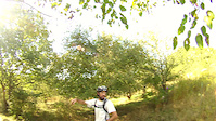
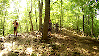
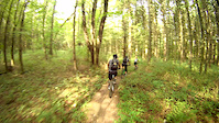
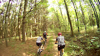
Photos of Loudonville Mountain Bike
Videos of Loudonville Mountain Bike
trail: Mohican MTB Trail - South
10:33 |
168 |
Apr 15, 2019
trail: Mohican MTB Trail - North
0:05 |
54 |
Apr 14, 2019
trail: Mohican MTB Trail - South
0:22 |
145 |
Apr 14, 2019
trail: Mohican MTB Trail - North
0:54 |
74 |
Apr 14, 2019

trail: Mohican MTB Trail - North
3:56 |
1242 |
Jul 22, 2011

trail: Mohican MTB Trail - North
2:01 |
349 |
Jun 24, 2011
trail: Mohican MTB Trail - North
4:48 |
339 |
Jun 14, 2011

trail: Mohican MTB Trail - North
0:56 |
382 |
Nov 20, 2010
Recent Trail Reports
| status | trail | date | condition | info | user |
|---|---|---|---|---|---|
| Skills Park Loop | May 20, 2026 @ 1:56pm (America/New_York) May 20, 2026 | Variable | RRader MMBC | ||
| Skills Course | May 20, 2026 @ 1:56pm (America/New_York) May 20, 2026 | Variable | RRader MMBC | ||
| Short Loop | May 20, 2026 @ 1:56pm (America/New_York) May 20, 2026 | Variable | RRader MMBC | ||
| Rocky Top | May 20, 2026 @ 1:56pm (America/New_York) May 20, 2026 | Variable | RRader MMBC | ||
| Park Road 58 South Connector | May 20, 2026 @ 1:56pm (America/New_York) May 20, 2026 | Variable | RRader MMBC | ||
| Park Road 58 North Connector | May 20, 2026 @ 1:56pm (America/New_York) May 20, 2026 | Variable | RRader MMBC | ||
| Park Road 51 Connector | May 20, 2026 @ 1:56pm (America/New_York) May 20, 2026 | Variable | RRader MMBC | ||
| Osprey/Lodge Trails to 30/06 Road Connector | May 20, 2026 @ 1:56pm (America/New_York) May 20, 2026 | Variable | RRader MMBC | ||
| Osprey To Buzzard Road Connector | May 20, 2026 @ 1:56pm (America/New_York) May 20, 2026 | Variable | RRader MMBC | ||
| Osprey | May 20, 2026 @ 1:56pm (America/New_York) May 20, 2026 | Variable | RRader MMBC |
Activity Feed
| username | action | type | title | date |
|---|---|---|---|---|
| EugeneNine | add | poi | activity #98077945 | Jun 29, 2026 @ 11:41am 17 hours |
| thebooms | wishlist | region | activity #96850510 | Jun 12, 2026 @ 11:29pm Jun 12, 2026 |
| thebooms | wishlist | trail | activity #96850455 and 1 more | Jun 12, 2026 @ 11:27pm Jun 12, 2026 |
| seansquatch79 | comment | route | activity #95536019 | May 25, 2026 @ 5:51pm May 25, 2026 |
| seansquatch79 | vote | route | activity #95535930 | May 25, 2026 @ 5:49pm May 25, 2026 |
Recent Comments
| username | type | title | comment | date |
|---|---|---|---|---|
| trail | Love this trail! It was everything I wanted in... | Sep 18, 2025 @ 11:46am Sep 18, 2025 | ||
| trail | Just want to correct the direction of this... | Mar 13, 2024 @ 4:50am Mar 13, 2024 | ||
| trail | I loved this trail. Great addition | Sep 9, 2023 @ 6:24pm Sep 9, 2023 | ||
| trail | The elevation listed here is about 3k for the... | Aug 14, 2023 @ 8:09am Aug 14, 2023 | ||
| trail | It's been a few years since I drove over to... | Oct 9, 2020 @ 3:27am Oct 9, 2020 |
Local Badges
-

Epic Ride Climb 2k270 awarded -

Climbing 10k Badge50 awarded -

Climbing 100k Badge4 awarded -

Epic Ride Descent 2k270 awarded -

Descent 10k Badge50 awarded -

Descent 100k Badge4 awarded
Bike & Skill Parks
| name | type | city | rating |
|---|---|---|---|
| Mohican State Park Skills Course | skill park | Loudonville |
Activity Type Stats
| activitytype | trails | distance | descent | descent distance | total vertical | rating | global rank | state rank | photos | reports | routes | ridelogs |
|---|---|---|---|---|---|---|---|---|---|---|---|---|
| Mountain Bike | 24 | 41 miles | 6,296 ft | 16 miles | 459 ft | #3,479 | #1,188 | 74 | 1,151 | 17 | 6,275 | |
| Horse | 8 | 10 miles | 1,509 ft | 5 miles | 446 ft | #2,217 | #1,231 | 244 | 2 | |||
| Hike | 29 | 49 miles | 7,343 ft | 19 miles | 453 ft | #4,710 | #1,661 | 539 | 14 | 486 | ||
| Trail Running | 25 | 43 miles | 6,424 ft | 16 miles | 433 ft | #4,876 | #1,521 | 538 | 14 | 161 | ||
| Nordic Ski | 1 | 4 miles | 364 ft | 1 mile | 272 ft | 1 |
Frequently Asked Questions About Loudonville
▼
What are the best places to ride in Loudonville?
Loudonville has 2 areas to explore for mountain biking. The top rated areas are:
▼
What are the highest rated mountain biking trails in Loudonville?
The highest rated mountain biking trails in Loudonville are:
- Mohican MTB Trail - North (4.5/5)
- Osprey (4.3/5)
- Mohican Group Camp Connector (4.1/5)
- Short Loop (4.1/5)
- Buzzard (4.1/5)
▼
What is the best time of the year to ride in Loudonville?
Based on ride log data, the most popular months to ride in Loudonville are:
- May (20 activities)
- September (19 activities)
- October (19 activities)
▼
Where can I park to ride in Loudonville?
There are 8 parking locations listed in Loudonville. The most popular parking spots are:
- Parking
- Snow Mobile / Mountain Bike Trail Head 2 Parking
- Official Main Mountain Bike Parking Lot and Map
- Lodge Trails Parking
- Parking
Activities
Trails
Points of Interest
- By swampboy62 & contributors
- Admins: MMBC
- #6057 - 3,915 views
- loudonville activity log | embed map of Loudonville mountain bike trails | loudonville mountain biking points of interest
Downloading of trail gps tracks in kml & gpx formats is enabled for Loudonville.
You must login to download files.