close
-
Layers w
- Weather Layers
- Pro
- Pro
- Pro
- Pro
- Pro
- Pro
- More Layers
- Pro
- Pro
- Pro
- Pro
-
Upgrade to

3D
Trail Conditions
- Unknown
- Snow Groomed
- Snow Packed
- Snow Covered
- Snow Cover Partial
- Freeze/thaw Cycle
- Icy
- Prevalent Mud
- Wet
- Variable
- Ideal
- Dry
- Very Dry
Trail Flow (Ridden Direction)
Trailforks scans users ridelogs to determine the most popular direction each trail is ridden. A good flowing trail network will have most trails flowing in a single direction according to their intension.
The colour categories are based on what percentage of riders are riding a trail in its intended direction.
The colour categories are based on what percentage of riders are riding a trail in its intended direction.
- > 96%
- > 90%
- > 80%
- > 70%
- > 50%
- < 50%
- bi-directional trail
- no data
Trail Last Ridden
Trailforks scans ridelogs to determine the last time a trail was ridden.
- < 2 days
- < 1 week
- < 2 weeks
- < 1 month
- < 6 months
- > 6 months
Trail Ridden Direction
The intended direction a trail should be ridden.
- Downhill Only
- Downhill Primary
- Both Directions
- Uphill Primary
- Uphill Only
- One Direction
Contribute Details
Colors indicate trail is missing specified detail.
- Description
- Photos
- Description & Photos
- Videos
Trail Popularity ?
Trailforks scans ridelogs to determine which trails are ridden the most in the last 9 months.
Trails are compared with nearby trails in the same city region with a possible 25 colour shades.
Think of this as a heatmap, more rides = more kinetic energy = warmer colors.
- most popular
- popular
- less popular
- not popular
ATV/ORV/OHV Filter
Max Vehicle Width
inches
US Cell Coverage
Legend

Radar Time
Activity Recordings
Trailforks uses anonymized public activity data.
?
Activity Recordings
Trailforks uses anonymized public activity data.
?
Personal Heatmap
▶
Activity Types
all
/
none
▶
Options
2
Date range
month
–
Winter Trails
Warning
A routing network for winter maps does not exist. Selecting trails using the winter trails layer has been disabled.
Missing Trails
Most Popular
Least Popular
Trails are colored based on popularity. The more popular a trail is, the more red. Less popular trails trend towards green.
Jump Magnitude Heatmap
Heatmap of where riders jump on trails. Zoom in to see individual jumps, click circles to view jump details.
BC Backroad Status
![map legend]()
Service Road Atlas is a free to use, community-driven service for viewing and creating reports on the numerous back-country service roads around B.C. and Alberta.

Slope Aspect
Direction the slope faces
Trails Deemphasized
Trails are shown in grey.
Only show trails with no bike usage.
Suggested Layers
Based on selected activity type
Save the current map location and zoom level as your default home location whenever this page is loaded.
Save
No description for Lousã has been added yet!
Login or register to submit one.
This region uses the Uk/Euro style trail grading system.
Activities Click to view
- Mountain Bike
31 trails
- E-Bike
22 trails
- Gravel Bike
0 trails
- Adaptive Bike
0 trails
- Horse
0 trails
- Hike
18 trails
- Trail Running
20 trails
- Dirtbike/Moto
1 trails
- Observed Trials
0 trails
- ATV/ORV/OHV
3 trails
Region Details
- 6
- 1
- 17
- 3
- 3
Region Status
Caution as of Jun 13, 2026Stats
- Avg Trail Rating
- Trails (view details)
- 30
- Trails Mountain Bike
- 31
- Trails E-Bike
- 22
- Trails Hike
- 18
- Trails Trail Running
- 20
- Trails Dirtbike/Moto
- 1
- Trails ATV/ORV/OHV
- 3
- Total Distance
- 22 miles
- Total Descent
- 12,213 ft
- Total Vertical
- 3,307 ft
- Highest Trailhead
- 3,719 ft
- Reports
- 98
- Photos
- 110
- Ridden Counter
- 1,439
Articles
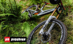
Video: Getting Back To World Cup DH Racing - The Privateer: Walk The Talk Episode 6
Nov 3, 2020 from pinkbike.com
After a horrible injury, Ben Cathro has rehabbed himself well enough to ride but is he well enough to race?
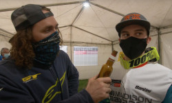
Video: Wyn TV Wraps Up the World Cup Season in Lousa
Nov 3, 2020 from pinkbike.com
Wyn cracks a cold one and gets the low down on the last race of the season.

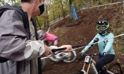
Practice Photo Epic: Off Camber Dancers - Lousa World Cup DH 2020
Oct 29, 2020 from pinkbike.com
All the action from a constantly shifting track.
Video: Rob Warner Analyses the Lousa World Cup Track
Oct 29, 2020 from pinkbike.com
Rob Warner takes his first look at the loamy off cambers, steep chutes and loose berms in Lousa.
Sub Regions
-
Louzanpark
- 6
- 3
- 3
Popular Lousã Mountain Biking Trails
• 70 ★ 4.0 • 3,052 ft • 0 ft • 120 •
Popular blue difficulty singletrack. This mountain bike primary trail can be used downhill only. On average it takes 4 minutes to complete this trail.
• 55 ★ 5.0 • 1 mile • 3 ft • 112 •
Moderately popular blue difficulty singletrack. This mountain bike primary trail can be used downhill only. On average it takes 8 minutes to complete this trail.
• 45 ★ 4.8 • 3,997 ft • 42 ft • 90 •
Moderately popular blue difficulty singletrack. This mountain bike primary trail can be used downhill primary and has a moderate overall physical rating with a 42 ft green climb. It features drop, pump track and rock garden. On average it takes 4 minutes to complete this trail.
• 60 ★ 3.8 • 3,504 ft • 39 ft • 87 •
Moderately popular blue difficulty singletrack. This mountain bike primary trail can be used downhill only. On average it takes 4 minutes to complete this trail.
• 90 ★ 1.0 • 2,142 ft • 0 ft • 65 •
Popular red difficulty machine groomed. This mountain bike primary trail can be used downhill only and has a hard overall physical rating. It features berm, drop and jump. Trail visibility is always easy to follow. On average it takes 2 minutes to complete this trail.
• 95 ★ 4.0 • 1 mile • 0 ft • 61 •
Popular black difficulty singletrack. This mountain bike primary trail can be used downhill only. It features berm, bridge, drop, jump, gap jump and other. On average it takes 5 minutes to complete this trail.
• 100 ★ 5.0 • 1,703 ft • 0 ft • 61 •
Popular black difficulty singletrack. This mountain bike primary trail can be used downhill only. It features berm, bridge, drop, jump, gap jump and other. On average it takes 1 minutes to complete this trail.
• 85 ★ 4.5 • 1 mile • 8 ft • 61 •
Popular blue difficulty singletrack. This mountain bike primary trail can be used downhill only. On average it takes 9 minutes to complete this trail.
Lousã Mountain Bike Routes
21 miles • 3,213 ft • 1 • Loop • Race •
O tão desejado FOX Enduro Race está de regresso ao Louzanpark nos dias 19 e 20 de Maio. Esta edição de...
22 miles • 3,516 ft • 8 • Point to Point • Race •
Annual Enduro event from Fox with fair and a race, organised in Lousã, Portugal.
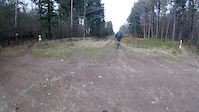
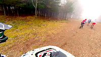
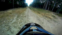
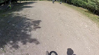
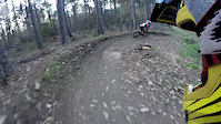
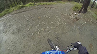
Photos of Lousã Mountain Bike
Videos of Lousã Mountain Bike
Current Trail Warnings
| status | trail | date | condition | user | info |
|---|---|---|---|---|---|
| Interminável | Jun 5, 2026 @ 9:57am (Europe/Lisbon) Jun 5, 2026 | Dry | Spectralon | ||
| EN4 | May 31, 2026 @ 8:48am (Europe/Lisbon) May 31, 2026 | Dry | muska10 | E-Bike Trail closed, needs a lot of work... | |
| EN3 | May 31, 2026 @ 8:46am (Europe/Lisbon) May 31, 2026 | Dry | muska10 | E-Bike Bottom half completely closed and... |
Recent Trail Reports
| status | trail | date | condition | info | user |
|---|---|---|---|---|---|
| EN6 | Jun 13, 2026 @ 11:48pm (Europe/Lisbon) Jun 13, 2026 | Dry | stifmanenc | ||
| EN7 | Jun 13, 2026 @ 11:46pm (Europe/Lisbon) Jun 13, 2026 | Dry | stifmanenc | ||
| World Cup DH 2 (Upper) | Apr 2, 2026 @ 5:24pm (Europe/Lisbon) Apr 2, 2026 | Dry | Fiti098 | ||
| World Cup DH 1 | Apr 2, 2026 @ 5:24pm (Europe/Lisbon) Apr 2, 2026 | Ideal | Fiti098 | ||
| DH3 | Apr 2, 2026 @ 5:24pm (Europe/Lisbon) Apr 2, 2026 | Dry | Fiti098 | ||
| EN5 | Apr 2, 2026 @ 5:24pm (Europe/Lisbon) Apr 2, 2026 | Ideal | Fiti098 | ||
| Upper Mountain Shuttle Road | Apr 2, 2026 @ 5:24pm (Europe/Lisbon) Apr 2, 2026 | Dry | Fiti098 | ||
| Terreiro - EN4 | Mar 15, 2026 @ 9:00am (Europe/Lisbon) Mar 15, 2026 | Unknown | muska10 | ||
| Terreiro - XC11 | Dec 8, 2025 @ 9:08am (Europe/Lisbon) Dec 8, 2025 | Wet | muska10 | ||
| Interm-ireita | Jul 29, 2025 @ 5:00pm Jul 29, 2025 | Prevalent Mud | McLasa |
Activity Feed
| username | action | type | title | date |
|---|---|---|---|---|
| stifmanenc | add | report | activity #96922313 and 1 more | Jun 13, 2026 @ 3:46pm Jun 13, 2026 |
| Spectralon | add | report | activity #96301536 | Jun 5, 2026 @ 9:14am Jun 5, 2026 |
| AMG | update | trail | activity #96105438 | Jun 2, 2026 @ 1:08pm Jun 2, 2026 |
| muska10 | add | trail | activity #96105366 | Jun 2, 2026 @ 1:07pm Jun 2, 2026 |
| muska10 | add | report | activity #96004292 and 2 more | Jun 1, 2026 @ 1:45am Jun 1, 2026 |
Recent Comments
| username | type | title | comment | date |
|---|---|---|---|---|
| trail | Not sure if the trail still exists. It's... | May 29, 2024 @ 11:27am May 29, 2024 | ||
| trail | Closed | Jun 3, 2023 @ 11:02am Jun 3, 2023 | ||
| trail | Interesting trail though the woods with a good... | Aug 9, 2022 @ 6:36am Aug 9, 2022 | ||
| trail | Nice easy trail. Not too clean. Hard way... | Aug 9, 2022 @ 6:30am Aug 9, 2022 | ||
| trail | Very overgrown and full of branches had to... | Aug 9, 2022 @ 6:26am Aug 9, 2022 |
Local Badges
-

Epic Mountain Bike Climb 2k62 awarded -

Climbing 10k Badge6 awarded -

Mountain Biking 100k Badge1 awarded -

Epic Ride Descent 2k62 awarded -

Descent 10k Badge13 awarded -

Descent 100k Badge1 awarded
Bike & Skill Parks
| name | type | city | rating |
|---|---|---|---|
| Louzanpark | bike park | Lousã |
Activity Type Stats
| activitytype | trails | distance | descent | descent distance | total vertical | rating | global rank | state rank | photos | reports | routes | ridelogs |
|---|---|---|---|---|---|---|---|---|---|---|---|---|
| Mountain Bike | 31 | 22 miles | 12,211 ft | 14 miles | 3,307 ft | #1,774 | #9 | 110 | 98 | 1 | 1,749 | |
| E-Bike | 22 | 11 miles | 8,346 ft | 10 miles | 3,173 ft | #430 | #5 | 89 | 281 | |||
| Hike | 18 | 8 miles | 5,928 ft | 7 miles | 3,307 ft | #2,336 | #9 | 89 | 99 | |||
| Trail Running | 20 | 10 miles | 7,379 ft | 9 miles | 3,307 ft | #1,776 | #8 | 91 | 10 | |||
| Dirtbike/Moto | 1 | 1 mile | 791 ft | 1 mile | 787 ft | #408 | #4 | 3 | ||||
| ATV/ORV/OHV | 3 | 7 miles | 92 ft | 3,192 ft | 2,543 ft | #219 | #1 | 3 |
Frequently Asked Questions About Lousã
▼
What are the best places to ride in Lousã?
Lousã has 1 areas to explore for mountain biking. The top rated areas are:
▼
What are the highest rated mountain biking trails in Lousã?
The highest rated mountain biking trails in Lousã are:
- EN7 (4.4/5)
- EN5 (4.3/5)
- EN4 (4.3/5)
- Raizes / Roots DH (4.2/5)
- EN3 (4.2/5)
▼
What is the best time of the year to ride in Lousã?
Based on ride log data, the most popular months to ride in Lousã are:
- May (11 activities)
- October (6 activities)
- March (5 activities)
▼
Where can I park to ride in Lousã?
There are 1 parking locations listed in Lousã. The most popular parking spots are:
Activities
Trails
- By canadaka
 Trailforks & contributors
 - Admins: elyari, AMG, marcossantamaria, ATBV
- #10403 - 20,399 views
- lousã activity log | embed map of Lousã mountain bike trails | lousã mountain biking points of interest
Downloading of trail gps tracks in kml & gpx formats is enabled for Lousã.
You must login to download files.