close
-
Layers w
- Weather Layers
- Pro
- Pro
- Pro
- Pro
- Pro
- Pro
- More Layers
- Pro
- Pro
- Pro
- Pro
-
Upgrade to

3D
Trail Conditions
- Unknown
- Snow Groomed
- Snow Packed
- Snow Covered
- Snow Cover Partial
- Freeze/thaw Cycle
- Icy
- Prevalent Mud
- Wet
- Variable
- Ideal
- Dry
- Very Dry
Trail Flow (Ridden Direction)
Trailforks scans users ridelogs to determine the most popular direction each trail is ridden. A good flowing trail network will have most trails flowing in a single direction according to their intension.
The colour categories are based on what percentage of riders are riding a trail in its intended direction.
The colour categories are based on what percentage of riders are riding a trail in its intended direction.
- > 96%
- > 90%
- > 80%
- > 70%
- > 50%
- < 50%
- bi-directional trail
- no data
Trail Last Ridden
Trailforks scans ridelogs to determine the last time a trail was ridden.
- < 2 days
- < 1 week
- < 2 weeks
- < 1 month
- < 6 months
- > 6 months
Trail Ridden Direction
The intended direction a trail should be ridden.
- Downhill Only
- Downhill Primary
- Both Directions
- Uphill Primary
- Uphill Only
- One Direction
Contribute Details
Colors indicate trail is missing specified detail.
- Description
- Photos
- Description & Photos
- Videos
Trail Popularity ?
Trailforks scans ridelogs to determine which trails are ridden the most in the last 9 months.
Trails are compared with nearby trails in the same city region with a possible 25 colour shades.
Think of this as a heatmap, more rides = more kinetic energy = warmer colors.
- most popular
- popular
- less popular
- not popular
ATV/ORV/OHV Filter
Max Vehicle Width
inches
US Cell Coverage
Legend

Radar Time
Activity Recordings
Trailforks uses anonymized public activity data.
?
Activity Recordings
Trailforks uses anonymized public activity data.
?
Personal Heatmap
▶
Activity Types
all
/
none
▶
Options
2
Date range
month
–
Winter Trails
Warning
A routing network for winter maps does not exist. Selecting trails using the winter trails layer has been disabled.
Missing Trails
Most Popular
Least Popular
Trails are colored based on popularity. The more popular a trail is, the more red. Less popular trails trend towards green.
Jump Magnitude Heatmap
Heatmap of where riders jump on trails. Zoom in to see individual jumps, click circles to view jump details.
BC Backroad Status
![map legend]()
Service Road Atlas is a free to use, community-driven service for viewing and creating reports on the numerous back-country service roads around B.C. and Alberta.

Slope Aspect
Direction the slope faces
Trails Deemphasized
Trails are shown in grey.
Only show trails with no bike usage.
Suggested Layers
Based on selected activity type
Save the current map location and zoom level as your default home location whenever this page is loaded.
Save
No description for Lower Hutt has been added yet!
Login or register to submit one.
Activities Click to view
- Mountain Bike
148 trails
- E-Bike
115 trails
- Gravel Bike
1 trails
- Adaptive Bike
0 trails
- Winter Fat Bike
0 trails
- Horse
4 trails
- Hike
148 trails
- Trail Running
147 trails
- Dirtbike/Moto
0 trails
- ATV/ORV/OHV
0 trails
- Snowmobile
0 trails
- Snowshoe
0 trails
- Downhill Ski
0 trails
- Backcountry Ski
0 trails
- Nordic Ski
0 trails
Region Details
- 21
- 8
- 28
- 40
- 5
- 14
- 3
Region Status
Open as of 2 daysStats
- Avg Trail Rating
- Trails (view details)
- 129
- Trails Mountain Bike
- 150
- Trails E-Bike
- 115
- Trails Gravel Bike
- 1
- Trails Horse
- 4
- Trails Hike
- 148
- Trails Trail Running
- 147
- Total Distance
- 135 miles
- Total Descent
- 35,687 ft
- Total Vertical
- 2,290 ft
- Highest Trailhead
- 2,303 ft
- Reports
- 2,428
- Photos
- 384
- Ridden Counter
- 43,801
Sub Regions
-
Belmont Regional Park
- 3
- 5
- 25
- 3
- 1
-
East Harbour Regional Park
- 2
- 1
- 1
-
Wainuiomata Trail Park (WTP)
- 2
- 21
- 13
- 1
- 10
- 3
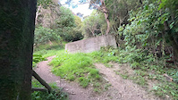
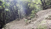
Popular Lower Hutt Mountain Biking Trails
• 100 ★ 4.0 • 1 mile • 74 ft • 1,047 •
is a fast flowing single track taking you from the Towai Trig to the Wainuiomata Hill Rd summit. traverses the western side of the hill (the Hutt side). It is fast flowing with an array of jumps, drops, switchbacks, shoots, banked...
• 95 ★ 4.2 • 1 mile • 320 ft • 996 •
is a good step up for those who have mastered and are looking for an intermediate level challenge. The climb is generally intermediate with a few pinch climbs, and the downhill is a fast, flowing fun ride. It makes a good loop from the...
• 100 ★ 4.5 • 610 ft • 9 ft • 985 •
Pukeatua Bridge is a walking/cycling bridge over the road at the summit of the Wainuiomata Hill Road. It allows you to safely and easily cross from Waiu Park to the Eastern Harbour Regional Park.
• 100 ★ 4.5 • 3,251 ft • 33 ft • 973 •
is a fast downhill digger built trail, full of berms, gaps, table tops.- all roll-able. First built in 2013 but rebuilt in 2019 A bypass of the berm heading towards the water reservoir is in the works, going straight over the grass on...
• 90 ★ 4.4 • 1 mile • 479 ft • 903 •
is the main track from the park floor to the upper trails. It is a flowing an easy climb to the top. Near the very top are few switch backs that may catch the odd beginner out. At the top, , offers a good easy grade track back to the...
• 95 ★ 3.2 • 808 ft • 0 ft • 896 •
This is a fun easy trail full with banked turns and jumps. All obstacles can be either rolled over or by passed. This is a great trail to practice skills or develop confidence. All ages can ride it.
Lower Hutt Mountain Bike Routes
★ 5.0 • 3 miles • 862 ft • 10 • Loop •
An intermediate loop for riders wanting to step up from . Starting at the Waiu Street Car Park, ride up...
176 miles • 8,907 ft • 6 •
This is the reverse of the Middle Dirt Aotearoa route: - Petone to the Martinborough campground via the...
2 miles • 98 ft • 4 • Point to Point •
From the trig at the top of Freewheel, all the way down to Gracefield Road. around 300 vertical metres....
8 miles • 1,475 ft • 7 •
Walk / ride from Wainu MTB park to Te White Riser
14 miles • 2,013 ft • 3 • Loop •
This loop goes up to the bopulder Hill Summuit then makes its way around to the gas station before...
3 miles • 860 ft • 3 • Loop •
Simple grade 2 - 3 loop around the old Dandig forest block
Photos of Lower Hutt Mountain Bike
Videos of Lower Hutt Mountain Bike
0:29 |
|
Jan 17, 2023
trail: Morepork
0:06 |
180 |
Jun 24, 2022
trail: Morepork
0:40 |
63 |
Jun 24, 2022

trail: Morepork
0:06 |
73 |
Jun 24, 2022
trail: Morepork
0:06 |
|
Jan 31, 2022

trail: Beeline
2:05 |
38 |
Dec 29, 2021
trail: Scrims
0:12 |
90 |
May 27, 2021
trail: Bull Run
0:17 |
258 |
Apr 23, 2021
Recent Trail Reports
| status | trail | date | condition | info | user |
|---|---|---|---|---|---|
| Wētā | Jun 12, 2026 @ 12:40pm (Pacific/Auckland) Jun 11, 2026 | Dry | xCoster | ||
| Electric Avenue | Jun 12, 2026 @ 12:40pm (Pacific/Auckland) Jun 11, 2026 | Dry | xCoster | ||
| Bull Run - Bull-a-varde Connector (unnamed) | Jun 12, 2026 @ 12:40pm (Pacific/Auckland) Jun 11, 2026 | Ideal | xCoster | ||
| Bull Run | Jun 12, 2026 @ 12:40pm (Pacific/Auckland) Jun 11, 2026 | Wet | xCoster | ||
| Bull-A-Varde | Jun 12, 2026 @ 12:40pm (Pacific/Auckland) Jun 11, 2026 | Variable | xCoster | ||
| Borderline | Jun 7, 2026 @ 11:47am (Pacific/Auckland) Jun 6, 2026 | Prevalent Mud | camerontod | ||
| Directa | May 10, 2026 @ 8:42am (Pacific/Auckland) May 9, 2026 | Ideal | evandnz | ||
| Chur-No-Bull | Apr 6, 2026 @ 5:51pm (Pacific/Auckland) Apr 5, 2026 | Ideal | evandnz | ||
| Te Whiti Riser | Apr 5, 2026 @ 10:37am (Pacific/Auckland) Apr 4, 2026 | Ideal | evandnz | ||
| Beeline | Apr 5, 2026 @ 6:36am (Pacific/Auckland) Apr 4, 2026 | Ideal | evandnz |
Activity Feed
| username | action | type | title | date |
|---|---|---|---|---|
| MTBwippage | ridden | trail | activity #96945127 and 3 more | Jun 14, 2026 @ 1:45am Jun 14, 2026 |
| 0LJG7m | wishlist | trail | activity #96942546 | Jun 14, 2026 @ 12:34am Jun 14, 2026 |
| xCoster | add | report | activity #96783875 and 4 more | Jun 11, 2026 @ 9:27pm Jun 11, 2026 |
| MCuthbert | wishlist | trail | activity #96521422 | Jun 7, 2026 @ 10:27pm Jun 7, 2026 |
| MCuthbert | wishlist | route | activity #96520592 | Jun 7, 2026 @ 9:54pm Jun 7, 2026 |
Recent Comments
| username | type | title | comment | date |
|---|---|---|---|---|
| trail | Gets fairly steep in parts. Fun but I did have... | Apr 4, 2026 @ 11:27pm Apr 4, 2026 | ||
| trail | I have ridden up this track probably hundreds... | Mar 21, 2026 @ 11:55pm Mar 21, 2026 | ||
| trail | There's currently a windfall across the track... | Mar 16, 2026 @ 1:29pm Mar 16, 2026 | ||
| trail | Very easy to over shoot landing from left gap... | Mar 10, 2026 @ 8:30pm Mar 10, 2026 | ||
| trail | Lots of trees and vegetation on trail at the... | Feb 23, 2026 @ 5:40pm Feb 23, 2026 |
Local Badges
-

Top 10 Trails1 awarded -

Descent 100k Badge26 awarded -

Big Ride 30k3,271 awarded -

Epic Ride 50k1,524 awarded -

Descent 10k Badge240 awarded -

Completionist0 awarded
Bike & Skill Parks
| name | type | city | rating |
|---|---|---|---|
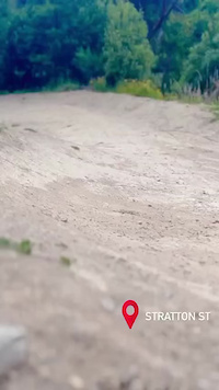
| Stratton Street Skills Area | skill park | Lower Hutt | |
| Avalon Dirt Jumps | skill park | Lower Hutt | |
| Waiu Park Skills Area | skill park | Lower Hutt |
Activity Type Stats
| activitytype | trails | distance | descent | descent distance | total vertical | rating | global rank | state rank | photos | reports | routes | ridelogs |
|---|---|---|---|---|---|---|---|---|---|---|---|---|
| Mountain Bike | 148 | 132 miles | 35,262 ft | 55 miles | 2,290 ft | #237 | #11 | 354 | 2,428 | 53 | 53,104 | |
| E-Bike | 115 | 76 miles | 22,638 ft | 34 miles | 1,476 ft | #382 | #15 | 15 | 2,312 | 9 | 5,927 | |
| Gravel Bike | 1 | #123 | #58 | 18 | 2 | 183 | ||||||
| Horse | 4 | 5 miles | 512 ft | 2 miles | 1,122 ft | #368 | #10 | 630 | 1 | |||
| Hike | 148 | 131 miles | 32,238 ft | 53 miles | 2,290 ft | #316 | #10 | 15 | 2,349 | 4 | 1,454 | |
| Trail Running | 147 | 130 miles | 31,909 ft | 52 miles | 2,290 ft | #580 | #13 | 2,337 | 7 | 3,347 |
Frequently Asked Questions About Lower Hutt
▼
What are the best places to ride in Lower Hutt?
Lower Hutt has 2 areas to explore for mountain biking. The top rated areas are:
▼
What are the highest rated mountain biking trails in Lower Hutt?
The highest rated mountain biking trails in Lower Hutt are:
- Pavlova (4.6/5)
- Rata Ridge (4.5/5)
- McMillan (4.4/5)
- 491 (4.4/5)
- Off Camber Daze (4.4/5)
▼
What is the best time of the year to ride in Lower Hutt?
Based on ride log data, the most popular months to ride in Lower Hutt are:
- January (317 activities)
- February (292 activities)
- October (262 activities)
▼
Where can I park to ride in Lower Hutt?
There are 13 parking locations listed in Lower Hutt. The most popular parking spots are:
- Waiu Park car park
- Hutt River Trailhead Parking Lot
- Te Whiti Park Playground Parking
- Skills Parking
- Stratton street car park
Activities
Trails
Points of Interest
- Korohiwa (Bus Barn) Track Lookout Viewpoint
- Small Jump TTF
- Large rock drop TTF
- Korokoro Dam Sight
- Korokoro Lower Dam Sight
- Drop (off a log) TTF
- Korimako Road Lookout Viewpoint
- Hawtrey Summit
- Howard Road Track Lookout Viewpoint
- Howard Roadend Lookout Viewpoint
- 1133 (1,125 m)
- 948 (944 m)
- Maymorn (850 m)
- By canadaka
 Trailforks & contributors
 - Admins: apply
- #13228 - 22,683 views
- lower hutt activity log | embed map of Lower Hutt mountain bike trails | lower hutt mountain biking points of interest polygons
Downloading of trail gps tracks in kml & gpx formats is enabled for Lower Hutt.
You must login to download files.