close
-
Layers w
- Weather Layers
- Pro
- Pro
- Pro
- Pro
- Pro
- Pro
- More Layers
- Pro
- Pro
- Pro
- Pro
-
Upgrade to

3D
Trail Conditions
- Unknown
- Snow Groomed
- Snow Packed
- Snow Covered
- Snow Cover Partial
- Freeze/thaw Cycle
- Icy
- Prevalent Mud
- Wet
- Variable
- Ideal
- Dry
- Very Dry
Trail Flow (Ridden Direction)
Trailforks scans users ridelogs to determine the most popular direction each trail is ridden. A good flowing trail network will have most trails flowing in a single direction according to their intension.
The colour categories are based on what percentage of riders are riding a trail in its intended direction.
The colour categories are based on what percentage of riders are riding a trail in its intended direction.
- > 96%
- > 90%
- > 80%
- > 70%
- > 50%
- < 50%
- bi-directional trail
- no data
Trail Last Ridden
Trailforks scans ridelogs to determine the last time a trail was ridden.
- < 2 days
- < 1 week
- < 2 weeks
- < 1 month
- < 6 months
- > 6 months
Trail Ridden Direction
The intended direction a trail should be ridden.
- Downhill Only
- Downhill Primary
- Both Directions
- Uphill Primary
- Uphill Only
- One Direction
Contribute Details
Colors indicate trail is missing specified detail.
- Description
- Photos
- Description & Photos
- Videos
Trail Popularity ?
Trailforks scans ridelogs to determine which trails are ridden the most in the last 9 months.
Trails are compared with nearby trails in the same city region with a possible 25 colour shades.
Think of this as a heatmap, more rides = more kinetic energy = warmer colors.
- most popular
- popular
- less popular
- not popular
ATV/ORV/OHV Filter
Max Vehicle Width
inches
US Cell Coverage
Legend

Radar Time
Activity Recordings
Trailforks uses anonymized public activity data.
?
Activity Recordings
Trailforks uses anonymized public activity data.
?
Personal Heatmap
▶
Activity Types
all
/
none
▶
Options
2
Date range
month
–
Winter Trails
Warning
A routing network for winter maps does not exist. Selecting trails using the winter trails layer has been disabled.
Missing Trails
Most Popular
Least Popular
Trails are colored based on popularity. The more popular a trail is, the more red. Less popular trails trend towards green.
Jump Magnitude Heatmap
Heatmap of where riders jump on trails. Zoom in to see individual jumps, click circles to view jump details.
BC Backroad Status
![map legend]()
Service Road Atlas is a free to use, community-driven service for viewing and creating reports on the numerous back-country service roads around B.C. and Alberta.

Slope Aspect
Direction the slope faces
Trails Deemphasized
Trails are shown in grey.
Only show trails with no bike usage.
Suggested Layers
Based on selected activity type
Save the current map location and zoom level as your default home location whenever this page is loaded.
Save
No description for Lugnet has been added yet!
Login or register to submit one.
 google parking directions
Primary Trail Type: Cross-Country
AKA: Lugnet Falun
Land Manager: Falu Kommun/Lugnet
google parking directionsThis region uses the Uk/Euro style trail grading system.
Activities Click to view
- Mountain Bike
37 trails
- Hike
30 trails
- Trail Running
30 trails
- Nordic Ski
12 trails
Region Details
- 15
- 9
- 8
- 3
- 1
Region Status
Open as of Mar 8, 2026Stats
- Avg Trail Rating
- Trails (view details)
- 36
- Trails Mountain Bike
- 37
- Trails Horse
- 1
- Trails Hike
- 30
- Trails Trail Running
- 30
- Trails Backcountry Ski
- 2
- Trails Nordic Ski
- 12
- Total Distance
- 22 miles
- Total Descent
- 2,737 ft
- Total Vertical
- 560 ft
- Highest Trailhead
- 991 ft
- Reports
- 206
- Photos
- 8
- Ridden Counter
- 7,081
Popular Lugnet Mountain Biking Trails
• 100 ★ 4.6 • 1,552 ft • 45 ft • 616 •
var för länge sedan ett smeknamn på Falu Gruva. Idag är det den helt nyöppnade flowleden som går från hopptornen hela vägen ner till stadion är en slät, välanlagd led som slingarar sig hit och dit, genom fårhagar,...
• 100 ★ 4.7 • 1,358 ft • 20 ft • 570 •
Popular blue difficulty singletrack. This mountain bike primary trail. On average it takes 1 minutes to complete this trail.
• 100 ★ 4.3 • 2,073 ft • 16 ft • 570 •
Popular blue difficulty family friendly singletrack. This mountain bike primary trail and has a easy overall physical rating. It features berm, jump, gap jump and pump track. On average it takes 1 minutes to complete this trail.
• 100 ★ 4.7 • 1,280 ft • 0 ft • 543 •
Popular green difficulty singletrack. This mountain bike primary trail. Trail visibility is always easy to follow. On average it takes 1 minutes to complete this trail.
• 100 ★ 4.2 • 3,074 ft • 6 ft • 438 •
Highly rated popular red difficulty singletrack. This mountain bike primary trail and has a easy overall physical rating with a 6 ft blue climb. It features berm, bridge, jump, ladder bridge, rock face and rock garden. On average it takes 5 minutes to complete this trail.
• 100 ★ 4.6 • 1,670 ft • 0 ft • 434 •
är en snabb och bitvis teknisk singletrack med skönt flow. Stigen går i fallinjen bredvid Mördarbacken och bjuder på berghällar, rötter, små drops och mycket annat trevligt. En variant av stigen användes som specialsträcka...
• 100 ★ 5.0 • 2,946 ft • 16 ft • 377 •
var för länge sedan ett smeknamn på Falu Gruva. Idag är det den helt nyöppnade flowleden som går från hopptornen hela vägen ner till stadion är en slät, välanlagd led som slingarar sig hit och dit, genom fårhagar,...
• 100 ★ 0.0 • 591 ft • 49 ft • 239 •
Popular blue difficulty singletrack. This mountain bike primary trail can be used uphill primary and has a moderate overall physical rating with a 49 ft blue climb. Trail visibility is always easy to follow. On average it takes 1 minutes to complete this trail.
Lugnet Mountain Bike Routes
★ 4.6 • 10 miles • 929 ft • 13 •
Lugnets Röda är vår mest populära led bland cyklister med god kondition. Leden följer Lugnets Blåa...
★ 5.0 • 7 miles • 891 ft • 3 • Loop •
Leden avslutas med de byggda lederna , och till sist ner till stadion igen.
4 miles • 430 ft • 3 • Loop •
Lugnet's official blue trail as followed by the trail signs. Quite a long climb through pastures and on...
6 miles • 591 ft • 9 • Loop •
Popular hiking and trail-running path where bikes are . Almost 10km with some very nice views along the...
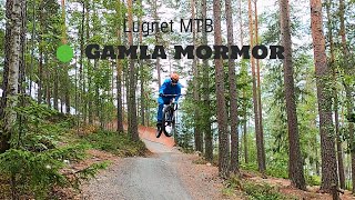
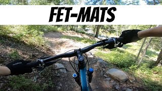
Videos of Lugnet Mountain Bike
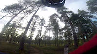
trail: Fet-Mats
0:18 |
66 |
Sep 18, 2020
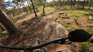
trail: Gamla Mormor Övre
0:55 |
1413 |
Jul 15, 2020 , Falun
trail: Fet-Mats
0:13 |
1138 |
Aug 16, 2018 , Falun
youtuber
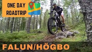
![MTB Roadtrip (Falun & Högbo)]()
454 |
Dec 17, 2016
youtuber
![Lugnet, Falun: Dag 3, Järvsöride]()
425 |
Nov 12, 2016

trail: The Enemy Within
808 |
Nov 12, 2016 , Falun

trail: Second Chance
619 |
Nov 12, 2016 , Falun
Recent Trail Reports
| status | trail | date | condition | info | user |
|---|---|---|---|---|---|
| The Enemy Within | Aug 6, 2025 @ 2:06am Aug 6, 2025 | Ideal | Manniger | ||
| Gamla Mormor Nedre | Jun 3, 2025 @ 11:42am Jun 3, 2025 | Dry | anderslindqvist74 | ||
| Halloween Knights | Jun 3, 2025 @ 11:42am Jun 3, 2025 | Dry | anderslindqvist74 | ||
| Second Chance | Jun 3, 2025 @ 11:42am Jun 3, 2025 | Dry | anderslindqvist74 | ||
| Stigklättring På Röda 1 | Jun 3, 2025 @ 11:42am Jun 3, 2025 | Dry | anderslindqvist74 | ||
| Stig På Röda | Jun 3, 2025 @ 11:42am Jun 3, 2025 | Dry | anderslindqvist74 | ||
| Every Time She Smiles | Jun 3, 2025 @ 11:42am Jun 3, 2025 | Dry | anderslindqvist74 | ||
| Röda Grus | Jun 3, 2025 @ 11:42am Jun 3, 2025 | Dry | anderslindqvist74 | ||
| Lugnet XC Övre Hagen | Jun 3, 2025 @ 11:42am Jun 3, 2025 | Dry | anderslindqvist74 | ||
| Fet-Mats | Aug 10, 2024 @ 5:01am Aug 10, 2024 | Ideal | sjorsroelofs |
Activity Feed
| username | action | type | title | date |
|---|---|---|---|---|
| MorganUkBzTU | wishlist | route | activity #93833693 | May 1, 2026 @ 10:52pm May 1, 2026 |
| GuillemDRCZqB | wishlist | region | activity #88820627 | Feb 13, 2026 @ 1:38am Feb 13, 2026 |
| Robertvd2t3q | wishlist | route | activity #79219897 and 2 more | Aug 29, 2025 @ 9:13pm Aug 29, 2025 |
| niklas021 | wishlist | route | activity #78870902 | Aug 24, 2025 @ 1:53pm Aug 24, 2025 |
| Leok7smlH | ridden | trail | activity #78168665 and 1 more | Aug 15, 2025 @ 4:20am Aug 15, 2025 |
Recent Comments
| username | type | title | comment | date |
|---|---|---|---|---|
| trail | Mycket bra utnyttjade 15 fallhöjdsmeter!... | Jun 16, 2018 @ 3:34am Jun 16, 2018 | ||
| trail | Lättkörd och rolig | Jun 16, 2018 @ 3:33am Jun 16, 2018 | ||
| report | Dry and Fast | Jul 22, 2017 @ 12:26pm Jul 22, 2017 | ||
| trail | Föreslår att GPS-spåret cropas på slutet... | Aug 25, 2016 @ 2:01am Aug 25, 2016 | ||
| trail | Börjar inte starten på denna stig längre... | Aug 25, 2016 @ 2:00am Aug 25, 2016 |
Nearby Areas
| name | distance | ||||
|---|---|---|---|---|---|
| Jungfruberget | 5 | 9 | 1.3 km | ||
| Övningsområdet | 21 | 51 | 1.3 km | ||
| Falun Central | 2 | 1.4 km | |||
| Samuelsdal - Galgberget | 2 | 2.5 km | |||
| Hornberget | 1 | 3 | 3 km |
Local Badges
-

Completionist1 awarded
Bike & Skill Parks
| name | type | city | rating |
|---|---|---|---|
| Pump track & skillpark | skill park | Falun |
Activity Type Stats
| activitytype | trails | distance | descent | descent distance | total vertical | rating | global rank | state rank | photos | reports | routes | ridelogs |
|---|---|---|---|---|---|---|---|---|---|---|---|---|
| Mountain Bike | 37 | 22 miles | 2,736 ft | 10 miles | 561 ft | #4,065 | #139 | 8 | 206 | 4 | 6,314 | |
| Horse | 1 | 2,215 ft | 20 ft | 1,171 ft | 20 ft | 47 | ||||||
| Hike | 30 | 19 miles | 2,211 ft | 8 miles | 561 ft | #6,288 | #280 | 190 | 1 | 63 | ||
| Trail Running | 30 | 19 miles | 2,211 ft | 8 miles | 561 ft | #4,964 | #256 | 190 | 1 | 758 | ||
| Backcountry Ski | 2 | 1 mile | 69 ft | 1,932 ft | 138 ft | |||||||
| Nordic Ski | 12 | 13 miles | 1,086 ft | 5 miles | 554 ft | #298 | #24 | 2,135 |
Frequently Asked Questions About Lugnet
▼
What are the highest rated mountain biking trails in Lugnet?
The highest rated mountain biking trails in Lugnet are:
- Fet-Mats (4.3/5)
- Gamla Mormor Övre (4.3/5)
- Gamla Mormor Nedre (4.2/5)
- Every Time She Smiles (4.2/5)
- Halloween Knights (4.2/5)
▼
What is the best time of the year to ride in Lugnet?
Based on ride log data, the most popular months to ride in Lugnet are:
- July (36 activities)
- September (26 activities)
- June (24 activities)
▼
Where can I park to ride in Lugnet?
There are 3 parking locations listed in Lugnet. The most popular parking spots are: View all parking and trailhead locations on the map to plan your visit.
▼
What is the longest trail in Lugnet?
The longest trail in Lugnet is Ovan Digertäkt at 1.3 km. View all trails sorted by distance.
Activities
Trails
Points of Interest
- By jbella
 VSC & contributors
 - Admins: Tote, MagnusThornberg, AndersK, RogerDavidsson, perhol, stegenfeldt, OrjanX, svenakela
- #13847 - 5,103 views
- lugnet activity log | embed map of Lugnet mountain bike trails | lugnet mountain biking points of interest
Downloading of trail gps tracks in kml & gpx formats is enabled for Lugnet.
You must login to download files.