close
-
Layers w
- Weather Layers
- Pro
- Pro
- Pro
- Pro
- Pro
- Pro
- More Layers
- Pro
- Pro
- Pro
- Pro
-
Upgrade to

3D
Trail Conditions
- Unknown
- Snow Groomed
- Snow Packed
- Snow Covered
- Snow Cover Partial
- Freeze/thaw Cycle
- Icy
- Prevalent Mud
- Wet
- Variable
- Ideal
- Dry
- Very Dry
Trail Flow (Ridden Direction)
Trailforks scans users ridelogs to determine the most popular direction each trail is ridden. A good flowing trail network will have most trails flowing in a single direction according to their intension.
The colour categories are based on what percentage of riders are riding a trail in its intended direction.
The colour categories are based on what percentage of riders are riding a trail in its intended direction.
- > 96%
- > 90%
- > 80%
- > 70%
- > 50%
- < 50%
- bi-directional trail
- no data
Trail Last Ridden
Trailforks scans ridelogs to determine the last time a trail was ridden.
- < 2 days
- < 1 week
- < 2 weeks
- < 1 month
- < 6 months
- > 6 months
Trail Ridden Direction
The intended direction a trail should be ridden.
- Downhill Only
- Downhill Primary
- Both Directions
- Uphill Primary
- Uphill Only
- One Direction
Contribute Details
Colors indicate trail is missing specified detail.
- Description
- Photos
- Description & Photos
- Videos
Trail Popularity ?
Trailforks scans ridelogs to determine which trails are ridden the most in the last 9 months.
Trails are compared with nearby trails in the same city region with a possible 25 colour shades.
Think of this as a heatmap, more rides = more kinetic energy = warmer colors.
- most popular
- popular
- less popular
- not popular
ATV/ORV/OHV Filter
Max Vehicle Width
inches
US Cell Coverage
Legend

Radar Time
Activity Recordings
Trailforks uses anonymized public activity data.
?
Activity Recordings
Trailforks uses anonymized public activity data.
?
Personal Heatmap
▶
Activity Types
all
/
none
▶
Options
2
Date range
month
–
Winter Trails
Warning
A routing network for winter maps does not exist. Selecting trails using the winter trails layer has been disabled.
Missing Trails
Most Popular
Least Popular
Trails are colored based on popularity. The more popular a trail is, the more red. Less popular trails trend towards green.
Jump Magnitude Heatmap
Heatmap of where riders jump on trails. Zoom in to see individual jumps, click circles to view jump details.
BC Backroad Status
![map legend]()
Service Road Atlas is a free to use, community-driven service for viewing and creating reports on the numerous back-country service roads around B.C. and Alberta.

Slope Aspect
Direction the slope faces
Trails Deemphasized
Trails are shown in grey.
Only show trails with no bike usage.
Suggested Layers
Based on selected activity type
Save the current map location and zoom level as your default home location whenever this page is loaded.
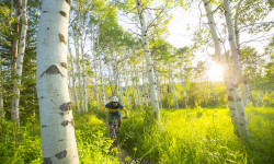
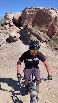
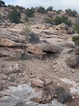
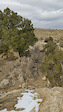
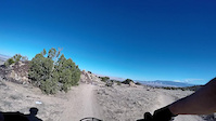
SaveThe Lunch Loops are a stacked singletrack trail system just two miles from downtown Grand Junction. The proximity to town gave the system its name; a trail system you could enjoy on your lunch break. A technical trail system, many riders who come from other areas learn there is another level of riding when exploring these trails. Rocky in nature, the trails cut through the multi-colored desert landscape with frequent step-up and drop moves, steep climbs, and ripping downhills.
The Lunch Loops feature the first direction downhill trail with "play" features constructed on BLM lands. Free Lunch, designed as an expert trail, has multiple drop sections and a rowdy, technical nature. Other advanced-expert trails in the system include Pucker Up, Holy Cross, Gunny Loop, and Eagle's Wing.
If you are first exploring the Lunch Loops, consider getting your bearings by riding the classic climbing route, Pet-e-kis up to High Noon, across to Raven's Ridge, down Curt's Down, to Curt's Lane. This is commonly referred to as the Lite Lunch Loop.
The Lunch Loops are very sensitive to moisture as many of the trails are entirely or have significant sections of expansive soils that become like greased peanut butter when wet, destroying your bike, making your feet each weigh 50 pounds, and hapless riders caught out on wet trails often return covered head to toe in thick, grey mud. Not to mention the damage it does to trails, it will quickly destroy your drivetrain, all your bearings, and invade seals. DO NOT RIDE THE LUNCH LOOPS WHEN IT IS WET
Primary Trail Type: Cross-Country
Land Status: Regional Recreation Area
Land Manager: Grand Junction Field Office of the BLM
 google parking directions
 Access Info:
There are several trailheads that serve the Lunch Loops. The main Lunch Loops Trailhead is accessed off of Monument Road. Parking at the TH can be full almost any day of the year so riding up the new, paved Monument Connector Bike Path from the River Front Trail which connects the entire valley is a great way to warm up and avoid the parking.
Links
Region Supporters & Maintainers
Activities Click to view
- Mountain Bike
68 trails
- Hike
72 trails
- Trail Running
72 trails
Region Details
- 8
- 9
- 28
- 18
- 3
Region Status
Open as of Jun 6, 2026Stats
- Avg Trail Rating
- Trails (view details)
- 72
- Trails Mountain Bike
- 68
- Trails E-Bike
- 1
- Trails Hike
- 72
- Trails Trail Running
- 72
- Total Distance
- 55 miles
- Total Descent
- 11,045 ft
- Total Vertical
- 2,140 ft
- Highest Trailhead
- 6,702 ft
- Reports
- 1,331
- Photos
- 296
- Ridden Counter
- 77,115
Articles
Colorado's 5 Most Popular Trail Networks According to Trailforks Data
Oct 20, 2021 from pinkbike.com
Colorado is the eighth most expansive of the 50 states by area and is home to 53 different mountain peaks in excess of 14,000 feet above sea level.
Popular Lunch Loops Mountain Biking Trails
• 100 ★ 3.0 • 1,362 ft • 48 ft • 3,387 •
Curt’s lane is a quick switch-back route up to the Lunch Loops rim. A tough single track climb but a fast and mostly-fluid downhill make Curt’s Lane a favorite access trail. Challenge yourself by taking the route along the rim, or...
• 100 ★ 4.2 • 2,589 ft • 37 ft • 3,365 •
Curt's Lane is one of the first constructed trails at the Lunch Loops. This trail leaves the trailhead and climbs up onto the prominent ridgeline connecting into many of the core trails of the Lunch Loops. Constructed as a mountain bike...
• 100 ★ 3.7 • 1,849 ft • 13 ft • 3,157 •
Popular blue difficulty singletrack. This mountain bike primary trail can be used downhill primary. On average it takes 1 minutes to complete this trail.
• 100 ★ 3.4 • 1,534 ft • 3 ft • 2,851 •
is a jaunty little connector with the standard ridge-top spattering of technical slickrock, with only one sturdy obstacle (steps, as seen in picture). Views are good all around and speeds are fairly fast either direction.
• 100 ★ 4.1 • 1 mile • 373 ft • 2,375 •
Pet-e-kes is a fun and technical climb up to the more difficult Lunch Loop trails. Mostly smooth hard-packed dirt trail with several technical obstacles to challenge even the best riders. This trail is ridden as a climbing trail. Please...
• 100 ★ 3.8 • 1 mile • 255 ft • 2,365 •
Coyote Ridge is a challenging connector with a little flow and many excellent drops and jumps (when ridden west-east). Ridden the other directions it's a technical climb that will test your riding ability. Short but sweet, it's a fun...
• 85 ★ 4.4 • 3 miles • 161 ft • 2,258 •
Bing bang boom! Rocks, desert, views! You're going to love this trail.
• 90 ★ 3.1 • 2 miles • 774 ft • 2,052 •
Tabegauche (pronounced \"Tab-uh-watch\") is the spine-trail of the Lunch Loops, connecting the trails together. Starting from the TH Tabegauche climbs gently to the Pet-e-Kes/ turn-offs, then becomes more aggressively steep and...
Lunch Loops Mountain Bike Routes
★ 3.7 • 5 miles • 609 ft • 5 •
This is a great sampling of the most fun intermediate trails in the lower Lunch Loops. The climb up...
★ 3.5 • 14 miles • 1,937 ft • 23 •
Lunch Loops Recon Loop. First iteration of our day at lunch loops.
★ 3.0 • 13 miles • 1,561 ft • 15 • Loop •
Shuttle without a vehicle. Ride up the gut on Tabeguache, then hit all of and come back down Lunch Loops...
7 miles • 924 ft • 5 •
A lunch loops classic! is a unique technically and aerobically challenging trail that is full of obstacles...
7 miles • 685 ft • 8 •
This is a great sampling of the most fun intermediate trails in the lower Lunch Loops. The climb up...
★ 2.0 • 7 miles • 811 ft • 12 • Loop •
This route offers a sampling of the blue trails in the lower lunch loop trail system. Start off with a...
Photos of Lunch Loops Mountain Bike
Videos of Lunch Loops Mountain Bike
trail: Moto
0:27 |
12 |
Oct 9, 2025

trail: Free Lunch
0:03 |
77 |
Aug 1, 2024
trail: Free Lunch
0:03 |
111 |
Nov 27, 2022

trail: Time Machine
0:08 |
349 |
Apr 14, 2021
trail: Holy Cross
0:26 |
201 |
Jan 22, 2021
trail: Pucker Up
0:34 |
239 |
Nov 21, 2020

trail: Free Lunch
0:32 |
304 |
Jan 5, 2020

trail: The Ribbon
10:52 |
155 |
Dec 19, 2019
Recent Trail Reports
| status | trail | date | condition | info | user |
|---|---|---|---|---|---|
| Curts Lane | Jun 6, 2026 @ 6:27am (America/Denver) Jun 6, 2026 | Ideal | Mechead | ||
| Curt's Down | Jun 6, 2026 @ 6:27am (America/Denver) Jun 6, 2026 | Ideal | Mechead | ||
| Curts Lane (S) | Jun 6, 2026 @ 6:27am (America/Denver) Jun 6, 2026 | Ideal | Mechead | ||
| Ali Alley | Jun 6, 2026 @ 6:27am (America/Denver) Jun 6, 2026 | Ideal | Mechead | ||
| Ali Ali Loop | Jun 6, 2026 @ 6:27am (America/Denver) Jun 6, 2026 | Ideal | Mechead | ||
| Clunker | Jun 6, 2026 @ 6:27am (America/Denver) Jun 6, 2026 | Ideal | Mechead | ||
| Gunny Loop (East) | Jun 6, 2026 @ 6:27am (America/Denver) Jun 6, 2026 | Ideal | Mechead | ||
| Gunny Loop | Jun 6, 2026 @ 6:27am (America/Denver) Jun 6, 2026 | Ideal | Mechead | ||
| Tabeguache | Jun 6, 2026 @ 6:27am (America/Denver) Jun 6, 2026 | Dry | Mechead | ||
| Moto | May 21, 2026 @ 10:16am (America/Denver) May 21, 2026 | Dry | kardi13 TFSPAIN |
Activity Feed
| username | action | type | title | date |
|---|---|---|---|---|
| ESP-OFF | wishlist | region | activity #97022201 | Jun 14, 2026 @ 9:20pm Jun 14, 2026 |
| bloamyhaywoodj | wishlist | route | activity #96720318 | Jun 10, 2026 @ 11:13pm Jun 10, 2026 |
| Rachjacoby | wishlist | route | activity #96420804 | Jun 6, 2026 @ 6:09pm Jun 6, 2026 |
| Mechead | add | report | activity #96410941 and 8 more | Jun 6, 2026 @ 3:32pm Jun 6, 2026 |
| Rachjacoby | wishlist | route | activity #96380424 and 1 more | Jun 6, 2026 @ 9:35am Jun 6, 2026 |
Recent Comments
| username | type | title | comment | date |
|---|---|---|---|---|
| trail | 90% of this trail is flat rocky XC. It’s... | Mar 23, 2026 @ 3:05pm Mar 23, 2026 | ||
| trail | I used to think i was a descent rider (30+... | Mar 19, 2026 @ 12:52pm Mar 19, 2026 | ||
| report | O | Mar 14, 2026 @ 2:58pm Mar 14, 2026 | ||
| trail | A good warmup trail before you hit free lunch... | Sep 25, 2025 @ 5:29am Sep 25, 2025 | ||
| trail | Extremely rocky. An occasional drop . I’d... | Sep 25, 2025 @ 5:27am Sep 25, 2025 |
Nearby Areas
| name | distance | ||||
|---|---|---|---|---|---|
| Third Flats | 3 | 17 | 4 | 2.2 km | |
| Redlands | 27 | 14 | 1 | 2.7 km | |
| Colorado State Park | 11 | 3.6 km | |||
| Bangs Canyon | 6 km | ||||
| Gunnison River Bluffs | 4 | 1 | 6.4 km |
Local Badges
-

Completionist5 awarded
Bike & Skill Parks
| name | type | city | rating |
|---|---|---|---|
| Lunch Loops Jump Park | skill park | Grand Junction |
Upcoming Local Events
Local Products
Local Products
Activity Type Stats
| activitytype | trails | distance | descent | descent distance | total vertical | rating | global rank | state rank | photos | reports | routes | ridelogs |
|---|---|---|---|---|---|---|---|---|---|---|---|---|
| Mountain Bike | 68 | 46 miles | 9,259 ft | 19 miles | 2,090 ft | #123 | #43 | 293 | 1,327 | 16 | 46,439 | |
| E-Bike | 1 | 1,112 | 1 | 869 | ||||||||
| Hike | 72 | 54 miles | 10,866 ft | 22 miles | 2,139 ft | #2,892 | #991 | 4 | 1,326 | 2,359 | ||
| Trail Running | 72 | 54 miles | 10,866 ft | 22 miles | 2,139 ft | #2,037 | #478 | 1 | 1,326 | 2,176 |
Frequently Asked Questions About Lunch Loops
▼
What are the highest rated mountain biking trails in Lunch Loops?
The highest rated mountain biking trails in Lunch Loops are:
- Gunny Loop (East) (4.7/5)
- Pucker Up (4.5/5)
- Free Lunch (4.5/5)
- The Ribbon (4.3/5)
- Holy Cross (4.3/5)
▼
What is the best time of the year to ride in Lunch Loops?
Based on ride log data, the most popular months to ride in Lunch Loops are:
- May (356 activities)
- April (332 activities)
- October (323 activities)
▼
Where can I park to ride in Lunch Loops?
There are 9 parking locations listed in Lunch Loops. The most popular parking spots are: View all parking and trailhead locations on the map to plan your visit.
▼
What is the longest trail in Lunch Loops?
The longest trail in Lunch Loops is Gunny Loop (East) at 4.3 miles. View all trails sorted by distance.
Activities
Trails
Points of Interest
- By todd
 Trailforks & contributors
 - Admins: COPMOBA-GVT, COPMOBA-GVT
- #4882 - 53,668 views
- lunch loops activity log | embed map of Lunch Loops mountain bike trails | lunch loops mountain biking points of interest
Downloading of trail gps tracks in kml & gpx formats is enabled for Lunch Loops.
You must login to download files.