close
-
Layers w
- Weather Layers
- Pro
- Pro
- Pro
- Pro
- Pro
- Pro
- More Layers
- Pro
- Pro
- Pro
- Pro
-
Upgrade to

3D
Trail Conditions
- Unknown
- Snow Groomed
- Snow Packed
- Snow Covered
- Snow Cover Partial
- Freeze/thaw Cycle
- Icy
- Prevalent Mud
- Wet
- Variable
- Ideal
- Dry
- Very Dry
Trail Flow (Ridden Direction)
Trailforks scans users ridelogs to determine the most popular direction each trail is ridden. A good flowing trail network will have most trails flowing in a single direction according to their intension.
The colour categories are based on what percentage of riders are riding a trail in its intended direction.
The colour categories are based on what percentage of riders are riding a trail in its intended direction.
- > 96%
- > 90%
- > 80%
- > 70%
- > 50%
- < 50%
- bi-directional trail
- no data
Trail Last Ridden
Trailforks scans ridelogs to determine the last time a trail was ridden.
- < 2 days
- < 1 week
- < 2 weeks
- < 1 month
- < 6 months
- > 6 months
Trail Ridden Direction
The intended direction a trail should be ridden.
- Downhill Only
- Downhill Primary
- Both Directions
- Uphill Primary
- Uphill Only
- One Direction
Contribute Details
Colors indicate trail is missing specified detail.
- Description
- Photos
- Description & Photos
- Videos
Trail Popularity ?
Trailforks scans ridelogs to determine which trails are ridden the most in the last 9 months.
Trails are compared with nearby trails in the same city region with a possible 25 colour shades.
Think of this as a heatmap, more rides = more kinetic energy = warmer colors.
- most popular
- popular
- less popular
- not popular
ATV/ORV/OHV Filter
Max Vehicle Width
inches
US Cell Coverage
Legend

Radar Time
Activity Recordings
Trailforks uses anonymized public activity data.
?
Activity Recordings
Trailforks uses anonymized public activity data.
?
Personal Heatmap
▶
Activity Types
all
/
none
▶
Options
2
Date range
month
–
Winter Trails
Warning
A routing network for winter maps does not exist. Selecting trails using the winter trails layer has been disabled.
Missing Trails
Most Popular
Least Popular
Trails are colored based on popularity. The more popular a trail is, the more red. Less popular trails trend towards green.
Jump Magnitude Heatmap
Heatmap of where riders jump on trails. Zoom in to see individual jumps, click circles to view jump details.
BC Backroad Status
![map legend]()
Service Road Atlas is a free to use, community-driven service for viewing and creating reports on the numerous back-country service roads around B.C. and Alberta.

Slope Aspect
Direction the slope faces
Trails Deemphasized
Trails are shown in grey.
Only show trails with no bike usage.
Suggested Layers
Based on selected activity type
Save the current map location and zoom level as your default home location whenever this page is loaded.
SaveThe Grand-Duchy of Luxembourg is a small country that borders to France, Belgium and Germany.
There are many hills and forests and plenty of hiking trails, which are open for mountain bikes as well.
There are many hills and forests and plenty of hiking trails, which are open for mountain bikes as well.
This region uses the Uk/Euro style trail grading system.
Stats
- Avg Trail Rating
- Trails (view details)
- 130
- Trails Mountain Bike
- 130
- Trails E-Bike
- 39
- Trails Horse
- 1
- Trails Hike
- 119
- Trails Trail Running
- 120
- Total Distance
- 162 miles
- Total Descent
- 30,828 ft
- Total Vertical
- 1,377 ft
- Highest Trailhead
- 1,625 ft
- Reports
- 158
- Photos
- 214
- Ridden Counter
- 4,387
Popular Trail Networks
view all areas »Sub Regions
- Capellen (0)
- Echternach (12)
- Esch an der Alzette (2)
- Rumelange (2)
- Rumelange (2)
- Grevenmacher (0)
- Luxemburg (0)
- Mersch (0)
- Redingen (0)
- Remich (0)
- Vianden (0)
- Wiltz (0)
- Berdorf (16)
- Dalheim (7)
- Dudelange (10)
- Echternach (6)
- Esch-sur-Alzette (7)
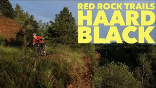
- Red Dirt (7)
- Esch-sur-Sure (8)
- Friedboesch (1)
- Greiveldange (4)
- Hoscheid (3)
- hosingen (0)
- Insenborn (1)
- Kautenbach (3)
- Kautenbach (3)
- Kopstal (1)
- Lultzhausen (1)
- Mondercange (1)
- Schuttrange (8)
- Schëtterhaard (5)
- senningerbierg (3)
- Strassen (11)
- Grengewald (5)
- Vianden (10)
- Vianden (10)
- Barrier Lake Esch-sur-Sure (1)
- Sauerdall (2)
- Schlënnerdall (17)
- Strossen / Bambech (0)
Popular Luxembourg Mountain Biking Trails
• 100 ★ 1.0 • 3,497 ft • 86 ft • 148 •
Popular white difficulty singletrack. This multi-use trail can be used both directions. On average it takes 3 minutes to complete this trail.
• 100 ★ 2.0 • 2,402 ft • 26 ft • 107 •
Popular white difficulty singletrack. This multi-use trail can be used both directions. Trail visibility is always easy to follow. On average it takes 3 minutes to complete this trail.
• 85 ★ 2.0 • 2,385 ft • 53 ft • 102 •
Popular white difficulty singletrack. This multi-use trail can be used both directions with a 53 ft green climb. Trail visibility is always easy to follow. On average it takes 9 minutes to complete this trail.
• 95 ★ 3.0 • 1,988 ft • 4 ft • 90 •
Popular green difficulty singletrack. This multi-use trail can be used downhill primary. On average it takes 1 minutes to complete this trail.
• 70 ★ 2.5 • 1 mile • 31 ft • 66 •
Popular green difficulty singletrack. This multi-use trail can be used both directions and has a easy overall physical rating with a 31 ft green climb. Trail visibility is always easy to follow. On average it takes 21 minutes to complete this trail.
• 100 ★ 0.0 • 2,936 ft • 0 ft • 55 •
Popular green difficulty singletrack. This mountain bike primary trail can be used one direction. On average it takes 3 minutes to complete this trail.
• 90 ★ 5.0 • 1,339 ft • 0 ft • 54 •
Popular blue difficulty family friendly singletrack. This mountain bike primary trail can be used downhill only and has a easy overall physical rating. It features berm, drop and jump. Trail visibility is always easy to follow. On average it takes 3 minutes to complete this trail.
• 80 ★ 4.0 • 3,320 ft • 51 ft • 53 •
Popular blue difficulty singletrack. This multi-use trail can be used downhill primary. Trail visibility is always easy to follow. On average it takes 16 minutes to complete this trail.
Luxembourg Mountain Bike Routes
★ 4.0 • 18 miles • 1,916 ft • 2 • Loop •
Luxemb.Schweiz / Müllertal. Highlights rundum Berdorf. S1-S2(+).Wenige Stellen schwerer. Fahrtrichtung...
★ 5.0 • 18 miles • 1,999 ft • 4 • Loop •
Tied with Dudelange Black trail as my favorite of the official routes. Lots of flowy singletrack, and some...
24 miles • 2,966 ft • 4 • Loop •
One of the more scenic rides in Luxembourg, this gives you a good tour of the famous Mullerthal region...
★ 2.0 • 14 miles • 1,353 ft • 4 •
The Greiveldange MTB route is signposted in the direction the different trails and connecting roads are...
★ 4.5 • 17 miles • 2,102 ft • 0 • Loop •
If I had to choose, this would probably be my favorite of the official Lux routes. High single-track ratio...
21 miles • 2,071 ft • 3 • Loop •
Nice Tour with a start in Echternach. Uphill starting on official Bike way with a smooth through the woods...
Photos of Luxembourg Mountain Bike
Videos of Luxembourg Mountain Bike
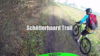
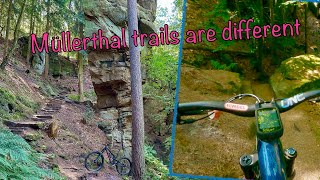
trail: Schëtterhaard Trail 1
5:56 |
206 |
Jun 7, 2015
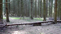
trail: Schëtterhaard Trail 3
0:09 |
127 |
Apr 14, 2015
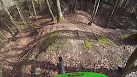
trail: Schëtterhaard Trail 4
0:19 |
121 |
Apr 13, 2015
2:26 |
261 |
Oct 31, 2014
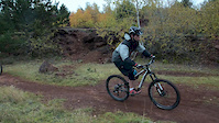
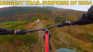
trail: Drip Cave Trail
4:54 |
75 |
Oct 7, 2025 , Berdorf
trail: Steinbruch Trail
5:25 |
171 |
Jan 11, 2025 , Wiltz
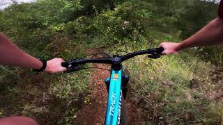
trail: Loose Loose
0:41 |
120 |
Sep 5, 2024 , Dudelange
youtuber
![Discover Luxembourg Most Scenic Mountainbike...]()
trail: Loose Loose
3:29 |
295 |
Jul 29, 2024 , Dudelange
Recent Comments
| username | type | title | comment | date |
|---|---|---|---|---|
| trail | Lovely trail, but hard to access! | Dec 28, 2025 @ 2:19am Dec 28, 2025 | ||
| trail | Nice short, easy trail. Not really difficult.... | Dec 28, 2025 @ 2:18am Dec 28, 2025 | ||
| trail | Last part is closed, very nice trial/enduro... | Mar 25, 2025 @ 8:58am Mar 25, 2025 | ||
| trail | Fun trail with nicely shaped jumps! | Feb 28, 2024 @ 10:44pm Feb 28, 2024 | ||
| trail | Funny S0/S1 switchback trail with a narrow S2... | Sep 7, 2023 @ 1:15am Sep 7, 2023 |
Bike & Skill Parks
| name | type | city | rating |
|---|---|---|---|
| Little Utah | skill park | Esch-sur-Alzette | |
| Senningerberg Skillpark | skill park | senningerbierg | |
| Bike Park Boy Konen | skill park | Luxembourg City | |
| Pumptrack Mondercange | skill park | Mondercange | |
| Losange motocross (måske) | skill park | Wiltz |
Activity Type Stats
| activitytype | trails | distance | descent | descent distance | total vertical | rating | global rank | state rank | photos | reports | routes | ridelogs |
|---|---|---|---|---|---|---|---|---|---|---|---|---|
| Mountain Bike | 130 | 156 miles | 30,115 ft | 62 miles | 1,378 ft | #73 | 214 | 156 | 70 | 34,053 | ||
| E-Bike | 39 | 15 miles | 4,501 ft | 9 miles | 984 ft | #80 | 135 | 15 | 4,012 | |||
| Horse | 1 | 463 ft | 59 ft | 390 ft | 59 ft | #69 | 17 | |||||
| Hike | 119 | 159 miles | 29,472 ft | 63 miles | 1,378 ft | #71 | 153 | 9 | 3,405 | |||
| Trail Running | 120 | 159 miles | 29,619 ft | 63 miles | 1,378 ft | #72 | 153 | 9 | 596 |
Activities
Trails
Points of Interest
- Jump on Red Dirt Trail 1 TTF
- Drop/steep slope on Red Dirt Trail 1 TTF
- Viewpoint on Red Dirt Trail 1
- Downhill slope TTF
- Old Mining Pit Viewpoint
- Drop TTF
- Viewpoint over the old mining pit
- Single trail downhill slope TTF
- Lavoir - a public washing place Sight
- Jump TTF
- Aux Sept Chemin (1,841 ft)
- La Since (1,837 ft)
- Martaimont (1,791 ft)
- By MrFord & contributors
- Admins: Freischneider
- #3268 - 22,608 views
- luxembourg activity log | embed map of Luxembourg mountain bike trails | luxembourg mountain biking points of interest
Downloading of trail gps tracks in kml & gpx formats is enabled for Luxembourg.
You must login to download files.