close
-
Layers w
- Weather Layers
- Pro
- Pro
- Pro
- Pro
- Pro
- Pro
- More Layers
- Pro
- Pro
- Pro
- Pro
-
Upgrade to

3D
Trail Conditions
- Unknown
- Snow Groomed
- Snow Packed
- Snow Covered
- Snow Cover Partial
- Freeze/thaw Cycle
- Icy
- Prevalent Mud
- Wet
- Variable
- Ideal
- Dry
- Very Dry
Trail Flow (Ridden Direction)
Trailforks scans users ridelogs to determine the most popular direction each trail is ridden. A good flowing trail network will have most trails flowing in a single direction according to their intension.
The colour categories are based on what percentage of riders are riding a trail in its intended direction.
The colour categories are based on what percentage of riders are riding a trail in its intended direction.
- > 96%
- > 90%
- > 80%
- > 70%
- > 50%
- < 50%
- bi-directional trail
- no data
Trail Last Ridden
Trailforks scans ridelogs to determine the last time a trail was ridden.
- < 2 days
- < 1 week
- < 2 weeks
- < 1 month
- < 6 months
- > 6 months
Trail Ridden Direction
The intended direction a trail should be ridden.
- Downhill Only
- Downhill Primary
- Both Directions
- Uphill Primary
- Uphill Only
- One Direction
Contribute Details
Colors indicate trail is missing specified detail.
- Description
- Photos
- Description & Photos
- Videos
Trail Popularity ?
Trailforks scans ridelogs to determine which trails are ridden the most in the last 9 months.
Trails are compared with nearby trails in the same city region with a possible 25 colour shades.
Think of this as a heatmap, more rides = more kinetic energy = warmer colors.
- most popular
- popular
- less popular
- not popular
ATV/ORV/OHV Filter
Max Vehicle Width
inches
US Cell Coverage
Legend

Radar Time
Activity Recordings
Trailforks uses anonymized public activity data.
?
Activity Recordings
Trailforks uses anonymized public activity data.
?
Personal Heatmap
▶
Activity Types
all
/
none
▶
Options
2
Date range
month
–
Winter Trails
Warning
A routing network for winter maps does not exist. Selecting trails using the winter trails layer has been disabled.
Missing Trails
Most Popular
Least Popular
Trails are colored based on popularity. The more popular a trail is, the more red. Less popular trails trend towards green.
Jump Magnitude Heatmap
Heatmap of where riders jump on trails. Zoom in to see individual jumps, click circles to view jump details.
BC Backroad Status
![map legend]()
Service Road Atlas is a free to use, community-driven service for viewing and creating reports on the numerous back-country service roads around B.C. and Alberta.

Slope Aspect
Direction the slope faces
Trails Deemphasized
Trails are shown in grey.
Only show trails with no bike usage.
Suggested Layers
Based on selected activity type
Save the current map location and zoom level as your default home location whenever this page is loaded.
SaveShared use trail network managed by the Mitcham Council.
Primary Trail Type: All-Mountain & Downhill
eBikes Allowed:
Yes
Shuttleable: YES
Land Status: Conservation Reserve
Activities Click to view
- Mountain Bike
71 trails
- E-Bike
8 trails
- Hike
62 trails
- Trail Running
62 trails
Region Details
- 9
- 14
- 29
- 11
- 1
Region Status
Caution as of 2 daysLocal Trail Association
Stats
- Avg Trail Rating
- Trails (view details)
- 65
- Trails Mountain Bike
- 71
- Trails E-Bike
- 8
- Trails Horse
- 1
- Trails Hike
- 62
- Trails Trail Running
- 62
- Total Distance
- 17 miles
- Total Descent
- 4,427 ft
- Total Vertical
- 772 ft
- Highest Trailhead
- 921 ft
- Reports
- 861
- Photos
- 47
- Ridden Counter
- 16,237
Popular Randell Reserve Mountain Biking Trails
• 95 ★ 5.0 • 1,161 ft • 42 ft • 443 •
Popular blue difficulty singletrack. This mountain bike primary trail can be used both directions and has a moderate overall physical rating with a 42 ft blue climb. It features berm and bridge. On average it takes 1 minutes to complete this trail.
• 90 ★ 2.0 • 1,939 ft • 10 ft • 431 •
Popular green difficulty gravel path. This mountain bike primary trail can be used both directions and has a easy overall physical rating with a 10 ft green climb. On average it takes 3 minutes to complete this trail.
• 100 ★ 3.5 • 771 ft • 49 ft • 399 •
Popular green difficulty singletrack. This mountain bike primary trail can be used both directions. On average it takes 1 minutes to complete this trail.
• 85 ★ 0.0 • 1,088 ft • 30 ft • 387 •
Popular green difficulty singletrack. This mountain bike primary trail can be used both directions and has a easy overall physical rating with a 30 ft green climb. On average it takes 1 minutes to complete this trail.
• 95 ★ 3.7 • 3,156 ft • 45 ft • 366 •
Popular blue difficulty singletrack. This mountain bike primary trail can be used both directions and has a hard overall physical rating with a 45 ft blue climb. It features bridge, drop and jump. On average it takes 3 minutes to complete this trail.
• 90 ★ 4.7 • 830 ft • 0 ft • 362 •
Its A pretty easy, flowy and smooth trail, with a fair few boaters
• 80 ★ 4.0 • 2,064 ft • 109 ft • 349 •
Popular blue difficulty singletrack. This mountain bike primary trail and has a moderate overall physical rating with a 109 ft blue climb. On average it takes 2 minutes to complete this trail.
• 80 ★ 3.0 • 2,073 ft • 37 ft • 331 •
Popular blue difficulty singletrack. This mountain bike primary trail can be used downhill primary and has a hard overall physical rating with a 37 ft black diamond climb. It features bridge. On average it takes 2 minutes to complete this trail.
Randell Reserve Mountain Bike Routes
★ 3.0 • 4 miles • 178 ft • 6 • Shuttled •
Black run starting at Pinera train station, down Gloucester Ave (past St John's Highschool), down , across...
3 miles • 125 ft • 4 • Shuttled •
Starts with a bit of blue down Sleeps ( ) then fly down . Stop off at for awesome dirt berms & jumps...
★ 2.0 • 2 miles • 442 ft • 12 •
Seeing if this is a good way to get from Lynton into sheps
7 miles • 668 ft • 0 • Shuttled •
Green trail starting at Coromandel train station, follows Sturt River and then Minnow Creek into Belair...
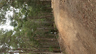
Photos of Randell Reserve Mountain Bike
Videos of Randell Reserve Mountain Bike

trail: Mitcham 4X Track
0:04 |
14 |
Jan 1, 2026
trail: Mitcham 4X Track
0:09 |
|
Jun 4, 2021

trail: Mitcham 4X Track
0:59 |
244 |
Apr 10, 2018
trail: Windies Right
0:05 |
523 |
Jul 1, 2017
trail: Lynton Green Link 1
3:20 |
185 |
Sep 26, 2016

trail: Sleeps 1 & 2
0:30 |
491 |
Jul 2, 2016
trail: Windies Right
2:21 |
1008 |
Feb 15, 2016
trail: Alternate
0:08 |
553 |
Jan 23, 2016
Recent Trail Reports
Activity Feed
| username | action | type | title | date |
|---|---|---|---|---|
| nogo12 | add | report | activity #94867372 | May 16, 2026 @ 6:32pm May 16, 2026 |
| j808 | add | report | activity #94069035 and 2 more | May 4, 2026 @ 8:43pm May 4, 2026 |
| skyjogger | add | video | activity #92242657 | Apr 9, 2026 @ 3:40am Apr 9, 2026 |
| skyjogger | add | video | activity #92172142 | Apr 8, 2026 @ 3:06am Apr 8, 2026 |
| Patrick5JeQJ1 | ridden | trail | activity #91936643 and 4 more | Apr 4, 2026 @ 3:20pm Apr 4, 2026 |
Recent Comments
| username | type | title | comment | date |
|---|---|---|---|---|
| trail | The trail is constantly getting closed by council | Jan 14, 2026 @ 1:12pm Jan 14, 2026 | ||
| trail | too many large loose rocks | Dec 5, 2025 @ 2:31pm Dec 5, 2025 | ||
| trail | Top half is destroyed and full of loose rocks,... | Sep 27, 2025 @ 10:47pm Sep 27, 2025 | ||
| trail | Very loose at the moment but is always a... | Apr 20, 2025 @ 6:01am Apr 20, 2025 | ||
| trail | Pretty fun tight track that opens up to some... | Apr 20, 2025 @ 6:00am Apr 20, 2025 |
Nearby Areas
| name | distance | ||||
|---|---|---|---|---|---|
| Brownhill Creek | 8 | 5 | 6 | 1 | 0.3 km |
| Randell Park Reserve | 3 | 1 | 0.8 km | ||
| Springwood Park | 0.8 km | ||||
| Lynton | 1.3 km | ||||
| Waite Conservation Reserve | 10 | 8 | 1.6 km |
Local Badges
-

Completionist0 awarded
Activity Type Stats
| activitytype | trails | distance | descent | descent distance | total vertical | rating | global rank | state rank | photos | reports | routes | ridelogs |
|---|---|---|---|---|---|---|---|---|---|---|---|---|
| Mountain Bike | 71 | 17 miles | 4,213 ft | 8 miles | 771 ft | #1,259 | #70 | 47 | 861 | 7 | 11,245 | |
| E-Bike | 8 | 1,818 ft | 98 ft | 535 ft | 98 ft | #3,790 | #183 | 525 | 3 | 1,410 | ||
| Horse | 1 | 741 ft | 217 ft | 696 ft | 217 ft | 141 | ||||||
| Hike | 62 | 16 miles | 3,573 ft | 7 miles | 735 ft | #5,856 | #172 | 820 | 159 | |||
| Trail Running | 62 | 16 miles | 3,573 ft | 7 miles | 735 ft | #4,262 | #118 | 820 | 1,201 |
Frequently Asked Questions About Randell Reserve
▼
What are the highest rated mountain biking trails in Randell Reserve?
The highest rated mountain biking trails in Randell Reserve are:
- Mitcham 4X Track (4.4/5)
- Windies Right (4.2/5)
- Bananas (4.1/5)
- Blue Ridge (4.1/5)
- Magpie Creek East Blue (4.1/5)
▼
What is the best time of the year to ride in Randell Reserve?
Based on ride log data, the most popular months to ride in Randell Reserve are:
- November (82 activities)
- October (74 activities)
- December (70 activities)
▼
Where can I park to ride in Randell Reserve?
Check the Randell Reserve trail map for trailhead and parking information. Community members regularly update access and parking details for trails in the area.
▼
What is the longest trail in Randell Reserve?
The longest trail in Randell Reserve is Adam's Orchard at 4,076 ft. View all trails sorted by distance.
Activities
Trails
Points of Interest
- By todd
 Trailforks & contributors
 - Admins: Mitcham, ForestrySA
- #5060 - 17,829 views
- randell reserve activity log | embed map of Randell Reserve mountain bike trails | randell reserve mountain biking points of interest
Downloading of trail gps tracks in kml & gpx formats is enabled for Randell Reserve.
You must login to download files.