close
-
Layers w
- Weather Layers
- Pro
- Pro
- Pro
- Pro
- Pro
- Pro
- More Layers
- Pro
- Pro
- Pro
- Pro
-
Upgrade to

3D
Trail Conditions
- Unknown
- Snow Groomed
- Snow Packed
- Snow Covered
- Snow Cover Partial
- Freeze/thaw Cycle
- Icy
- Prevalent Mud
- Wet
- Variable
- Ideal
- Dry
- Very Dry
Trail Flow (Ridden Direction)
Trailforks scans users ridelogs to determine the most popular direction each trail is ridden. A good flowing trail network will have most trails flowing in a single direction according to their intension.
The colour categories are based on what percentage of riders are riding a trail in its intended direction.
The colour categories are based on what percentage of riders are riding a trail in its intended direction.
- > 96%
- > 90%
- > 80%
- > 70%
- > 50%
- < 50%
- bi-directional trail
- no data
Trail Last Ridden
Trailforks scans ridelogs to determine the last time a trail was ridden.
- < 2 days
- < 1 week
- < 2 weeks
- < 1 month
- < 6 months
- > 6 months
Trail Ridden Direction
The intended direction a trail should be ridden.
- Downhill Only
- Downhill Primary
- Both Directions
- Uphill Primary
- Uphill Only
- One Direction
Contribute Details
Colors indicate trail is missing specified detail.
- Description
- Photos
- Description & Photos
- Videos
Trail Popularity ?
Trailforks scans ridelogs to determine which trails are ridden the most in the last 9 months.
Trails are compared with nearby trails in the same city region with a possible 25 colour shades.
Think of this as a heatmap, more rides = more kinetic energy = warmer colors.
- most popular
- popular
- less popular
- not popular
ATV/ORV/OHV Filter
Max Vehicle Width
inches
US Cell Coverage
Legend

Radar Time
Activity Recordings
Trailforks uses anonymized public activity data.
?
Activity Recordings
Trailforks uses anonymized public activity data.
?
Personal Heatmap
▶
Activity Types
all
/
none
▶
Options
2
Date range
month
–
Winter Trails
Warning
A routing network for winter maps does not exist. Selecting trails using the winter trails layer has been disabled.
Missing Trails
Most Popular
Least Popular
Trails are colored based on popularity. The more popular a trail is, the more red. Less popular trails trend towards green.
Jump Magnitude Heatmap
Heatmap of where riders jump on trails. Zoom in to see individual jumps, click circles to view jump details.
BC Backroad Status
![map legend]()
Service Road Atlas is a free to use, community-driven service for viewing and creating reports on the numerous back-country service roads around B.C. and Alberta.

Slope Aspect
Direction the slope faces
Trails Deemphasized
Trails are shown in grey.
Only show trails with no bike usage.
Suggested Layers
Based on selected activity type
Save the current map location and zoom level as your default home location whenever this page is loaded.
Save
No description for Lyon has been added yet!
Login or register to submit one.
This region uses the Uk/Euro style trail grading system.
Activities Click to view
- Mountain Bike
113 trails
- E-Bike
93 trails
- Gravel Bike
0 trails
- Adaptive Bike
0 trails
- Winter Fat Bike
0 trails
- Horse
4 trails
- Hike
96 trails
- Trail Running
97 trails
- Dirtbike/Moto
1 trails
- Observed Trials
0 trails
- ATV/ORV/OHV
0 trails
Region Details
- 16
- 1
- 41
- 27
- 10
- 4
Region Status
Open as of Jun 6, 2026Stats
- Avg Trail Rating
- Trails (view details)
- 101
- Trails Mountain Bike
- 113
- Trails E-Bike
- 93
- Trails Horse
- 4
- Trails Hike
- 96
- Trails Trail Running
- 97
- Trails Dirtbike/Moto
- 1
- Total Distance
- 47 miles
- Total Descent
- 10,846 ft
- Total Vertical
- 1,406 ft
- Highest Trailhead
- 1,945 ft
- Reports
- 1,147
- Photos
- 45
- Ridden Counter
- 2,922
Sub Regions
-
Bike Park Courzieu
- 1
- 1
- 1
- 1
-
Les Monts d'Or
- 12
- 22
- 10
- 3
Popular Lyon Mountain Biking Trails
• 100 ★ 0.0 • 3,819 ft • 14 ft • 54 •
Popular green difficulty paved path. This multi-use trail can be used both directions. On average it takes 3 minutes to complete this trail.
• 100 ★ 0.0 • 791 ft • 4 ft • 54 •
Popular green difficulty paved path. This multi-use trail can be used both directions. On average it takes minutes to complete this trail.
• 95 ★ 3.7 • 3,789 ft • 0 ft • 47 •
Single permettant d'éviter le large chemin sans intérêt. A enchaîner ensuite avec le Track nommé " ". Ne pas manquer son entrée à gauche après le départ dans la prairie, ensuite il y a 2 embranchements où il faut rester à...
• 90 ★ 5.0 • 1,486 ft • 0 ft • 47 •
Petite descente dans les sapins vraiment sympatique, attention en cas de pluie la piste peut vachement glisser! Send it!
• 100 ★ 0.0 • 3,468 ft • 12 ft • 37 •
Popular green difficulty paved path. This multi-use trail can be used both directions. On average it takes 3 minutes to complete this trail.
• 95 ★ 0.0 • 1,417 ft • 3 ft • 34 •
Popular green difficulty paved path. This multi-use trail can be used both directions. On average it takes 1 minutes to complete this trail.
• 90 ★ 4.0 • 3,845 ft • 14 ft • 33 •
Popular green difficulty singletrack. This mountain bike primary trail can be used both directions and has a moderate overall physical rating with a 14 ft blue climb. Trail visibility is always easy to follow. On average it takes 5 minutes to complete this trail.
Lyon Mountain Bike Routes
22 miles • 470 ft • 0 • Point to Point •
Après l’ardente agitation lyonnaise, cette étape de ViaRhôna mène à Givors, puis...
23 miles • 694 ft • 0 • Loop •
6994073-VTT Croix-Rousse - Sathonay
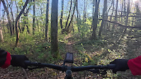
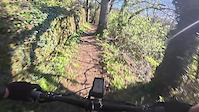
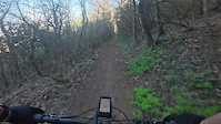
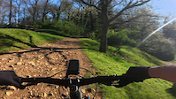
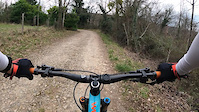
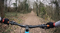
Photos of Lyon Mountain Bike
Videos of Lyon Mountain Bike
trail: La Secrète Enduro
2:50 |
8 |
Apr 6, 2026
trail: Sentier Des Alagneraies
2:15 |
8 |
Apr 6, 2026

trail: Route PifPaf
2:05 |
9 |
Apr 6, 2026
trail: Mont Py vers Moulin
2:05 |
5 |
Apr 6, 2026
trail: Enduro La Germinoise
7:27 |
8 |
Apr 6, 2026
trail: Cemetery Access
0:44 |
22 |
Feb 22, 2025

trail: Chute Saint Romain
0:26 |
40 |
Feb 22, 2025
trail: DH des Rapaces
0:24 |
54 |
Feb 22, 2025
Recent Trail Reports
| status | trail | date | condition | info | user |
|---|---|---|---|---|---|
| DH des sapins du Mont Verdun | Jun 7, 2026 @ 8:10am (Europe/Monaco) Jun 6, 2026 | Ideal | educhene69 | ||
| Chanelette Par Les Carrières | May 31, 2026 @ 2:40pm (Europe/Paris) May 31, 2026 | Ideal | ManuVTT | ||
| La Céleste | May 31, 2026 @ 11:48am (Europe/Paris) May 31, 2026 | Ideal | ManuVTT | ||
| Chemin De La Garenne | May 14, 2026 @ 12:06am (Europe/Paris) May 13, 2026 | Ideal | fabien-69-73 | ||
| Allée de Ceinture | May 5, 2026 @ 10:15am (America/Los_Angeles) May 5, 2026 | Ideal | fbalxdre | ||
| Allée du Lac | May 5, 2026 @ 10:15am (America/Los_Angeles) May 5, 2026 | Ideal | fbalxdre | ||
| Allée du Chemin de Fer | May 5, 2026 @ 10:15am (America/Vancouver) May 5, 2026 | Ideal | fbalxdre | ||
| Xyphos | Apr 26, 2026 @ 9:52pm (Europe/Paris) Apr 26, 2026 | Ideal | Aurel02 | ||
| DH des Combes | Apr 26, 2026 @ 9:51pm (Europe/Paris) Apr 26, 2026 | Unknown | Aurel02 | ||
| Le Petit Dévers | Apr 26, 2026 @ 7:48am (America/Los_Angeles) Apr 26, 2026 | Unknown | ManuVTT |
Activity Feed
| username | action | type | title | date |
|---|---|---|---|---|
| educhene69 | add | report | activity #96615819 | Jun 9, 2026 @ 10:36am Jun 9, 2026 |
| ManuVTT | add | report | activity #95919206 and 1 more | May 31, 2026 @ 2:48am May 31, 2026 |
| vkallmann | wishlist | region | activity #95794026 | May 29, 2026 @ 12:06pm May 29, 2026 |
| Bentoy69 | ridden | trail | activity #95500137 and 7 more | May 25, 2026 @ 10:11am May 25, 2026 |
| brucecyr | wishlist | region | activity #95173630 | May 21, 2026 @ 7:26am May 21, 2026 |
Recent Comments
| username | type | title | comment | date |
|---|---|---|---|---|
| report | Oui, j'ai vu ça aussi... J'apporterai ma... | Apr 24, 2026 @ 8:42am Apr 24, 2026 | ||
| trail | Sentier vraiment technique de part les virages... | Apr 6, 2026 @ 11:20am Apr 6, 2026 | ||
| trail | Après la petite montée, le chemin... | Apr 6, 2026 @ 11:18am Apr 6, 2026 | ||
| report | Trail is not really rideable half way through. | Mar 17, 2026 @ 1:24pm Mar 17, 2026 | ||
| trail | Sait-on pourquoi ? la commune souhaite... | Mar 7, 2026 @ 5:30am Mar 7, 2026 |
Local Badges
-

Epic Ride Climb 2k51 awarded -

Climbing 10k Badge63 awarded -

Climbing 100k Badge7 awarded -

Epic Ride Descent 2k51 awarded -

Descent 10k Badge60 awarded -

Descent 100k Badge7 awarded
Bike & Skill Parks
| name | type | city | rating |
|---|---|---|---|
| WeRide | skill park | Lyon |
Activity Type Stats
| activitytype | trails | distance | descent | descent distance | total vertical | rating | global rank | state rank | photos | reports | routes | ridelogs |
|---|---|---|---|---|---|---|---|---|---|---|---|---|
| Mountain Bike | 113 | 47 miles | 10,846 ft | 24 miles | 1,404 ft | #2,319 | #53 | 43 | 1,147 | 3 | 14,861 | |
| E-Bike | 93 | 41 miles | 7,267 ft | 19 miles | 1,404 ft | #1,909 | #108 | 3 | 410 | 3 | 1,267 | |
| Horse | 4 | 7 miles | 52 ft | 2 miles | 36 ft | #499 | #27 | 3 | ||||
| Hike | 96 | 41 miles | 6,900 ft | 19 miles | 1,404 ft | #3,247 | #80 | 155 | 298 | |||
| Trail Running | 97 | 41 miles | 6,900 ft | 19 miles | 1,404 ft | #2,197 | #63 | 155 | 1,579 | |||
| Dirtbike/Moto | 1 | 3,468 ft | 7 ft | 118 ft | 16 ft | #433 | #14 | 2 |
Frequently Asked Questions About Lyon
▼
What are the best places to ride in Lyon?
Lyon has 2 areas to explore for mountain biking. The top rated areas are:
▼
What are the highest rated mountain biking trails in Lyon?
The highest rated mountain biking trails in Lyon are:
- Spéciale Saint Fortunat (4.1/5)
- Xyphos (4.1/5)
- DH Les Gambins-Variante (4.1/5)
- Chanelette Par Les Carrières (4.1/5)
- DH des Rapaces (4.1/5)
▼
What is the best time of the year to ride in Lyon?
Based on ride log data, the most popular months to ride in Lyon are:
- September (116 activities)
- October (99 activities)
- August (96 activities)
▼
Where can I park to ride in Lyon?
Check the Lyon trail map for trailhead and parking information. Community members regularly update access and parking details for trails in the area.
Activities
Trails
- By funkdogg & contributors
- Admins: Whipperman
- #26306 - 10,570 views
- lyon activity log | embed map of Lyon mountain bike trails | lyon mountain biking points of interest
Downloading of trail gps tracks in kml & gpx formats is enabled for Lyon.
You must login to download files.