close
-
Layers w
- Weather Layers
- Pro
- Pro
- Pro
- Pro
- Pro
- Pro
- More Layers
- Pro
- Pro
- Pro
- Pro
-
Upgrade to

3D
Trail Conditions
- Unknown
- Snow Groomed
- Snow Packed
- Snow Covered
- Snow Cover Partial
- Freeze/thaw Cycle
- Icy
- Prevalent Mud
- Wet
- Variable
- Ideal
- Dry
- Very Dry
Trail Flow (Ridden Direction)
Trailforks scans users ridelogs to determine the most popular direction each trail is ridden. A good flowing trail network will have most trails flowing in a single direction according to their intension.
The colour categories are based on what percentage of riders are riding a trail in its intended direction.
The colour categories are based on what percentage of riders are riding a trail in its intended direction.
- > 96%
- > 90%
- > 80%
- > 70%
- > 50%
- < 50%
- bi-directional trail
- no data
Trail Last Ridden
Trailforks scans ridelogs to determine the last time a trail was ridden.
- < 2 days
- < 1 week
- < 2 weeks
- < 1 month
- < 6 months
- > 6 months
Trail Ridden Direction
The intended direction a trail should be ridden.
- Downhill Only
- Downhill Primary
- Both Directions
- Uphill Primary
- Uphill Only
- One Direction
Contribute Details
Colors indicate trail is missing specified detail.
- Description
- Photos
- Description & Photos
- Videos
Trail Popularity ?
Trailforks scans ridelogs to determine which trails are ridden the most in the last 9 months.
Trails are compared with nearby trails in the same city region with a possible 25 colour shades.
Think of this as a heatmap, more rides = more kinetic energy = warmer colors.
- most popular
- popular
- less popular
- not popular
ATV/ORV/OHV Filter
Max Vehicle Width
inches
US Cell Coverage
Legend

Radar Time
Activity Recordings
Trailforks uses anonymized public activity data.
?
Activity Recordings
Trailforks uses anonymized public activity data.
?
Personal Heatmap
▶
Activity Types
all
/
none
▶
Options
2
Date range
month
–
Winter Trails
Warning
A routing network for winter maps does not exist. Selecting trails using the winter trails layer has been disabled.
Missing Trails
Most Popular
Least Popular
Trails are colored based on popularity. The more popular a trail is, the more red. Less popular trails trend towards green.
Jump Magnitude Heatmap
Heatmap of where riders jump on trails. Zoom in to see individual jumps, click circles to view jump details.
BC Backroad Status
![map legend]()
Service Road Atlas is a free to use, community-driven service for viewing and creating reports on the numerous back-country service roads around B.C. and Alberta.

Slope Aspect
Direction the slope faces
Trails Deemphasized
Trails are shown in grey.
Only show trails with no bike usage.
Suggested Layers
Based on selected activity type
Save the current map location and zoom level as your default home location whenever this page is loaded.
Save
No description for Lyons has been added yet!
Login or register to submit one.
Activities Click to view
- Mountain Bike
18 trails
- E-Bike
0 trails
- Gravel Bike
0 trails
- Adaptive Bike
0 trails
- Hike
38 trails
- Trail Running
38 trails
Region Details
- 2
- 1
- 4
- 8
- 2
Region Status
Open as of 2 daysStats
- Avg Trail Rating
- Trails (view details)
- 38
- Trails Mountain Bike
- 19
- Trails Horse
- 3
- Trails Hike
- 38
- Trails Trail Running
- 38
- Total Distance
- 56 miles
- Total Descent
- 7,801 ft
- Total Vertical
- 1,674 ft
- Highest Trailhead
- 6,991 ft
- Reports
- 2,953
- Photos
- 287
- Ridden Counter
- 21,382
Articles
Boulder County Proposes Major Trail Restrictions for Mountain Bikers
May 11, 2026 from pinkbike.com
Access at Hall Ranch and Heil Valley is under fire. Learn how a "design problem" is being treated as a "user problem" and how you can take action.
Sub Regions
-
Hall Ranch
- 2
- 1
-
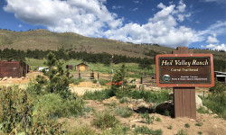
Heil Valley Ranch
- 3
- 3
-
Rabbit Mountain Open Space
- 1
- 2
- 1
Popular Lyons Mountain Biking Trails
• 100 ★ 4.2 • 1 mile • 448 ft • 2,425 •
Upper is a bi-directional trail used to access the at the top of Hall ranch. The climb up is smooth, sustained, and easy. The descent is very fast and fun, mostly smooth with only one or two rocky sections!
• 100 ★ 4.6 • 2 miles • 323 ft • 2,310 •
is when the fun descending of Hall Ranch begins! Climb all the way up to and prepare for a fast descent the entire way down! This trail is a bi-directional loop but is best when ridden in a clockwise direction. If it has rained or...
• 95 ★ 3.8 • 4,931 ft • 0 ft • 2,040 •
is a fun trail both climbing and descending. This trail is mostly used as an alternative to climbing or descending the very technical Lower trail and can be used to access the upper parts of Hall ranch. Expect fun twisty singletrack,...
• 90 ★ 4.5 • 2 miles • 61 ft • 1,911 •
Very deserving of its black diamond rating. Lower reminds me of desert riding in southern Utah, almost like a steeper version of UPS/LPS in Moab. Suffice it to say, there are many technical rock features, interspersed with brief patches...
• 85 ★ 3.9 • 5 miles • 990 ft • 1,433 •
is a critical link trail out of Lyons. It's insanely popular, but for a good reason. Want to ride out of town and do some miles and come back for a beer? This trail has your name on it! It's sort of a Jekyll and Hyde trail. The bottom...
• 80 ★ 3.5 • 2 miles • 526 ft • 1,333 •
Voted one of the best after-work trails in Boulder County (well, by just one dude who wrote this), and also one of the most filling-removing trails in Boulder County by everyone with a hardtail bike, is an action-packed,...
• 60 ★ 3.5 • 3 miles • 291 ft • 1,137 •
This trail is a really hoot! You can't go wrong adding this to your ride at Heil! So many people want to ride this clockwise (from the overlook past and then up to ), but they are missing out. Okay, to be clear going clockwise is fun....
• 40 ★ 4.0 • 3 miles • 269 ft • 696 •
Fast and flowy through the trees. The sits on top of a mesa and is accessible either from the south via Left Hand canyon and the trail or from the north via Lyons and the trail. The Boulder Mountainbike Alliance has done extensive rock...
Lyons Mountain Bike Routes
Hall Ranch Technical Side Featured
★ 5.0 • 10 miles • 1,594 ft • 6 • Out & Back •
Tackling Hall Ranch up aka "The Rock Garden" bumps this intermediate/advanced area into solid double...
Hall Ranch: Intermediate Fun Featured
★ 4.4 • 7 miles • 1,191 ft • 5 • Out & Back •
This is an great alternative if you're not up to the black diamond challenge. It's primarily uphill all...
Hall Ranch Technical Descent Featured
★ 3.8 • 12 miles • 1,670 ft • 5 • Loop •
By far the best way to ride Hall Ranch. This ride is best started by parking in the town of Lyons either...
Heil Ranch, frontside Featured
★ 3.0 • 8 miles • 1,028 ft • 4 • Out & Back •
A fun ride through the fastest and most technical parts of Heil Ranch. From the main parking lot climb the...
The Van Hagar - Best of Both Worlds! Featured
★ 5.0 • 12 miles • 1,402 ft • 6 • Loop •
Before the 2020 Calwood Fire, this was a favorite after-work route for the big kids. The post fire...
The Diamond Dave Featured
★ 2.0 • 10 miles • 1,246 ft • 5 • Loop •
This was a really popular route at Heil before the 2020 Calwood fire. It's great for putting on more miles...
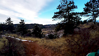
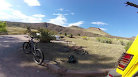
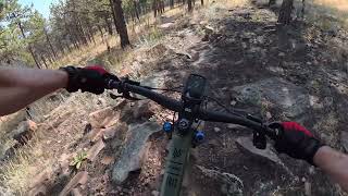
Photos of Lyons Mountain Bike
Videos of Lyons Mountain Bike
trail: Lower Bitterbrush
0:05 |
48 |
Jan 10, 2026
trail: Lower Bitterbrush
0:16 |
|
Nov 8, 2023
trail: Lower Bitterbrush
0:12 |
|
Nov 8, 2023
trail: Upper Bitterbrush
2:33 |
35 |
Dec 10, 2020
trail: Lower Bitterbrush
0:00 |
185 |
Jan 11, 2017
trail: Lower Bitterbrush
8:26 |
182 |
Oct 24, 2016
trail: Ponderosa Loop
14:18 |
36 |
Mar 14, 2026 , Lyons
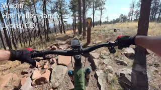
trail: Wapiti
10:54 |
22 |
Mar 8, 2026 , Lyons
Recent Trail Reports
| status | trail | date | condition | info | user |
|---|---|---|---|---|---|
| Bitterbrush Connector | Jun 10, 2026 @ 6:03pm (America/Denver) Jun 10, 2026 | Dry | tshralper | ||
| Lower Bitterbrush | Jun 10, 2026 @ 6:03pm (America/Denver) Jun 10, 2026 | Dry | tshralper | ||
| Nelson Loop | Jun 10, 2026 @ 6:03pm (America/Denver) Jun 10, 2026 | Dry | tshralper | ||
| Upper Bitterbrush | Jun 10, 2026 @ 6:03pm (America/Denver) Jun 10, 2026 | Dry | tshralper | ||
| Antelope | Jun 10, 2026 @ 6:03pm (America/Denver) Jun 10, 2026 | Dry | tshralper | ||
| Schoolhouse Loop | May 31, 2026 @ 11:33am (America/Denver) May 31, 2026 | Ideal | tshralper | ||
| Overland Loop | May 31, 2026 @ 11:33am (America/Denver) May 31, 2026 | Ideal | tshralper | ||
| Wapiti Road | May 31, 2026 @ 11:33am (America/Denver) May 31, 2026 | Ideal | tshralper | ||
| Heil Valley Ranch Road | May 31, 2026 @ 11:33am (America/Denver) May 31, 2026 | Ideal | tshralper | ||
| Overland Access (N) | May 31, 2026 @ 11:33am (America/Denver) May 31, 2026 | Ideal | tshralper |
Activity Feed
| username | action | type | title | date |
|---|---|---|---|---|
| russwilliams34 | add | report | activity #97159881 | Jun 16, 2026 @ 8:30pm 2 days |
| switxcraft | wishlist | region | activity #96957039 | Jun 14, 2026 @ 5:13am Jun 14, 2026 |
| BryanNSlzTP | wishlist | route | activity #96910661 | Jun 13, 2026 @ 1:19pm Jun 13, 2026 |
| dougherpt | wishlist | route | activity #96907746 | Jun 13, 2026 @ 12:48pm Jun 13, 2026 |
| tshralper | add | report | activity #96732146 and 4 more | Jun 11, 2026 @ 6:08am Jun 11, 2026 |
Recent Comments
| username | type | title | comment | date |
|---|---|---|---|---|
| trail | I ride this trail a couple of times a month. I... | Apr 3, 2026 @ 11:38am Apr 3, 2026 | ||
| trail | TRUE | Apr 3, 2026 @ 11:33am Apr 3, 2026 | ||
| report | Thanks, that's a biggun'! | Oct 21, 2025 @ 10:42am Oct 21, 2025 | ||
| trail | Nice trail but pretty crowded. As a beginner,... | Oct 5, 2025 @ 3:40am Oct 5, 2025 | ||
| trail | Awesome trail! A lot of work put into... | Sep 27, 2025 @ 8:23am Sep 27, 2025 |
Local Badges
-

Epic Ride Climb 2k113 awarded -

Climbing 10k Badge172 awarded -

Climbing 100k Badge2 awarded -

Epic Ride Descent 2k117 awarded -

Descent 10k Badge173 awarded -

Descent 100k Badge2 awarded
Bike & Skill Parks
| name | type | city | rating |
|---|---|---|---|
| Lyons Bike Park | skill park | Lyons |
Activity Type Stats
| activitytype | trails | distance | descent | descent distance | total vertical | rating | global rank | state rank | photos | reports | routes | ridelogs |
|---|---|---|---|---|---|---|---|---|---|---|---|---|
| Mountain Bike | 18 | 31 miles | 3,281 ft | 11 miles | 1,493 ft | #1,143 | #441 | 290 | 2,910 | 14 | 29,211 | |
| Horse | 3 | 5 miles | 322 ft | 1 mile | 1,047 ft | 746 | 6 | 2 | ||||
| Hike | 38 | 54 miles | 7,726 ft | 22 miles | 1,673 ft | 9 | 2,895 | 8 | 1,136 | |||
| Trail Running | 38 | 54 miles | 7,726 ft | 22 miles | 1,673 ft | #3,683 | #1,098 | 2,894 | 8 | 612 |
Frequently Asked Questions About Lyons
▼
What are the best places to ride in Lyons?
Lyons has 3 areas to explore for mountain biking. The top rated areas are:
▼
What are the highest rated mountain biking trails in Lyons?
The highest rated mountain biking trails in Lyons are:
- Nelson Loop (4.5/5)
- Lower Bitterbrush (4.4/5)
- Upper Bitterbrush (4.1/5)
- Schoolhouse Loop (4/5)
- Rabbit Mountain (4/5)
▼
What is the best time of the year to ride in Lyons?
Based on ride log data, the most popular months to ride in Lyons are:
- July (216 activities)
- August (168 activities)
- June (167 activities)
▼
Where can I park to ride in Lyons?
There are 7 parking locations listed in Lyons. The most popular parking spots are: View all parking and trailhead locations on the map to plan your visit.
Trails
Points of Interest
- By jdeg & contributors
- Admins: BMA, amrosen, getvert, mpopetz, Pumpntrail, andrewbikeboulder, Skyryk, Iowegian, 303JL
- #15522 - 10,449 views
- lyons activity log | embed map of Lyons mountain bike trails | lyons mountain biking points of interest
Downloading of trail gps tracks in kml & gpx formats is enabled for Lyons.
You must login to download files.