close
-
Layers w
- Weather Layers
- Pro
- Pro
- Pro
- Pro
- Pro
- Pro
- More Layers
- Pro
- Pro
- Pro
- Pro
-
Upgrade to

3D
Trail Conditions
- Unknown
- Snow Groomed
- Snow Packed
- Snow Covered
- Snow Cover Partial
- Freeze/thaw Cycle
- Icy
- Prevalent Mud
- Wet
- Variable
- Ideal
- Dry
- Very Dry
Trail Flow (Ridden Direction)
Trailforks scans users ridelogs to determine the most popular direction each trail is ridden. A good flowing trail network will have most trails flowing in a single direction according to their intension.
The colour categories are based on what percentage of riders are riding a trail in its intended direction.
The colour categories are based on what percentage of riders are riding a trail in its intended direction.
- > 96%
- > 90%
- > 80%
- > 70%
- > 50%
- < 50%
- bi-directional trail
- no data
Trail Last Ridden
Trailforks scans ridelogs to determine the last time a trail was ridden.
- < 2 days
- < 1 week
- < 2 weeks
- < 1 month
- < 6 months
- > 6 months
Trail Ridden Direction
The intended direction a trail should be ridden.
- Downhill Only
- Downhill Primary
- Both Directions
- Uphill Primary
- Uphill Only
- One Direction
Contribute Details
Colors indicate trail is missing specified detail.
- Description
- Photos
- Description & Photos
- Videos
Trail Popularity ?
Trailforks scans ridelogs to determine which trails are ridden the most in the last 9 months.
Trails are compared with nearby trails in the same city region with a possible 25 colour shades.
Think of this as a heatmap, more rides = more kinetic energy = warmer colors.
- most popular
- popular
- less popular
- not popular
ATV/ORV/OHV Filter
Max Vehicle Width
inches
US Cell Coverage
Legend

Radar Time
Activity Recordings
Trailforks uses anonymized public activity data.
?
Activity Recordings
Trailforks uses anonymized public activity data.
?
Personal Heatmap
▶
Activity Types
all
/
none
▶
Options
2
Date range
month
–
Winter Trails
Warning
A routing network for winter maps does not exist. Selecting trails using the winter trails layer has been disabled.
Missing Trails
Most Popular
Least Popular
Trails are colored based on popularity. The more popular a trail is, the more red. Less popular trails trend towards green.
Jump Magnitude Heatmap
Heatmap of where riders jump on trails. Zoom in to see individual jumps, click circles to view jump details.
BC Backroad Status
![map legend]()
Service Road Atlas is a free to use, community-driven service for viewing and creating reports on the numerous back-country service roads around B.C. and Alberta.

Slope Aspect
Direction the slope faces
Trails Deemphasized
Trails are shown in grey.
Only show trails with no bike usage.
Suggested Layers
Based on selected activity type
Save the current map location and zoom level as your default home location whenever this page is loaded.
Save
No description for Lysá Trails has been added yet!
Login or register to submit one.
Primary Trail Type: All-Mountain & Downhill
Activities Click to view
- Mountain Bike
7 trails
- E-Bike
0 trails
- Hike
7 trails
- Trail Running
5 trails
Region Details
- 1
- 1
- 3
- 2
Region Status
Caution as of Apr 25, 2026Stats
- Avg Trail Rating
- Trails (view details)
- 7
- Trails Mountain Bike
- 7
- Trails Hike
- 7
- Trails Trail Running
- 5
- Total Distance
- 12 miles
- Total Descent Distance
- 8 miles
- Total Descent
- 6,119 ft
- Total Vertical
- 1,559 ft
- Highest Trailhead
- 3,281 ft
- Reports
- 21
- Photos
- 7
- Ridden Counter
- 230
Popular Lysá Trails Mountain Biking Trails
• 90 ★ 5.0 • 1 mile • 19 ft • 49 •
Popular blue difficulty singletrack. This mountain bike primary trail can be used downhill only. It features a-frame, berm, bridge, drop, jump and gap jump. On average it takes 11 minutes to complete this trail.
• 100 ★ 5.0 • 2 miles • 45 ft • 42 •
Popular blue difficulty singletrack. This mountain bike primary trail can be used downhill only. On average it takes 6 minutes to complete this trail.
• 80 ★ 0.0 • 4,101 ft • 0 ft • 26 •
Popular black diamond difficulty singletrack. This mountain bike primary trail can be used downhill only. On average it takes 10 minutes to complete this trail.
• 60 ★ 5.0 • 3 miles • 118 ft • 11 •
Moderately popular blue difficulty singletrack. This mountain bike primary trail can be used downhill only and has a moderate overall physical rating with a 118 ft green climb. It features other. Trail visibility is always easy to follow. On average it takes 23 minutes to complete this trail.
• 5 ★ 0.0 • 2 miles • 80 ft • 2 •
Less popular green difficulty singletrack. This mountain bike primary trail can be used downhill primary. Trail visibility is always easy to follow.
• 5 ★ 0.0 • 3,747 ft • 0 ft • 2 •
Less popular black diamond difficulty singletrack. This mountain bike primary trail can be used downhill only. It features berm, drop, jump, gap jump and rock garden. On average it takes 13 minutes to complete this trail.
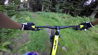
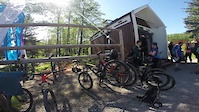
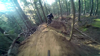
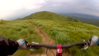
Videos of Lysá Trails Mountain Bike
trail: Enduro/DH Lysa Trails
2:13 |
55 |
Feb 3, 2024
trail: Besný Flow
0:41 |
83 |
Dec 14, 2021
trail: Enduro
0:08 |
521 |
Sep 13, 2018

trail: Enduro
0:06 |
139 |
Jul 24, 2018
trail: Enduro
5:04 |
106 |
Jul 2, 2018
trail: Enduro
4:04 |
185 |
May 3, 2018
trail: Enduro
0:56 |
815 |
Nov 27, 2016
trail: Enduro
3:36 |
105 |
Jul 17, 2016
Recent Trail Reports
| status | trail | date | condition | info | user |
|---|---|---|---|---|---|
| Besný Flow | Apr 25, 2026 @ 11:35pm (Europe/Bratislava) Apr 25, 2026 | Dry | VitaliiJB4gdU | ||
| Enduro/DH Lysa Trails | Jul 22, 2025 @ 12:09pm Jul 22, 2025 | Dry | JurajHipsky | ||
| Startrack AM | Jul 22, 2025 @ 12:09pm Jul 22, 2025 | Dry | JurajHipsky | ||
| Mayer Trail | Aug 27, 2023 @ 12:23am Aug 27, 2023 | Very Dry | cr0coDiL | ||
| Enduro | Jul 28, 2021 @ 2:13am Jul 28, 2021 | Dry | cr0coDiL | ||
| Trail Modrá | Jul 22, 2020 @ 6:42am Jul 22, 2020 | Ideal | sebasg3r |
Activity Feed
| username | action | type | title | date |
|---|---|---|---|---|
| VitaliiJB4gdU | add | report | activity #93392728 | Apr 25, 2026 @ 2:35pm Apr 25, 2026 |
| lacog | wishlist | trail | activity #81994904 and 3 more | Oct 9, 2025 @ 3:38am Oct 9, 2025 |
| JurajHipsky | add | report | activity #76511357 and 1 more | Jul 23, 2025 @ 12:47am Jul 23, 2025 |
| xidedix | wishlist | trail | activity #70360826 | Apr 25, 2025 @ 1:33pm Apr 25, 2025 |
| MariuszBukowiec | wishlist | region | activity #70169241 | Apr 22, 2025 @ 2:42pm Apr 22, 2025 |
Recent Comments
| username | type | title | comment | date |
|---|---|---|---|---|
| trail | Ešte sa to jazdí? | Aug 26, 2023 @ 6:25am Aug 26, 2023 | ||
| trail | super traily tam mate. len skoda ze lanovka... | Sep 13, 2021 @ 12:19am Sep 13, 2021 | ||
| report | We are glad to hear that... | Oct 25, 2020 @ 2:33pm Oct 25, 2020 |
Nearby Areas
| name | distance | ||||
|---|---|---|---|---|---|
| Prešovské singletracky | 1 | 7 | 2 | 1 | 13.1 km |
| Liečivé singletracky | 3 | 2 | 1 | 13.6 km | |
| Bardejovská Nová Ves | 1 | 2 | 13.8 km | ||
| Bajkobranie | 6 | 8 | 5 | 1 | 13.9 km |
| Bike park Janov | 1 | 15.2 km |
Activity Type Stats
| activitytype | trails | distance | descent | descent distance | total vertical | rating | global rank | state rank | photos | reports | routes | ridelogs |
|---|---|---|---|---|---|---|---|---|---|---|---|---|
| Mountain Bike | 7 | 12 miles | 6,119 ft | 8 miles | 1,558 ft | #6,104 | #67 | 7 | 21 | 177 | ||
| Hike | 7 | 12 miles | 6,119 ft | 8 miles | 1,558 ft | #4,415 | #53 | 21 | 65 | |||
| Trail Running | 5 | 7 miles | 3,786 ft | 4 miles | 1,558 ft | #3,877 | #55 | 19 | 10 |
Frequently Asked Questions About Lysá Trails
▼
What are the highest rated mountain biking trails in Lysá Trails?
The highest rated mountain biking trails in Lysá Trails are:
- Besný Flow (4.2/5)
- Startrack AM (4.1/5)
- Trail Modrá (4.1/5)
- Enduro/DH Lysa Trails (0/5)
- Trail Zelená (0/5)
▼
What is the best time of the year to ride in Lysá Trails?
Based on ride log data, the most popular months to ride in Lysá Trails are:
- June (1 activities)
- August (1 activities)
▼
Where can I park to ride in Lysá Trails?
Check the Lysá Trails trail map for trailhead and parking information. Community members regularly update access and parking details for trails in the area.
▼
What is the longest trail in Lysá Trails?
The longest trail in Lysá Trails is Trail Modrá at 2.7 miles. View all trails sorted by distance.
- By Tomasrpm & contributors
- Admins: apply
- #32534 - 4,041 views
- lysá trails activity log | embed map of Lysá Trails mountain bike trails |
Downloading of trail gps tracks in kml & gpx formats is enabled for Lysá Trails.
You must login to download files.