close
-
Layers w
- Weather Layers
- Pro
- Pro
- Pro
- Pro
- Pro
- Pro
- More Layers
- Pro
- Pro
- Pro
- Pro
-
Upgrade to

3D
Trail Conditions
- Unknown
- Snow Groomed
- Snow Packed
- Snow Covered
- Snow Cover Partial
- Freeze/thaw Cycle
- Icy
- Prevalent Mud
- Wet
- Variable
- Ideal
- Dry
- Very Dry
Trail Flow (Ridden Direction)
Trailforks scans users ridelogs to determine the most popular direction each trail is ridden. A good flowing trail network will have most trails flowing in a single direction according to their intension.
The colour categories are based on what percentage of riders are riding a trail in its intended direction.
The colour categories are based on what percentage of riders are riding a trail in its intended direction.
- > 96%
- > 90%
- > 80%
- > 70%
- > 50%
- < 50%
- bi-directional trail
- no data
Trail Last Ridden
Trailforks scans ridelogs to determine the last time a trail was ridden.
- < 2 days
- < 1 week
- < 2 weeks
- < 1 month
- < 6 months
- > 6 months
Trail Ridden Direction
The intended direction a trail should be ridden.
- Downhill Only
- Downhill Primary
- Both Directions
- Uphill Primary
- Uphill Only
- One Direction
Contribute Details
Colors indicate trail is missing specified detail.
- Description
- Photos
- Description & Photos
- Videos
Trail Popularity ?
Trailforks scans ridelogs to determine which trails are ridden the most in the last 9 months.
Trails are compared with nearby trails in the same city region with a possible 25 colour shades.
Think of this as a heatmap, more rides = more kinetic energy = warmer colors.
- most popular
- popular
- less popular
- not popular
ATV/ORV/OHV Filter
Max Vehicle Width
inches
US Cell Coverage
Legend

Radar Time
Activity Recordings
Trailforks uses anonymized public activity data.
?
Activity Recordings
Trailforks uses anonymized public activity data.
?
Personal Heatmap
▶
Activity Types
all
/
none
▶
Options
2
Date range
month
–
Winter Trails
Warning
A routing network for winter maps does not exist. Selecting trails using the winter trails layer has been disabled.
Missing Trails
Most Popular
Least Popular
Trails are colored based on popularity. The more popular a trail is, the more red. Less popular trails trend towards green.
Jump Magnitude Heatmap
Heatmap of where riders jump on trails. Zoom in to see individual jumps, click circles to view jump details.
BC Backroad Status
![map legend]()
Service Road Atlas is a free to use, community-driven service for viewing and creating reports on the numerous back-country service roads around B.C. and Alberta.

Slope Aspect
Direction the slope faces
Trails Deemphasized
Trails are shown in grey.
Only show trails with no bike usage.
Suggested Layers
Based on selected activity type
Save the current map location and zoom level as your default home location whenever this page is loaded.
SaveThis region is Unsanctioned, Ride at your own Risk!
No description for Mělník has been added yet! Login or register to submit one.This region uses the Uk/Euro style trail grading system.
Activities Click to view
- Mountain Bike
71 trails
- E-Bike
2 trails
- Gravel Bike
0 trails
- Adaptive Bike
0 trails
- Winter Fat Bike
0 trails
- Hike
69 trails
- Trail Running
69 trails
Region Details
- 3
- 6
- 28
- 26
Region Status
Open as of May 25, 2026Stats
- Avg Trail Rating
- Trails (view details)
- 68
- Trails Mountain Bike
- 71
- Trails E-Bike
- 2
- Trails Hike
- 69
- Trails Trail Running
- 69
- Total Distance
- 102 miles
- Total Descent
- 17,915 ft
- Total Vertical
- 1,075 ft
- Highest Trailhead
- 1,592 ft
- Reports
- 227
- Photos
- 59
- Ridden Counter
- 2,638
Sub Regions
-
Kokostezky
- 6
- 28
- 26
Popular Mělník Mountain Biking Trails
• 100 ★ 4.0 • 2 miles • 652 ft • 154 •
Popular green difficulty singletrack. This mountain bike primary trail can be used both directions and has a moderate overall physical rating. Trail visibility is sometimes hard to follow. On average it takes 28 minutes to complete this trail.
• 100 ★ 2.5 • 1,771 ft • 112 ft • 135 •
Popular green difficulty singletrack. This mountain bike primary trail can be used both directions with a 112 ft blue climb. On average it takes 5 minutes to complete this trail.
• 90 ★ 4.0 • 2 miles • 593 ft • 99 •
Více informací na www.kokostezky.cz. Stezky nejsou značeny. PROSÍM NEZAPOMÍNEJTE, ŽE NA CESTÁCH NEJSTE SAMI A BUĎTE K OSTATNÍM OHLEDUPLNÍ
• 5 ★ 4.4 • 4,826 ft • 100 ft • 92 •
Less popular green difficulty singletrack. This mountain bike primary trail. On average it takes 14 minutes to complete this trail.
• 95 ★ 4.0 • 1,257 ft • 41 ft • 71 •
Popular blue difficulty singletrack. This mountain bike primary trail can be used one direction. Trail visibility is always easy to follow. On average it takes 5 minutes to complete this trail.
Photos of Mělník Mountain Bike
Videos of Mělník Mountain Bike
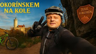
trail: Around the Castle
33:01 |
45 |
Dec 21, 2025 , Mělník

trail: Milča
19:46 |
33 |
Oct 24, 2025 , Mělník

trail: Drnclík
19:43 |
28 |
Oct 5, 2025 , Mělník

trail: Drnclík
19:43 |
25 |
Oct 5, 2025 , Mělník
trail: Pod Bořejovem
8:20 |
87 |
Sep 14, 2025 , Mělník

trail: Kokořín
22:13 |
45 |
Sep 14, 2025 , Mělník
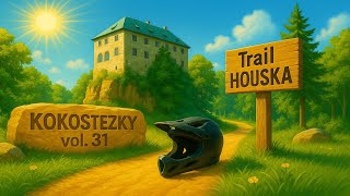
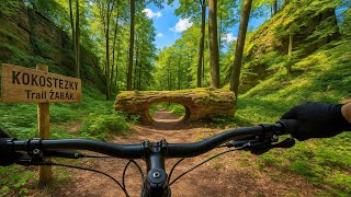
trail: Z Housky
6:39 |
50 |
May 29, 2025 , Mělník
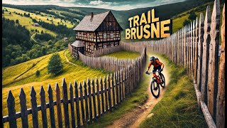
trail: Přes Brusné
7:56 |
65 |
Apr 7, 2025 , Mělník
Recent Trail Reports
| status | trail | date | condition | info | user |
|---|---|---|---|---|---|
| Kominík | Mar 16, 2026 @ 11:17am (Europe/Prague) Mar 16, 2026 | Variable | radosta | ||
| Milča | Mar 16, 2026 @ 11:17am (Europe/Prague) Mar 16, 2026 | Variable | radosta | ||
| Around the Castle | Mar 16, 2026 @ 11:17am (Europe/Prague) Mar 16, 2026 | Variable | radosta | ||
| Kokořín | Mar 16, 2026 @ 11:17am (Europe/Prague) Mar 16, 2026 | Variable | radosta | ||
| Harakoko 2 | Mar 16, 2026 @ 11:17am (Europe/Prague) Mar 16, 2026 | Variable | radosta | ||
| Blaženka | Mar 16, 2026 @ 11:17am (Europe/Prague) Mar 16, 2026 | Variable | radosta | ||
| Klučno | Feb 28, 2026 @ 6:33pm (Europe/Prague) Feb 28, 2026 | Unknown | raino | ||
| Přes Víno | Aug 17, 2025 @ 3:24pm Aug 17, 2025 | Dry | aeldryn | ||
| Přes Brusné | Aug 17, 2025 @ 3:24pm Aug 17, 2025 | Dry | aeldryn | ||
| Drnclík | Aug 17, 2025 @ 3:24pm Aug 17, 2025 | Dry | aeldryn |
Activity Feed
| username | action | type | title | date |
|---|---|---|---|---|
| MatiSzklarska | wishlist | trail | activity #95426317 | May 24, 2026 @ 10:50am May 24, 2026 |
| Denis7 | wishlist | region | activity #94746791 | May 15, 2026 @ 6:33am May 15, 2026 |
| Daniel4WZyB9 | wishlist | trail | activity #93670728 | Apr 29, 2026 @ 2:00pm Apr 29, 2026 |
| SXFYXn | wishlist | trail | activity #92657703 | Apr 15, 2026 @ 7:07am Apr 15, 2026 |
| Kevin5UCwo4 | wishlist | region | activity #91725148 | Apr 1, 2026 @ 1:22pm Apr 1, 2026 |
Recent Comments
| username | type | title | comment | date |
|---|---|---|---|---|
| trail | Stezka je sjízdná oběma směry – jak od... | Dec 21, 2025 @ 12:09pm Dec 21, 2025 | ||
| trail | Tento trail je v podstatě zaniklej. Jinak... | Jul 21, 2025 @ 12:29am Jul 21, 2025 | ||
| trail | Trail jsme pod listím a popadaných stromech... | May 24, 2025 @ 7:21am May 24, 2025 | ||
| trail | Stejný charakter jako trail Kokořín,... | Mar 24, 2025 @ 5:34am Mar 24, 2025 | ||
| trail | Hodnotil bych spise jako zelenou teda. Pokud... | Sep 7, 2024 @ 9:36am Sep 7, 2024 |
Local Badges
-

Epic Ride Climb 2k44 awarded -

Climbing 10k Badge14 awarded -

Climbing 100k Badge1 awarded -

Epic Ride Descent 2k48 awarded -

Descent 10k Badge14 awarded -

Descent 100k Badge1 awarded
Activity Type Stats
| activitytype | trails | distance | descent | descent distance | total vertical | rating | global rank | state rank | photos | reports | routes | ridelogs |
|---|---|---|---|---|---|---|---|---|---|---|---|---|
| Mountain Bike | 71 | 102 miles | 17,913 ft | 55 miles | 1,076 ft | #1,702 | #11 | 59 | 226 | 3,012 | ||
| E-Bike | 2 | 2 miles | 161 ft | 4,944 ft | 154 ft | #2,814 | #28 | 184 | 73 | |||
| Hike | 69 | 100 miles | 17,421 ft | 53 miles | 1,076 ft | #1,712 | #9 | 228 | 369 | |||
| Trail Running | 69 | 100 miles | 17,421 ft | 53 miles | 1,076 ft | #1,281 | #9 | 228 | 34 |
Frequently Asked Questions About Mělník
▼
What are the best places to ride in Mělník?
Mělník has 1 areas to explore for mountain biking. The top rated areas are:
▼
What are the highest rated mountain biking trails in Mělník?
The highest rated mountain biking trails in Mělník are:
- Z Housky (4.1/5)
- Liběchovka (4.1/5)
- Černá díra (4.1/5)
- Kokořín (4.1/5)
- Milča (4.1/5)
▼
What is the best time of the year to ride in Mělník?
Based on ride log data, the most popular months to ride in Mělník are:
- July (13 activities)
- August (13 activities)
- October (9 activities)
▼
Where can I park to ride in Mělník?
There are 5 parking locations listed in Mělník. The most popular parking spots are: View all parking and trailhead locations on the map to plan your visit.
Trails
- By Glogi & contributors
- Admins: ČeMBA, ČeMBA, ČeMBA, ČeMBA, ČeMBA, ČeMBA, ČeMBA, ČeMBA, ČeMBA, ČeMBA
- #17240 - 3,014 views
- mělník activity log | embed map of Mělník mountain bike trails | mělník mountain biking points of interest
Downloading of trail gps tracks in kml & gpx formats is enabled for Mělník.
You must login to download files.