close
-
Layers w
- Weather Layers
- Pro
- Pro
- Pro
- Pro
- Pro
- Pro
- More Layers
- Pro
- Pro
- Pro
- Pro
-
Upgrade to

3D
Trail Conditions
- Unknown
- Snow Groomed
- Snow Packed
- Snow Covered
- Snow Cover Partial
- Freeze/thaw Cycle
- Icy
- Prevalent Mud
- Wet
- Variable
- Ideal
- Dry
- Very Dry
Trail Flow (Ridden Direction)
Trailforks scans users ridelogs to determine the most popular direction each trail is ridden. A good flowing trail network will have most trails flowing in a single direction according to their intension.
The colour categories are based on what percentage of riders are riding a trail in its intended direction.
The colour categories are based on what percentage of riders are riding a trail in its intended direction.
- > 96%
- > 90%
- > 80%
- > 70%
- > 50%
- < 50%
- bi-directional trail
- no data
Trail Last Ridden
Trailforks scans ridelogs to determine the last time a trail was ridden.
- < 2 days
- < 1 week
- < 2 weeks
- < 1 month
- < 6 months
- > 6 months
Trail Ridden Direction
The intended direction a trail should be ridden.
- Downhill Only
- Downhill Primary
- Both Directions
- Uphill Primary
- Uphill Only
- One Direction
Contribute Details
Colors indicate trail is missing specified detail.
- Description
- Photos
- Description & Photos
- Videos
Trail Popularity ?
Trailforks scans ridelogs to determine which trails are ridden the most in the last 9 months.
Trails are compared with nearby trails in the same city region with a possible 25 colour shades.
Think of this as a heatmap, more rides = more kinetic energy = warmer colors.
- most popular
- popular
- less popular
- not popular
ATV/ORV/OHV Filter
Max Vehicle Width
inches
US Cell Coverage
Legend

Radar Time
Activity Recordings
Trailforks uses anonymized public activity data.
?
Activity Recordings
Trailforks uses anonymized public activity data.
?
Personal Heatmap
▶
Activity Types
all
/
none
▶
Options
2
Date range
month
–
Winter Trails
Warning
A routing network for winter maps does not exist. Selecting trails using the winter trails layer has been disabled.
Missing Trails
Most Popular
Least Popular
Trails are colored based on popularity. The more popular a trail is, the more red. Less popular trails trend towards green.
Jump Magnitude Heatmap
Heatmap of where riders jump on trails. Zoom in to see individual jumps, click circles to view jump details.
BC Backroad Status
![map legend]()
Service Road Atlas is a free to use, community-driven service for viewing and creating reports on the numerous back-country service roads around B.C. and Alberta.

Slope Aspect
Direction the slope faces
Trails Deemphasized
Trails are shown in grey.
Only show trails with no bike usage.
Suggested Layers
Based on selected activity type
Save the current map location and zoom level as your default home location whenever this page is loaded.
Save
No description for Maastricht has been added yet!
Login or register to submit one.
This region uses the Uk/Euro style trail grading system.
Activities Click to view
- Mountain Bike
10 trails
- E-Bike
1 trails
- Gravel Bike
0 trails
- Hike
10 trails
- Trail Running
10 trails
Stats
- Avg Trail Rating
- Trails (view details)
- 9
- Trails Mountain Bike
- 10
- Trails E-Bike
- 1
- Trails Hike
- 10
- Trails Trail Running
- 10
- Total Distance
- 5 miles
- Total Descent
- 1,612 ft
- Total Vertical
- 350 ft
- Highest Trailhead
- 558 ft
- Reports
- 51
- Photos
- 17
- Ridden Counter
- 680
Popular Maastricht Mountain Biking Trails
• 100 ★ 5.0 • 3 miles • 492 ft • 214 •
Excellent All-Mountain trail with a couple steep climbs, and a nice gravel road to the top if you want an easy climb. A man-made and well maintained single track the entire way, with some great views. There are bypasses for almost every...
• 80 ★ 5.0 • 1,467 ft • 16 ft • 92 •
A wide trail with many tight switchbacks.
• 70 ★ 0.0 • 588 ft • 0 ft • 52 •
Popular blue difficulty singletrack. This mountain bike primary trail can be used both directions. On average it takes 2 minutes to complete this trail.
• 90 ★ 4.7 • 1,112 ft • 0 ft • 46 •
Very nice enduro trail with a few very steep sections. In the bottom it rejoins the main mtb trail.
• 35 ★ 0.0 • 885 ft • 17 ft • 17 •
Less popular blue difficulty singletrack. This mountain bike primary trail can be used downhill primary. On average it takes 2 minutes to complete this trail.
Maastricht Mountain Bike Routes
17 miles • 685 ft • 0 • Loop •
The Maastricht route is a route for beginners. This is a fast and fairly flat route.
17 miles • 685 ft • 0 •
The Maastricht route is a route for beginners. It is a fast flat route.
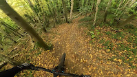
Photos of Maastricht Mountain Bike
Videos of Maastricht Mountain Bike
trail: Covid
2:29 |
53 |
Nov 2, 2025
youtuber
![MTB Challenge // Sint-Pietersberg]()

trail: Rondje D'n Observant
6:36 |
219 |
Jan 2, 2024 , Maastricht

trail: Rondje D'n Observant
9:32 |
247 |
Jun 15, 2023 , Maastricht

trail: Rondje D'n Observant
2:55 |
757 |
Aug 13, 2019 , Maastricht
Recent Trail Reports
| status | trail | date | condition | info | user |
|---|---|---|---|---|---|
| Covid | Apr 18, 2026 @ 10:01am (Europe/Amsterdam) Apr 18, 2026 | Variable | olafjeffsy | ||
| Rondje D'n Observant | Apr 18, 2026 @ 10:01am (Europe/Amsterdam) Apr 18, 2026 | Ideal | olafjeffsy | ||
| ENCI Switchbacks | Apr 26, 2023 @ 7:07pm Apr 26, 2023 | Variable | jeroenslee | ||
| Neercanne | Mar 26, 2021 @ 2:30am Mar 26, 2021 | Ideal | schafb |
Activity Feed
| username | action | type | title | date |
|---|---|---|---|---|
| rakker | difficultyvote | trail | activity #96171748 | Jun 3, 2026 @ 11:55am Jun 3, 2026 |
| AlexDownhill92 | wishlist | region | activity #96162286 | Jun 3, 2026 @ 9:44am Jun 3, 2026 |
| olafjeffsy | add | report | activity #92860017 and 1 more | Apr 18, 2026 @ 7:39am Apr 18, 2026 |
| vacarme | ridden | trail | activity #85641847 | Dec 17, 2025 @ 12:12am Dec 17, 2025 |
| vacarme | wishlist | trail | activity #84596935 | Nov 23, 2025 @ 6:50am Nov 23, 2025 |
Recent Comments
| username | type | title | comment | date |
|---|---|---|---|---|
| trail | C’est la Covid 😉, Corona c’est... | Mar 27, 2025 @ 12:06am Mar 27, 2025 | ||
| trail | The name of the trail is "Corona". :) | Jul 5, 2024 @ 3:12pm Jul 5, 2024 | ||
| report | This was cleared within a few days. We ride... | Sep 1, 2023 @ 10:33am Sep 1, 2023 | ||
| trail | Dikke boom over pas bij afdaling | Aug 5, 2023 @ 3:48am Aug 5, 2023 | ||
| trail | Great trail to test your climbing and downhill... | Sep 23, 2021 @ 7:27am Sep 23, 2021 |
Activity Type Stats
| activitytype | trails | distance | descent | descent distance | total vertical | rating | global rank | state rank | photos | reports | routes | ridelogs |
|---|---|---|---|---|---|---|---|---|---|---|---|---|
| Mountain Bike | 10 | 5 miles | 1,611 ft | 2 miles | 351 ft | #2,093 | #11 | 17 | 51 | 2 | 6,512 | |
| E-Bike | 1 | 3 miles | 476 ft | 1 mile | 351 ft | #1,880 | #17 | 44 | 240 | |||
| Hike | 10 | 5 miles | 1,611 ft | 2 miles | 351 ft | #2,834 | #26 | 51 | 115 | |||
| Trail Running | 10 | 5 miles | 1,611 ft | 2 miles | 351 ft | #2,297 | #25 | 51 | 285 |
Frequently Asked Questions About Maastricht
▼
What are the highest rated mountain biking trails in Maastricht?
The highest rated mountain biking trails in Maastricht are:
- Rondje D'n Observant (4.3/5)
- Covid (4.2/5)
- ENCI Switchbacks (4.1/5)
- Neercanne (0/5)
- Feij Groeve (0/5)
▼
What is the best time of the year to ride in Maastricht?
Based on ride log data, the most popular months to ride in Maastricht are:
- August (9 activities)
- June (7 activities)
- March (7 activities)
▼
Where can I park to ride in Maastricht?
Check the Maastricht trail map for trailhead and parking information. Community members regularly update access and parking details for trails in the area.
▼
What is the longest trail in Maastricht?
The longest trail in Maastricht is Rondje D'n Observant at 4.9 km. View all trails sorted by distance.
- By brenthillier
 NSMBA TRAILFORKS & contributors
 - Admins: apply
- #10812 - 6,770 views
- maastricht activity log | embed map of Maastricht mountain bike trails |
Downloading of trail gps tracks in kml & gpx formats is enabled for Maastricht.
You must login to download files.