close
-
Layers w
- Weather Layers
- Pro
- Pro
- Pro
- Pro
- Pro
- Pro
- More Layers
- Pro
- Pro
- Pro
- Pro
-
Upgrade to

3D
Trail Conditions
- Unknown
- Snow Groomed
- Snow Packed
- Snow Covered
- Snow Cover Partial
- Freeze/thaw Cycle
- Icy
- Prevalent Mud
- Wet
- Variable
- Ideal
- Dry
- Very Dry
Trail Flow (Ridden Direction)
Trailforks scans users ridelogs to determine the most popular direction each trail is ridden. A good flowing trail network will have most trails flowing in a single direction according to their intension.
The colour categories are based on what percentage of riders are riding a trail in its intended direction.
The colour categories are based on what percentage of riders are riding a trail in its intended direction.
- > 96%
- > 90%
- > 80%
- > 70%
- > 50%
- < 50%
- bi-directional trail
- no data
Trail Last Ridden
Trailforks scans ridelogs to determine the last time a trail was ridden.
- < 2 days
- < 1 week
- < 2 weeks
- < 1 month
- < 6 months
- > 6 months
Trail Ridden Direction
The intended direction a trail should be ridden.
- Downhill Only
- Downhill Primary
- Both Directions
- Uphill Primary
- Uphill Only
- One Direction
Contribute Details
Colors indicate trail is missing specified detail.
- Description
- Photos
- Description & Photos
- Videos
Trail Popularity ?
Trailforks scans ridelogs to determine which trails are ridden the most in the last 9 months.
Trails are compared with nearby trails in the same city region with a possible 25 colour shades.
Think of this as a heatmap, more rides = more kinetic energy = warmer colors.
- most popular
- popular
- less popular
- not popular
ATV/ORV/OHV Filter
Max Vehicle Width
inches
US Cell Coverage
Legend

Radar Time
Activity Recordings
Trailforks uses anonymized public activity data.
?
Activity Recordings
Trailforks uses anonymized public activity data.
?
Personal Heatmap
▶
Activity Types
all
/
none
▶
Options
2
Date range
month
–
Winter Trails
Warning
A routing network for winter maps does not exist. Selecting trails using the winter trails layer has been disabled.
Missing Trails
Most Popular
Least Popular
Trails are colored based on popularity. The more popular a trail is, the more red. Less popular trails trend towards green.
Jump Magnitude Heatmap
Heatmap of where riders jump on trails. Zoom in to see individual jumps, click circles to view jump details.
BC Backroad Status
![map legend]()
Service Road Atlas is a free to use, community-driven service for viewing and creating reports on the numerous back-country service roads around B.C. and Alberta.

Slope Aspect
Direction the slope faces
Trails Deemphasized
Trails are shown in grey.
Only show trails with no bike usage.
Suggested Layers
Based on selected activity type
Save the current map location and zoom level as your default home location whenever this page is loaded.
SaveMabie forest is strikingly beautiful and has something for everyone - including a skills area, Mini X track and variety of trails including the graded 7stanes Mountain Bike Trails (GREEN, BLUE, RED, ORANGE Mini X jump line).
A skills area with different-graded sections of trail gives a taste of Mabie riding for those new to the area. It also includes a fantastic 300m free-ride/Mini X line with plenty of sections for you to practise your jumping technique.
https://forestryandland.gov.scot/visit/mabie#bike
https://forestryandland.gov.scot/images/pdf/rec_pdfs/7stanes_Mabie_trail_map__info.pdf
source: 7stanes Mountain Biking
Primary Trail Type: Cross-Country
eBikes Allowed:
Yes
Land Status: National Forest
Land Manager: Forestry & Land Scotland
 google parking directions
Links
This region uses the Uk/Euro style trail grading system.
Activities Click to view
- Mountain Bike
44 trails
- E-Bike
44 trails
- Hike
17 trails
- Trail Running
17 trails
Region Details
- 10
- 2
- 2
- 16
- 14
Region Status
Caution as of 1 dayStats
- Avg Trail Rating
- Trails (view details)
- 44
- Trails Mountain Bike
- 44
- Trails E-Bike
- 44
- Trails Horse
- 3
- Trails Hike
- 17
- Trails Trail Running
- 17
- Total Distance
- 37 miles
- Total Descent
- 8,013 ft
- Total Vertical
- 1,881 ft
- Highest Trailhead
- 2,013 ft
- Reports
- 1,081
- Photos
- 424
- Ridden Counter
- 13,756
Popular Mabie Forest Mountain Biking Trails
• 100 ★ 3.0 • 2,671 ft • 79 ft • 731 •
The official 7stanes Mountain Bike Trails - All trails Outbound linking the at Post 7 to the fork junction at Post 12. The RED trail climbs up the crag to riders left (keep left and avoid the walking trail) before splitting to riders...
• 90 ★ 4.8 • 2,871 ft • 21 ft • 722 •
Linking the Tower End at Post 34 to the below at Post 35 the second section of Descender Bender (part of the official 7stanes RED graded Mountain Bike Trail) comprises of berms and whoops.
• 90 ★ 4.5 • 2,221 ft • 7 ft • 719 •
Stans Pond forms part of the official RED graded 7stanes Mountain Bike Trail. From Post 35 at the crossing the single-track trail descends down to the Burn Splash. The trail goes from graded and smooth (relatively speaking) to more...
• 95 ★ 4.5 • 1 mile • 213 ft • 713 •
The forms part of the official 7stanes RED graded Mountain Bike Trail. Leaving the at Post 23 a single-track climbs slightly then traverses the hill, this section is known locally as The Hand Cut, at Post 25 there is a BLACK option line...
• 95 ★ 4.4 • 1,404 ft • 0 ft • 711 •
Descender Bender forms part of the official RED graded 7stanes Mountain Bike Trail, smooth single-track trail with the odd rocky outcrop flows downhill to the Tower End Road at Post 24.
• 100 ★ 3.5 • 5,089 ft • 74 ft • 703 •
This comprises of two sections, first the climb then the descent. Descent links into "The Bad Step" which is a stand alone Technical Trail Feature (TTF) in the trail. Fast hard-pack single track with bed rock outcrops and a short...
• 95 ★ 3.4 • 2,789 ft • 153 ft • 673 •
Popular red difficulty singletrack. This mountain bike primary trail can be used uphill only. On average it takes 5 minutes to complete this trail.
Mabie Forest Mountain Bike Routes
13 miles • 1,375 ft • 0 •
• 6 miles • 830 ft • 4 •
• 16 miles • 2,219 ft • 16 •
• 9 miles • 1,406 ft • 9 •
• 10 miles • 1,383 ft • 11 •
• 11 miles • 1,805 ft • 15 •
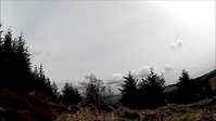
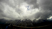
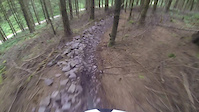
Photos of Mabie Forest Mountain Bike
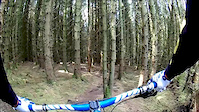
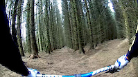
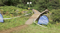
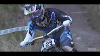
Videos of Mabie Forest Mountain Bike
trail: White route
2:39 |
293 |
Apr 29, 2018
trail: Kids Trail
2:39 |
372 |
Apr 29, 2018
trail: Afternoon Trail
4:26 |
361 |
Apr 29, 2018
trail: The Ridge
3:49 |
220 |
Jul 18, 2014
trail: The Race Track
2:00 |
340 |
Jul 7, 2014
trail: The Elevator
0:17 |
8599 |
Aug 11, 2013
trail: The Race Track
7:19 |
12432 |
May 13, 2013

trail: The Race Track
2:04 |
1968 |
Mar 18, 2013
Recent Trail Reports
| status | trail | date | condition | info | user |
|---|---|---|---|---|---|
| Deer Fence | Jun 10, 2026 @ 2:08pm (Europe/London) Jun 10, 2026 | Variable | ftigu30 MTC | ||
| Mabies Sweet | Apr 21, 2026 @ 12:36pm (Europe/London) Apr 21, 2026 | Unknown | marccr0wley FLS | ||
| Afternoon Trail | Apr 21, 2026 @ 12:36pm (Europe/London) Apr 21, 2026 | Unknown | marccr0wley FLS | ||
| NewZealand | Apr 8, 2026 @ 8:57am (Europe/London) Apr 8, 2026 | Unknown | THEATB ATB | ||
| Out at the Barrier/Tea Break | Apr 8, 2026 @ 8:57am (Europe/London) Apr 8, 2026 | Unknown | THEATB ATB | ||
| Kids Trail | Apr 8, 2026 @ 8:57am (Europe/London) Apr 8, 2026 | Unknown | THEATB ATB | ||
| White route | Jan 3, 2026 @ 7:54pm (Europe/London) Jan 3, 2026 | Unknown | Scotty_dog | ||
| The Ridge | Dec 24, 2025 @ 6:37pm (Europe/London) Dec 24, 2025 | Unknown | seamanstanes | ||
| Rattle 'N' Hum | Dec 24, 2025 @ 6:37pm (Europe/London) Dec 24, 2025 | Unknown | seamanstanes | ||
| Slap Yer Nan | Dec 24, 2025 @ 6:37pm (Europe/London) Dec 24, 2025 | Unknown | seamanstanes |
Activity Feed
| username | action | type | title | date |
|---|---|---|---|---|
| ftigu30 | add | report | activity #96667738 | Jun 10, 2026 @ 6:08am Jun 10, 2026 |
| backyardsender | add | video | activity #95499159 | May 25, 2026 @ 10:00am May 25, 2026 |
| marccr0wley | add | polygon | activity #94692313 | May 14, 2026 @ 8:35am May 14, 2026 |
| LukasSchmid | add | photo | activity #94204986 and 2 more | May 7, 2026 @ 2:25am May 7, 2026 |
| andrewQ7ZD5H | ridden | trail | activity #93971994 | May 3, 2026 @ 12:21pm May 3, 2026 |
Recent Comments
| username | type | title | comment | date |
|---|---|---|---|---|
| report | Yep, open and excellent | Aug 4, 2025 @ 2:16am Aug 4, 2025 | ||
| report | Is it open or not? You've marked it as closed | Jul 1, 2025 @ 1:05pm Jul 1, 2025 | ||
| trail | Don't follow this, go for threehope peak and... | May 20, 2025 @ 10:41am May 20, 2025 | ||
| trail | Fast and all clear. Gid fun. | Mar 19, 2025 @ 2:51am Mar 19, 2025 | ||
| trail | Nice thin fast singletrack decent riding prime... | Mar 19, 2025 @ 2:50am Mar 19, 2025 |
Nearby Areas
| name | distance | ||||
|---|---|---|---|---|---|
| Shambellie | 2 | 3.1 km | |||
| White Hill Wood | 1 | 4 km | |||
| Dalbeattie Forest | 1 | 9 | 9.6 km | ||
| Mark Hill | 3 | 4 | 11.5 km | ||
| Forest of Ae | 3 | 8 | 13.4 km |
Local Badges
-

Completionist0 awarded
Bike & Skill Parks
| name | type | city | rating |
|---|---|---|---|
| Mabie Skills Park | skill park | Dumfries |
Activity Type Stats
| activitytype | trails | distance | descent | descent distance | total vertical | rating | global rank | state rank | photos | reports | routes | ridelogs |
|---|---|---|---|---|---|---|---|---|---|---|---|---|
| Mountain Bike | 44 | 37 miles | 8,012 ft | 19 miles | 1,880 ft | #1,534 | #55 | 424 | 1,081 | 1 | 4,173 | |
| E-Bike | 44 | 37 miles | 8,012 ft | 19 miles | 1,880 ft | #2,191 | #78 | 1,010 | 671 | |||
| Horse | 3 | 5 miles | 1,506 ft | 3 miles | 1,680 ft | 481 | ||||||
| Hike | 17 | 24 miles | 3,661 ft | 11 miles | 1,880 ft | #5,256 | #98 | 879 | 17 | |||
| Trail Running | 17 | 24 miles | 3,661 ft | 11 miles | 1,880 ft | #4,423 | #91 | 879 | 68 |
Frequently Asked Questions About Mabie Forest
▼
What are the highest rated mountain biking trails in Mabie Forest?
The highest rated mountain biking trails in Mabie Forest are:
- Lower Descender Bender (4.5/5)
- Contour Climb (4.2/5)
- Stan's Pond (4.2/5)
- Upper Descender Bender (4.2/5)
- Woodhead Hill Climb (4.1/5)
▼
What is the best time of the year to ride in Mabie Forest?
Based on ride log data, the most popular months to ride in Mabie Forest are:
- December (21 activities)
- July (18 activities)
- June (18 activities)
▼
Where can I park to ride in Mabie Forest?
There are 1 parking locations listed in Mabie Forest. The most popular parking spots are:
▼
What is the longest trail in Mabie Forest?
The longest trail in Mabie Forest is Dempster Road at 7.0 km. View all trails sorted by distance.
Activities
Trails
Points of Interest
- By brenthillier
 NSMBA TRAILFORKS & contributors
 - Admins: ATB, GHBC, mtbskills
- #6477 - 21,155 views
- mabie forest activity log | embed map of Mabie Forest mountain bike trails | mabie forest mountain biking points of interest polygons
Downloading of trail gps tracks in kml & gpx formats is enabled for Mabie Forest.
You must login to download files.