close
-
Layers w
- Weather Layers
- Pro
- Pro
- Pro
- Pro
- Pro
- Pro
- More Layers
- Pro
- Pro
- Pro
- Pro
-
Upgrade to

3D
Trail Conditions
- Unknown
- Snow Groomed
- Snow Packed
- Snow Covered
- Snow Cover Partial
- Freeze/thaw Cycle
- Icy
- Prevalent Mud
- Wet
- Variable
- Ideal
- Dry
- Very Dry
Trail Flow (Ridden Direction)
Trailforks scans users ridelogs to determine the most popular direction each trail is ridden. A good flowing trail network will have most trails flowing in a single direction according to their intension.
The colour categories are based on what percentage of riders are riding a trail in its intended direction.
The colour categories are based on what percentage of riders are riding a trail in its intended direction.
- > 96%
- > 90%
- > 80%
- > 70%
- > 50%
- < 50%
- bi-directional trail
- no data
Trail Last Ridden
Trailforks scans ridelogs to determine the last time a trail was ridden.
- < 2 days
- < 1 week
- < 2 weeks
- < 1 month
- < 6 months
- > 6 months
Trail Ridden Direction
The intended direction a trail should be ridden.
- Downhill Only
- Downhill Primary
- Both Directions
- Uphill Primary
- Uphill Only
- One Direction
Contribute Details
Colors indicate trail is missing specified detail.
- Description
- Photos
- Description & Photos
- Videos
Trail Popularity ?
Trailforks scans ridelogs to determine which trails are ridden the most in the last 9 months.
Trails are compared with nearby trails in the same city region with a possible 25 colour shades.
Think of this as a heatmap, more rides = more kinetic energy = warmer colors.
- most popular
- popular
- less popular
- not popular
ATV/ORV/OHV Filter
Max Vehicle Width
inches
US Cell Coverage
Legend

Radar Time
Activity Recordings
Trailforks uses anonymized public activity data.
?
Activity Recordings
Trailforks uses anonymized public activity data.
?
Personal Heatmap
▶
Activity Types
all
/
none
▶
Options
2
Date range
month
–
Winter Trails
Warning
A routing network for winter maps does not exist. Selecting trails using the winter trails layer has been disabled.
Missing Trails
Most Popular
Least Popular
Trails are colored based on popularity. The more popular a trail is, the more red. Less popular trails trend towards green.
Jump Magnitude Heatmap
Heatmap of where riders jump on trails. Zoom in to see individual jumps, click circles to view jump details.
BC Backroad Status
![map legend]()
Service Road Atlas is a free to use, community-driven service for viewing and creating reports on the numerous back-country service roads around B.C. and Alberta.

Slope Aspect
Direction the slope faces
Trails Deemphasized
Trails are shown in grey.
Only show trails with no bike usage.
Suggested Layers
Based on selected activity type
Save the current map location and zoom level as your default home location whenever this page is loaded.
Save
No description for Macclesfield has been added yet!
Login or register to submit one.
This region uses the Uk/Euro style trail grading system.
Activities Click to view
- Mountain Bike
14 trails
- E-Bike
12 trails
- Horse
10 trails
- Hike
10 trails
- Trail Running
9 trails
Region Details
- 4
- 2
- 6
- 2
Region Status
Open as of Apr 8, 2026Stats
- Avg Trail Rating
- Trails (view details)
- 14
- Trails Mountain Bike
- 14
- Trails E-Bike
- 12
- Trails Horse
- 10
- Trails Hike
- 10
- Trails Trail Running
- 9
- Trails Observed Trials
- 2
- Trails ATV/ORV/OHV
- 1
- Total Distance
- 12 miles
- Total Descent Distance
- 7 miles
- Total Descent
- 3,211 ft
- Total Vertical
- 868 ft
- Highest Trailhead
- 1,752 ft
- Reports
- 74
- Photos
- 5
- Ridden Counter
- 2,900
Sub Regions
-
Goyt Valley
- 1
- 1
- 1
-
Kerridge
-
Macclesfield Forest
- 1
- 5
Popular Macclesfield Mountain Biking Trails
• 65 ★ 5.0 • 1,417 ft • 0 ft • 219 •
Moderately popular red difficulty doubletrack. This multi-use trail can be used downhill primary and has a hard overall physical rating with a 0 ft black diamond climb. It features drop and rock garden. Trail visibility is always easy to follow. On average it takes 1 minutes to complete this trail.
• 85 ★ 4.5 • 2,260 ft • 0 ft • 219 •
Popular red difficulty singletrack. This mountain bike primary trail can be used downhill primary and has a hard overall physical rating. It features berm, drop, jump and rock garden. Trail visibility is sometimes hard to follow. On average it takes 7 minutes to complete this trail.
• 45 ★ 4.0 • 1 mile • 3 ft • 201 •
Moderately popular red difficulty mixed. This multi-use trail can be used both directions and has a hard overall physical rating with a 3 ft black diamond climb. It features drop and rock garden. Trail visibility is always easy to follow. On average it takes 11 minutes to complete this trail.
• 50 ★ 4.4 • 1 mile • 58 ft • 200 •
Danebower Hollow is a bridleway that traverses the Whetstone Ridge and links the A537 to the A54
• 70 ★ 0.0 • 1 mile • 236 ft • 144 •
Popular green difficulty family friendly dirt/gravel road. This multi-use trail can be used both directions and has a easy overall physical rating with a 236 ft green climb. Trail visibility is always easy to follow. On average it takes 14 minutes to complete this trail.
• 75 ★ 4.0 • 2,546 ft • 0 ft • 94 •
Popular red difficulty singletrack. This mountain bike primary trail can be used downhill only and has a moderate overall physical rating. Trail visibility is always easy to follow. On average it takes 3 minutes to complete this trail.
• 40 ★ 0.0 • 1,585 ft • 251 ft • 60 •
Rocky at the top, majority of path cobble stone, quite steep.
• 15 ★ 0.0 • 2,257 ft • 0 ft • 17 •
Old Broken Road, No longer used for Cars, Ruts, Large Rocks, Quite Steep, Rough Terrain, Some Small Drops
Videos of Macclesfield Mountain Bike
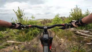
trail: Stump Fu$$er
0:45 |
475 |
Mar 12, 2023 , Macclesfield
Recent Trail Reports
| status | trail | date | condition | info | user |
|---|---|---|---|---|---|
| Oven Lane | Jul 20, 2025 @ 12:57pm Jul 20, 2025 | Wet | Spoonmeister | ||
| Cumberland Clough | Jul 20, 2025 @ 12:57pm Jul 20, 2025 | Wet | Spoonmeister | ||
| Charity Lane | May 2, 2025 @ 2:42pm May 2, 2025 | Very Dry | SF1212 | ||
| Hoo Moor (Bridleway) | Apr 1, 2025 @ 2:11pm Apr 1, 2025 | Dry | samanthabeans | ||
| Roach End DH | Dec 30, 2024 @ 10:23am Dec 30, 2024 | Variable | AndyRoss | ||
| Stump Fu$$er | Aug 31, 2024 @ 10:39am Aug 31, 2024 | Dry | KaixkWDX | ||
| Forest Bridleway | Jul 19, 2024 @ 11:06pm Jul 19, 2024 | Dry | SteveMc60 | ||
| Macc Forest DH Main Line | Jun 16, 2024 @ 6:54am Jun 16, 2024 | Prevalent Mud | meeseek | ||
| Danebower Hollow (Bridleway) | Jan 27, 2024 @ 2:06am Jan 27, 2024 | Variable | Gary026 | ||
| Forest Bridleway | Sep 3, 2023 @ 2:26am Sep 3, 2023 | Ideal | SimonHardwick2020 |
Activity Feed
| username | action | type | title | date |
|---|---|---|---|---|
| AlTeVw | ridden | trail | activity #94443129 | May 10, 2026 @ 10:59am May 10, 2026 |
| VDVoNc | wishlist | trail | activity #91477567 | Mar 28, 2026 @ 3:41pm Mar 28, 2026 |
| PaulpyCKea | wishlist | region | activity #83935456 | Nov 10, 2025 @ 3:30pm Nov 10, 2025 |
| mdjmcr | ridden | trail | activity #80652548 | Sep 19, 2025 @ 4:05am Sep 19, 2025 |
| 6ffDY5 | wishlist | region | activity #79477053 | Sep 2, 2025 @ 3:46am Sep 2, 2025 |
Local Badges
-

Epic Mountain Bike Climb 2k58 awarded -

Climbing 10k Badge42 awarded -

Mountain Biking 100k Badge3 awarded -

Epic Ride Descent 2k58 awarded -

Descent 10k Badge42 awarded -

Descent 100k Badge3 awarded
Bike & Skill Parks
| name | type | city | rating |
|---|---|---|---|
| Windmill Street Pumptrack | skill park | Macclesfield |
Activity Type Stats
| activitytype | trails | distance | descent | descent distance | total vertical | rating | global rank | state rank | photos | reports | routes | ridelogs |
|---|---|---|---|---|---|---|---|---|---|---|---|---|
| Mountain Bike | 14 | 12 miles | 3,212 ft | 7 miles | 869 ft | #7,124 | #256 | 4 | 74 | 8,568 | ||
| E-Bike | 12 | 11 miles | 2,569 ft | 6 miles | 860 ft | #4,385 | #173 | 1 | 73 | 1,065 | ||
| Horse | 10 | 9 miles | 1,965 ft | 5 miles | 860 ft | #1,526 | #81 | 10 | ||||
| Hike | 10 | 10 miles | 2,254 ft | 6 miles | 860 ft | #7,802 | #229 | 73 | 991 | |||
| Trail Running | 9 | 9 miles | 1,965 ft | 5 miles | 860 ft | #7,576 | #225 | 71 | 185 | |||
| Observed Trials | 2 | 2 miles | 223 ft | 1 mile | 837 ft | 2 | 2 | |||||
| ATV/ORV/OHV | 1 | 2,257 ft | 285 ft | 1,736 ft | 289 ft |
Frequently Asked Questions About Macclesfield
▼
What are the best places to ride in Macclesfield?
Macclesfield has 3 areas to explore for mountain biking. The top rated areas are:
▼
What are the highest rated mountain biking trails in Macclesfield?
The highest rated mountain biking trails in Macclesfield are:
- Oven Lane (4.1/5)
- Macc Forest DH Main Line (4.1/5)
- Danebower Hollow (Bridleway) (4.1/5)
- Cumberland Clough (4/5)
- Stump Fu$$er (4/5)
▼
What is the best time of the year to ride in Macclesfield?
Based on ride log data, the most popular months to ride in Macclesfield are:
- November (15 activities)
- May (14 activities)
- July (12 activities)
▼
Where can I park to ride in Macclesfield?
Activities
Trails
Points of Interest
- By Healeyman & contributors
- Admins: wisey, MathieuC, cemoorelife
- #27818 - 4,620 views
- macclesfield activity log | embed map of Macclesfield mountain bike trails | macclesfield mountain biking points of interest
Downloading of trail gps tracks in kml & gpx formats is enabled for Macclesfield.
You must login to download files.