close
-
Layers w
- Weather Layers
- Pro
- Pro
- Pro
- Pro
- Pro
- Pro
- More Layers
- Pro
- Pro
- Pro
- Pro
-
Upgrade to

3D
Trail Conditions
- Unknown
- Snow Groomed
- Snow Packed
- Snow Covered
- Snow Cover Partial
- Freeze/thaw Cycle
- Icy
- Prevalent Mud
- Wet
- Variable
- Ideal
- Dry
- Very Dry
Trail Flow (Ridden Direction)
Trailforks scans users ridelogs to determine the most popular direction each trail is ridden. A good flowing trail network will have most trails flowing in a single direction according to their intension.
The colour categories are based on what percentage of riders are riding a trail in its intended direction.
The colour categories are based on what percentage of riders are riding a trail in its intended direction.
- > 96%
- > 90%
- > 80%
- > 70%
- > 50%
- < 50%
- bi-directional trail
- no data
Trail Last Ridden
Trailforks scans ridelogs to determine the last time a trail was ridden.
- < 2 days
- < 1 week
- < 2 weeks
- < 1 month
- < 6 months
- > 6 months
Trail Ridden Direction
The intended direction a trail should be ridden.
- Downhill Only
- Downhill Primary
- Both Directions
- Uphill Primary
- Uphill Only
- One Direction
Contribute Details
Colors indicate trail is missing specified detail.
- Description
- Photos
- Description & Photos
- Videos
Trail Popularity ?
Trailforks scans ridelogs to determine which trails are ridden the most in the last 9 months.
Trails are compared with nearby trails in the same city region with a possible 25 colour shades.
Think of this as a heatmap, more rides = more kinetic energy = warmer colors.
- most popular
- popular
- less popular
- not popular
ATV/ORV/OHV Filter
Max Vehicle Width
inches
US Cell Coverage
Legend

Radar Time
Activity Recordings
Trailforks uses anonymized public activity data.
?
Activity Recordings
Trailforks uses anonymized public activity data.
?
Personal Heatmap
▶
Activity Types
all
/
none
▶
Options
2
Date range
month
–
Winter Trails
Warning
A routing network for winter maps does not exist. Selecting trails using the winter trails layer has been disabled.
Missing Trails
Most Popular
Least Popular
Trails are colored based on popularity. The more popular a trail is, the more red. Less popular trails trend towards green.
Jump Magnitude Heatmap
Heatmap of where riders jump on trails. Zoom in to see individual jumps, click circles to view jump details.
BC Backroad Status
![map legend]()
Service Road Atlas is a free to use, community-driven service for viewing and creating reports on the numerous back-country service roads around B.C. and Alberta.

Slope Aspect
Direction the slope faces
Trails Deemphasized
Trails are shown in grey.
Only show trails with no bike usage.
Suggested Layers
Based on selected activity type
Save the current map location and zoom level as your default home location whenever this page is loaded.
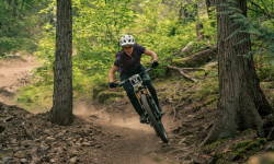
SaveThe Mackenzie area is home to approximately 14 kilometres of trails and the new paragliding launch. Recent trail building has seen the completion of the Happy-Nimby Loop and adds an extension to the newly opened Nimby Trail. Great trails for the advanced to expert mountain bikers
Primary Trail Type: All-Mountain & Downhill
eBikes Allowed:
Yes
 google parking directions
 Access Info:
This area is accessed via thedeactivated Cell Tower Road or from Happy Trail.
Activities Click to view
- Mountain Bike
57 trails
- E-Bike
57 trails
- Horse
6 trails
- Hike
51 trails
- Trail Running
51 trails
- Dirtbike/Moto
6 trails
- Observed Trials
6 trails
- ATV/ORV/OHV
6 trails
- Snowshoe
6 trails
Region Details
- 9
- 4
- 17
- 15
- 9
- 2
Region Status
Caution as of Jun 14, 2026Stats
- Avg Trail Rating
- Trails (view details)
- 56
- Trails Mountain Bike
- 57
- Trails E-Bike
- 57
- Trails Horse
- 6
- Trails Hike
- 51
- Trails Trail Running
- 51
- Trails Dirtbike/Moto
- 6
- Trails Observed Trials
- 6
- Trails ATV/ORV/OHV
- 6
- Trails Snowshoe
- 6
- Total Distance
- 49 miles
- Total Descent
- 24,829 ft
- Total Vertical
- 4,002 ft
- Highest Trailhead
- 4,680 ft
- Reports
- 2,698
- Photos
- 827
- Ridden Counter
- 61,189
Articles
Details Announced for 2026 Spud Crusher Women’s Enduro
Feb 10, 2026 from pinkbike.com
The Spud Crusher Women’s Enduro will be returning to the trails on May 9th, 2026.
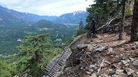
Popular Mackenzie Mountain Biking Trails
• 100 ★ 4.5 • 4,793 ft • 473 ft • 3,043 •
The best climbing trail you will ever ride. Drains well so easy to ride in the wet or after rain without causing trail damage. Reworked this past fall (2017) to make it easier for all to ride, much smoother now.
• 95 ★ 4.2 • 3 miles • 1,048 ft • 2,960 •
Great, challenging, but fair climb with lots of switchbacks. This is an amazing hand built climbing trail that needs to be ridden if you are riding in Pemberton. So much better than ridding an FSR
• 90 ★ 4.3 • 1 mile • 60 ft • 2,550 •
A Pemberton classic and must-ride. It is a relatively steep descent with a couple uphill punches. There are rocky bits and loose steep chutes with a go-around detour. All-mountain bikes are plenty capable for this trail. Also the views...
• 100 ★ 4.0 • 4,012 ft • 226 ft • 2,463 •
Long upper portion of WACo after the switch back. An older double track that rides more like a single track now. Easier and less direct than climb to get to after riding
• 100 ★ 3.9 • 1,703 ft • 85 ft • 2,357 •
Mellow climb from the top of to the gaining access to the trails
• 80 ★ 4.1 • 2 miles • 31 ft • 2,130 •
Trail was built in memory of Pemberton resident Rudy Rozsypalek, a Glider Pilot killed in a mid air collision. It is a true blue trail off the climb, just past a view point which traverses the slope and ends on the above .
• 80 ★ 4.2 • 3 miles • 1,295 ft • 1,990 •
A well built, bench cut, single track climbing trail that accesses , Gravatron, Gravatrout, and Extra Tron to and Skelula7.
Mackenzie Mountain Bike Routes
3 miles • 983 ft • 1 •
This week’s Fiver heads to the Mackenzie zone for the fall fiver return. Course: From to Sign In Time:...
★ 3.7 • 14 miles • 3,632 ft • 15 • Point to Point •
Trail for James Merinuk and friends - introduction to Mackenzie riding.
★ 3.0 • 26 miles • 6,148 ft • 14 • Loop •
A classic adventure loop. Great views on the climb and several lakes to swim in during your lunch stop....
★ 2.0 • 8 miles • 2,263 ft • 20 • Loop •
This is one of our favorite routes in the Pemberton Valley and is featured in Freehub Magazine's Sea to...
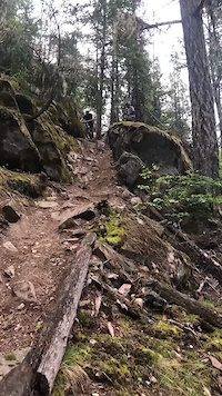
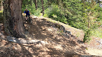
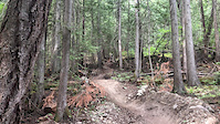
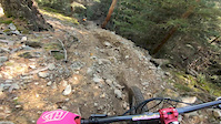
Photos of Mackenzie Mountain Bike
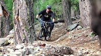
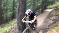
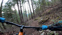
Videos of Mackenzie Mountain Bike
trail: Jack the Ripper
0:07 |
766 |
Jun 22, 2021
trail: Live Like Lisa
0:12 |
292 |
May 22, 2021
trail: Cop Killer
0:19 |
268 |
Oct 8, 2020
trail: Cop Killer - Lower
0:02 |
58 |
Jun 30, 2020
trail: Back Pains
0:13 |
177 |
Apr 9, 2020
trail: Back Pains
0:07 |
71 |
Apr 9, 2020
trail: Hawaii 3
2:28 |
184 |
Mar 4, 2020
trail: Cop Killer - Lower
0:16 |
265 |
Nov 3, 2019
Recent Trail Reports
| status | trail | date | condition | info | user |
|---|---|---|---|---|---|
| Rudy's | Jun 14, 2026 @ 9:35pm (America/Vancouver) Jun 14, 2026 | Dry | Hydralix | ||
| Overnight Sensation | Jun 14, 2026 @ 9:34pm (America/Vancouver) Jun 14, 2026 | Very Dry | Hydralix | ||
| Psychopath | Jun 14, 2026 @ 9:34pm (America/Vancouver) Jun 14, 2026 | Very Dry | Hydralix | ||
| Back Pains | Jun 11, 2026 @ 5:52pm (America/Vancouver) Jun 11, 2026 | Dry | trailrunnerx | ||
| Nimby | Jun 11, 2026 @ 5:52pm (America/Vancouver) Jun 11, 2026 | Dry | trailrunnerx | ||
| Live Like Lisa | Jun 6, 2026 @ 10:34am (America/Vancouver) Jun 6, 2026 | Dry | noelpullen | ||
| Bathtub Trail | May 27, 2026 @ 11:03am (America/Vancouver) May 27, 2026 | Ideal | wadeinbc | ||
| Mackenzie Basin Access Road | May 27, 2026 @ 11:03am (America/Vancouver) May 27, 2026 | Ideal | wadeinbc | ||
| Connector | May 27, 2026 @ 11:03am (America/Vancouver) May 27, 2026 | Ideal | wadeinbc | ||
| Waco Connector | May 27, 2026 @ 11:03am (America/Vancouver) May 27, 2026 | Ideal | wadeinbc |
Activity Feed
| username | action | type | title | date |
|---|---|---|---|---|
| perkisam | wishlist | trail | activity #97251752 and 1 more | Jun 18, 2026 @ 7:47am 16 hours |
| inthesky | ridden | trail | activity #97128306 | Jun 16, 2026 @ 11:51am 2 days |
| nursekimj | wishlist | trail | activity #97113593 and 1 more | Jun 16, 2026 @ 8:45am 3 days |
| bs420 | ridden | trail | activity #97072257 | Jun 15, 2026 @ 4:20pm Jun 15, 2026 |
| Hydralix | add | report | activity #97022477 and 2 more | Jun 14, 2026 @ 9:34pm Jun 14, 2026 |
Recent Comments
| username | type | title | comment | date |
|---|---|---|---|---|
| trail | L | May 24, 2026 @ 10:54am May 24, 2026 | ||
| report | And | May 23, 2026 @ 11:32am May 23, 2026 | ||
| report | Cleared thanks! | Feb 1, 2026 @ 8:14pm Feb 1, 2026 | ||
| report | Gone, thank you! | Jan 31, 2026 @ 1:14pm Jan 31, 2026 | ||
| report | Gone thank you! | Jan 31, 2026 @ 1:14pm Jan 31, 2026 |
Nearby Areas
| name | distance | ||||
|---|---|---|---|---|---|
| Mosquito Lake | 9 | 39 | 17 | 7 | 1.5 km |
| Valley | 3 | 1.8 km | |||
| Upper Pemberton and Signal Hill | 6 | 2 | 2.4 km | ||
| One Mile Lake | 11 | 11 | 9 | 2 | 3.1 km |
| South Rutherford | 2 | 2 | 2 | 3 | 7.6 km |
Local Badges
-

Completionist0 awarded
Local Products
Activity Type Stats
| activitytype | trails | distance | descent | descent distance | total vertical | rating | global rank | state rank | photos | reports | routes | ridelogs |
|---|---|---|---|---|---|---|---|---|---|---|---|---|
| Mountain Bike | 57 | 49 miles | 24,829 ft | 27 miles | 4,003 ft | #200 | #28 | 794 | 2,695 | 10 | 30,744 | |
| E-Bike | 57 | 49 miles | 24,829 ft | 27 miles | 4,003 ft | #1,949 | #67 | 10 | 2,380 | 1,549 | ||
| Horse | 6 | 12 miles | 387 ft | 2 miles | 3,425 ft | #951 | #27 | 9 | 734 | 3 | ||
| Hike | 51 | 45 miles | 19,462 ft | 23 miles | 4,003 ft | #1,706 | #90 | 11 | 2,658 | 2 | 463 | |
| Trail Running | 51 | 45 miles | 19,462 ft | 23 miles | 4,003 ft | #2,628 | #84 | 2,658 | 2 | 1,325 | ||
| Dirtbike/Moto | 6 | 12 miles | 387 ft | 2 miles | 3,425 ft | #474 | #50 | 874 | 29 | |||
| Observed Trials | 6 | 12 miles | 387 ft | 2 miles | 3,425 ft | #56 | #18 | 152 | 7 | |||
| ATV/ORV/OHV | 6 | 12 miles | 387 ft | 2 miles | 3,425 ft | #310 | #24 | 874 | 9 | |||
| Snowshoe | 6 | 6 miles | 184 ft | 1 mile | 131 ft | #894 | #80 | 127 | 1 |
Frequently Asked Questions About Mackenzie
▼
What are the highest rated mountain biking trails in Mackenzie?
The highest rated mountain biking trails in Mackenzie are:
- Max Pains (4.6/5)
- Cop Killer (4.6/5)
- Hawaii 3 (4.5/5)
- Back Pains (4.4/5)
- Lower Mackenzie Cruise (4.4/5)
▼
What is the best time of the year to ride in Mackenzie?
Based on ride log data, the most popular months to ride in Mackenzie are:
- April (484 activities)
- May (448 activities)
- July (406 activities)
▼
Where can I park to ride in Mackenzie?
There are 1 parking locations listed in Mackenzie. The most popular parking spots are:
▼
What is the longest trail in Mackenzie?
The longest trail in Mackenzie is Jack the Ripper at 6.1 km. View all trails sorted by distance.
Activities
Trails
- By canadaka
 Trailforks & contributors
 - Admins: PORCA, PVTA, sjf405, PORCA, PVTA, HowlerContractingLimited, Pembree, 99, snowdan
- #850 - 25,229 views
- mackenzie activity log | embed map of Mackenzie mountain bike trails | mackenzie mountain biking points of interest polygons
Downloading of trail gps tracks in kml & gpx formats is enabled for Mackenzie.
You must login to download files.