close
-
Layers w
- Weather Layers
- Pro
- Pro
- Pro
- Pro
- Pro
- Pro
- More Layers
- Pro
- Pro
- Pro
- Pro
-
Upgrade to

3D
Trail Conditions
- Unknown
- Snow Groomed
- Snow Packed
- Snow Covered
- Snow Cover Partial
- Freeze/thaw Cycle
- Icy
- Prevalent Mud
- Wet
- Variable
- Ideal
- Dry
- Very Dry
Trail Flow (Ridden Direction)
Trailforks scans users ridelogs to determine the most popular direction each trail is ridden. A good flowing trail network will have most trails flowing in a single direction according to their intension.
The colour categories are based on what percentage of riders are riding a trail in its intended direction.
The colour categories are based on what percentage of riders are riding a trail in its intended direction.
- > 96%
- > 90%
- > 80%
- > 70%
- > 50%
- < 50%
- bi-directional trail
- no data
Trail Last Ridden
Trailforks scans ridelogs to determine the last time a trail was ridden.
- < 2 days
- < 1 week
- < 2 weeks
- < 1 month
- < 6 months
- > 6 months
Trail Ridden Direction
The intended direction a trail should be ridden.
- Downhill Only
- Downhill Primary
- Both Directions
- Uphill Primary
- Uphill Only
- One Direction
Contribute Details
Colors indicate trail is missing specified detail.
- Description
- Photos
- Description & Photos
- Videos
Trail Popularity ?
Trailforks scans ridelogs to determine which trails are ridden the most in the last 9 months.
Trails are compared with nearby trails in the same city region with a possible 25 colour shades.
Think of this as a heatmap, more rides = more kinetic energy = warmer colors.
- most popular
- popular
- less popular
- not popular
ATV/ORV/OHV Filter
Max Vehicle Width
inches
US Cell Coverage
Legend

Radar Time
Activity Recordings
Trailforks uses anonymized public activity data.
?
Activity Recordings
Trailforks uses anonymized public activity data.
?
Personal Heatmap
▶
Activity Types
all
/
none
▶
Options
2
Date range
month
–
Winter Trails
Warning
A routing network for winter maps does not exist. Selecting trails using the winter trails layer has been disabled.
Missing Trails
Most Popular
Least Popular
Trails are colored based on popularity. The more popular a trail is, the more red. Less popular trails trend towards green.
Jump Magnitude Heatmap
Heatmap of where riders jump on trails. Zoom in to see individual jumps, click circles to view jump details.
BC Backroad Status
![map legend]()
Service Road Atlas is a free to use, community-driven service for viewing and creating reports on the numerous back-country service roads around B.C. and Alberta.

Slope Aspect
Direction the slope faces
Trails Deemphasized
Trails are shown in grey.
Only show trails with no bike usage.
Suggested Layers
Based on selected activity type
Save the current map location and zoom level as your default home location whenever this page is loaded.
SaveMadrid es un municipio y una ciudad de España. La localidad, con categoría histórica de villa, es la capital de España y de la Comunidad de Madrid. También conocida como la Villa y Corte, es la más poblada del estado, con 3.207.247 de habitantes en el año 2013, mientras que, con la inclusión de su área metropolitana la cifra de población asciende a 6.543.031 habitantes, siendo por ello la tercera o cuarta área metropolitana, según la fuente, por detrás de las de París y Londres, y en algunas fuentes detrás también de la Región del Ruhr, y la tercera ciudad más poblada de la Unión Europea, por detrás de Berlín y Londres.
Primary Trail Type: All-Mountain & Downhill
Access Info:
El Pardo, Somontes, El Faro
This region uses the Uk/Euro style trail grading system.
Activities Click to view
- Mountain Bike
774 trails
- E-Bike
723 trails
- Gravel Bike
121 trails
- Adaptive Bike
1 trails
- Horse
297 trails
- Hike
751 trails
- Trail Running
752 trails
Region Details
- 406
- 2
- 211
- 131
- 21
- 1
Region Status
Open as of Jun 19, 2026Stats
- Avg Trail Rating
- Trails (view details)
- 773
- Trails Mountain Bike
- 774
- Trails E-Bike
- 723
- Trails Gravel Bike
- 121
- Trails Adaptive Bike
- 1
- Trails Horse
- 297
- Trails Hike
- 751
- Trails Trail Running
- 752
- Total Distance
- 784 miles
- Total Descent
- 45,185 ft
- Total Vertical
- 1,465 ft
- Highest Trailhead
- 3,082 ft
- Reports
- 2,861
- Photos
- 328
- Ridden Counter
- 53,450
Sub Regions
-
Casa de Campo
- 30
- 57
- 14
- 2
-
Cerro Almodóvar
- 15
- 6
-
El Pardo
- 35
- 66
- 13
-
Parque Pinar de La Piovera
- 2
- 18
- 3
- 2
-
Parque Regional del Sureste
- 29
- 22
- 5
- 1
-
Valdelatas
- 40
- 10
Popular Madrid Mountain Biking Trails
• 100 ★ 4.5 • 1 mile • 63 ft • 466 •
Popular white difficulty paved path. This multi-use trail can be used both directions and has a easy overall physical rating with a 63 ft green climb. Trail visibility is always easy to follow. On average it takes 3 minutes to complete this trail.
• 100 ★ 4.9 • 1,752 ft • 0 ft • 384 •
Una de las bajadas más famosas de la zona. Apta para principiantes y divertida para todos. La bajada transcurre totalmente por un surco o trinchera, con curvas muy fluidas y algún saltito artificial (rampas de unos 20 cm) Tiene mucho...
• 100 ★ 4.6 • 2,598 ft • 0 ft • 382 •
Highly rated popular blue difficulty singletrack. This multi-use trail can be used downhill primary and has a easy overall physical rating. It features drop and jump. Trail visibility is always easy to follow. On average it takes 2 minutes to complete this trail.
• 100 ★ 3.0 • 1 mile • 218 ft • 368 •
Hay tramos con senderos en paralelo a la carretera por si se quiere evitar el asfalto.
• 100 ★ 5.0 • 3,645 ft • 52 ft • 361 •
Popular white difficulty paved path. This multi-use trail can be used both directions and has a easy overall physical rating with a 52 ft green climb. Trail visibility is always easy to follow. On average it takes 5 minutes to complete this trail.
• 100 ★ 4.5 • 2,877 ft • 0 ft • 356 •
Trail cuyo comienzo es el mirador que hay en cerca del campo de tiro. La bajada en general es algo dificil, aunque la mayoría de saltos se pueden evitar, alguna pendiente se le puede atragantar a alguno. En la parte más baja del trail...
• 95 ★ 3.5 • 2,795 ft • 39 ft • 346 •
Popular green difficulty singletrack. This multi-use trail can be used both directions and has a easy overall physical rating with a 39 ft green climb. On average it takes 2 minutes to complete this trail.
• 100 ★ 4.7 • 478 ft • 22 ft • 307 •
Variante para cruzar la M-40 y acceder a la pista para subir/bajar.
Madrid Mountain Bike Routes
468 miles • 27,743 ft • 6 • Point to Point •
[/QUOTE] Partimos del KM0 de las carreteras radiales en la Puerta del Sol de Madrid y llegamos al punto...
495 miles • 32,955 ft • 23 • Point to Point •
Salimos del centro de Madrid para coger a escasos 15 kilómetros las pistas que nos llevaran hasta el...
572 miles • 31,572 ft • 10 • Point to Point •
La salida desde el Kilómetro Cero de la Puerta del Sol es especial. Se trata de uno de los lugares más...
★ 4.0 • 21 miles • 908 ft • 4 • Loop •
Circuito circular alrededor del solar vacío detrás de La Gavia. Pasamos por el Cerro Almodovar, al lado...
6 miles • 495 ft • 1 • Loop •
Ruta circular de dificultad física media. Dificultad técnica baja con algún paso de nivel medio en la...
★ 3.0 • 28 miles • 1,542 ft • 1 • Loop •
Ida y vuelta al cerro de los ángeles y búnkeres de Pinto
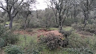
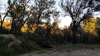
Photos of Madrid Mountain Bike
Videos of Madrid Mountain Bike

trail: Mercancias
0:03 |
3 |
Apr 13, 2026
trail: Garabitas Norte
4:03 |
27 |
Dec 20, 2022
trail: Arroyo de Valpalomero Upper
0:08 |
314 |
May 21, 2021
trail: Cresta de Valpalomero Upper
0:10 |
36 |
May 21, 2021
trail: Bamboleo
0:11 |
356 |
May 21, 2021
trail: Bamboleo
0:23 |
176 |
May 21, 2021
trail: Salto del Loco
0:15 |
246 |
May 21, 2021
trail: Salto del Loco
0:09 |
199 |
May 21, 2021
Current Trail Warnings
| status | trail | date | condition | user | info |
|---|---|---|---|---|---|
| Alto de Viñas | May 31, 2026 @ 7:22am (Europe/Madrid) May 30, 2026 | Ideal | JokingCreole | Gravel Bike | |
| Puerta Somosaguas - Camino del Santo | May 31, 2026 @ 6:17pm (Europe/Madrid) May 31, 2026 | Unknown | jennek | Hike Authorities destroyed mayor part of the... |
Recent Trail Reports
| status | trail | date | condition | info | user |
|---|---|---|---|---|---|
| Curvas Arroyo Valpalomero | Jun 20, 2026 @ 8:11am (Europe/Madrid) Jun 19, 2026 | Ideal | minnowslayer | ||
| Arroyo de Valpalomero Upper | Jun 20, 2026 @ 8:11am (Europe/Madrid) Jun 19, 2026 | Ideal | minnowslayer | ||
| Valpalomero Acceso Norte | Jun 20, 2026 @ 8:11am (Europe/Madrid) Jun 19, 2026 | Ideal | minnowslayer | ||
| El Palomar | Jun 20, 2026 @ 8:11am (Europe/Madrid) Jun 19, 2026 | Ideal | minnowslayer | ||
| El Palomar Up | Jun 20, 2026 @ 8:11am (Europe/Madrid) Jun 19, 2026 | Ideal | minnowslayer | ||
| Acceso Palomar | Jun 20, 2026 @ 8:11am (Europe/Madrid) Jun 19, 2026 | Variable | minnowslayer | ||
| Train Line | Jun 20, 2026 @ 8:11am (Europe/Madrid) Jun 19, 2026 | Ideal | minnowslayer | ||
| Paseo de Torrecilla | Jun 17, 2026 @ 9:39am (Europe/Madrid) Jun 17, 2026 | Ideal | Rataza | ||
| Enlace Somontes | Jun 17, 2026 @ 9:39am (Europe/Madrid) Jun 17, 2026 | Ideal | Rataza | ||
| Enlace Camino Viejo | Jun 17, 2026 @ 9:39am (Europe/Madrid) Jun 17, 2026 | Ideal | Rataza |
Activity Feed
| username | action | type | title | date |
|---|---|---|---|---|
| minnowslayer | add | report | activity #97379846 and 6 more | Jun 20, 2026 @ 4:07am Jun 20, 2026 |
| Jupiter01 | ridden | trail | activity #97245637 | Jun 18, 2026 @ 5:42am Jun 18, 2026 |
| Rataza | add | report | activity #97170758 and 2 more | Jun 17, 2026 @ 3:04am Jun 17, 2026 |
| Rataza | add | report | activity #97170756 and 2 more | Jun 17, 2026 @ 3:04am Jun 17, 2026 |
| ashernandez64 | add | report | activity #96955361 and 3 more | Jun 14, 2026 @ 4:49am Jun 14, 2026 |
Recent Comments
| username | type | title | comment | date |
|---|---|---|---|---|
| trail | el sendero se encuentra actualmente en... | May 25, 2026 @ 4:11am May 25, 2026 | ||
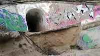
| report | El tunel que pasa por debajo de la M40 está... | Mar 8, 2026 @ 11:09am Mar 8, 2026 | ||
| trail | Terreno muy suelto, ojo | Jan 16, 2025 @ 4:02pm Jan 16, 2025 | ||
| trail | Impracticable | Dec 31, 2024 @ 4:52am Dec 31, 2024 | ||
| trail | Track fundamentalmente de bajada. Primera... | Nov 10, 2024 @ 7:26am Nov 10, 2024 |
Local Badges
-

Completionist0 awarded -

Epic Ride 50k14,155 awarded -

Top 10 Trails0 awarded -
Completionist0 awarded -
Completionist0 awarded -
Completionist0 awarded
Bike & Skill Parks
| name | type | city | rating |
|---|---|---|---|
| Pump Track Barajas | skill park | Madrid | |
| BikePark Moratalaz | skill park | Madrid | |
| Campillo de Sanse | skill park | Madrid | |
| San Sebastian de los Reyes motocross | skill park | Madrid | |
| Alcobendas supercross ??? | skill park | Madrid |
Activity Type Stats
| activitytype | trails | distance | descent | descent distance | total vertical | rating | global rank | state rank | photos | reports | routes | ridelogs |
|---|---|---|---|---|---|---|---|---|---|---|---|---|
| Mountain Bike | 774 | 784 miles | 45,180 ft | 297 miles | 1,467 ft | #83 | #13 | 300 | 2,861 | 20 | 85,864 | |
| E-Bike | 723 | 735 miles | 40,118 ft | 274 miles | 1,467 ft | #19 | #17 | 5 | 2,780 | 15 | 6,227 | |
| Gravel Bike | 121 | #19 | #16 | 23 | 15 | 11 | 1,467 | |||||
| Adaptive Bike | 1 | #87 | #81 | 1 | ||||||||
| Horse | 297 | 389 miles | 9,308 ft | 114 miles | 879 ft | #18 | #2 | 913 | 1 | |||
| Hike | 751 | 728 miles | 43,530 ft | 277 miles | 1,168 ft | #64 | #21 | 2,851 | 3 | 2,739 | ||
| Trail Running | 752 | 728 miles | 43,530 ft | 277 miles | 1,168 ft | #39 | #17 | 2,855 | 2 | 3,805 |
Frequently Asked Questions About Madrid
▼
What are the best places to ride in Madrid?
Madrid has 6 areas to explore for mountain biking. The top rated areas are:
▼
What are the highest rated mountain biking trails in Madrid?
The highest rated mountain biking trails in Madrid are:
- Trinchera Tuberia (4.5/5)
- Tuberia (4.4/5)
- El Palomar (4.3/5)
- Cresta de Valpalomero West (4.3/5)
- Cagigal (4.2/5)
▼
What is the best time of the year to ride in Madrid?
Based on ride log data, the most popular months to ride in Madrid are:
- February (309 activities)
- May (282 activities)
- April (272 activities)
▼
Where can I park to ride in Madrid?
There are 10 parking locations listed in Madrid. The most popular parking spots are: View all parking and trailhead locations on the map to plan your visit.
Activities
Trails
Points of Interest
- Acceso Arroyo del Encinar Information
- Puente de las Siete Rejas Bridge
- Puente Other
- Presa de El Pardo Sight
- Mirador (Desaguadero) Viewpoint
- Cuevas de La Magdalena Sight
- Acceso Arroyo del Encinar/Calle Peñalara Information
- Puente Information
- Acceso Kelsen Information
- Acceso Calle Peñalara Information
- Cerro Gurugú (2,753 ft)
- Los Llanos 2 (2,667 ft)
- Canto Celidorio (2,589 ft)
- By coletassoft & contributors
- Admins: Kalamarrrrrdo, not-really
- #4679 - 28,155 views
- madrid activity log | embed map of Madrid mountain bike trails | madrid mountain biking points of interest polygons
Downloading of trail gps tracks in kml & gpx formats is enabled for Madrid.
You must login to download files.