close
-
Layers w
- Weather Layers
- Pro
- Pro
- Pro
- Pro
- Pro
- Pro
- More Layers
- Pro
- Pro
- Pro
- Pro
-
Upgrade to

3D
Trail Conditions
- Unknown
- Snow Groomed
- Snow Packed
- Snow Covered
- Snow Cover Partial
- Freeze/thaw Cycle
- Icy
- Prevalent Mud
- Wet
- Variable
- Ideal
- Dry
- Very Dry
Trail Flow (Ridden Direction)
Trailforks scans users ridelogs to determine the most popular direction each trail is ridden. A good flowing trail network will have most trails flowing in a single direction according to their intension.
The colour categories are based on what percentage of riders are riding a trail in its intended direction.
The colour categories are based on what percentage of riders are riding a trail in its intended direction.
- > 96%
- > 90%
- > 80%
- > 70%
- > 50%
- < 50%
- bi-directional trail
- no data
Trail Last Ridden
Trailforks scans ridelogs to determine the last time a trail was ridden.
- < 2 days
- < 1 week
- < 2 weeks
- < 1 month
- < 6 months
- > 6 months
Trail Ridden Direction
The intended direction a trail should be ridden.
- Downhill Only
- Downhill Primary
- Both Directions
- Uphill Primary
- Uphill Only
- One Direction
Contribute Details
Colors indicate trail is missing specified detail.
- Description
- Photos
- Description & Photos
- Videos
Trail Popularity ?
Trailforks scans ridelogs to determine which trails are ridden the most in the last 9 months.
Trails are compared with nearby trails in the same city region with a possible 25 colour shades.
Think of this as a heatmap, more rides = more kinetic energy = warmer colors.
- most popular
- popular
- less popular
- not popular
ATV/ORV/OHV Filter
Max Vehicle Width
inches
US Cell Coverage
Legend

Radar Time
Activity Recordings
Trailforks uses anonymized public activity data.
?
Activity Recordings
Trailforks uses anonymized public activity data.
?
Personal Heatmap
▶
Activity Types
all
/
none
▶
Options
2
Date range
month
–
Winter Trails
Warning
A routing network for winter maps does not exist. Selecting trails using the winter trails layer has been disabled.
Missing Trails
Most Popular
Least Popular
Trails are colored based on popularity. The more popular a trail is, the more red. Less popular trails trend towards green.
Jump Magnitude Heatmap
Heatmap of where riders jump on trails. Zoom in to see individual jumps, click circles to view jump details.
BC Backroad Status
![map legend]()
Service Road Atlas is a free to use, community-driven service for viewing and creating reports on the numerous back-country service roads around B.C. and Alberta.

Slope Aspect
Direction the slope faces
Trails Deemphasized
Trails are shown in grey.
Only show trails with no bike usage.
Suggested Layers
Based on selected activity type
Save the current map location and zoom level as your default home location whenever this page is loaded.
Save
No description for Maia has been added yet!
Login or register to submit one.
This region uses the Uk/Euro style trail grading system.
Activities Click to view
- Mountain Bike
49 trails
- E-Bike
37 trails
- Adaptive Bike
0 trails
- Winter Fat Bike
0 trails
- Hike
24 trails
- Trail Running
24 trails
Region Details
- 10
- 8
- 21
- 5
Region Status
Caution as of Nov 22, 2025Stats
- Avg Trail Rating
- Trails (view details)
- 44
- Trails Mountain Bike
- 49
- Trails E-Bike
- 37
- Trails Hike
- 24
- Trails Trail Running
- 24
- Trails Dirtbike/Moto
- 2
- Total Distance
- 11 miles
- Total Descent Distance
- 8 miles
- Total Descent
- 3,066 ft
- Total Vertical
- 520 ft
- Highest Trailhead
- 709 ft
- Reports
- 90
- Photos
- 48
- Ridden Counter
- 911
Sub Regions
-
Alvarelhos
-
Facho
-
Guilhabreu
- 4
- 13
-
Meia Perna
- 1
- 6
- 4
Popular Maia Mountain Biking Trails
• 95 ★ 5.0 • 2,356 ft • 10 ft • 57 •
Popular blue difficulty singletrack. This mountain bike primary trail can be used both directions. On average it takes 3 minutes to complete this trail.
• 100 ★ 5.0 • 1,093 ft • 17 ft • 50 •
Flowy jump trail, mostly gap jumps, some berms and shark fins but you have to link everything together to be able to clear all of it
• 95 ★ 4.5 • 922 ft • 0 ft • 46 •
Popular green difficulty singletrack. This mountain bike primary trail can be used downhill primary. On average it takes 1 minutes to complete this trail.
• 75 ★ 5.0 • 2,510 ft • 10 ft • 40 •
The original single track of Meia Perna, Maia. This track has a ride-around for most features so it is accessible to everyone on every skill level.
• 55 ★ 4.0 • 3,314 ft • 0 ft • 39 •
Moderately popular blue difficulty singletrack. This multi-use trail can be used downhill primary and has a moderate overall physical rating with a 0 ft green climb. Trail visibility is always easy to follow. On average it takes 12 minutes to complete this trail.
• 40 ★ 4.4 • 1,070 ft • 0 ft • 33 •
Moderately popular blue difficulty singletrack. This mountain bike primary trail can be used downhill primary and has a moderate overall physical rating with a 0 ft green climb. It features berm and jump. Trail visibility is always easy to follow. On average it takes minutes to complete this trail.
• 60 ★ 5.0 • 971 ft • 3 ft • 29 •
Moderately popular green difficulty singletrack. This mountain bike primary trail can be used both directions. On average it takes 1 minutes to complete this trail.
• 100 ★ 5.0 • 863 ft • 0 ft • 28 •
Popular red difficulty singletrack. This mountain bike primary trail can be used downhill only. It features drop. On average it takes 2 minutes to complete this trail.
Maia Mountain Bike Routes
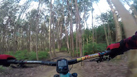
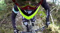
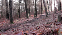
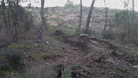
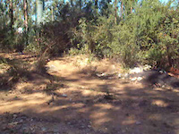
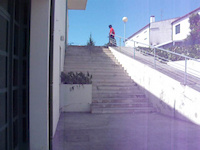
Photos of Maia Mountain Bike
Videos of Maia Mountain Bike
trail: MBGA | Passo Aqui Há 15 Anos
0:00 |
45 |
Aug 4, 2022
trail: Meia Perna
0:32 |
308 |
Jan 22, 2014
trail: Meia Perna
0:00 |
203 |
Feb 27, 2013
trail: Meia Perna
0:07 |
92 |
Dec 2, 2012

trail: Meia Perna
0:53 |
63 |
Jul 13, 2012
trail: Meia Perna
0:13 |
113 |
Oct 29, 2011
trail: Meia Perna
0:19 |
57 |
Oct 29, 2011

trail: Meia Perna
4:47 |
209 |
Sep 12, 2010
Recent Trail Reports
| status | trail | date | condition | info | user |
|---|---|---|---|---|---|
| Loose Cannon | Nov 22, 2025 @ 9:12am (Europe/Lisbon) Nov 22, 2025 | Unknown | Franklim | ||
| MBGA | Passo Aqui Há 15 Anos | Sep 27, 2025 @ 9:44am (Europe/Lisbon) Sep 27, 2025 | Ideal | Zeronerocks | ||
| Acesso | Sep 27, 2025 @ 9:44am (Europe/Lisbon) Sep 27, 2025 | Ideal | Zeronerocks | ||
| Twister | Nov 23, 2024 @ 2:40pm Nov 23, 2024 | Ideal | jaguiar | ||
| Gully | Nov 23, 2024 @ 2:40pm Nov 23, 2024 | Ideal | jaguiar | ||
| Pro Line | Jul 14, 2024 @ 8:22am Jul 14, 2024 | Dry | FYMXSi | ||
| Enduro um (2ª parte) | Jul 14, 2024 @ 8:22am Jul 14, 2024 | Dry | FYMXSi | ||
| Enduro um (1ª parte) | Jul 14, 2024 @ 8:22am Jul 14, 2024 | Dry | FYMXSi | ||
| Meia Perna | May 26, 2024 @ 3:34am May 26, 2024 | Dry | FYMXSi | ||
| Ramos | Apr 6, 2024 @ 2:23am Apr 6, 2024 | Ideal | Franklim |
Activity Feed
| username | action | type | title | date |
|---|---|---|---|---|
| FranciscoMMXJ9U | wishlist | trail | activity #97494291 | Jun 21, 2026 @ 9:41am 3 days |
| Jonpfelix | wishlist | region | activity #97371908 | Jun 20, 2026 @ 1:18am Jun 20, 2026 |
| Jonpfelix | wishlist | trail | activity #97371889 | Jun 20, 2026 @ 1:18am Jun 20, 2026 |
| rfgamaral | like | directory | activity #95316020 | May 23, 2026 @ 7:32am May 23, 2026 |
| kCjcX5 | ridden | trail | activity #92309692 | Apr 10, 2026 @ 3:42am Apr 10, 2026 |
Recent Comments
| username | type | title | comment | date |
|---|---|---|---|---|
| trail | I think it was destroyed by farmers | Jun 18, 2023 @ 3:08pm Jun 18, 2023 | ||
| report | Está definitivamente fechado este spot? | Jun 2, 2022 @ 1:07am Jun 2, 2022 |
Local Badges
-

Epic Mountain Bike Climb 2k20 awarded -

Climbing 10k Badge29 awarded -

Mountain Biking 100k Badge3 awarded -

Epic Ride Descent 2k20 awarded -

Descent 10k Badge29 awarded -

Descent 100k Badge3 awarded
Activity Type Stats
| activitytype | trails | distance | descent | descent distance | total vertical | rating | global rank | state rank | photos | reports | routes | ridelogs |
|---|---|---|---|---|---|---|---|---|---|---|---|---|
| Mountain Bike | 49 | 11 miles | 3,068 ft | 8 miles | 522 ft | #3,154 | #22 | 48 | 90 | 3 | 7,451 | |
| E-Bike | 37 | 8 miles | 1,942 ft | 6 miles | 495 ft | #2,907 | #34 | 81 | 1 | 958 | ||
| Hike | 24 | 5 miles | 909 ft | 3 miles | 522 ft | #5,670 | #42 | 63 | 227 | |||
| Trail Running | 24 | 5 miles | 909 ft | 3 miles | 522 ft | #5,137 | #42 | 63 | 10 | |||
| Dirtbike/Moto | 2 | 3,652 ft | 131 ft | 2,717 ft | 72 ft | 1 | 1 |
Frequently Asked Questions About Maia
▼
What are the best places to ride in Maia?
Maia has 4 areas to explore for mountain biking. The top rated areas are:
▼
What are the highest rated mountain biking trails in Maia?
The highest rated mountain biking trails in Maia are:
- Smooth Operator (4.2/5)
- MBGA | Passo Aqui Há 15 Anos (4.1/5)
- Enduro um (1ª parte) (4.1/5)
- 3 Gerações (4.1/5)
- Marc B (4.1/5)
▼
What is the best time of the year to ride in Maia?
Based on ride log data, the most popular months to ride in Maia are:
- May (33 activities)
- April (25 activities)
- July (21 activities)
▼
Where can I park to ride in Maia?
There are 1 parking locations listed in Maia. The most popular parking spots are:
Activities
Trails
Points of Interest
- By koundes & contributors
- Admins: elyari, AMG, marcossantamaria
- #12483 - 2,986 views
- maia activity log | embed map of Maia mountain bike trails | maia mountain biking points of interest
Downloading of trail gps tracks in kml & gpx formats is enabled for Maia.
You must login to download files.