close
-
Layers w
- Weather Layers
- Pro
- Pro
- Pro
- Pro
- Pro
- Pro
- More Layers
- Pro
- Pro
- Pro
- Pro
-
Upgrade to

3D
Trail Conditions
- Unknown
- Snow Groomed
- Snow Packed
- Snow Covered
- Snow Cover Partial
- Freeze/thaw Cycle
- Icy
- Prevalent Mud
- Wet
- Variable
- Ideal
- Dry
- Very Dry
Trail Flow (Ridden Direction)
Trailforks scans users ridelogs to determine the most popular direction each trail is ridden. A good flowing trail network will have most trails flowing in a single direction according to their intension.
The colour categories are based on what percentage of riders are riding a trail in its intended direction.
The colour categories are based on what percentage of riders are riding a trail in its intended direction.
- > 96%
- > 90%
- > 80%
- > 70%
- > 50%
- < 50%
- bi-directional trail
- no data
Trail Last Ridden
Trailforks scans ridelogs to determine the last time a trail was ridden.
- < 2 days
- < 1 week
- < 2 weeks
- < 1 month
- < 6 months
- > 6 months
Trail Ridden Direction
The intended direction a trail should be ridden.
- Downhill Only
- Downhill Primary
- Both Directions
- Uphill Primary
- Uphill Only
- One Direction
Contribute Details
Colors indicate trail is missing specified detail.
- Description
- Photos
- Description & Photos
- Videos
Trail Popularity ?
Trailforks scans ridelogs to determine which trails are ridden the most in the last 9 months.
Trails are compared with nearby trails in the same city region with a possible 25 colour shades.
Think of this as a heatmap, more rides = more kinetic energy = warmer colors.
- most popular
- popular
- less popular
- not popular
ATV/ORV/OHV Filter
Max Vehicle Width
inches
US Cell Coverage
Legend

Radar Time
Activity Recordings
Trailforks uses anonymized public activity data.
?
Activity Recordings
Trailforks uses anonymized public activity data.
?
Personal Heatmap
▶
Activity Types
all
/
none
▶
Options
2
Date range
month
–
Winter Trails
Warning
A routing network for winter maps does not exist. Selecting trails using the winter trails layer has been disabled.
Missing Trails
Most Popular
Least Popular
Trails are colored based on popularity. The more popular a trail is, the more red. Less popular trails trend towards green.
Jump Magnitude Heatmap
Heatmap of where riders jump on trails. Zoom in to see individual jumps, click circles to view jump details.
BC Backroad Status
![map legend]()
Service Road Atlas is a free to use, community-driven service for viewing and creating reports on the numerous back-country service roads around B.C. and Alberta.

Slope Aspect
Direction the slope faces
Trails Deemphasized
Trails are shown in grey.
Only show trails with no bike usage.
Suggested Layers
Based on selected activity type
Save the current map location and zoom level as your default home location whenever this page is loaded.
Save
No description for Makawao has been added yet!
Login or register to submit one.
Activities Click to view
- Mountain Bike
10 trails
- Gravel Bike
0 trails
- Adaptive Bike
0 trails
- Winter Fat Bike
0 trails
- Hike
7 trails
- Trail Running
7 trails
- ATV/ORV/OHV
0 trails
Region Details
- 2
- 5
- 2
Region Status
Open as of Mar 26, 2025Stats
- Avg Trail Rating
- Trails (view details)
- 9
- Trails Mountain Bike
- 10
- Trails E-Bike
- 1
- Trails Horse
- 2
- Trails Hike
- 7
- Trails Trail Running
- 7
- Total Distance
- 10 miles
- Total Descent
- 2,233 ft
- Total Vertical
- 975 ft
- Highest Trailhead
- 3,690 ft
- Reports
- 164
- Photos
- 140
- Ridden Counter
- 3,467
Sub Regions
-
Kahakapao Recreation Area
- 5
- 2
Popular Makawao Mountain Biking Trails
• 70 ★ 4.8 • 2 miles • 0 ft • 563 •
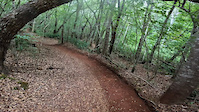
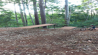
Berms and Jumps. Hard packed clay with thick layer of leaves, sticks and branches. Winter is the wet season and the hard packed clay is slick, AKA Hawaiian ice.
• 100 ★ 3.4 • 994 ft • 39 ft • 562 •
Secret trail starts at top of the lower gravel lot and is a fast fun route to the jump zone, pump track, Tweener trail, main trail intersection. Mostly uphill on the way back to the parking lot. Wetter than the main trail which is...
• 90 ★ 3.0 • 1,215 ft • 130 ft • 525 •
Tweener trail is the preferred downhill route from the loop trail due to the heavy hiker traffic on the main trail. Steeper climbing route than main trail. Viewing of the bottom section of the trail is also possible in few spots.
• 80 ★ 3.0 • 2 miles • 959 ft • 302 •
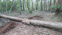
Kahakapao West Loop Trail. This is the easier way to the top and connects with the Kahakapao East Loop Trail, /Downhill Flow Trail and the Renegade Trail. The West Loop Trail climbs just over 2 miles and includes single track and plenty...
• 45 ★ 4.5 • 2 miles • 784 ft • 258 •
. This trail has the added level of difficulty of roots, tight switchback corners and an average of just over a seven-percent grade. It’s just a bit shorter than the West Loop Trail but more technical. Also one of Makawao Forest...
• 35 ★ 3.0 • 1 mile • 79 ft • 148 •
The is a two-way traffic trail and is as challenging to climb as it is to descend. There’s a lot of exposed off-camber roots, narrow trail sections, and hair-pin turns. One section borders the gulch and is extra challenging. Renegade...
Makawao Mountain Bike Routes
10 miles • 1,975 ft • 6 • Loop •
Makawao Forest reserve that hits , , and
• 2 miles • 8 ft • 1 •
• 5 miles • 1,006 ft • 5 •
• 4,954 ft • 969 ft • 2 •
• 7 miles • 1,065 ft • 5 •
Photos of Makawao Mountain Bike
Videos of Makawao Mountain Bike
trail: Pineapple Express
0:16 |
|
May 31, 2022

trail: Pineapple Express
0:10 |
183 |
May 8, 2022
trail: Renegade Trail
0:05 |
201 |
Nov 3, 2021
trail: Pineapple Express
0:08 |
214 |
Nov 28, 2020

28:27 |
338 |
Sep 9, 2022

29:46 |
171 |
Sep 9, 2022

trail: Ravine
876 |
Jul 22, 2022 , Makawao
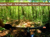
trail: Renegade Trail
376 |
Jul 14, 2022 , Makawao
Recent Trail Reports
| status | trail | date | condition | info | user |
|---|---|---|---|---|---|
| Pineapple Express | Mar 26, 2025 @ 6:53pm Mar 26, 2025 | Ideal | PhilipZMTuxR | ||
| Kahakapao East Loop Trail | Mar 26, 2025 @ 6:51pm Mar 26, 2025 | Ideal | PhilipZMTuxR | ||
| Fong Ridge Road | Jan 19, 2025 @ 8:17am Jan 19, 2025 | Variable | JamesAgepoguyiu | ||
| Renegade Trail | Sep 3, 2024 @ 7:34pm Sep 3, 2024 | Dry | docjas13 | ||
| Secret Trail | Jun 6, 2024 @ 5:11pm Jun 6, 2024 | Unknown | unko | ||
| Tweener Trail | Jun 6, 2024 @ 5:11pm Jun 6, 2024 | Unknown | unko | ||
| Kahakapao West Loop Trail | Jun 6, 2024 @ 5:11pm Jun 6, 2024 | Unknown | unko | ||
| Midway Fong to East loop connector | Jun 6, 2024 @ 5:11pm Jun 6, 2024 | Unknown | unko | ||
| Ravine | Jun 6, 2024 @ 5:11pm Jun 6, 2024 | Unknown | unko |
Activity Feed
| username | action | type | title | date |
|---|---|---|---|---|
| skibikeJunkie | wishlist | trail | activity #96636771 | Jun 9, 2026 @ 4:24pm Jun 9, 2026 |
| WDNcNH | wishlist | route | activity #96526284 | Jun 8, 2026 @ 1:30am Jun 8, 2026 |
| bfruge | wishlist | route | activity #96336648 | Jun 5, 2026 @ 6:53pm Jun 5, 2026 |
| YekaiLuke | ridden | trail | activity #95534858 and 5 more | May 25, 2026 @ 5:27pm May 25, 2026 |
| hW2agu | vote | trail | activity #94532182 | May 11, 2026 @ 6:32pm May 11, 2026 |
Recent Comments
| username | type | title | comment | date |
|---|---|---|---|---|
| trail | Real well made trail with some cracking... | Jul 8, 2024 @ 7:49pm Jul 8, 2024 | ||
| trail | Rating on these trails are inaccurately High | Mar 16, 2024 @ 3:19am Mar 16, 2024 | ||
| trail | Thanks Mtnbike Maui for the bike. This trail... | Jun 9, 2023 @ 11:44am Jun 9, 2023 | ||
| trail | In terrible condition as the middle of March... | Mar 22, 2023 @ 11:42pm Mar 22, 2023 | ||
| trail | Ravine is a legitimate black diamond within... | Jul 22, 2022 @ 5:01am Jul 22, 2022 |
Bike & Skill Parks
| name | type | city | rating |
|---|---|---|---|
| Akamai Skills Area | skill park | Makawao | |
| ‘Akahi Akahi Skills Area | skill park | Makawao | |
| Akamai Skills Area | skill park | Makawao | |
| Pauma Skills Area | skill park | Makawao | |
| Pauma Skills Area | skill park | Makawao |
Local Mountain Biking Directory
-
Krank CyclesBike Shop
![Krank Cycles]()
Activity Type Stats
| activitytype | trails | distance | descent | descent distance | total vertical | rating | global rank | state rank | photos | reports | routes | ridelogs |
|---|---|---|---|---|---|---|---|---|---|---|---|---|
| Mountain Bike | 10 | 10 miles | 2,234 ft | 4 miles | 974 ft | #4,379 | #1,479 | 144 | 163 | 2 | 4,133 | |
| E-Bike | 1 | 124 | 179 | |||||||||
| Horse | 2 | 1 mile | 702 ft | 90 | 11 | |||||||
| Hike | 7 | 8 miles | 856 ft | 2 miles | 968 ft | #6,137 | #2,158 | 1 | 132 | 1,355 | ||
| Trail Running | 7 | 8 miles | 856 ft | 2 miles | 968 ft | #5,735 | #1,827 | 131 | 68 |
Frequently Asked Questions About Makawao
▼
What are the best places to ride in Makawao?
Makawao has 1 areas to explore for mountain biking. The top rated areas are:
▼
What are the highest rated mountain biking trails in Makawao?
The highest rated mountain biking trails in Makawao are:
- Pineapple Express (4.5/5)
- Kahakapao East Loop Trail (4.3/5)
- Ravine (4/5)
- Secret Trail (3.7/5)
- Tweener Trail (3.7/5)
▼
What is the best time of the year to ride in Makawao?
Based on ride log data, the most popular months to ride in Makawao are:
- July (46 activities)
- August (37 activities)
- April (37 activities)
▼
Where can I park to ride in Makawao?
There are 3 parking locations listed in Makawao. The most popular parking spots are: View all parking and trailhead locations on the map to plan your visit.
Trails
Points of Interest
- By unko
 & contributors
 - Admins: MMBC
- #7747 - 3,779 views
- makawao activity log | embed map of Makawao mountain bike trails | makawao mountain biking points of interest
Downloading of trail gps tracks in kml & gpx formats is enabled for Makawao.
You must login to download files.