close
-
Layers w
- Weather Layers
- Pro
- Pro
- Pro
- Pro
- Pro
- Pro
- More Layers
- Pro
- Pro
- Pro
- Pro
-
Upgrade to

3D
Trail Conditions
- Unknown
- Snow Groomed
- Snow Packed
- Snow Covered
- Snow Cover Partial
- Freeze/thaw Cycle
- Icy
- Prevalent Mud
- Wet
- Variable
- Ideal
- Dry
- Very Dry
Trail Flow (Ridden Direction)
Trailforks scans users ridelogs to determine the most popular direction each trail is ridden. A good flowing trail network will have most trails flowing in a single direction according to their intension.
The colour categories are based on what percentage of riders are riding a trail in its intended direction.
The colour categories are based on what percentage of riders are riding a trail in its intended direction.
- > 96%
- > 90%
- > 80%
- > 70%
- > 50%
- < 50%
- bi-directional trail
- no data
Trail Last Ridden
Trailforks scans ridelogs to determine the last time a trail was ridden.
- < 2 days
- < 1 week
- < 2 weeks
- < 1 month
- < 6 months
- > 6 months
Trail Ridden Direction
The intended direction a trail should be ridden.
- Downhill Only
- Downhill Primary
- Both Directions
- Uphill Primary
- Uphill Only
- One Direction
Contribute Details
Colors indicate trail is missing specified detail.
- Description
- Photos
- Description & Photos
- Videos
Trail Popularity ?
Trailforks scans ridelogs to determine which trails are ridden the most in the last 9 months.
Trails are compared with nearby trails in the same city region with a possible 25 colour shades.
Think of this as a heatmap, more rides = more kinetic energy = warmer colors.
- most popular
- popular
- less popular
- not popular
ATV/ORV/OHV Filter
Max Vehicle Width
inches
US Cell Coverage
Legend

Radar Time
Activity Recordings
Trailforks uses anonymized public activity data.
?
Activity Recordings
Trailforks uses anonymized public activity data.
?
Personal Heatmap
▶
Activity Types
all
/
none
▶
Options
2
Date range
month
–
Winter Trails
Warning
A routing network for winter maps does not exist. Selecting trails using the winter trails layer has been disabled.
Missing Trails
Most Popular
Least Popular
Trails are colored based on popularity. The more popular a trail is, the more red. Less popular trails trend towards green.
Jump Magnitude Heatmap
Heatmap of where riders jump on trails. Zoom in to see individual jumps, click circles to view jump details.
BC Backroad Status
![map legend]()
Service Road Atlas is a free to use, community-driven service for viewing and creating reports on the numerous back-country service roads around B.C. and Alberta.

Slope Aspect
Direction the slope faces
Trails Deemphasized
Trails are shown in grey.
Only show trails with no bike usage.
Suggested Layers
Based on selected activity type
Save the current map location and zoom level as your default home location whenever this page is loaded.
SavePopular Trail Networks
view all areas »
No description for Málaga has been added yet!
Login or register to submit one.
This region uses the Uk/Euro style trail grading system.
Activities Click to view
- Mountain Bike
1,174 trails
- E-Bike
1,130 trails
- Horse
75 trails
- Hike
1,176 trails
- Trail Running
1,176 trails
- Dirtbike/Moto
12 trails
Region Details
- 436
- 99
- 389
- 187
- 28
- 1
Stats
- Avg Trail Rating
- Trails (view details)
- 1,156
- Trails Mountain Bike
- 1,174
- Trails E-Bike
- 1,130
- Trails Gravel Bike
- 8
- Trails Adaptive Bike
- 7
- Trails Horse
- 75
- Trails Hike
- 1,176
- Trails Trail Running
- 1,176
- Trails Dirtbike/Moto
- 12
- Trails ATV/ORV/OHV
- 2
- Total Distance
- 941 miles
- Total Descent
- 269,569 ft
- Total Vertical
- 6,755 ft
- Highest Trailhead
- 6,755 ft
- Reports
- 1,975
- Photos
- 597
- Ridden Counter
- 34,502
Articles
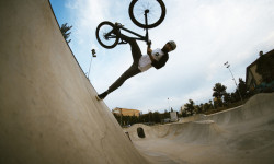
Video: Touring Malaga's Skate Parks and Dirt Jumps with Viktor Novak
Apr 22, 2020 from pinkbike.com
An autumn escape to an iconic BMX destination.
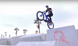
Video: Creative Street Trials in 'Inspired in Malaga'
Dec 28, 2019 from pinkbike.com
Ali Clarkson, Duncan Shaw, John Langlois & Thom Triboulat find Malaga's best spots.
Sub Regions
- Alhaurin de la Torre (27)
- Antequera (54)
- Sierra de Humilladero (17)
- Sierra de Yeguas (36)
- Archidona (0)
- Benahavis (2)
- Estepona (26)
- Casares (16)
- NicolaTrails (0)
- Sierra Bermeja (3)
- Fuengirola (82)
- Jimera De Líbar (1)
- Málaga (490)
- Alkornoke Bike Park (2)
- Almendrales (110)
- Calamorro (72)
- El Chorro (25)
- Gibralfaro (13)
- Guadalhorce (11)
- Montes de Málaga (85)
- Rincon de la Victoria (30)
- Sierra Mijas (68)
- Marbella (167)
- Benahavis (13)
- Coín (31)
- Ojén (72)
- Sierra de Las Nieves (37)
- Nerja (189)
- Ronda (31)
- Serranía de Ronda (29)
- Vélez-Málaga (0)
- Villanueva Del Rosario (31)
- Antequera (72)
- Archidona (30)
Popular Málaga Mountain Biking Trails
• 100 ★ 4.9 • 1 mile • 5 ft • 310 •
Fast trail with different variations, all end on same place.
• 90 ★ 4.7 • 2,418 ft • 17 ft • 302 •
Al haber mucha roca por la que circular, no es muy recomendable hacerlo en mojado.
• 100 ★ 4.7 • 1,781 ft • 0 ft • 298 •
Highly rated popular blue difficulty singletrack. This multi-use trail can be used downhill primary and has a moderate overall physical rating with a 0 ft blue climb. It features berm, jump and roller coaster. On average it takes 2 minutes to complete this trail.
• 95 ★ 4.1 • 2,612 ft • 0 ft • 280 •
Highly rated popular blue difficulty singletrack. This multi-use trail can be used downhill primary and has a moderate overall physical rating. On average it takes 5 minutes to complete this trail.
• 85 ★ 3.9 • 2 miles • 168 ft • 270 •
Descenso con muchas piedras, muy suelto, escaloncitos y alguna curva cerrada.
• 95 ★ 4.4 • 3,530 ft • 0 ft • 266 •
Interesting trail with rocky sections, curves. Places to hurt yourself, plenty drop possibilities :) Plenty of fun :)
• 90 ★ 4.5 • 3,215 ft • 104 ft • 259 •
Highly rated popular red difficulty singletrack. This multi-use trail can be used downhill primary and has a hard overall physical rating with a 104 ft blue climb. It features rock face. Exposure: Life Threatening Consequences. On average it takes 10 minutes to complete this trail.
Málaga Mountain Bike Routes
★ 5.0 • 16 miles • 3,379 ft • 16 • Loop •
Route that links main trails in Alemdrales area in Malaga region
24 miles • 3,351 ft • 3 • Loop •
This ride starts at the Recyclo Bike Shop and Cafe, where you can get good food and coffee, rent a bike or...
21 miles • 3,293 ft • 2 • Loop •
La Bokeron Bike 2023 discurrirá por la parte norte de los Montes de Málaga, pasando cerca de la...
★ 3.0 • 16 miles • 3,379 ft • 16 • Loop •
A series of loops on Almendrales area, with 5 nice down sections and not so bad climbing through access roads.
Photos of Málaga Mountain Bike
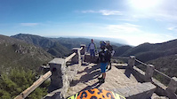
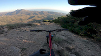
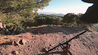
Videos of Málaga Mountain Bike
0:01 |
1 |
Feb 3, 2026
trail: Karakorum
0:07 |
|
Dec 15, 2021

trail: Arenosa upper left
3:02 |
123 |
Jan 13, 2019
trail: Juanar hacia Ojen
4:44 |
303 |
Dec 23, 2018
trail: Levante
2:56 |
350 |
Jan 18, 2018
trail: Karakorum
3:20 |
394 |
Jan 17, 2018
trail: Juanar hacia Ojen
2:53 |
179 |
Mar 29, 2017
trail: Juanar hacia Ojen
2:50 |
308 |
Jan 30, 2017
Current Trail Warnings
| status | trail | date | condition | user | info |
|---|---|---|---|---|---|
| The Rugby Trail Marbella | Jun 2, 2026 @ 9:35am (Europe/Madrid) Jun 2, 2026 | Very Dry | Milan1mfIE1 | Police tape blocking entrance and a big... |
Recent Trail Reports
| status | trail | date | condition | info | user |
|---|---|---|---|---|---|
| Baby Fon Calamorro | Jun 17, 2026 @ 7:38pm (Europe/Gibraltar) Jun 17, 2026 | Dry | sanell07 | ||
| El Coto 2 Montes de Alhaurin de La Torre | Jun 17, 2026 @ 7:38pm (Europe/Gibraltar) Jun 17, 2026 | Dry | sanell07 | ||
| The Abandoned House Trail Marbella | Jun 2, 2026 @ 9:44am (Europe/Madrid) Jun 2, 2026 | Unknown | Milan1mfIE1 | ||
| Kawasaki Almendrales | Jun 1, 2026 @ 12:17pm (Europe/Madrid) Jun 1, 2026 | Dry | Sergio7F | ||
| Nagüeles Marbella | May 31, 2026 @ 1:57pm (Europe/Madrid) May 31, 2026 | Dry | Milan1mfIE1 | ||
| Cerro Cabello 5 Málaga | May 31, 2026 @ 12:25am (Europe/Madrid) May 30, 2026 | Ideal | Sergio7F | ||
| Pastor Almendrales | May 29, 2026 @ 8:22pm (Europe/Madrid) May 29, 2026 | Dry | Gonzalobr2006 | ||
| Conexión Pastor New Almendrales | May 29, 2026 @ 8:20pm (Europe/Madrid) May 29, 2026 | Dry | Gonzalobr2006 | ||
| Adam 2 Almendrales | May 24, 2026 @ 1:28pm (Europe/Madrid) May 24, 2026 | Very Dry | Sergio7F | ||
| Casa Rota Almendrales | May 21, 2026 @ 4:12pm (Europe/Madrid) May 21, 2026 | Dry | Gonzalobr2006 |
Activity Feed
| username | action | type | title | date |
|---|---|---|---|---|
| sanell07 | add | report | activity #97209015 | Jun 17, 2026 @ 2:15pm Jun 17, 2026 |
| sanell07 | add | report | activity #97209014 | Jun 17, 2026 @ 2:15pm Jun 17, 2026 |
| Mexilot07T2rdMa | difficultyvote | trail | activity #96929521 | Jun 13, 2026 @ 5:44pm Jun 13, 2026 |
| MarkTL | ridden | trail | activity #96798019 | Jun 12, 2026 @ 6:03am Jun 12, 2026 |
| Milan1mfIE1 | add | report | activity #96066431 and 1 more | Jun 2, 2026 @ 12:35am Jun 2, 2026 |
Recent Comments
| username | type | title | comment | date |
|---|---|---|---|---|
| report | You can go around it from the left. | May 31, 2026 @ 4:57am May 31, 2026 | ||
| trail | Really fun divers trail! | Mar 17, 2026 @ 12:59pm Mar 17, 2026 | ||
| trail | Lower half of the trail is obstructed by... | Mar 12, 2026 @ 10:22am Mar 12, 2026 | ||
| trail | We will update you all after the 17th March 2026 | Mar 9, 2026 @ 12:07pm Mar 9, 2026 | ||
| trail | El tramo inicial es difícil debido a la... | Mar 1, 2026 @ 12:49pm Mar 1, 2026 |
Local Badges
-

Climbing 10k Badge1 awarded -

Mountain Biking 100k Badge0 awarded -
Mountain Biking 100k Badge0 awarded -
Climbing 10k Badge15 awarded -
Climbing 10k Badge0 awarded -
Climbing 10k Badge0 awarded
Bike & Skill Parks
| name | type | city | rating |
|---|---|---|---|
| Alkornoke Bike Park | bike park | Málaga | |
| Fuengirola motocross | skill park | Málaga | |
| Cartama estación motocross | skill park | Málaga | |
| Benahavís motocross | skill park | Benahavis |
Local Trail Supporters
- Pura Esencia Villanueva del Rosario
![]()
- Pura Esencia Vva del Rosario
- Badfish Proshop
- Loosedownhill
- Loosedownhill_enduro
Activity Type Stats
| activitytype | trails | distance | descent | descent distance | total vertical | rating | global rank | state rank | photos | reports | routes | ridelogs |
|---|---|---|---|---|---|---|---|---|---|---|---|---|
| Mountain Bike | 1,174 | 921 miles | 262,201 ft | 473 miles | 6,755 ft | 553 | 1,975 | 44 | 45,888 | |||
| E-Bike | 1,130 | 873 miles | 251,703 ft | 453 miles | 6,752 ft | 31 | 1,869 | 17 | 7,392 | |||
| Gravel Bike | 8 | 1 | 18 | 1 | 327 | |||||||
| Adaptive Bike | 7 | 2 | ||||||||||
| Horse | 75 | 48 miles | 8,150 ft | 22 miles | 3,074 ft | 782 | 2 | |||||
| Hike | 1,176 | 919 miles | 262,756 ft | 470 miles | 6,755 ft | 12 | 1,955 | 152 | 3,290 | |||
| Trail Running | 1,176 | 919 miles | 262,756 ft | 470 miles | 6,755 ft | 1,955 | 1,205 | |||||
| Dirtbike/Moto | 12 | 6 miles | 840 ft | 2 miles | 2,251 ft | 774 | 14 | |||||
| ATV/ORV/OHV | 2 | 2 miles | 564 ft | 1 mile | 564 ft | 772 | 2 |
Frequently Asked Questions About Málaga
▼
What are the best places to ride in Málaga?
Málaga has 31 areas to explore for mountain biking. The top rated areas are:
▼
What are the highest rated mountain biking trails in Málaga?
The highest rated mountain biking trails in Málaga are:
- Cañada del Lobo (4.6/5)
- Bobastro ruins (4.5/5)
- Karakorum (4.5/5)
- Bancales (4.4/5)
- Descenso Puerto Rico (cabra) (4.4/5)
▼
What is the best time of the year to ride in Málaga?
Based on ride log data, the most popular months to ride in Málaga are:
- November (159 activities)
- February (125 activities)
- October (112 activities)
▼
What is the longest trail in Málaga?
The longest trail in Málaga is Mirador De Colmenar at 7.8 miles. View all trails sorted by distance.
Activities
Trails
Points of Interest
- Mirador Pocopan Viewpoint
- Mirador Vazquez Sell Viewpoint
- Mirador del Cochino Viewpoint
- Ermita de los Verdiales Viewpoint
- Jeep Abandonado Information
- Arco de Jarapalos Sight
- Mirador del Lobo Viewpoint
- Ojen viewpoint
- Primer Merendero Viewpoint
- Segundo Merendero Viewpoint
- Mojón de tres Términos (6,762 ft)
- La Maroma (6,755 ft)
- Cima de Tejeda (6,752 ft)
- By brenthillier
 NSMBA TRAILFORKS & contributors
 - Admins: mul0w, elyari, AMG, juanx, Angelreing, AMG, juanx
- #8838 - 12,517 views
- málaga activity log | embed map of Málaga mountain bike trails | málaga mountain biking points of interest
Downloading of trail gps tracks in kml & gpx formats is enabled for Málaga.
You must login to download files.