close
-
Layers w
- Weather Layers
- Pro
- Pro
- Pro
- Pro
- Pro
- Pro
- More Layers
- Pro
- Pro
- Pro
- Pro
-
Upgrade to

3D
Trail Conditions
- Unknown
- Snow Groomed
- Snow Packed
- Snow Covered
- Snow Cover Partial
- Freeze/thaw Cycle
- Icy
- Prevalent Mud
- Wet
- Variable
- Ideal
- Dry
- Very Dry
Trail Flow (Ridden Direction)
Trailforks scans users ridelogs to determine the most popular direction each trail is ridden. A good flowing trail network will have most trails flowing in a single direction according to their intension.
The colour categories are based on what percentage of riders are riding a trail in its intended direction.
The colour categories are based on what percentage of riders are riding a trail in its intended direction.
- > 96%
- > 90%
- > 80%
- > 70%
- > 50%
- < 50%
- bi-directional trail
- no data
Trail Last Ridden
Trailforks scans ridelogs to determine the last time a trail was ridden.
- < 2 days
- < 1 week
- < 2 weeks
- < 1 month
- < 6 months
- > 6 months
Trail Ridden Direction
The intended direction a trail should be ridden.
- Downhill Only
- Downhill Primary
- Both Directions
- Uphill Primary
- Uphill Only
- One Direction
Contribute Details
Colors indicate trail is missing specified detail.
- Description
- Photos
- Description & Photos
- Videos
Trail Popularity ?
Trailforks scans ridelogs to determine which trails are ridden the most in the last 9 months.
Trails are compared with nearby trails in the same city region with a possible 25 colour shades.
Think of this as a heatmap, more rides = more kinetic energy = warmer colors.
- most popular
- popular
- less popular
- not popular
ATV/ORV/OHV Filter
Max Vehicle Width
inches
US Cell Coverage
Legend

Radar Time
Activity Recordings
Trailforks uses anonymized public activity data.
?
Activity Recordings
Trailforks uses anonymized public activity data.
?
Personal Heatmap
▶
Activity Types
all
/
none
▶
Options
2
Date range
month
–
Winter Trails
Warning
A routing network for winter maps does not exist. Selecting trails using the winter trails layer has been disabled.
Missing Trails
Most Popular
Least Popular
Trails are colored based on popularity. The more popular a trail is, the more red. Less popular trails trend towards green.
Jump Magnitude Heatmap
Heatmap of where riders jump on trails. Zoom in to see individual jumps, click circles to view jump details.
BC Backroad Status
![map legend]()
Service Road Atlas is a free to use, community-driven service for viewing and creating reports on the numerous back-country service roads around B.C. and Alberta.

Slope Aspect
Direction the slope faces
Trails Deemphasized
Trails are shown in grey.
Only show trails with no bike usage.
Suggested Layers
Based on selected activity type
Save the current map location and zoom level as your default home location whenever this page is loaded.
SavePopular Trail Networks
view all areas »
No description for Malaysia has been added yet!
Login or register to submit one.
Region Details
- 16
- 3
- 81
- 132
- 23
- 3
Stats
- Avg Trail Rating
- Trails (view details)
- 426
- Trails Mountain Bike
- 258
- Trails E-Bike
- 57
- Trails Gravel Bike
- 14
- Trails Adaptive Bike
- 23
- Trails Winter Fat Bike
- 2
- Trails Hike
- 361
- Trails Trail Running
- 352
- Trails Dirtbike/Moto
- 1
- Total Distance
- 363 miles
- Total Descent
- 97,322 ft
- Total Vertical
- 13,245 ft
- Highest Trailhead
- 13,259 ft
- Reports
- 888
- Photos
- 1,132
- Ridden Counter
- 26,866
Articles
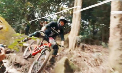
Video: Highlights from the First Ever Enduro World Series Qualifier in Malaysia
Dec 27, 2019 from pinkbike.com
More than 200 riders tackled the Mad Enduro 2019 that included 6 brutal stages.
Sub Regions
- Damansara Damai (0)
- Johor (6)
- Mersing (6)
- Kota Tinggi (1)
- Mersing (6)
- Johor (0)
- johor (0)
- Kedah (8)
- Kuala Muda (2)
- Pulau Langkawi (6)
- Kuala Muda (2)
- Negeri Sembilan (0)
- Pahang (4)
- Penang Island (3)
- George Town (3)
- Teluk Bahang (0)
- George Town (3)
- Perak (0)
- Sabah (11)
- Kota Kinabalu (10)
- Kota Kinabalu (10)
- Sarawak (6)
- Miri (4)
- Miri (4)
- Seberang Perai (0)
- Selangor (0)
- Selangor (183)
- Hulu Langat (8)
- Hulu Selangor (7)
- Cheras (16)
- Kuala Lumpur (110)
- Puchong (1)
- Shah Alam (31)
- Hulu Langat (8)
- Terengganu (3)
- Kuala Berang (1)
- Kuala Besut (1)
- Marang (1)
- Kuala Berang (1)
- Ipoh (4)
- Kedah (1)
- Kuching (1)
- Melacca (1)
- Nilai (0)
- Petaling Jaya (11)
- Putrajaya (25)
Popular Malaysia Mountain Biking Trails
• 90 ★ 3.0 • 2,054 ft • 135 ft • 449 •
Popular green difficulty mixed. This mountain bike primary trail and has a easy overall physical rating with a 135 ft green climb. On average it takes 7 minutes to complete this trail.
• 100 ★ 3.7 • 5,233 ft • 133 ft • 315 •
This trail is the mainstay of Bukit Kiara. Recently a few wooden features have been added to 2K, namely a drop and a gap jump. Be advised that this is an intermediate trail, as such please exercise caution when attempting to ride these...
• 100 ★ 4.0 • 2,871 ft • 180 ft • 248 •
Popular green difficulty singletrack. This mountain bike primary trail and has a easy overall physical rating with a 180 ft blue climb. It features bridge. On average it takes 11 minutes to complete this trail.
• 100 ★ 3.0 • 676 ft • 0 ft • 246 •
Popular green difficulty singletrack. This mountain bike primary trail can be used downhill only and has a easy overall physical rating. It features bridge and drop. On average it takes 3 minutes to complete this trail.
• 95 ★ 4.0 • 4,416 ft • 346 ft • 244 •
Popular green difficulty singletrack. This mountain bike primary trail can be used uphill primary and has a moderate overall physical rating with a 346 ft blue climb. It features jump. On average it takes 31 minutes to complete this trail.
• 95 ★ 4.5 • 1,178 ft • 10 ft • 237 •
Popular blue difficulty singletrack. This mountain bike primary trail and has a easy overall physical rating. On average it takes 10 minutes to complete this trail.
• 70 ★ 0.0 • 719 ft • 47 ft • 236 •
Popular blue difficulty singletrack. This mountain bike primary trail and has a moderate overall physical rating with a 47 ft blue climb. On average it takes 3 minutes to complete this trail.
Malaysia Mountain Bike Routes
★ 5.0 • 18 miles • 2,028 ft • 0 • Point to Point •
PCC Route - Huge Climb and multiple way in and out.
★ 5.0 • 19 miles • 3,562 ft • 0 • Loop •
Gombak bash trail. Parts of it may no longer be there due to development. But just improvise.
★ 5.0 • 18 miles • 1,174 ft • 0 •
★ 2.0 • 12 miles • 1,052 ft • 0 • Loop •
Easy with nice views around the wetlands. Very low elevation. Trail is dusty and covered with small...
3 miles • 378 ft • 0 • Shuttled •
It starts about 800m above sea level at Bukit Karatong Transmission Tower at Kokol Hill, descending mostly...
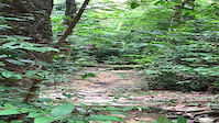
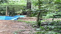
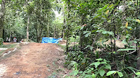
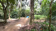
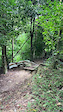
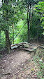
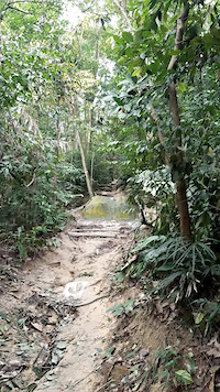
Photos of Malaysia Mountain Bike
Videos of Malaysia Mountain Bike
0:11 |
|
Mar 12, 2023

trail: Lower Carnival
0:16 |
|
Mar 12, 2023
trail: Free Cross (16)
0:20 |
25 |
Jan 6, 2023
trail: Free Cross (16)
0:18 |
14 |
Jan 6, 2023
trail: Free Cross (16)
0:07 |
19 |
Jan 6, 2023
trail: Shaolin
0:10 |
26 |
Dec 16, 2022
trail: Shaolin
0:13 |
7 |
Dec 16, 2022
trail: Shaolin
0:16 |
13 |
Dec 16, 2022
Recent Comments
| username | type | title | comment | date |
|---|---|---|---|---|
| trail | Steep on the upper section, corners creep up... | Feb 15, 2024 @ 9:36am Feb 15, 2024 | ||
| trail | Uprooted tree | Aug 13, 2022 @ 9:43pm Aug 13, 2022 | ||
| report | Duplicate report | Aug 13, 2022 @ 6:03pm Aug 13, 2022 | ||
| trail | Just want to say Thank you succ crew. Munirt... | Feb 21, 2021 @ 7:57pm Feb 21, 2021 | ||
| trail | 9 | Dec 12, 2020 @ 7:12pm Dec 12, 2020 |
Bike & Skill Parks
| name | type | city | rating |
|---|---|---|---|
| Whiplash Dirt Jump Trail | skill park | Kuala Lumpur |
Activity Type Stats
| activitytype | trails | distance | descent | descent distance | total vertical | rating | global rank | state rank | photos | reports | routes | ridelogs |
|---|---|---|---|---|---|---|---|---|---|---|---|---|
| Mountain Bike | 258 | 228 miles | 51,191 ft | 105 miles | 5,476 ft | #44 | 1,115 | 888 | 22 | 66,255 | ||
| E-Bike | 57 | 85 miles | 13,415 ft | 38 miles | 1,677 ft | #69 | 7 | 652 | 6 | 3,578 | ||
| Gravel Bike | 14 | 9 miles | 3,212 ft | 5 miles | 2,208 ft | #39 | 72 | 9 | 27 | |||
| Adaptive Bike | 23 | 36 miles | 6,709 ft | 16 miles | 2,264 ft | #35 | 71 | 6 | ||||
| Winter Fat Bike | 2 | 15 miles | 1,801 ft | 6 miles | 499 ft | #37 | ||||||
| Hike | 361 | 327 miles | 83,681 ft | 139 miles | 13,245 ft | #54 | 9 | 859 | 5 | 7,939 | ||
| Trail Running | 352 | 321 miles | 82,986 ft | 138 miles | 13,245 ft | #58 | 1 | 859 | 5 | 3,007 | ||
| Dirtbike/Moto | 1 | 6 miles | 1,640 ft | 2 miles | 2,073 ft | #70 | 249 | 24 |
Activities
Trails
Points of Interest
- Kem Pacat Camping
- Bukit Delma Summit
- Gunung Nuang Summit
- Bukit Tunggul Summit
- Kabus Campsite Camping
- Bukit Botak Camping
- Gunung Belumut Summit
- Gunung Gua Rimau Summit
- Lata Tengkorak Campsite Camping
- Kem Pengasih Camping
- Bur Karang Putih (3,349 m)
- Gunung Leuser (3,349 m)
- Gunung Karang Putih (3,296 m)
- By canadaka
 Trailforks & contributors
 - Admins: Joe27
- #3240 - 23,765 views
- malaysia activity log | embed map of Malaysia mountain bike trails | malaysia mountain biking points of interest
Downloading of trail gps tracks in kml & gpx formats is enabled for Malaysia.
You must login to download files.