close
-
Layers w
- Weather Layers
- Pro
- Pro
- Pro
- Pro
- Pro
- Pro
- More Layers
- Pro
- Pro
- Pro
- Pro
-
Upgrade to

3D
Trail Conditions
- Unknown
- Snow Groomed
- Snow Packed
- Snow Covered
- Snow Cover Partial
- Freeze/thaw Cycle
- Icy
- Prevalent Mud
- Wet
- Variable
- Ideal
- Dry
- Very Dry
Trail Flow (Ridden Direction)
Trailforks scans users ridelogs to determine the most popular direction each trail is ridden. A good flowing trail network will have most trails flowing in a single direction according to their intension.
The colour categories are based on what percentage of riders are riding a trail in its intended direction.
The colour categories are based on what percentage of riders are riding a trail in its intended direction.
- > 96%
- > 90%
- > 80%
- > 70%
- > 50%
- < 50%
- bi-directional trail
- no data
Trail Last Ridden
Trailforks scans ridelogs to determine the last time a trail was ridden.
- < 2 days
- < 1 week
- < 2 weeks
- < 1 month
- < 6 months
- > 6 months
Trail Ridden Direction
The intended direction a trail should be ridden.
- Downhill Only
- Downhill Primary
- Both Directions
- Uphill Primary
- Uphill Only
- One Direction
Contribute Details
Colors indicate trail is missing specified detail.
- Description
- Photos
- Description & Photos
- Videos
Trail Popularity ?
Trailforks scans ridelogs to determine which trails are ridden the most in the last 9 months.
Trails are compared with nearby trails in the same city region with a possible 25 colour shades.
Think of this as a heatmap, more rides = more kinetic energy = warmer colors.
- most popular
- popular
- less popular
- not popular
ATV/ORV/OHV Filter
Max Vehicle Width
inches
US Cell Coverage
Legend

Radar Time
Activity Recordings
Trailforks uses anonymized public activity data.
?
Activity Recordings
Trailforks uses anonymized public activity data.
?
Personal Heatmap
▶
Activity Types
all
/
none
▶
Options
2
Date range
month
–
Winter Trails
Warning
A routing network for winter maps does not exist. Selecting trails using the winter trails layer has been disabled.
Missing Trails
Most Popular
Least Popular
Trails are colored based on popularity. The more popular a trail is, the more red. Less popular trails trend towards green.
Jump Magnitude Heatmap
Heatmap of where riders jump on trails. Zoom in to see individual jumps, click circles to view jump details.
BC Backroad Status
![map legend]()
Service Road Atlas is a free to use, community-driven service for viewing and creating reports on the numerous back-country service roads around B.C. and Alberta.

Slope Aspect
Direction the slope faces
Trails Deemphasized
Trails are shown in grey.
Only show trails with no bike usage.
Suggested Layers
Based on selected activity type
Save the current map location and zoom level as your default home location whenever this page is loaded.
Save
No description for Malibu has been added yet!
Login or register to submit one.
Activities Click to view
- Mountain Bike
18 trails
- E-Bike
1 trails
- Adaptive Bike
1 trails
- Winter Fat Bike
0 trails
- Hike
55 trails
- Trail Running
55 trails
Region Details
- 6
- 4
- 7
Region Status
Caution as of 2 daysStats
- Avg Trail Rating
- Trails (view details)
- 53
- Trails Mountain Bike
- 18
- Trails E-Bike
- 1
- Trails Gravel Bike
- 1
- Trails Adaptive Bike
- 1
- Trails Horse
- 1
- Trails Hike
- 55
- Trails Trail Running
- 55
- Total Distance
- 55 miles
- Total Descent
- 15,177 ft
- Total Vertical
- 2,382 ft
- Highest Trailhead
- 2,404 ft
- Reports
- 88
- Photos
- 78
- Ridden Counter
- 7,316
Sub Regions
-
Charmlee Wilderness Park
- 1
-
Leo Carrillo State Park
- 2
-
Malibu Creek
- 1
- 4
-
Zuma and Trancas Canyons
- 1
Popular Malibu Mountain Biking Trails
• 95 ★ 3.8 • 5 miles • 1,128 ft • 355 •
Popular blue difficulty singletrack. This mountain bike primary trail can be used downhill primary and has a hard overall physical rating with a 1,128 ft blue climb. On average it takes 1 hour1 minutes to complete this trail.
• 100 ★ 4.0 • 2 miles • 59 ft • 289 •
Popular green difficulty mixed. This mountain bike primary trail can be used both directions and has a easy overall physical rating with a 59 ft green climb. Trail visibility is always easy to follow. On average it takes 18 minutes to complete this trail.
• 90 ★ 3.0 • 3 miles • 1,696 ft • 96 •
Popular blue difficulty dirt/gravel road. This mountain bike primary trail can be used both directions. Trail visibility is always easy to follow. On average it takes 50 minutes to complete this trail.
• 85 ★ 0.0 • 3,520 ft • 12 ft • 35 •
Popular green difficulty singletrack. This multi-use trail can be used both directions. On average it takes 5 minutes to complete this trail.
• 5 ★ 4.0 • 2 miles • 30 ft • 26 •
Less popular blue difficulty singletrack. This mountain bike primary trail can be used downhill primary. On average it takes 14 minutes to complete this trail.
• 70 ★ 0.0 • 2,293 ft • 15 ft • 23 •
Popular blue difficulty singletrack. This mountain bike primary trail can be used both directions and has a moderate overall physical rating with a 15 ft blue climb. On average it takes 26 minutes to complete this trail.
• 5 ★ 0.0 • 4,852 ft • 0 ft • 11 •
This trail is a fairly smooth flowing singletrack run with some sharp switchbacks along the way.
• 60 ★ 0.0 • 942 ft • 29 ft • 3 • • hike
A trail that goes above multiple beaches and rocks at Leo Carrillo State Beach. The trail is very gentle but has some rough surfaces. You can access many of the beaches from this trail.
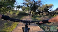
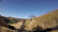
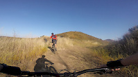
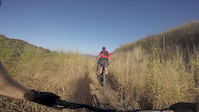
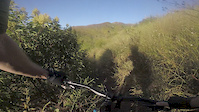
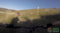
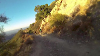
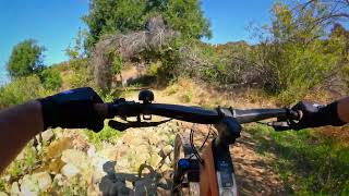
Photos of Malibu Mountain Bike
Videos of Malibu Mountain Bike
trail: Nicholas Ridge Motorway
2:14 |
26 |
Apr 18, 2021
2:59 |
174 |
Jun 13, 2020
0:55 |
31 |
Jun 13, 2020
2:11 |
27 |
Jun 13, 2020
0:28 |
29 |
Jun 13, 2020
0:13 |
102 |
Jun 13, 2020
trail: Lower Stunt High Trail
4:28 |
77 |
Sep 11, 2019
trail: Lower Stunt High Trail
22:46 |
152 |
Oct 20, 2023 , Malibu
Current Trail Warnings
| status | trail | date | condition | user | info |
|---|---|---|---|---|---|
| Lookout Trail | Jun 23, 2026 @ 2:50pm (America/Los_Angeles) 2 days | Ideal | empower98 |
Recent Trail Reports
| status | trail | date | condition | info | user |
|---|---|---|---|---|---|
| Backbone - Kanan T1 to Encinal Parking Lot | May 8, 2026 @ 10:37am (America/Los_Angeles) May 8, 2026 | Dry | bernsense | ||
| Crags Road | Apr 25, 2026 @ 10:57pm (America/Los_Angeles) Apr 25, 2026 | Dry | billwu | ||
| Bulldog Motorway | Aug 2, 2025 @ 2:51pm Aug 2, 2025 | Ideal | redman84 | ||
| Gokite Beach | May 31, 2025 @ 4:15pm May 31, 2025 | Ideal | G99DA | ||
| Zuma Ridge Trail | Dec 7, 2024 @ 8:51am Dec 7, 2024 | Variable | markholloway Trailforks | ||
| Willow Creek Trail | Sep 27, 2023 @ 4:29pm Sep 27, 2023 | Dry | FlowRips | ||
| Gokite Connector | Sep 27, 2023 @ 4:29pm Sep 27, 2023 | Dry | FlowRips | ||
| Calabasas Peak Motorway | Jun 5, 2020 @ 7:39am Jun 5, 2020 | Ideal | Danhowell | ||
| Forest Trail | Jan 5, 2020 @ 8:14pm Jan 5, 2020 | Dry | JackTheMtb07 |
Activity Feed
| username | action | type | title | date |
|---|---|---|---|---|
| empower98 | add | report | activity #97653582 | Jun 23, 2026 @ 2:50pm 2 days |
| bernsense | add | report | activity #94287148 | May 8, 2026 @ 4:32pm May 8, 2026 |
| SherrieLKBR7F | ridden | trail | activity #93787344 | May 1, 2026 @ 8:45am May 1, 2026 |
| thechrisfr | ridden | trail | activity #93742740 | Apr 30, 2026 @ 4:44pm Apr 30, 2026 |
| HDM94 | add | report | activity #93492926 | Apr 26, 2026 @ 6:18pm Apr 26, 2026 |
Recent Comments
| username | type | title | comment | date |
|---|---|---|---|---|
| trail | Rode to the top and had to turn around due to... | Apr 7, 2026 @ 10:51am Apr 7, 2026 | ||
| trail | bridge was not there, but there was a bypass... | Apr 4, 2026 @ 7:28pm Apr 4, 2026 | ||
| trail | No bike access anymore has a sign on the trail. | Mar 26, 2026 @ 7:37pm Mar 26, 2026 | ||
| trail | Bridge was not there had to turn back only way... | Mar 26, 2026 @ 7:35pm Mar 26, 2026 | ||
| trail | Unrelenting climb. Great views. Some very... | Aug 2, 2025 @ 1:44pm Aug 2, 2025 |
Local Badges
-

10 Blue Trails193 awarded -

Epic Ride Climb 2k104 awarded -

Climbing 10k Badge100 awarded -

Climbing 100k Badge1 awarded -

Epic Ride Descent 2k103 awarded -

Descent 10k Badge102 awarded
Activity Type Stats
| activitytype | trails | distance | descent | descent distance | total vertical | rating | global rank | state rank | photos | reports | routes | ridelogs |
|---|---|---|---|---|---|---|---|---|---|---|---|---|
| Mountain Bike | 18 | 32 miles | 8,602 ft | 16 miles | 2,375 ft | #6,202 | #2,099 | 77 | 84 | 3,911 | ||
| E-Bike | 1 | #9,989 | #3,119 | 57 | 664 | |||||||
| Gravel Bike | 1 | #1,001 | #549 | 27 | 52 | |||||||
| Adaptive Bike | 1 | #684 | #1,905 | |||||||||
| Horse | 1 | 4,688 ft | 98 ft | 3,107 ft | 82 ft | 12 | 1 | |||||
| Hike | 55 | 55 miles | 15,177 ft | 28 miles | 2,382 ft | #3,468 | #1,223 | 1 | 88 | 925 | ||
| Trail Running | 55 | 55 miles | 15,177 ft | 28 miles | 2,382 ft | #3,851 | #1,150 | 87 | 202 |
Frequently Asked Questions About Malibu
▼
What are the best places to ride in Malibu?
Malibu has 6 areas to explore for mountain biking. The top rated areas are:
▼
What are the highest rated mountain biking trails in Malibu?
The highest rated mountain biking trails in Malibu are:
- Gokite Beach (4/5)
- Crags Road (4/5)
- Backbone - Kanan T1 to Encinal Parking Lot (3.9/5)
- Bulldog Motorway (0/5)
- Mott Road (0/5)
▼
What is the best time of the year to ride in Malibu?
Based on ride log data, the most popular months to ride in Malibu are:
- July (41 activities)
- March (41 activities)
- February (38 activities)
▼
Where can I park to ride in Malibu?
Trails
- By Mlyell21 & contributors
- Admins: CORBA
- #15069 - 10,178 views
- malibu activity log | embed map of Malibu mountain bike trails | malibu mountain biking points of interest
Downloading of trail gps tracks in kml & gpx formats is enabled for Malibu.
You must login to download files.