close
-
Layers w
- Weather Layers
- Pro
- Pro
- Pro
- Pro
- Pro
- Pro
- More Layers
- Pro
- Pro
- Pro
- Pro
-
Upgrade to

3D
Trail Conditions
- Unknown
- Snow Groomed
- Snow Packed
- Snow Covered
- Snow Cover Partial
- Freeze/thaw Cycle
- Icy
- Prevalent Mud
- Wet
- Variable
- Ideal
- Dry
- Very Dry
Trail Flow (Ridden Direction)
Trailforks scans users ridelogs to determine the most popular direction each trail is ridden. A good flowing trail network will have most trails flowing in a single direction according to their intension.
The colour categories are based on what percentage of riders are riding a trail in its intended direction.
The colour categories are based on what percentage of riders are riding a trail in its intended direction.
- > 96%
- > 90%
- > 80%
- > 70%
- > 50%
- < 50%
- bi-directional trail
- no data
Trail Last Ridden
Trailforks scans ridelogs to determine the last time a trail was ridden.
- < 2 days
- < 1 week
- < 2 weeks
- < 1 month
- < 6 months
- > 6 months
Trail Ridden Direction
The intended direction a trail should be ridden.
- Downhill Only
- Downhill Primary
- Both Directions
- Uphill Primary
- Uphill Only
- One Direction
Contribute Details
Colors indicate trail is missing specified detail.
- Description
- Photos
- Description & Photos
- Videos
Trail Popularity ?
Trailforks scans ridelogs to determine which trails are ridden the most in the last 9 months.
Trails are compared with nearby trails in the same city region with a possible 25 colour shades.
Think of this as a heatmap, more rides = more kinetic energy = warmer colors.
- most popular
- popular
- less popular
- not popular
ATV/ORV/OHV Filter
Max Vehicle Width
inches
US Cell Coverage
Legend

Radar Time
Activity Recordings
Trailforks uses anonymized public activity data.
?
Activity Recordings
Trailforks uses anonymized public activity data.
?
Personal Heatmap
▶
Activity Types
all
/
none
▶
Options
2
Date range
month
–
Winter Trails
Warning
A routing network for winter maps does not exist. Selecting trails using the winter trails layer has been disabled.
Missing Trails
Most Popular
Least Popular
Trails are colored based on popularity. The more popular a trail is, the more red. Less popular trails trend towards green.
Jump Magnitude Heatmap
Heatmap of where riders jump on trails. Zoom in to see individual jumps, click circles to view jump details.
BC Backroad Status
![map legend]()
Service Road Atlas is a free to use, community-driven service for viewing and creating reports on the numerous back-country service roads around B.C. and Alberta.

Slope Aspect
Direction the slope faces
Trails Deemphasized
Trails are shown in grey.
Only show trails with no bike usage.
Suggested Layers
Based on selected activity type
Save the current map location and zoom level as your default home location whenever this page is loaded.
Save
No description for Malija has been added yet!
Login or register to submit one.
This region uses the Uk/Euro style trail grading system.
Activities Click to view
- Mountain Bike
15 trails
- Adaptive Bike
1 trails
- Winter Fat Bike
1 trails
- Hike
15 trails
- Trail Running
15 trails
Region Details
- 11
- 3
- 1
Region Status
Caution as of Feb 28, 2026Stats
- Avg Trail Rating
- Trails (view details)
- 15
- Trails Mountain Bike
- 15
- Trails E-Bike
- 2
- Trails Gravel Bike
- 2
- Trails Adaptive Bike
- 1
- Trails Winter Fat Bike
- 1
- Trails Horse
- 2
- Trails Hike
- 15
- Trails Trail Running
- 15
- Total Distance
- 16 miles
- Total Descent
- 2,740 ft
- Total Vertical
- 757 ft
- Highest Trailhead
- 878 ft
- Reports
- 121
- Photos
- 65
- Ridden Counter
- 545
Popular Malija Mountain Biking Trails
• 5 ★ 4.5 • 1 mile • 218 ft • 16 •
A very beautiful XC training ring. Top of the hill was the first settlement of the istra 178-177 B.C. Mystic place. Trail is easy, half on multipurpouse dirt road, other half on a mix of doubletrack/singletrack with a short technical...
• 5 ★ 1.5 • 3,745 ft • 47 ft • 8 •
some gravel, some singletrail, unfortunately for now ends into nothing. Ridable in both directions
• ★ 4.0 • 2 miles • 110 ft • 3 •
An old village connection path cool for XC riding
Videos of Malija Mountain Bike
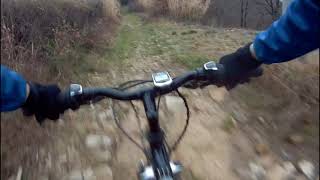
trail: Vnič
0:39 |
296 |
Feb 13, 2021 , malija
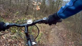
trail: Kaštelir XC trail
9:54 |
556 |
Feb 13, 2021 , malija
Recent Trail Reports
| status | trail | date | condition | info | user |
|---|---|---|---|---|---|
| access road | Feb 28, 2026 @ 10:53am (Europe/Ljubljana) Feb 28, 2026 | Ideal | Istriano | ||
| access road | Feb 28, 2026 @ 10:53am (Europe/Ljubljana) Feb 28, 2026 | Ideal | Istriano | ||
| access road | May 16, 2025 @ 4:52pm May 16, 2025 | Dry | Istriano | ||
| access road to krožna | May 13, 2025 @ 4:44pm May 13, 2025 | Ideal | Istriano | ||
| Kaštelir XC trail | Mar 17, 2024 @ 3:20pm Mar 17, 2024 | Dry | zocknroll TRAILFORKS | ||
| access road | Oct 18, 2023 @ 5:07am Oct 18, 2023 | Unknown | Istriano | ||
| Kurcheva | Oct 18, 2023 @ 5:07am Oct 18, 2023 | Ideal | Istriano | ||
| Vnič | Jan 22, 2022 @ 1:47am Jan 22, 2022 | Variable | Istriano | ||
| access road | Oct 25, 2020 @ 3:53am Oct 25, 2020 | Dry | MetodR | ||
| access road to malija | May 11, 2019 @ 12:20am May 11, 2019 | Dry | Istriano |
Activity Feed
| username | action | type | title | date |
|---|---|---|---|---|
| Istriano | vote | trail | activity #92058384 | Apr 6, 2026 @ 9:08am Apr 6, 2026 |
| lovro81 | add | trail | activity #90787546 | Mar 18, 2026 @ 2:23am Mar 18, 2026 |
| Istriano | add | report | activity #89752154 and 1 more | Mar 1, 2026 @ 1:12am Mar 1, 2026 |
| Istriano | add | report | activity #75935720 | Jul 14, 2025 @ 10:59pm Jul 14, 2025 |
| Istriano | add | report | activity #71809781 and 1 more | May 16, 2025 @ 11:52pm May 16, 2025 |
Recent Comments
| username | type | title | comment | date |
|---|---|---|---|---|
| trail | There is a spot on the trail far more... | Mar 17, 2024 @ 3:23pm Mar 17, 2024 | ||
| trail | Trail is natural, no flow, tight corners,... | Mar 10, 2023 @ 9:25am Mar 10, 2023 | ||
| trail | Trail is cool, can be flowy, needs better flow... | Oct 8, 2022 @ 5:26am Oct 8, 2022 | ||
| trail | It is not a trail, really. It is acess gravel... | Oct 25, 2021 @ 8:09am Oct 25, 2021 | ||
| trail | Don’t bother. Starts by following some power... | Aug 22, 2019 @ 4:27am Aug 22, 2019 |
Local Badges
-

Epic Ride Climb 2k4 awarded -

Climbing 10k Badge7 awarded -

Climbing 100k Badge0 awarded -

Epic Ride Descent 2k5 awarded -

Descent 10k Badge7 awarded -

Descent 100k Badge0 awarded
Activity Type Stats
| activitytype | trails | distance | descent | descent distance | total vertical | rating | global rank | state rank | photos | reports | routes | ridelogs |
|---|---|---|---|---|---|---|---|---|---|---|---|---|
| Mountain Bike | 15 | 16 miles | 2,740 ft | 7 miles | 758 ft | #4,605 | #43 | 48 | 121 | 823 | ||
| E-Bike | 2 | 96 | 162 | |||||||||
| Gravel Bike | 2 | #4,620 | #38 | 17 | 10 | |||||||
| Adaptive Bike | 1 | #203 | #37 | |||||||||
| Winter Fat Bike | 1 | #171 | #34 | |||||||||
| Horse | 2 | 1 mile | 463 ft | 5,128 ft | 463 ft | 15 | ||||||
| Hike | 15 | 16 miles | 2,740 ft | 7 miles | 758 ft | #4,472 | #34 | 99 | 15 | |||
| Trail Running | 15 | 16 miles | 2,740 ft | 7 miles | 758 ft | #3,873 | #33 | 98 | 12 |
Frequently Asked Questions About Malija
▼
What are the highest rated mountain biking trails in Malija?
The highest rated mountain biking trails in Malija are:
- Kaštelir XC trail (4.1/5)
- Krožna Cetoranska (4/5)
- Kurcheva (3.6/5)
- Vnič (3.4/5)
- Bonino XC (0/5)
▼
What is the best time of the year to ride in Malija?
Based on ride log data, the most popular months to ride in Malija are:
- April (40 activities)
- May (32 activities)
- March (29 activities)
▼
Where can I park to ride in Malija?
Check the Malija trail map for trailhead and parking information. Community members regularly update access and parking details for trails in the area.
▼
What is the longest trail in Malija?
The longest trail in Malija is Krožna Cetoranska at 3.9 km. View all trails sorted by distance.
Trails
Points of Interest
- By lovro81
 OBS & contributors
 - Admins: OBS
- #17337 - 3,471 views
- malija activity log | embed map of Malija mountain bike trails | malija mountain biking points of interest
Downloading of trail gps tracks in kml & gpx formats is enabled for Malija.
You must login to download files.