close
-
Layers w
- Weather Layers
- Pro
- Pro
- Pro
- Pro
- Pro
- Pro
- More Layers
- Pro
- Pro
- Pro
- Pro
-
Upgrade to

3D
Trail Conditions
- Unknown
- Snow Groomed
- Snow Packed
- Snow Covered
- Snow Cover Partial
- Freeze/thaw Cycle
- Icy
- Prevalent Mud
- Wet
- Variable
- Ideal
- Dry
- Very Dry
Trail Flow (Ridden Direction)
Trailforks scans users ridelogs to determine the most popular direction each trail is ridden. A good flowing trail network will have most trails flowing in a single direction according to their intension.
The colour categories are based on what percentage of riders are riding a trail in its intended direction.
The colour categories are based on what percentage of riders are riding a trail in its intended direction.
- > 96%
- > 90%
- > 80%
- > 70%
- > 50%
- < 50%
- bi-directional trail
- no data
Trail Last Ridden
Trailforks scans ridelogs to determine the last time a trail was ridden.
- < 2 days
- < 1 week
- < 2 weeks
- < 1 month
- < 6 months
- > 6 months
Trail Ridden Direction
The intended direction a trail should be ridden.
- Downhill Only
- Downhill Primary
- Both Directions
- Uphill Primary
- Uphill Only
- One Direction
Contribute Details
Colors indicate trail is missing specified detail.
- Description
- Photos
- Description & Photos
- Videos
Trail Popularity ?
Trailforks scans ridelogs to determine which trails are ridden the most in the last 9 months.
Trails are compared with nearby trails in the same city region with a possible 25 colour shades.
Think of this as a heatmap, more rides = more kinetic energy = warmer colors.
- most popular
- popular
- less popular
- not popular
ATV/ORV/OHV Filter
Max Vehicle Width
inches
US Cell Coverage
Legend

Radar Time
Activity Recordings
Trailforks uses anonymized public activity data.
?
Activity Recordings
Trailforks uses anonymized public activity data.
?
Personal Heatmap
▶
Activity Types
all
/
none
▶
Options
2
Date range
month
–
Winter Trails
Warning
A routing network for winter maps does not exist. Selecting trails using the winter trails layer has been disabled.
Missing Trails
Most Popular
Least Popular
Trails are colored based on popularity. The more popular a trail is, the more red. Less popular trails trend towards green.
Jump Magnitude Heatmap
Heatmap of where riders jump on trails. Zoom in to see individual jumps, click circles to view jump details.
BC Backroad Status
![map legend]()
Service Road Atlas is a free to use, community-driven service for viewing and creating reports on the numerous back-country service roads around B.C. and Alberta.

Slope Aspect
Direction the slope faces
Trails Deemphasized
Trails are shown in grey.
Only show trails with no bike usage.
Suggested Layers
Based on selected activity type
Save the current map location and zoom level as your default home location whenever this page is loaded.
Save
No description for Malinô Brdo has been added yet!
Login or register to submit one.
 google parking directions
Primary Trail Type: All-Mountain & Downhill
google parking directionsLinks
Activities Click to view
- Mountain Bike
18 trails
- E-Bike
3 trails
- Hike
2 trails
- Trail Running
2 trails
Bike Park Details
- 1
- 1
- 3
- 4
- 5
- 1
- 2
Region Status
Open as of May 28, 2026- Day Ticket
- €15 EUR
- Uplift Type
- Gondola
Stats
- Avg Trail Rating
- Trails (view details)
- 18
- Trails Mountain Bike
- 18
- Trails E-Bike
- 3
- Trails Hike
- 2
- Trails Trail Running
- 2
- Total Distance
- 12 miles
- Total Descent
- 8,749 ft
- Total Vertical
- 2,167 ft
- Highest Trailhead
- 3,896 ft
- Reports
- 219
- Photos
- 55
- Ridden Counter
- 4,758
Popular Malinô Brdo Mountain Biking Trails
• 100 ★ 4.6 • 2 miles • 31 ft • 555 •
Highly rated popular blue difficulty singletrack. This mountain bike primary trail can be used downhill only. It features drop and rock face. On average it takes 7 minutes to complete this trail.
• 95 ★ 4.5 • 1,306 ft • 0 ft • 476 •
Highly rated popular blue difficulty doubletrack. This mountain bike primary trail can be used downhill only and has a moderate overall physical rating. It features berm and jump. On average it takes 1 minutes to complete this trail.
• 30 ★ 4.4 • 2 miles • 2 ft • 384 •
Highly rated less popular blue difficulty mixed. This mountain bike primary trail can be used downhill only. It features bridge and rock face. On average it takes 10 minutes to complete this trail.
• 80 ★ 5.0 • 764 ft • 0 ft • 367 •
Popular black diamond difficulty singletrack. This mountain bike primary trail can be used downhill only. It features bridge, drop and rock face. On average it takes 1 minutes to complete this trail.
• 60 ★ 4.5 • 2,548 ft • 0 ft • 356 •
Highly rated moderately popular black diamond difficulty singletrack. This mountain bike primary trail can be used downhill only. It features drop. On average it takes 3 minutes to complete this trail.
• 90 ★ 4.7 • 1,336 ft • 2 ft • 352 •
Highly rated popular black diamond difficulty singletrack. This mountain bike primary trail can be used downhill only. On average it takes 1 minutes to complete this trail.
• 65 ★ 4.5 • 2,978 ft • 16 ft • 308 •
Highly rated moderately popular double black diamond difficulty singletrack. This mountain bike primary trail can be used downhill only and has a hard overall physical rating. It features drop, jump and rock face. On average it takes 6 minutes to complete this trail.
Malinô Brdo Mountain Bike Routes
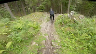
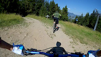
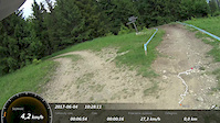
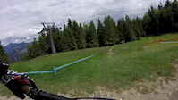
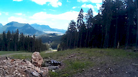
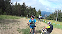
Photos of Malinô Brdo Mountain Bike
Videos of Malinô Brdo Mountain Bike
trail: Intro DH
0:10 |
111 |
Sep 25, 2020
trail: Modrý Zamat upper
3:36 |
112 |
Aug 23, 2020

trail: Blizzard
2:03 |
51 |
Jul 6, 2018
trail: Modrý Zamat upper
6:34 |
112 |
May 27, 2018

trail: Modrý Zamat upper
6:16 |
134 |
May 26, 2018
trail: Intro DH
0:11 |
158 |
May 26, 2018
trail: Modrý Zamat upper
3:46 |
33 |
Dec 14, 2017
trail: Modrý Zamat upper
6:33 |
40 |
Oct 1, 2017
Recent Trail Reports
| status | trail | date | condition | info | user |
|---|---|---|---|---|---|
| Modrý Zamat lower | May 26, 2026 @ 8:38am (Europe/Bratislava) May 25, 2026 | Very Dry | katko | ||
| Blizzard | May 26, 2026 @ 8:38am (Europe/Bratislava) May 25, 2026 | Very Dry | katko | ||
| Ederička | May 26, 2026 @ 8:38am (Europe/Bratislava) May 25, 2026 | Dry | katko | ||
| Enzed | Aug 12, 2025 @ 6:09am Aug 12, 2025 | Ideal | Dan3958 | ||
| Modrý Zamat upper | Aug 30, 2024 @ 7:16am Aug 30, 2024 | Variable | tomtoylc | ||
| Blizzard intro | Aug 30, 2024 @ 7:16am Aug 30, 2024 | Ideal | tomtoylc | ||
| Malina | Aug 30, 2024 @ 7:16am Aug 30, 2024 | Ideal | tomtoylc | ||
| Zelená lower | Sep 15, 2023 @ 1:37pm Sep 15, 2023 | Dry | standa71 | ||
| OMG | Aug 20, 2023 @ 4:00am Aug 20, 2023 | Dry | minetoo | ||
| DH Pro | Jun 25, 2023 @ 4:06am Jun 25, 2023 | Ideal | deviz |
Activity Feed
| username | action | type | title | date |
|---|---|---|---|---|
| AndiKow | ridden | trail | activity #96593595 | Jun 9, 2026 @ 3:17am Jun 9, 2026 |
| katko | add | report | activity #95578644 and 2 more | May 26, 2026 @ 11:25am May 26, 2026 |
| Malarkie | ridden | trail | activity #95562089 and 7 more | May 26, 2026 @ 7:04am May 26, 2026 |
| mtbrajder | add | video | activity #95377365 | May 23, 2026 @ 8:49pm May 23, 2026 |
| trailforks | add | video | activity #94615723 | May 13, 2026 @ 3:00am May 13, 2026 |
Recent Comments
| username | type | title | comment | date |
|---|---|---|---|---|
| trail | Red trail ;) a lot of roots and rocks. | Jun 14, 2025 @ 1:08am Jun 14, 2025 | ||
| trail | Wrong classification of the trail. Should be... | Sep 26, 2022 @ 2:48am Sep 26, 2022 | ||
| trail | Vyhľady, trail fajn ale. Chýbajú trochu... | Aug 16, 2020 @ 8:58am Aug 16, 2020 | ||
| trail | Very fast and long turns. Steep terrain.... | Jul 20, 2019 @ 1:42pm Jul 20, 2019 | ||
| trail | Lazy and boring trail. Beautiful views. Loose... | Jul 20, 2019 @ 1:38pm Jul 20, 2019 |
Nearby Areas
| name | distance | ||||
|---|---|---|---|---|---|
| Šípska Fatra | 3 | 2 | 6.1 km | ||
| Liptovská Lúžna | 4 | 7 | 1 | 9.4 km | |
| Bike Park Jasenska | 2 | 2 | 4 | 12.5 km | |
| Chata pod Chlebom | 1 | 3 | 2 | 12.8 km | |
| Donovaly | 2 | 3 | 12.9 km |
Activity Type Stats
| activitytype | trails | distance | descent | descent distance | total vertical | rating | global rank | state rank | photos | reports | routes | ridelogs |
|---|---|---|---|---|---|---|---|---|---|---|---|---|
| Mountain Bike | 18 | 12 miles | 8,750 ft | 11 miles | 2,169 ft | #1,048 | #10 | 55 | 219 | 1 | 1,881 | |
| E-Bike | 3 | 2 miles | 1,424 ft | 2 miles | 1,378 ft | #1,397 | #26 | 197 | 84 | |||
| Hike | 2 | 1 mile | 617 ft | 1 mile | 1,978 ft | #2,092 | #30 | 196 | 103 | |||
| Trail Running | 2 | 1 mile | 617 ft | 1 mile | 1,978 ft | #1,419 | #28 | 196 | 17 |
Frequently Asked Questions About Malinô Brdo
▼
What are the highest rated mountain biking trails in Malinô Brdo?
The highest rated mountain biking trails in Malinô Brdo are:
- OMG (4.4/5)
- Modrý Zamat upper (4.4/5)
- Intro DH (4.3/5)
- Enzed (4.3/5)
- Modrý Zamat lower (4.3/5)
▼
What is the best time of the year to ride in Malinô Brdo?
Based on ride log data, the most popular months to ride in Malinô Brdo are:
- July (21 activities)
- August (13 activities)
- June (11 activities)
▼
Where can I park to ride in Malinô Brdo?
There are 1 parking locations listed in Malinô Brdo. The most popular parking spots are:
▼
What is the longest trail in Malinô Brdo?
The longest trail in Malinô Brdo is Blizzard at 1.8 miles. View all trails sorted by distance.
Activities
Trails
Points of Interest
- By micolai
 TRAILFORKS Poland & contributors
 - Admins: apply
- #10877 - 10,754 views
- malinô brdo activity log | embed map of Malinô Brdo mountain bike trails | malinô brdo mountain biking points of interest
Downloading of trail gps tracks in kml & gpx formats is enabled for Malinô Brdo.
You must login to download files.