close
-
Layers w
- Weather Layers
- Pro
- Pro
- Pro
- Pro
- Pro
- Pro
- More Layers
- Pro
- Pro
- Pro
- Pro
-
Upgrade to

3D
Trail Conditions
- Unknown
- Snow Groomed
- Snow Packed
- Snow Covered
- Snow Cover Partial
- Freeze/thaw Cycle
- Icy
- Prevalent Mud
- Wet
- Variable
- Ideal
- Dry
- Very Dry
Trail Flow (Ridden Direction)
Trailforks scans users ridelogs to determine the most popular direction each trail is ridden. A good flowing trail network will have most trails flowing in a single direction according to their intension.
The colour categories are based on what percentage of riders are riding a trail in its intended direction.
The colour categories are based on what percentage of riders are riding a trail in its intended direction.
- > 96%
- > 90%
- > 80%
- > 70%
- > 50%
- < 50%
- bi-directional trail
- no data
Trail Last Ridden
Trailforks scans ridelogs to determine the last time a trail was ridden.
- < 2 days
- < 1 week
- < 2 weeks
- < 1 month
- < 6 months
- > 6 months
Trail Ridden Direction
The intended direction a trail should be ridden.
- Downhill Only
- Downhill Primary
- Both Directions
- Uphill Primary
- Uphill Only
- One Direction
Contribute Details
Colors indicate trail is missing specified detail.
- Description
- Photos
- Description & Photos
- Videos
Trail Popularity ?
Trailforks scans ridelogs to determine which trails are ridden the most in the last 9 months.
Trails are compared with nearby trails in the same city region with a possible 25 colour shades.
Think of this as a heatmap, more rides = more kinetic energy = warmer colors.
- most popular
- popular
- less popular
- not popular
ATV/ORV/OHV Filter
Max Vehicle Width
inches
US Cell Coverage
Legend

Radar Time
Activity Recordings
Trailforks uses anonymized public activity data.
?
Activity Recordings
Trailforks uses anonymized public activity data.
?
Personal Heatmap
▶
Activity Types
all
/
none
▶
Options
2
Date range
month
–
Winter Trails
Warning
A routing network for winter maps does not exist. Selecting trails using the winter trails layer has been disabled.
Missing Trails
Most Popular
Least Popular
Trails are colored based on popularity. The more popular a trail is, the more red. Less popular trails trend towards green.
Jump Magnitude Heatmap
Heatmap of where riders jump on trails. Zoom in to see individual jumps, click circles to view jump details.
BC Backroad Status
![map legend]()
Service Road Atlas is a free to use, community-driven service for viewing and creating reports on the numerous back-country service roads around B.C. and Alberta.

Slope Aspect
Direction the slope faces
Trails Deemphasized
Trails are shown in grey.
Only show trails with no bike usage.
Suggested Layers
Based on selected activity type
Save the current map location and zoom level as your default home location whenever this page is loaded.
Save
No description for Manchester has been added yet!
Login or register to submit one.
This region uses the Uk/Euro style trail grading system.
Activities Click to view
- Mountain Bike
32 trails
- E-Bike
2 trails
- Adaptive Bike
0 trails
- Winter Fat Bike
0 trails
- Hike
1 trails
- Trail Running
1 trails
Region Details
- 1
- 20
- 9
- 1
- 1
Region Status
Open as of Jun 8, 2026Stats
- Avg Trail Rating
- Trails (view details)
- 32
- Trails Mountain Bike
- 32
- Trails E-Bike
- 2
- Trails Hike
- 1
- Trails Trail Running
- 1
- Total Distance
- 7 miles
- Total Descent
- 869 ft
- Total Vertical
- 214 ft
- Highest Trailhead
- 336 ft
- Reports
- 209
- Photos
- 57
- Ridden Counter
- 2,686
Sub Regions
-
Clayton Vale
- 1
- 11
- 2
- 1
- 1
-
Philips Park
- 9
- 2
Popular Manchester Mountain Biking Trails
• 95 ★ 4.7 • 4,806 ft • 42 ft • 176 •
Optional very small drop at the , reasonably fast trail with a tabletop section, side by side small and bigger tabletops which are all rollable.
• 100 ★ 4.0 • 3,294 ft • 32 ft • 163 •
Steep Roller coaster type , climb in the middle then back down
• 75 ★ 3.5 • 4,934 ft • 71 ft • 141 •
Popular blue difficulty singletrack. This mountain bike primary trail can be used one direction. Trail visibility is always easy to follow. On average it takes 9 minutes to complete this trail.
• 70 ★ 3.0 • 1,303 ft • 24 ft • 126 •
Popular green difficulty singletrack. This mountain bike primary trail. On average it takes 2 minutes to complete this trail.
• 70 ★ 3.0 • 1,824 ft • 20 ft • 123 •
Popular red difficulty singletrack. This mountain bike primary trail can be used one direction. On average it takes 3 minutes to complete this trail.
• 80 ★ 3.0 • 1,365 ft • 10 ft • 117 •
Popular blue difficulty singletrack. This mountain bike primary trail can be used one direction. On average it takes 2 minutes to complete this trail.
• 85 ★ 3.0 • 463 ft • 23 ft • 117 •
Popular blue difficulty singletrack. This mountain bike primary trail can be used one direction. On average it takes minutes to complete this trail.
• 95 ★ 2.0 • 948 ft • 23 ft • 112 •
Popular red difficulty singletrack. This mountain bike primary trail can be used one direction. On average it takes 1 minutes to complete this trail.
Manchester Mountain Bike Routes
★ 3.0 • 2 miles • 232 ft • 0 • Loop •
3.5 km Figure 8 Red trail loop, consisting of fast flowy sections with optional jumps and rollers.
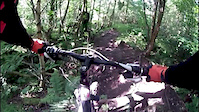
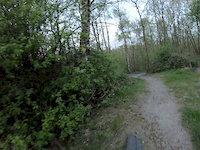
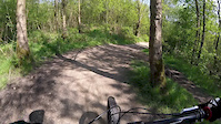
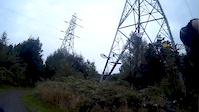
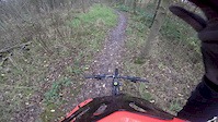
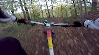
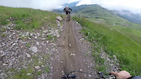
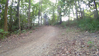
Photos of Manchester Mountain Bike
Recent Trail Reports
| status | trail | date | condition | info | user |
|---|---|---|---|---|---|
| Start | Apr 14, 2026 @ 9:59am (Europe/Isle_of_Man) Apr 14, 2026 | Variable | weridemtbskillscoaching | ||
| Thru The Woods first | Oct 16, 2025 @ 10:20am (Europe/Isle_of_Man) Oct 16, 2025 | Variable | weridemtbskillscoaching | ||
| Southwood Trail (Right Trail) | Oct 16, 2025 @ 10:20am (Europe/Isle_of_Man) Oct 16, 2025 | Ideal | weridemtbskillscoaching | ||
| Northwood Trail (Left Trail) | Oct 16, 2025 @ 10:20am (Europe/Isle_of_Man) Oct 16, 2025 | Ideal | weridemtbskillscoaching | ||
| Newton Heath Sidewinder First Descent | May 29, 2025 @ 1:54pm May 29, 2025 | Ideal | ElliottblwYe | ||
| Urban Red Rock-it Climb to pylon | May 29, 2025 @ 1:48pm May 29, 2025 | Ideal | ElliottblwYe | ||
| Urban Red Rock-it Descent to Medlock | Mar 5, 2025 @ 4:52pm Mar 5, 2025 | Variable | JWXBO5 | ||
| Newton Heath Sidewinder Descent and Climb | Mar 5, 2025 @ 4:52pm Mar 5, 2025 | Variable | JWXBO5 | ||
| Urban Red Rock-it Second Braid | Mar 5, 2025 @ 4:52pm Mar 5, 2025 | Variable | JWXBO5 | ||
| Clayton Vale Easy Rider Climb 2 | Mar 5, 2025 @ 4:52pm Mar 5, 2025 | Variable | JWXBO5 |
Activity Feed
| username | action | type | title | date |
|---|---|---|---|---|
| Charlie12artpro | add | photo | activity #94231205 and 1 more | May 7, 2026 @ 11:32am May 7, 2026 |
| weridemtbskillscoaching | add | report | activity #92599022 | Apr 14, 2026 @ 8:29am Apr 14, 2026 |
| RyanD199 | ridden | trail | activity #92188758 and 1 more | Apr 8, 2026 @ 9:07am Apr 8, 2026 |
| RyanD199 | wishlist | region | activity #92186562 | Apr 8, 2026 @ 8:34am Apr 8, 2026 |
| Nat1omvL0 | ridden | trail | activity #91694817 | Apr 1, 2026 @ 1:26am Apr 1, 2026 |
Recent Comments
| username | type | title | comment | date |
|---|---|---|---|---|
| trail | Plenty of broken glass in random parts of the... | Oct 11, 2022 @ 5:11am Oct 11, 2022 | ||
| trail | Now it's been re surfaced by the Dirt Factory... | Oct 4, 2021 @ 8:50am Oct 4, 2021 | ||
| trail | Be careful on this section of the trail.... | Apr 21, 2020 @ 1:28am Apr 21, 2020 | ||
| trail | No sidewinder anymore,just straight line now | Jan 3, 2020 @ 5:01am Jan 3, 2020 | ||
| skillpark | Small,but quite good fun, a perfect warm up... | Apr 13, 2018 @ 2:02am Apr 13, 2018 |
Local Badges
-

10 Blue Trails24 awarded -

Epic Ride Climb 2k24 awarded -

Climbing 10k Badge58 awarded -

Climbing 100k Badge5 awarded -

Epic Ride Descent 2k23 awarded -

Descent 10k Badge58 awarded
Bike & Skill Parks
| name | type | city | rating |
|---|---|---|---|
| Philips Park Skills Area and Pump Track | skill park | Manchester | |
| Park Bridge Mountain Bike Trail | skill park | Manchester | |
| Plop Pump Track | skill park | Manchester | |
| Brabyns Park BMX Track | skill park | Manchester | |
| Cross Lane Pump Track | skill park | Manchester |
Activity Type Stats
| activitytype | trails | distance | descent | descent distance | total vertical | rating | global rank | state rank | photos | reports | routes | ridelogs |
|---|---|---|---|---|---|---|---|---|---|---|---|---|
| Mountain Bike | 32 | 7 miles | 869 ft | 4 miles | 213 ft | #4,096 | #131 | 50 | 208 | 2 | 24,044 | |
| E-Bike | 2 | 3,878 ft | 131 ft | 2,028 ft | 200 ft | #3,646 | #131 | 7 | 142 | 1,069 | ||
| Hike | 1 | 1,302 ft | 20 ft | 364 ft | 16 ft | #6,224 | #155 | 163 | 176 | |||
| Trail Running | 1 | 1,302 ft | 20 ft | 364 ft | 16 ft | #5,646 | #141 | 163 | 204 |
Frequently Asked Questions About Manchester
▼
What are the best places to ride in Manchester?
Manchester has 2 areas to explore for mountain biking. The top rated areas are:
▼
What are the highest rated mountain biking trails in Manchester?
The highest rated mountain biking trails in Manchester are:
- Southwood Trail (Right Trail) (4.2/5)
- Northwood Trail (Left Trail) (4/5)
- Newton Heath Sidewinder Outbound (3.9/5)
- Urban Red Rock-it Second Braid (3.8/5)
- Urban Red Rock-it Trail 3rd Section (3.8/5)
▼
What is the best time of the year to ride in Manchester?
Based on ride log data, the most popular months to ride in Manchester are:
- July (215 activities)
- May (125 activities)
- September (109 activities)
▼
Where can I park to ride in Manchester?
Check the Manchester trail map for trailhead and parking information. Community members regularly update access and parking details for trails in the area.
- By Architrail & contributors
- Admins: wisey, MathieuC, cemoorelife
- #8402 - 7,670 views
- manchester activity log | embed map of Manchester mountain bike trails |
Downloading of trail gps tracks in kml & gpx formats is enabled for Manchester.
You must login to download files.