close
-
Layers w
- Weather Layers
- Pro
- Pro
- Pro
- Pro
- Pro
- Pro
- More Layers
- Pro
- Pro
- Pro
- Pro
-
Upgrade to

3D
Trail Conditions
- Unknown
- Snow Groomed
- Snow Packed
- Snow Covered
- Snow Cover Partial
- Freeze/thaw Cycle
- Icy
- Prevalent Mud
- Wet
- Variable
- Ideal
- Dry
- Very Dry
Trail Flow (Ridden Direction)
Trailforks scans users ridelogs to determine the most popular direction each trail is ridden. A good flowing trail network will have most trails flowing in a single direction according to their intension.
The colour categories are based on what percentage of riders are riding a trail in its intended direction.
The colour categories are based on what percentage of riders are riding a trail in its intended direction.
- > 96%
- > 90%
- > 80%
- > 70%
- > 50%
- < 50%
- bi-directional trail
- no data
Trail Last Ridden
Trailforks scans ridelogs to determine the last time a trail was ridden.
- < 2 days
- < 1 week
- < 2 weeks
- < 1 month
- < 6 months
- > 6 months
Trail Ridden Direction
The intended direction a trail should be ridden.
- Downhill Only
- Downhill Primary
- Both Directions
- Uphill Primary
- Uphill Only
- One Direction
Contribute Details
Colors indicate trail is missing specified detail.
- Description
- Photos
- Description & Photos
- Videos
Trail Popularity ?
Trailforks scans ridelogs to determine which trails are ridden the most in the last 9 months.
Trails are compared with nearby trails in the same city region with a possible 25 colour shades.
Think of this as a heatmap, more rides = more kinetic energy = warmer colors.
- most popular
- popular
- less popular
- not popular
ATV/ORV/OHV Filter
Max Vehicle Width
inches
US Cell Coverage
Legend

Radar Time
Activity Recordings
Trailforks uses anonymized public activity data.
?
Activity Recordings
Trailforks uses anonymized public activity data.
?
Personal Heatmap
▶
Activity Types
all
/
none
▶
Options
2
Date range
month
–
Winter Trails
Warning
A routing network for winter maps does not exist. Selecting trails using the winter trails layer has been disabled.
Missing Trails
Most Popular
Least Popular
Trails are colored based on popularity. The more popular a trail is, the more red. Less popular trails trend towards green.
Jump Magnitude Heatmap
Heatmap of where riders jump on trails. Zoom in to see individual jumps, click circles to view jump details.
BC Backroad Status
![map legend]()
Service Road Atlas is a free to use, community-driven service for viewing and creating reports on the numerous back-country service roads around B.C. and Alberta.

Slope Aspect
Direction the slope faces
Trails Deemphasized
Trails are shown in grey.
Only show trails with no bike usage.
Suggested Layers
Based on selected activity type
Save the current map location and zoom level as your default home location whenever this page is loaded.
SaveManitoba is home to some of the most enjoyable single track and technical riding around, come check it out :-)
The Birch Ski Area was the site for the 1999 Pan Am Games XC event, and Bison Butte Recreational Trails was the site for the 2017 Canada Summer Games XC event.
Most of the popular trails that are maintained and ridden regularly are across the southern 200 km of the province.
Trail difficulty ranges from green to blue mostly, with some sections of black and double black challenges.
There is a fair selection of river trails within the Winnipeg city limits, and from 2018, the Bison Butte Recreational Trails area has been open to the public with a variety of easy to very challenging trails with berms, table tops, drops, steep roll downs, logs, rocks, and single track.
Within 1-3 hours drive from the city of Winnipeg are a wide variety of trail types..
Tight hard pack single track near the city (Birds Hill Park), predominantly flat with some mild elevation changes.
Rocky outcrops of the Canadian shield in east, rock face, dirt single track, double track (Falcon Ridge Ski Area, Blue Highway, Pinawa, Ingolf).. lot's of small steep hills. Five of Diamonds and Blue Highway routes both have berms, table tops, natural rock drops and open granite rock face roll downs.
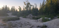
Grand Beach (North of Winnipeg) Double track/ single track, hard pack, sandy sections, some rock gardens
Falcon Trails, Blue Highway, and Grand Beach trails are in Provincial parks so a provincial park pass is needed to enter with your car.
Riding Mountain (central) has some new hard pack single track trails.
The southwest region including Brandon, Morden, and Carmon areas have some of the sweetest hard pack single track around, with regularly maintained and improved trail networks. Lots of short to medium elevation changes going through valleys, including some challenging climbs.
Trails are snow free and free of spring mud drying usually by late April - mid May. Snow starts again in late Oct-Nov. Winter riding on groomed fat bike trail growing in popularity (Oak Ridge Mountain Bike Trail, Grand Beach, Falcon Ridge Ski Area).
If you're visiting bring your bike(s) Manitoba has some trails you don't want to miss. Local clubs will help you find the trails. We have some fine XC races that run generally from May to September (mbcycling.ca)
The Birch Ski Area was the site for the 1999 Pan Am Games XC event, and Bison Butte Recreational Trails was the site for the 2017 Canada Summer Games XC event.
Most of the popular trails that are maintained and ridden regularly are across the southern 200 km of the province.
Trail difficulty ranges from green to blue mostly, with some sections of black and double black challenges.
There is a fair selection of river trails within the Winnipeg city limits, and from 2018, the Bison Butte Recreational Trails area has been open to the public with a variety of easy to very challenging trails with berms, table tops, drops, steep roll downs, logs, rocks, and single track.
Within 1-3 hours drive from the city of Winnipeg are a wide variety of trail types..
Tight hard pack single track near the city (Birds Hill Park), predominantly flat with some mild elevation changes.
Rocky outcrops of the Canadian shield in east, rock face, dirt single track, double track (Falcon Ridge Ski Area, Blue Highway, Pinawa, Ingolf).. lot's of small steep hills. Five of Diamonds and Blue Highway routes both have berms, table tops, natural rock drops and open granite rock face roll downs.
Grand Beach (North of Winnipeg) Double track/ single track, hard pack, sandy sections, some rock gardens
Falcon Trails, Blue Highway, and Grand Beach trails are in Provincial parks so a provincial park pass is needed to enter with your car.
Riding Mountain (central) has some new hard pack single track trails.
The southwest region including Brandon, Morden, and Carmon areas have some of the sweetest hard pack single track around, with regularly maintained and improved trail networks. Lots of short to medium elevation changes going through valleys, including some challenging climbs.
Trails are snow free and free of spring mud drying usually by late April - mid May. Snow starts again in late Oct-Nov. Winter riding on groomed fat bike trail growing in popularity (Oak Ridge Mountain Bike Trail, Grand Beach, Falcon Ridge Ski Area).
If you're visiting bring your bike(s) Manitoba has some trails you don't want to miss. Local clubs will help you find the trails. We have some fine XC races that run generally from May to September (mbcycling.ca)
Stats
- Avg Trail Rating
- Trails (view details)
- 1,615
- Trails Mountain Bike
- 1,069
- Trails E-Bike
- 587
- Trails Gravel Bike
- 86
- Trails Adaptive Bike
- 122
- Trails Winter Fat Bike
- 383
- Trails Horse
- 113
- Trails Hike
- 1,195
- Trails Trail Running
- 1,085
- Trails Dirtbike/Moto
- 5
- Trails Observed Trials
- 2
- Trails ATV/ORV/OHV
- 23
- Trails Snowmobile
- 58
- Trails Snowshoe
- 431
- Trails Downhill Ski
- 35
- Trails Backcountry Ski
- 22
- Trails Nordic Ski
- 543
- Total Distance
- 2,182 miles
- Total Descent
- 75,298 ft
- Total Vertical
- 2,110 ft
- Highest Trailhead
- 2,721 ft
- Reports
- 10,509
- Photos
- 3,042
- Ridden Counter
- 84,395
Articles
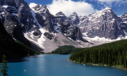
The 10 Most Beautiful National Parks in Canada
Jun 17, 2024 from outsideonline.com
Spectacular mountains and deep fjords, powder-blue lakes and sea stacks: here’s your bucket list of national parks to visit up north
Popular Trail Networks
view all areas »Sub Regions
- Central Region - Manitoba (348)
- Birds Hill (16)
- RM of St Andrews (4)
- Eastern Region - Manitoba (60)
- North Whiteshell (33)
- South Whiteshell (106)
- Northeast Region - Manitoba (0)
- Northwest Region - Manitoba (10)
- Western Region - Manitoba (479)
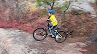
Popular Manitoba Mountain Biking Trails
• 85 ★ 5.0 • 4 miles • 226 ft • 527 •
Popular blue difficulty singletrack. This mountain bike primary trail can be used one direction. On average it takes 27 minutes to complete this trail.
• 100 ★ 4.0 • 3 miles • 41 ft • 477 •
7 km loop. Dedicated mountain bike trail in the South West section of Birds Hill Provincial Park. Single track. Very minor elevation changes. Many sections are built on deer trails and have extremely tight corners and very narrow...
• 50 ★ 5.0 • 2 miles • 155 ft • 266 •
Double track onnecting to Weclome Centre and chalet parking lot.
• 100 ★ 4.5 • 1,191 ft • 0 ft • 421 •
Wide and smooth switch back climb. Turns get tighter and steeper as you climb. Takes you to the top of the hill where you have many descent choices from easy to an advanced mandatory drop.
• 100 ★ 3.7 • 1,073 ft • 0 ft • 421 •
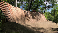
Nice flowy bermed descent with table tops between some berms. Final rocky drop before finishing with three large table tops. Ride around option for rocky drop. Three new large jumps under construction.
• 95 ★ 0.0 • 787 ft • 7 ft • 135 •
Popular blue difficulty singletrack. This multi-use trail can be used both directions. On average it takes minutes to complete this trail.
• 100 ★ 3.4 • 1,873 ft • 9 ft • 399 •
Rooty descent, mildly downhill, mildly rooty climb back to the main loop. Similar to , but no run-up.
Manitoba Mountain Bike Routes
Five of Diamonds Featured
★ 4.2 • 4 miles • 347 ft • 14 •
The links together Falcon Trails Resort's best mountain bike trails. It winds through the boreal forest...
Tour de Falcon Featured
★ 5.0 • 24 miles • 1,457 ft • 8 • Loop •
Embark on the "Tour de Falcon," a scenic trail that circumnavigates the beautiful Falcon Lake. This route...
Blue Highway Featured
★ 5.0 • 9 miles • 499 ft • 26 • Out & Back •
Our Canadian slick rock! Predominantly open rock face with drops that can be rolled or dropped, wood...
Onishkatoon Gwaykaadiziwin Featured
10 miles • 859 ft • 5 • Out & Back •
The route is wider than a single track trail but narrower than a double track trail and is marked but some...
Blue Highway - Ascent to Hub Featured
2,224 ft • 81 ft • 3 • Point to Point •
This is the route from the caddy parking lot to the Hub
Blue Highway Winter Fat Bike Featured
8 miles • 481 ft • 27 • Out & Back •
This is the winter version for the Blue Highway. Check grooming reports before you go as it is a challenge...
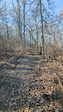
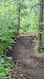
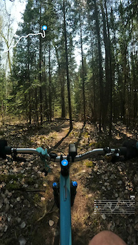
Photos of Manitoba Mountain Bike
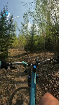
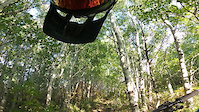
Videos of Manitoba Mountain Bike
trail: Tough Line
0:11 |
32 |
Oct 24, 2025
trail: Tough Line
0:16 |
75 |
Mar 31, 2025
trail: Naurco Flats (1)
3:50 |
13 |
May 15, 2024
trail: Mogul climb
2:25 |
|
May 15, 2024
trail: Paul's Landing
0:07 |
|
Apr 12, 2024
trail: Cindy Lou Who
2:14 |
45 |
Nov 8, 2023
trail: Nimowin Self-guiding Trail
0:10 |
79 |
Aug 3, 2023
trail: Wall Street
0:06 |
184 |
Sep 14, 2022
Activity Feed
| username | action | type | title | date |
|---|---|---|---|---|
| Carriers | wishlist | trail | activity #97354798 | Jun 19, 2026 @ 5:08pm 14 hours |
| James1qZNq4 | ridden | trail | activity #97337971 and 4 more | Jun 19, 2026 @ 12:35pm 18 hours |
| KevinMillerTranscona | comment | route | activity #97230649 | Jun 17, 2026 @ 9:00pm 2 days |
| RussHillman | add | trail | activity #97199207 | Jun 17, 2026 @ 11:36am 3 days |
| Matdeking | wishlist | region | activity #97158057 | Jun 16, 2026 @ 7:49pm Jun 16, 2026 |
Recent Comments
| username | type | title | comment | date |
|---|---|---|---|---|
| trail | Trail under construction till further notice | Jun 11, 2026 @ 6:58pm Jun 11, 2026 | ||
| trail | Had a great MTB ride this weekend. I think... | Jun 8, 2026 @ 10:53am Jun 8, 2026 | ||
| trail | Gravel bike too | May 9, 2026 @ 6:37am May 9, 2026 | ||
| trail | Great for gravel biking | May 9, 2026 @ 6:32am May 9, 2026 | ||
| report | Awesome. Thank you! | May 2, 2026 @ 10:58am May 2, 2026 |
Local Badges
-

Climbing 10k Badge0 awarded -
Climbing 10k Badge3 awarded -
Climbing 10k Badge4 awarded -
Climbing 10k Badge0 awarded -

Mountain Biking 100k Badge0 awarded -
Mountain Biking 100k Badge0 awarded
Bike & Skill Parks
| name | type | city | rating |
|---|---|---|---|
| River's Edge bike Skills park. | skill park | Minnedosa | |
| Blue Highway Skills Area | skill park | West Hawk Lake | |
| Skinnyville | skill park | Dauphin | |
| Ole Heie Skillz Park | skill park | Minnedosa |
Activity Type Stats
| activitytype | trails | distance | descent | descent distance | total vertical | rating | global rank | state rank | photos | reports | routes | ridelogs |
|---|---|---|---|---|---|---|---|---|---|---|---|---|
| Mountain Bike | 1,069 | 1,296 miles | 48,379 ft | 405 miles | 1,759 ft | #44 | 1,964 | 7,920 | 89 | 129,602 | ||
| E-Bike | 587 | 673 miles | 22,346 ft | 221 miles | 1,755 ft | #41 | 14 | 6,797 | 25 | 1,836 | ||
| Gravel Bike | 86 | 131 miles | 4,984 ft | 48 miles | 1,755 ft | #47 | 1 | 1,005 | 21 | 1,141 | ||
| Adaptive Bike | 122 | 118 miles | 3,642 ft | 38 miles | 1,453 ft | #47 | 688 | 3 | 1 | |||
| Winter Fat Bike | 383 | 455 miles | 16,877 ft | 142 miles | 1,736 ft | #24 | 16 | 3,730 | 28 | 248 | ||
| Horse | 113 | 336 miles | 9,856 ft | 136 miles | 1,709 ft | #43 | 4 | 1,960 | 2 | 16 | ||
| Hike | 1,195 | 1,510 miles | 57,910 ft | 475 miles | 2,110 ft | #46 | 633 | 9,063 | 43 | 8,484 | ||
| Trail Running | 1,085 | 1,421 miles | 53,806 ft | 452 miles | 1,900 ft | #46 | 10 | 7,724 | 38 | 7,761 | ||
| Dirtbike/Moto | 5 | 70 miles | 449 ft | 32 miles | 705 ft | #47 | 1,844 | 1 | 44 | |||
| Observed Trials | 2 | 11 miles | 118 ft | 5 miles | 236 ft | #45 | 65 | 7 | ||||
| ATV/ORV/OHV | 23 | 107 miles | 1,132 ft | 46 miles | 1,660 ft | #43 | 1,844 | 1 | 88 | |||
| Snowmobile | 58 | 502 miles | 6,066 ft | 163 miles | 1,663 ft | #21 | 383 | 1 | 118 | |||
| Snowshoe | 431 | 404 miles | 17,612 ft | 127 miles | 1,693 ft | #26 | 127 | 1,102 | 19 | 1,512 | ||
| Downhill Ski | 35 | 6 miles | 5,256 ft | 5 miles | 787 ft | #45 | 383 | 250 | ||||
| Backcountry Ski | 22 | 68 miles | 1,624 ft | 31 miles | 1,667 ft | #37 | 9 | 324 | 2 | 163 | ||
| Nordic Ski | 543 | 499 miles | 12,700 ft | 129 miles | 1,673 ft | #22 | 259 | 2,968 | 35 | 7,302 |
Activities
- Manitoba Mountain Biking Trails
- Manitoba E-Biking Trails
- Manitoba Gravel Biking Trails
- Manitoba Adaptive Biking Trails
- Manitoba Winter Fat Biking Trails
- Manitoba Horseback Trails
- Manitoba Hiking Trails
- Manitoba Trail Running Trails
- Manitoba Dirtbiking Trails
- Manitoba ATVing/Offroading Trails
- Manitoba Snowmobiling Trails
- Manitoba Snowshoeing Trails
- Manitoba Skiing Trails
- Manitoba Backcountry Skiing Trails
- Manitoba Nordic Skiing Trails
Trails
- By canadaka
 Trailforks & contributors
 - Admins: IMBA Canada, brenthillier, adaptivemike, maddy03, MPP, MB, crislabossiere
- #3150 - 58,934 views
- manitoba activity log | embed map of Manitoba mountain bike trails | manitoba mountain biking points of interest polygons
Downloading of trail gps tracks in kml & gpx formats is enabled for Manitoba.
You must login to download files.