close
-
Layers w
- Weather Layers
- Pro
- Pro
- Pro
- Pro
- Pro
- Pro
- More Layers
- Pro
- Pro
- Pro
- Pro
-
Upgrade to

3D
Trail Conditions
- Unknown
- Snow Groomed
- Snow Packed
- Snow Covered
- Snow Cover Partial
- Freeze/thaw Cycle
- Icy
- Prevalent Mud
- Wet
- Variable
- Ideal
- Dry
- Very Dry
Trail Flow (Ridden Direction)
Trailforks scans users ridelogs to determine the most popular direction each trail is ridden. A good flowing trail network will have most trails flowing in a single direction according to their intension.
The colour categories are based on what percentage of riders are riding a trail in its intended direction.
The colour categories are based on what percentage of riders are riding a trail in its intended direction.
- > 96%
- > 90%
- > 80%
- > 70%
- > 50%
- < 50%
- bi-directional trail
- no data
Trail Last Ridden
Trailforks scans ridelogs to determine the last time a trail was ridden.
- < 2 days
- < 1 week
- < 2 weeks
- < 1 month
- < 6 months
- > 6 months
Trail Ridden Direction
The intended direction a trail should be ridden.
- Downhill Only
- Downhill Primary
- Both Directions
- Uphill Primary
- Uphill Only
- One Direction
Contribute Details
Colors indicate trail is missing specified detail.
- Description
- Photos
- Description & Photos
- Videos
Trail Popularity ?
Trailforks scans ridelogs to determine which trails are ridden the most in the last 9 months.
Trails are compared with nearby trails in the same city region with a possible 25 colour shades.
Think of this as a heatmap, more rides = more kinetic energy = warmer colors.
- most popular
- popular
- less popular
- not popular
ATV/ORV/OHV Filter
Max Vehicle Width
inches
US Cell Coverage
Legend

Radar Time
Activity Recordings
Trailforks uses anonymized public activity data.
?
Activity Recordings
Trailforks uses anonymized public activity data.
?
Personal Heatmap
▶
Activity Types
all
/
none
▶
Options
2
Date range
month
–
Winter Trails
Warning
A routing network for winter maps does not exist. Selecting trails using the winter trails layer has been disabled.
Missing Trails
Most Popular
Least Popular
Trails are colored based on popularity. The more popular a trail is, the more red. Less popular trails trend towards green.
Jump Magnitude Heatmap
Heatmap of where riders jump on trails. Zoom in to see individual jumps, click circles to view jump details.
BC Backroad Status
![map legend]()
Service Road Atlas is a free to use, community-driven service for viewing and creating reports on the numerous back-country service roads around B.C. and Alberta.

Slope Aspect
Direction the slope faces
Trails Deemphasized
Trails are shown in grey.
Only show trails with no bike usage.
Suggested Layers
Based on selected activity type
Save the current map location and zoom level as your default home location whenever this page is loaded.
Save
No description for Mankato has been added yet!
Login or register to submit one.
Activities Click to view
- Mountain Bike
50 trails
- E-Bike
23 trails
- Adaptive Bike
0 trails
- Winter Fat Bike
0 trails
- Horse
0 trails
- Hike
42 trails
- Trail Running
42 trails
- Dirtbike/Moto
0 trails
- Observed Trials
0 trails
- ATV/ORV/OHV
0 trails
- Snowmobile
0 trails
- Snowshoe
4 trails
- Downhill Ski
19 trails
- Backcountry Ski
0 trails
- Nordic Ski
0 trails
Region Details
- 22
- 11
- 9
- 8
Region Status
Open as of Apr 22, 2024Stats
- Avg Trail Rating
- Trails (view details)
- 84
- Trails Mountain Bike
- 50
- Trails E-Bike
- 23
- Trails Hike
- 42
- Trails Trail Running
- 42
- Trails Snowshoe
- 4
- Trails Downhill Ski
- 19
- Total Distance
- 74 miles
- Total Descent
- 4,420 ft
- Total Vertical
- 318 ft
- Highest Trailhead
- 1,071 ft
- Reports
- 110
- Photos
- 59
- Ridden Counter
- 4,837
Sub Regions
-
Bluff, Hiniker, and Spring Lake Parks
- 12
-
Ft Lehillier
- 1
- 1
-
Indian Lake Conservation Area
- 1
-
Minneopa State Park
-
Mount Kato
- 8
- 7
- 6
-
Riverfront Park
- 3
Popular Mankato Mountain Biking Trails
• 95 ★ 2.0 • 781 ft • 6 ft • 275 •
Popular blue difficulty singletrack. This mountain bike primary trail can be used one direction. On average it takes 1 minutes to complete this trail.
• 85 ★ 2.0 • 1,968 ft • 62 ft • 272 •
Popular green difficulty singletrack. This mountain bike primary trail can be used one direction. On average it takes 3 minutes to complete this trail.
• 65 ★ 2.4 • 1,910 ft • 22 ft • 271 •
Flat and easy, just winds you around the bottom of the lift and serves as a link. The map calls this The Maze, but the signage calls it Reed's Way.
• 100 ★ 2.0 • 1,158 ft • 21 ft • 270 •
Popular green difficulty singletrack. This mountain bike primary trail can be used one direction. On average it takes minutes to complete this trail.
• 80 ★ 1.0 • 1,634 ft • 22 ft • 270 •
Almost totally flat with just a few little roots here and there. Once you round the lake there is a little woodwork
• 90 ★ 3.5 • 1,399 ft • 29 ft • 268 •
This is a fast and fun descent through a deep forest trail. Fast straight sections and some loose turns make this a great cross country style downhill
• 75 ★ 2.0 • 1,926 ft • 143 ft • 262 •
Pretty easy climb but unrelenting. Winds through a similar forest to Trail.
• 70 ★ 3.4 • 1,425 ft • 5 ft • 249 •
A bit of a mix of intermediate with a few little rooty drops at the bottom. But really not that difficult. Some of the turns are a bit tight, but after the first couple turns you can get some pretty good speed as it runs out to the...
Mankato Mountain Bike Routes
4 miles • 509 ft • 12 • Loop •
Course for the 2024 MN MTB Bluff Riders Charge event for Marathon, Sport, Comp, and Elite classes.
3 miles • 393 ft • 9 • Race •
There are many spectator-friendly spots at Mount Kato to watch the races and cheer the riders on. The...
★ 2.0 • 4 miles • 454 ft • 10 • Loop • Race •
Course for pre-riding the 2018 Minnesota High School Cycling League championship course at Mt Kato in...
★ 2.0 • 3 miles • 393 ft • 9 • Loop • Race •
See official race page for most current accurate information: https://minnesotacycling.org/mount-kato/
3 miles • 393 ft • 9 • Race •
There are many spectator-friendly spots at Mount Kato to watch the races and cheer the riders on. The...
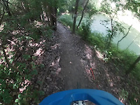
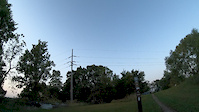
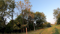
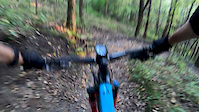
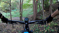
Photos of Mankato Mountain Bike
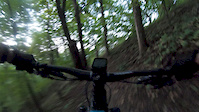
Videos of Mankato Mountain Bike

trail: Green Loop
0:58 |
32 |
Oct 22, 2020
trail: Blue Loop
0:38 |
33 |
Oct 22, 2020
trail: Compresser
0:29 |
86 |
Sep 23, 2019
trail: Luge
0:50 |
126 |
Sep 23, 2019
trail: Ridge Run
0:21 |
124 |
Sep 23, 2019
trail: Dead Horse
0:30 |
248 |
Sep 23, 2019
trail: Mad Squirrel
0:20 |
102 |
Sep 23, 2019
trail: Gets Tight
0:44 |
43 |
Sep 23, 2019
Recent Trail Reports
| status | trail | date | condition | info | user |
|---|---|---|---|---|---|
| Short Loop | Mar 16, 2024 @ 11:32am Mar 16, 2024 | Variable | Jzrrl | ||
| Ridge Run | Sep 16, 2023 @ 1:47am Sep 16, 2023 | Variable | RollerRoller8 | ||
| Staircase | Sep 16, 2023 @ 1:47am Sep 16, 2023 | Variable | RollerRoller8 | ||
| Pink Poodle | Sep 16, 2023 @ 1:47am Sep 16, 2023 | Ideal | RollerRoller8 | ||
| Cabin Run | Sep 16, 2023 @ 1:47am Sep 16, 2023 | Variable | RollerRoller8 | ||
| The Maze (Reed's Way) | Sep 16, 2023 @ 1:47am Sep 16, 2023 | Variable | RollerRoller8 | ||
| Dead Horse | Sep 16, 2023 @ 1:47am Sep 16, 2023 | Ideal | RollerRoller8 | ||
| Killer Toad Loop | Sep 16, 2023 @ 1:47am Sep 16, 2023 | Variable | RollerRoller8 | ||
| Gets Tight | Sep 16, 2023 @ 1:47am Sep 16, 2023 | Variable | RollerRoller8 | ||
| Outlook Traverse | Sep 16, 2023 @ 1:47am Sep 16, 2023 | Variable | RollerRoller8 |
Activity Feed
| username | action | type | title | date |
|---|---|---|---|---|
| WinChester1971 | wishlist | region | activity #94272983 | May 8, 2026 @ 12:06pm May 8, 2026 |
| coreyrich87 | wishlist | region | activity #92699424 | Apr 15, 2026 @ 6:55pm Apr 15, 2026 |
| AChase17 | wishlist | region | activity #89093308 | Feb 17, 2026 @ 2:01pm Feb 17, 2026 |
| AChase17 | wishlist | region | activity #89093195 | Feb 17, 2026 @ 1:59pm Feb 17, 2026 |
| Km2Xe9 | wishlist | region | activity #84208862 | Nov 15, 2025 @ 2:54pm Nov 15, 2025 |
Recent Comments
| username | type | title | comment | date |
|---|---|---|---|---|
| trail | Secret MTB spots if you find them | Mar 11, 2024 @ 5:14pm Mar 11, 2024 |
Local Badges
-

10 Blue Trails57 awarded -

Epic Ride Climb 2k2 awarded -

Climbing 10k Badge7 awarded -

Climbing 100k Badge1 awarded -

Epic Ride Descent 2k2 awarded -

Descent 10k Badge7 awarded
Bike & Skill Parks
| name | type | city | rating |
|---|---|---|---|
| Mount Kato | bike park | Mankato |
Local Mountain Biking Directory
-
Mankato Area Mountain BikersTrail Association
![Mankato Area Mountain Bikers]()
-
Nicollet Bike & SkiBike Shop
![Nicollet Bike & Ski]()
-
Scheels - MankatoBike Shop
![Scheels - Mankato]()
-
University CycleBike Shop
Activity Type Stats
| activitytype | trails | distance | descent | descent distance | total vertical | rating | global rank | state rank | photos | reports | routes | ridelogs |
|---|---|---|---|---|---|---|---|---|---|---|---|---|
| Mountain Bike | 50 | 61 miles | 2,162 ft | 16 miles | 318 ft | #3,503 | #1,194 | 59 | 109 | 7 | 3,283 | |
| E-Bike | 23 | 53 miles | 564 ft | 13 miles | 312 ft | #3,227 | #1,160 | 66 | 136 | |||
| Hike | 42 | 64 miles | 1,106 ft | 17 miles | 318 ft | #4,391 | #1,546 | 93 | 40 | |||
| Trail Running | 42 | 64 miles | 1,106 ft | 17 miles | 318 ft | #3,798 | #1,133 | 93 | 28 | |||
| Snowshoe | 4 | 2 miles | 200 ft | 4,770 ft | 144 ft | #1,488 | #836 | 1 | ||||
| Downhill Ski | 19 | 3 miles | 1,837 ft | 3 miles | 184 ft | #504 | #214 | 1 | 22 |
Frequently Asked Questions About Mankato
▼
What are the best places to ride in Mankato?
Mankato has 9 areas to explore for mountain biking. The top rated areas are:
▼
What are the highest rated mountain biking trails in Mankato?
The highest rated mountain biking trails in Mankato are:
- Sakatah Singing Hills (4.1/5)
- Short Loop (4/5)
- Gets Tight (3.9/5)
- Red Jacket (3.8/5)
- Dead Horse (3.8/5)
▼
What is the best time of the year to ride in Mankato?
Based on ride log data, the most popular months to ride in Mankato are:
- July (31 activities)
- October (24 activities)
- September (23 activities)
▼
Where can I park to ride in Mankato?
There are 13 parking locations listed in Mankato. The most popular parking spots are: View all parking and trailhead locations on the map to plan your visit.
Activities
Trails
- By duggus & contributors
- Admins: MAMB, SeaHag
- #7746 - 5,686 views
- mankato activity log | embed map of Mankato mountain bike trails | mankato mountain biking points of interest
Downloading of trail gps tracks in kml & gpx formats is enabled for Mankato.
You must login to download files.