close
-
Layers w
- Weather Layers
- Pro
- Pro
- Pro
- Pro
- Pro
- Pro
- More Layers
- Pro
- Pro
- Pro
- Pro
-
Upgrade to

3D
Trail Conditions
- Unknown
- Snow Groomed
- Snow Packed
- Snow Covered
- Snow Cover Partial
- Freeze/thaw Cycle
- Icy
- Prevalent Mud
- Wet
- Variable
- Ideal
- Dry
- Very Dry
Trail Flow (Ridden Direction)
Trailforks scans users ridelogs to determine the most popular direction each trail is ridden. A good flowing trail network will have most trails flowing in a single direction according to their intension.
The colour categories are based on what percentage of riders are riding a trail in its intended direction.
The colour categories are based on what percentage of riders are riding a trail in its intended direction.
- > 96%
- > 90%
- > 80%
- > 70%
- > 50%
- < 50%
- bi-directional trail
- no data
Trail Last Ridden
Trailforks scans ridelogs to determine the last time a trail was ridden.
- < 2 days
- < 1 week
- < 2 weeks
- < 1 month
- < 6 months
- > 6 months
Trail Ridden Direction
The intended direction a trail should be ridden.
- Downhill Only
- Downhill Primary
- Both Directions
- Uphill Primary
- Uphill Only
- One Direction
Contribute Details
Colors indicate trail is missing specified detail.
- Description
- Photos
- Description & Photos
- Videos
Trail Popularity ?
Trailforks scans ridelogs to determine which trails are ridden the most in the last 9 months.
Trails are compared with nearby trails in the same city region with a possible 25 colour shades.
Think of this as a heatmap, more rides = more kinetic energy = warmer colors.
- most popular
- popular
- less popular
- not popular
ATV/ORV/OHV Filter
Max Vehicle Width
inches
US Cell Coverage
Legend

Radar Time
Activity Recordings
Trailforks uses anonymized public activity data.
?
Activity Recordings
Trailforks uses anonymized public activity data.
?
Personal Heatmap
▶
Activity Types
all
/
none
▶
Options
2
Date range
month
–
Winter Trails
Warning
A routing network for winter maps does not exist. Selecting trails using the winter trails layer has been disabled.
Missing Trails
Most Popular
Least Popular
Trails are colored based on popularity. The more popular a trail is, the more red. Less popular trails trend towards green.
Jump Magnitude Heatmap
Heatmap of where riders jump on trails. Zoom in to see individual jumps, click circles to view jump details.
BC Backroad Status
![map legend]()
Service Road Atlas is a free to use, community-driven service for viewing and creating reports on the numerous back-country service roads around B.C. and Alberta.

Slope Aspect
Direction the slope faces
Trails Deemphasized
Trails are shown in grey.
Only show trails with no bike usage.
Suggested Layers
Based on selected activity type
Save the current map location and zoom level as your default home location whenever this page is loaded.
Save
No description for Manresa has been added yet!
Login or register to submit one.
This region uses the Uk/Euro style trail grading system.
Activities Click to view
- Mountain Bike
814 trails
- E-Bike
805 trails
- Gravel Bike
0 trails
- Adaptive Bike
34 trails
- Winter Fat Bike
0 trails
- Horse
68 trails
- Hike
774 trails
- Trail Running
774 trails
Region Details
- 181
- 1
- 279
- 247
- 70
- 28
Region Status
Open as of 3 daysStats
- Avg Trail Rating
- Trails (view details)
- 806
- Trails Mountain Bike
- 820
- Trails E-Bike
- 805
- Trails Adaptive Bike
- 34
- Trails Horse
- 68
- Trails Hike
- 774
- Trails Trail Running
- 774
- Trails Dirtbike/Moto
- 3
- Trails Observed Trials
- 1
- Trails ATV/ORV/OHV
- 2
- Total Distance
- 487 miles
- Total Descent
- 99,696 ft
- Total Vertical
- 2,331 ft
- Highest Trailhead
- 2,939 ft
- Reports
- 4,171
- Photos
- 272
- Ridden Counter
- 26,052
Sub Regions
-
Artés
- 12
- 25
- 6
- 2
-
Cardona
- 9
- 3
- 5
- 4
-
El Poal
- 29
- 7
- 2
-
El Serrat de Castellnou
- 89
- 41
- 4
- 1
-
Manresa Est
- 80
- 102
- 22
- 9
-
Manresa Oest
- 1
- 56
- 66
- 29
- 11
Popular Manresa Mountain Biking Trails
• 100 ★ 4.5 • 2,123 ft • 86 ft • 136 •
Popular green difficulty singletrack. This multi-use trail can be used both directions. On average it takes 1 minutes to complete this trail.
• 85 ★ 4.8 • 2,270 ft • 43 ft • 96 •
Popular green difficulty singletrack. This multi-use trail can be used both directions. On average it takes 5 minutes to complete this trail.
• 85 ★ 5.0 • 1,230 ft • 49 ft • 89 •
Popular green difficulty singletrack. This multi-use trail can be used both directions. On average it takes 2 minutes to complete this trail.
• 95 ★ 4.0 • 2,680 ft • 19 ft • 87 •
Popular green difficulty singletrack. This multi-use trail can be used both directions. On average it takes 2 minutes to complete this trail.
• 75 ★ 4.3 • 2 miles • 143 ft • 85 •
Popular blue difficulty singletrack. This multi-use trail can be used downhill primary. On average it takes 13 minutes to complete this trail.
• 100 ★ 5.0 • 2 miles • 312 ft • 85 •
Popular green difficulty singletrack. This multi-use trail can be used both directions. Trail visibility is always easy to follow. On average it takes 12 minutes to complete this trail.
• 70 ★ 0.0 • 1,555 ft • 27 ft • 80 •
Popular green difficulty singletrack. This multi-use trail can be used both directions. On average it takes 2 minutes to complete this trail.
Manresa Mountain Bike Routes
★ 4.0 • 12 miles • 1,449 ft • 13 • Loop •
Empieza en la carretera a unos 200 metros del Pont de Cabrianes (carretera entre Artés y Navarcles), sube...
★ 5.0 • 10 miles • 1,225 ft • 14 • Loop •
Primeros 3 km pisteros Últimos 3 km pisteros Resto del track, superdivertido y con un 90% de Singletrack
28 miles • 5,011 ft • 10 •
recorrido de la Artesenca 2024 - 90% singletrack, disfrutona la bajada, hay que apretar las subidas
21 miles • 2,224 ft • 8 • Loop •
Pedalada popular Senders de Navarcles 2026. Actualment els millors senders de la zona així com els que...
32 miles • 4,454 ft • 31 • Loop •
Recorregut de la Hivernal del Bages 2022 versió llarga. La Hivernal del Bages és una prova no competitiva
57 miles • 7,187 ft • 4 • Loop •
Volta pensada per fer amb bici tipus gravel, tot i que tambè es podría fer amb XC. La base de la ruta es...
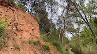
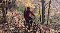
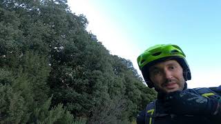
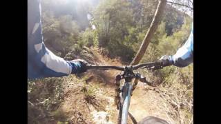
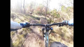
Photos of Manresa Mountain Bike
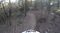
Videos of Manresa Mountain Bike
trail: El Gat Còsmic
0:05 |
21 |
May 13, 2025
trail: La Serra
5:35 |
81 |
Nov 8, 2015
trail: Project
2:42 |
172 |
Feb 19, 2015
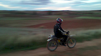
trail: Motos
0:17 |
88 |
Nov 17, 2012
trail: Reixac i les Blanqueres
9:06 |
194 |
Feb 23, 2022 , Manresa
trail: Arboç
3:32 |
195 |
Jan 28, 2022 , Manresa

trail: Romaní
3:58 |
184 |
Jan 28, 2022 , Manresa
trail: Camagroc
3:41 |
198 |
Jan 28, 2022 , Manresa
Recent Trail Reports
| status | trail | date | condition | info | user |
|---|---|---|---|---|---|
| Senyera | Jun 16, 2026 @ 10:03pm (Europe/Madrid) 3 days | Dry | JORDIVT | ||
| Zona Blava | Jun 16, 2026 @ 10:02pm (Europe/Madrid) 3 days | Dry | JORDIVT | ||
| Skilab | Jun 16, 2026 @ 10:00pm (Europe/Madrid) 3 days | Dry | JORDIVT | ||
| Bandera Collbaix | May 17, 2026 @ 6:32pm (Europe/Madrid) May 17, 2026 | Dry | Teomtbtrailforks | ||
| Reixac i les Blanqueres | Jun 7, 2026 @ 9:10pm (Europe/Madrid) Jun 7, 2026 | Variable | IsraRrHOva | ||
| Estenalles a Mura | Jun 7, 2026 @ 9:07pm (Europe/Madrid) Jun 7, 2026 | Dry | IsraRrHOva | ||
| Serra Suanya Final Feliç | Jun 4, 2026 @ 5:09pm (Europe/Madrid) Jun 4, 2026 | Dry | delabozzo | ||
| Bosquet connector | Jun 4, 2026 @ 10:35am (Europe/Madrid) Jun 4, 2026 | Dry | kardi13 TFSPAIN | ||
| Feixa Els Ànecs II | Jun 4, 2026 @ 10:35am (Europe/Madrid) Jun 4, 2026 | Dry | kardi13 TFSPAIN | ||
| Casa de les Tines | Jun 4, 2026 @ 10:35am (Europe/Madrid) Jun 4, 2026 | Dry | kardi13 TFSPAIN |
Activity Feed
| username | action | type | title | date |
|---|---|---|---|---|
| JORDIVT | comment | trail | activity #97133599 | Jun 16, 2026 @ 1:06pm 3 days |
| JORDIVT | add | report | activity #97133209 and 2 more | Jun 16, 2026 @ 1:00pm 3 days |
| JoseAntonionr0LiO | ridden | trail | activity #96698998 | Jun 10, 2026 @ 3:25pm Jun 10, 2026 |
| Teomtbtrailforks | add | report | activity #96556454 and 1 more | Jun 8, 2026 @ 12:12pm Jun 8, 2026 |
| JoseAntonionr0LiO | ridden | trail | activity #96503262 | Jun 7, 2026 @ 3:41pm Jun 7, 2026 |
Recent Comments
| username | type | title | comment | date |
|---|---|---|---|---|
| trail | Baixada molt guapa! Les primeres corbes son... | Jun 16, 2026 @ 1:06pm 3 days | ||
| trail | Brutal! Combinació de tècnica, flow i salts,... | May 13, 2026 @ 5:24am May 13, 2026 | ||
| trail | Baixada exigent, molt i molt guapa!🍯 | May 12, 2026 @ 11:04am May 12, 2026 | ||
| trail | Doble opcional a l’entrada, foto sota... | Mar 17, 2026 @ 1:29pm Mar 17, 2026 | ||
| trail | Molt bona feina 🙌 | Feb 28, 2026 @ 10:32am Feb 28, 2026 |
Local Badges
-

Completionist0 awarded -

Epic Ride 50k2,369 awarded -

Top 10 Trails0 awarded -
Completionist0 awarded -
Completionist0 awarded -
Completionist0 awarded
Activity Type Stats
| activitytype | trails | distance | descent | descent distance | total vertical | rating | global rank | state rank | photos | reports | routes | ridelogs |
|---|---|---|---|---|---|---|---|---|---|---|---|---|
| Mountain Bike | 814 | 487 miles | 99,695 ft | 241 miles | 2,333 ft | #218 | #30 | 267 | 4,171 | 20 | 16,642 | |
| E-Bike | 805 | 474 miles | 97,602 ft | 235 miles | 2,333 ft | #47 | #32 | 5 | 4,166 | 13 | 2,824 | |
| Adaptive Bike | 34 | #329 | #139 | 1 | ||||||||
| Horse | 68 | 39 miles | 4,383 ft | 16 miles | 1,004 ft | #906 | #56 | 14 | ||||
| Hike | 774 | 467 miles | 93,524 ft | 230 miles | 2,333 ft | #159 | #39 | 4,131 | 7 | 660 | ||
| Trail Running | 774 | 467 miles | 93,524 ft | 230 miles | 2,333 ft | #116 | #35 | 4,129 | 2 | 1,174 | ||
| Dirtbike/Moto | 3 | 4 miles | 148 ft | 4,570 ft | 492 ft | 7 | ||||||
| Observed Trials | 1 | 5 | ||||||||||
| ATV/ORV/OHV | 2 | 4,331 ft | 7 ft | 387 ft | 125 ft | 7 | 1 |
Frequently Asked Questions About Manresa
▼
What are the best places to ride in Manresa?
Manresa has 6 areas to explore for mountain biking. The top rated areas are:
▼
What are the highest rated mountain biking trails in Manresa?
The highest rated mountain biking trails in Manresa are:
- Zona Blava (4.5/5)
- Ca l'Aguilar (4.4/5)
- Jarama Flow (4.3/5)
- Ansia (4.3/5)
- LaCalavera Extended (4.3/5)
▼
What is the best time of the year to ride in Manresa?
Based on ride log data, the most popular months to ride in Manresa are:
- December (43 activities)
- May (41 activities)
- November (37 activities)
▼
Where can I park to ride in Manresa?
There are 15 parking locations listed in Manresa. The most popular parking spots are: View all parking and trailhead locations on the map to plan your visit.
Activities
Trails
- By ricardmolins
 & contributors
 - Admins: snaker4, kai-bcn, henrikenduro, Galis, kardi13
- #17592 - 4,441 views
- manresa activity log | embed map of Manresa mountain bike trails | manresa mountain biking points of interest
Downloading of trail gps tracks in kml & gpx formats is enabled for Manresa.
You must login to download files.