close
-
Layers w
- Weather Layers
- Pro
- Pro
- Pro
- Pro
- Pro
- Pro
- More Layers
- Pro
- Pro
- Pro
- Pro
-
Upgrade to

3D
Trail Conditions
- Unknown
- Snow Groomed
- Snow Packed
- Snow Covered
- Snow Cover Partial
- Freeze/thaw Cycle
- Icy
- Prevalent Mud
- Wet
- Variable
- Ideal
- Dry
- Very Dry
Trail Flow (Ridden Direction)
Trailforks scans users ridelogs to determine the most popular direction each trail is ridden. A good flowing trail network will have most trails flowing in a single direction according to their intension.
The colour categories are based on what percentage of riders are riding a trail in its intended direction.
The colour categories are based on what percentage of riders are riding a trail in its intended direction.
- > 96%
- > 90%
- > 80%
- > 70%
- > 50%
- < 50%
- bi-directional trail
- no data
Trail Last Ridden
Trailforks scans ridelogs to determine the last time a trail was ridden.
- < 2 days
- < 1 week
- < 2 weeks
- < 1 month
- < 6 months
- > 6 months
Trail Ridden Direction
The intended direction a trail should be ridden.
- Downhill Only
- Downhill Primary
- Both Directions
- Uphill Primary
- Uphill Only
- One Direction
Contribute Details
Colors indicate trail is missing specified detail.
- Description
- Photos
- Description & Photos
- Videos
Trail Popularity ?
Trailforks scans ridelogs to determine which trails are ridden the most in the last 9 months.
Trails are compared with nearby trails in the same city region with a possible 25 colour shades.
Think of this as a heatmap, more rides = more kinetic energy = warmer colors.
- most popular
- popular
- less popular
- not popular
ATV/ORV/OHV Filter
Max Vehicle Width
inches
US Cell Coverage
Legend

Radar Time
Activity Recordings
Trailforks uses anonymized public activity data.
?
Activity Recordings
Trailforks uses anonymized public activity data.
?
Personal Heatmap
▶
Activity Types
all
/
none
▶
Options
2
Date range
month
–
Winter Trails
Warning
A routing network for winter maps does not exist. Selecting trails using the winter trails layer has been disabled.
Missing Trails
Most Popular
Least Popular
Trails are colored based on popularity. The more popular a trail is, the more red. Less popular trails trend towards green.
Jump Magnitude Heatmap
Heatmap of where riders jump on trails. Zoom in to see individual jumps, click circles to view jump details.
BC Backroad Status
![map legend]()
Service Road Atlas is a free to use, community-driven service for viewing and creating reports on the numerous back-country service roads around B.C. and Alberta.

Slope Aspect
Direction the slope faces
Trails Deemphasized
Trails are shown in grey.
Only show trails with no bike usage.
Suggested Layers
Based on selected activity type
Save the current map location and zoom level as your default home location whenever this page is loaded.
Save
No description for Mansfield has been added yet!
Login or register to submit one.
This region uses the Uk/Euro style trail grading system.
Activities Click to view
- Mountain Bike
98 trails
- E-Bike
71 trails
- Gravel Bike
4 trails
- Adaptive Bike
0 trails
- Winter Fat Bike
0 trails
- Horse
46 trails
- Hike
76 trails
- Trail Running
76 trails
Region Details
- 48
- 4
- 18
- 26
Region Status
Open as of Apr 22, 2026Stats
- Avg Trail Rating
- Trails (view details)
- 96
- Trails Mountain Bike
- 99
- Trails E-Bike
- 71
- Trails Gravel Bike
- 4
- Trails Horse
- 46
- Trails Hike
- 76
- Trails Trail Running
- 76
- Total Distance
- 54 miles
- Total Descent
- 3,671 ft
- Total Vertical
- 213 ft
- Highest Trailhead
- 405 ft
- Reports
- 602
- Photos
- 177
- Ridden Counter
- 31,956
Sub Regions
-
Sherwood Pines
- 2
- 11
- 22
Popular Mansfield Mountain Biking Trails
• 100 ★ 4.5 • 2,474 ft • 61 ft • 1,085 •
Popular red difficulty singletrack. This mountain bike primary trail can be used downhill primary. On average it takes 3 minutes to complete this trail.
• 95 ★ 3.7 • 1,601 ft • 30 ft • 1,084 •
Popular red difficulty singletrack. This mountain bike primary trail can be used downhill primary. On average it takes 1 minutes to complete this trail.
• 100 ★ 4.8 • 2,192 ft • 55 ft • 1,083 •
Popular red difficulty singletrack. This mountain bike primary trail can be used downhill primary. On average it takes 2 minutes to complete this trail.
• 95 ★ 3.5 • 3,419 ft • 73 ft • 1,080 •
Popular red difficulty singletrack. This mountain bike primary trail can be used downhill primary. On average it takes 5 minutes to complete this trail.
• 100 ★ 4.0 • 2,516 ft • 46 ft • 1,075 •
Popular red difficulty singletrack. This mountain bike primary trail can be used downhill primary. On average it takes 2 minutes to complete this trail.
• 95 ★ 4.0 • 2,438 ft • 5 ft • 1,063 •
Popular red difficulty singletrack. This mountain bike primary trail can be used one direction. On average it takes 2 minutes to complete this trail.
• 90 ★ 4.0 • 1,138 ft • 5 ft • 1,051 •
Popular red difficulty singletrack. This mountain bike primary trail can be used downhill primary. On average it takes 1 minutes to complete this trail.
• 100 ★ 4.0 • 1,388 ft • 3 ft • 1,049 •
Popular red difficulty singletrack. This mountain bike primary trail can be used one direction. On average it takes 1 minutes to complete this trail.
Mansfield Mountain Bike Routes
★ 4.0 • 7 miles • 556 ft • 2 • Loop •
Smooth flowing singletrack route with berms, rollers and gentle climbs. Official Blue Route as of July...
17 miles • 849 ft • 0 • Out & Back •
A scenic route from Farnsfield, Nottinghamshire up to Sherwood Pines via Bilsthorpe following the...
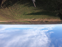
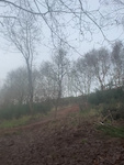
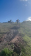
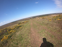
Photos of Mansfield Mountain Bike
Videos of Mansfield Mountain Bike

trail: Thoresby Colliery DH
0:10 |
66 |
Jan 9, 2025
trail: Thoresby Colliery DH
0:16 |
|
Jan 9, 2025
trail: Thoresby Colliery DH
0:12 |
25 |
Jan 9, 2025
trail: Thoresby Colliery DH
0:07 |
83 |
Mar 24, 2024
trail: Thoresby Colliery DH
0:22 |
75 |
Apr 21, 2023
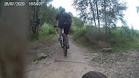
trail: Hellfire Alley
3:19 |
336 |
Jul 31, 2020
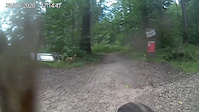
trail: Death Valley
3:01 |
318 |
Jul 31, 2020
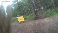
trail: Fifth avenue
0:51 |
72 |
Jul 31, 2020
Recent Trail Reports
| status | trail | date | condition | info | user |
|---|---|---|---|---|---|
| Gas Pipe Cavalry | Apr 22, 2026 @ 2:48pm (Europe/London) Apr 22, 2026 | Dry | reddog77798 | ||
| Death Valley | Apr 22, 2026 @ 2:48pm (Europe/London) Apr 22, 2026 | Ideal | reddog77798 | ||
| 10 Berms | Apr 22, 2026 @ 2:48pm (Europe/London) Apr 22, 2026 | Very Dry | reddog77798 | ||
| Culloden Wood | Apr 22, 2026 @ 2:48pm (Europe/London) Apr 22, 2026 | Ideal | reddog77798 | ||
| Middle | Mar 2, 2026 @ 10:53pm (Europe/London) Mar 2, 2026 | Ideal | Andyscott1547 | ||
| OG Short | Mar 2, 2026 @ 10:53pm (Europe/London) Mar 2, 2026 | Ideal | Andyscott1547 | ||
| Thoresby Colliery DH | Mar 2, 2026 @ 10:53pm (Europe/London) Mar 2, 2026 | Ideal | Andyscott1547 | ||
| Third OG | Mar 2, 2026 @ 10:53pm (Europe/London) Mar 2, 2026 | Ideal | Andyscott1547 | ||
| Mac Long | Mar 2, 2026 @ 10:53pm (Europe/London) Mar 2, 2026 | Ideal | Andyscott1547 | ||
| Hellfire Alley | Oct 27, 2025 @ 1:40pm (Europe/London) Oct 27, 2025 | Wet | jimmyjam4355 |
Activity Feed
| username | action | type | title | date |
|---|---|---|---|---|
| JoshuaAf0RXOC | vote | route | activity #96929641 | Jun 13, 2026 @ 5:46pm Jun 13, 2026 |
| RebeccaJeffery | ridden | route | activity #96041585 | Jun 1, 2026 @ 2:38pm Jun 1, 2026 |
| Trailgirl7 | wishlist | route | activity #94424195 | May 10, 2026 @ 7:18am May 10, 2026 |
| carlessd | wishlist | region | activity #94408347 | May 10, 2026 @ 2:59am May 10, 2026 |
| reddog77798 | add | report | activity #93149907 and 3 more | Apr 22, 2026 @ 8:32am Apr 22, 2026 |
Recent Comments
| username | type | title | comment | date |
|---|---|---|---|---|
| trail | First time Visiting this today. Great few... | Oct 27, 2024 @ 11:56am Oct 27, 2024 | ||
| trail | Great trail for all levels! Can take it steady... | Apr 21, 2023 @ 12:49am Apr 21, 2023 | ||
| trail | This route is way out of date and no longer... | Jul 30, 2022 @ 2:00am Jul 30, 2022 | ||
| trail | This part of the Red trail is no longer here -... | Jul 25, 2022 @ 1:30pm Jul 25, 2022 | ||
| trail | Have been riding Sherwood pines for years as... | Jun 12, 2020 @ 2:08am Jun 12, 2020 |
Local Badges
-

Epic Ride Climb 2k7 awarded -

Climbing 10k Badge64 awarded -

Climbing 100k Badge4 awarded -

Epic Ride Descent 2k8 awarded -

Descent 10k Badge64 awarded -

Descent 100k Badge4 awarded
Bike & Skill Parks
| name | type | city | rating |
|---|---|---|---|
| Sherwood Pines Dirt Jumps | skill park | Mansfield | |
| Kirkby-in-Ashfield play Track | skill park | Mansfield |
Local Mountain Biking Directory
-
On Yer BikeBike Shop
Activity Type Stats
| activitytype | trails | distance | descent | descent distance | total vertical | rating | global rank | state rank | photos | reports | routes | ridelogs |
|---|---|---|---|---|---|---|---|---|---|---|---|---|
| Mountain Bike | 98 | 54 miles | 3,671 ft | 28 miles | 213 ft | #755 | #31 | 175 | 602 | 2 | 16,769 | |
| E-Bike | 71 | 42 miles | 2,598 ft | 22 miles | 213 ft | #1,870 | #70 | 580 | 1 | 4,244 | ||
| Gravel Bike | 4 | #154 | #149 | 5 | 32 | |||||||
| Horse | 46 | 34 miles | 1,831 ft | 18 miles | 177 ft | #914 | #37 | 95 | ||||
| Hike | 76 | 45 miles | 2,848 ft | 24 miles | 213 ft | #3,968 | #86 | 595 | 225 | |||
| Trail Running | 76 | 45 miles | 2,848 ft | 24 miles | 213 ft | #3,330 | #72 | 595 | 346 |
Frequently Asked Questions About Mansfield
▼
What are the best places to ride in Mansfield?
Mansfield has 1 areas to explore for mountain biking. The top rated areas are:
▼
What are the highest rated mountain biking trails in Mansfield?
The highest rated mountain biking trails in Mansfield are:
- Hellfire Alley (4.4/5)
- Tornado Alley (4.3/5)
- Section 1 (4.2/5)
- Thoresby Colliery DH (4.2/5)
- Right Line (4.2/5)
▼
What is the best time of the year to ride in Mansfield?
Based on ride log data, the most popular months to ride in Mansfield are:
- July (43 activities)
- October (43 activities)
- March (40 activities)
▼
Where can I park to ride in Mansfield?
There are 1 parking locations listed in Mansfield. The most popular parking spots are:
Activities
Trails
Points of Interest
- By wisey
 TRAILFORKS & contributors
 - Admins: wisey, MathieuC, cemoorelife
- #11425 - 5,253 views
- mansfield activity log | embed map of Mansfield mountain bike trails | mansfield mountain biking points of interest polygons
Downloading of trail gps tracks in kml & gpx formats is enabled for Mansfield.
You must login to download files.