close
-
Layers w
- Weather Layers
- Pro
- Pro
- Pro
- Pro
- Pro
- Pro
- More Layers
- Pro
- Pro
- Pro
- Pro
-
Upgrade to

3D
Trail Conditions
- Unknown
- Snow Groomed
- Snow Packed
- Snow Covered
- Snow Cover Partial
- Freeze/thaw Cycle
- Icy
- Prevalent Mud
- Wet
- Variable
- Ideal
- Dry
- Very Dry
Trail Flow (Ridden Direction)
Trailforks scans users ridelogs to determine the most popular direction each trail is ridden. A good flowing trail network will have most trails flowing in a single direction according to their intension.
The colour categories are based on what percentage of riders are riding a trail in its intended direction.
The colour categories are based on what percentage of riders are riding a trail in its intended direction.
- > 96%
- > 90%
- > 80%
- > 70%
- > 50%
- < 50%
- bi-directional trail
- no data
Trail Last Ridden
Trailforks scans ridelogs to determine the last time a trail was ridden.
- < 2 days
- < 1 week
- < 2 weeks
- < 1 month
- < 6 months
- > 6 months
Trail Ridden Direction
The intended direction a trail should be ridden.
- Downhill Only
- Downhill Primary
- Both Directions
- Uphill Primary
- Uphill Only
- One Direction
Contribute Details
Colors indicate trail is missing specified detail.
- Description
- Photos
- Description & Photos
- Videos
Trail Popularity ?
Trailforks scans ridelogs to determine which trails are ridden the most in the last 9 months.
Trails are compared with nearby trails in the same city region with a possible 25 colour shades.
Think of this as a heatmap, more rides = more kinetic energy = warmer colors.
- most popular
- popular
- less popular
- not popular
ATV/ORV/OHV Filter
Max Vehicle Width
inches
US Cell Coverage
Legend

Radar Time
Activity Recordings
Trailforks uses anonymized public activity data.
?
Activity Recordings
Trailforks uses anonymized public activity data.
?
Personal Heatmap
▶
Activity Types
all
/
none
▶
Options
2
Date range
month
–
Winter Trails
Warning
A routing network for winter maps does not exist. Selecting trails using the winter trails layer has been disabled.
Missing Trails
Most Popular
Least Popular
Trails are colored based on popularity. The more popular a trail is, the more red. Less popular trails trend towards green.
Jump Magnitude Heatmap
Heatmap of where riders jump on trails. Zoom in to see individual jumps, click circles to view jump details.
BC Backroad Status
![map legend]()
Service Road Atlas is a free to use, community-driven service for viewing and creating reports on the numerous back-country service roads around B.C. and Alberta.

Slope Aspect
Direction the slope faces
Trails Deemphasized
Trails are shown in grey.
Only show trails with no bike usage.
Suggested Layers
Based on selected activity type
Save the current map location and zoom level as your default home location whenever this page is loaded.
Save
No description for Manti has been added yet!
Login or register to submit one.
Activities Click to view
- Mountain Bike
24 trails
- E-Bike
7 trails
- Gravel Bike
1 trails
- Adaptive Bike
0 trails
- Winter Fat Bike
0 trails
- Horse
0 trails
- Hike
25 trails
- Trail Running
25 trails
- Dirtbike/Moto
1 trails
- ATV/ORV/OHV
1 trails
- Snowshoe
0 trails
Region Details
- 3
- 5
- 6
- 1
Region Status
Open as of May 22, 2026Stats
- Avg Trail Rating
- Trails (view details)
- 15
- Trails Mountain Bike
- 25
- Trails E-Bike
- 7
- Trails Gravel Bike
- 1
- Trails Hike
- 25
- Trails Trail Running
- 25
- Trails Dirtbike/Moto
- 1
- Trails ATV/ORV/OHV
- 1
- Total Distance
- 12 miles
- Total Descent
- 2,113 ft
- Total Vertical
- 1,457 ft
- Highest Trailhead
- 6,610 ft
- Reports
- 116
- Photos
- 77
- Ridden Counter
- 885
Sub Regions
-
Dwight's Rocky Point Trail System
- 8
- 2
Popular Manti Mountain Biking Trails
• 100 ★ 0.0 • 1 mile • 3 ft • 131 •
The trail zig zags down to the bottom. Some ledges to go over. Both directions...uphill is a good moderate climb. There is a good view point of the whole back side of the trail system on this trail.
• 90 ★ 0.0 • 3,330 ft • 82 ft • 128 •
Service road to get to the beginning of the from Stitches Trail.
• 80 ★ 0.0 • 1 mile • 68 ft • 126 •
Fun turns and berms and a couple of spots with slickrock. You can go both directions.
• 95 ★ 0.0 • 2,487 ft • 0 ft • 122 •
Fun downhill section with a bunch of large rollers. If you go fast enough, you'll catch some air. You can either connect onto the service road to go ride or turn around and ride back up.
• 70 ★ 3.0 • 1 mile • 122 ft • 53 •
The beginner loop of Dwight's Rocky Point Trail System. One directional trail. Counter clockwise direction.
• 30 ★ 1.0 • 3,117 ft • 9 ft • 35 •
Less popular green difficulty singletrack. This mountain bike primary trail can be used both directions with a 9 ft green climb. It features rock garden. On average it takes 7 minutes to complete this trail.
• 65 ★ 5.0 • 2 miles • 82 ft • 30 •
The is rated blue with black diamond features. It has rocks, bridges, and other technical features on the upper part of the trail. The bottom part has some pretty cool gullies to ride through while riding right by the "G". You can ride...
Manti Mountain Bike Routes
5 miles • 359 ft • 5 •
This is a preliminary mock-up of the UT League NICA course in Gunnison, UT. This still appears to be...
79 miles • 10,742 ft • 120 •
This segment of the GWT largely follows Skyline Drive, a scenic dirt road, before descending into Salina...
2 miles • 100 ft • 0 •
This is a modified version of a loop often used for the mountain bike team practice.
4 miles • 103 ft • 0 • Loop •
This is a route created for mileage (for biking, running, walking, etc).
5 miles • 406 ft • 5 • Race •
This exciting new course in Gunnison combines an equal amount of double and singletrack and is very...
★ 2.5 • 6 miles • 424 ft • 0 • Loop • Race •
2021 High School Race Course Utah NICA, South Region, Race #4
Photos of Manti Mountain Bike
Videos of Manti Mountain Bike

trail: Fireman's
3:48 |
651 |
Nov 27, 2017
youtuber
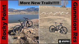
![More & More New Trails Being Built! |...]()

trail: Roasted Starburst
28:16 |
117 |
Nov 16, 2024 , Manti

youtuber
![More & More New Trails Being Built! |...]()

trail: Bone Breaker
28:16 |
113 |
Nov 16, 2024 , Manti
youtuber
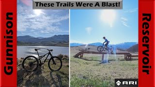
![Who knew the Gunnison Reservoir Trails were so...]()
trail: Roasted Starburst
33:30 |
94 |
May 3, 2024 , Manti
Recent Trail Reports
| status | trail | date | condition | info | user |
|---|---|---|---|---|---|
| X-Ray | May 22, 2026 @ 3:38pm (America/Denver) May 22, 2026 | Dry | FaithToSend | ||
| Stitches | Apr 6, 2026 @ 4:52pm (America/Denver) Apr 6, 2026 | Ideal | quarry | ||
| I.V. Loop Connector | Apr 6, 2026 @ 4:52pm (America/Denver) Apr 6, 2026 | Dry | quarry | ||
| I.V. Loop | Apr 6, 2026 @ 4:52pm (America/Denver) Apr 6, 2026 | Dry | quarry | ||
| Antidote | Feb 28, 2026 @ 4:40pm (America/Denver) Feb 28, 2026 | Dry | mtncrzydadch2017 | ||
| Morphine | Feb 28, 2026 @ 4:40pm (America/Denver) Feb 28, 2026 | Dry | mtncrzydadch2017 | ||
| Grit | Feb 28, 2026 @ 9:41pm (America/Denver) Feb 28, 2026 | Dry | mtncrzydadch2017 | ||
| Enema | Oct 5, 2025 @ 12:23pm (America/Denver) Oct 5, 2025 | Ideal | falcon013 | ||
| Sedation | Oct 5, 2025 @ 12:23pm (America/Denver) Oct 5, 2025 | Ideal | falcon013 | ||
| Vertigo | Oct 5, 2025 @ 12:23pm (America/Denver) Oct 5, 2025 | Ideal | falcon013 |
Activity Feed
| username | action | type | title | date |
|---|---|---|---|---|
| KevinBinggeli | wishlist | route | activity #97162233 | Jun 16, 2026 @ 9:47pm Jun 16, 2026 |
| tterry04 | ridden | trail | activity #95877357 | May 30, 2026 @ 12:23pm May 30, 2026 |
| FaithToSend | add | report | activity #95288375 | May 22, 2026 @ 9:02pm May 22, 2026 |
| jeffoliver1951 | wishlist | trail | activity #92909064 | Apr 18, 2026 @ 5:56pm Apr 18, 2026 |
| quarry | comment | trail | activity #92289709 | Apr 9, 2026 @ 5:05pm Apr 9, 2026 |
Recent Comments
| username | type | title | comment | date |
|---|---|---|---|---|
| trail | Fun techy ride with some interesting and... | Apr 9, 2026 @ 5:05pm Apr 9, 2026 | ||
| trail | Needs more tires to help with the compaction!... | Apr 7, 2026 @ 6:45am Apr 7, 2026 | ||
| trail | This trail is very soft. Excellent little work... | Feb 28, 2026 @ 7:49pm Feb 28, 2026 | ||
| trail | I recommend riding first part of Bone Breaker... | Aug 17, 2024 @ 3:44pm Aug 17, 2024 | ||
| trail | Best trail in the area except the new blue... | Jul 24, 2024 @ 3:36pm Jul 24, 2024 |
Local Badges
-

Epic Ride Climb 2k0 awarded -

Climbing 10k Badge3 awarded -

Climbing 100k Badge0 awarded -

Epic Ride Descent 2k0 awarded -

Descent 10k Badge3 awarded -

Descent 100k Badge0 awarded
Activity Type Stats
| activitytype | trails | distance | descent | descent distance | total vertical | rating | global rank | state rank | photos | reports | routes | ridelogs |
|---|---|---|---|---|---|---|---|---|---|---|---|---|
| Mountain Bike | 24 | 12 miles | 2,113 ft | 5 miles | 1,457 ft | #6,442 | #2,173 | 77 | 116 | 6 | 1,791 | |
| E-Bike | 7 | 5 miles | 1,155 ft | 3 miles | 676 ft | #8,264 | #2,512 | 78 | 2 | 75 | ||
| Gravel Bike | 1 | #726 | #1,228 | |||||||||
| Hike | 25 | 12 miles | 2,113 ft | 5 miles | 1,457 ft | #9,312 | #3,280 | 116 | 2 | 98 | ||
| Trail Running | 25 | 12 miles | 2,113 ft | 5 miles | 1,457 ft | #8,847 | #2,967 | 116 | 2 | 33 | ||
| Dirtbike/Moto | 1 | #1,311 | #537 | 17 | 2 | 10 | ||||||
| ATV/ORV/OHV | 1 | #1,029 | #487 | 17 | 2 | 11 |
Frequently Asked Questions About Manti
▼
What are the best places to ride in Manti?
Manti has 1 areas to explore for mountain biking. The top rated areas are:
▼
What are the highest rated mountain biking trails in Manti?
The highest rated mountain biking trails in Manti are:
- Bone Breaker (4.1/5)
- Duncan's DH (lower section) (4/5)
- Firemans DH Fork (4/5)
- Duncan's DH (upper section) (4/5)
- Fireman's (3.9/5)
▼
What is the best time of the year to ride in Manti?
Based on ride log data, the most popular months to ride in Manti are:
- June (21 activities)
- July (14 activities)
- October (11 activities)
▼
Where can I park to ride in Manti?
There are 1 parking locations listed in Manti. The most popular parking spots are:
Activities
Trails
- By UnicornJerky & contributors
- Admins: jkwilliamz, UtahJohn, jpmcghee, jasonmalczyk, Sanpete
- #20445 - 5,923 views
- manti activity log | embed map of Manti mountain bike trails | manti mountain biking points of interest
Downloading of trail gps tracks in kml & gpx formats is enabled for Manti.
You must login to download files.