close
-
Layers w
- Weather Layers
- Pro
- Pro
- Pro
- Pro
- Pro
- Pro
- More Layers
- Pro
- Pro
- Pro
- Pro
-
Upgrade to

3D
Trail Conditions
- Unknown
- Snow Groomed
- Snow Packed
- Snow Covered
- Snow Cover Partial
- Freeze/thaw Cycle
- Icy
- Prevalent Mud
- Wet
- Variable
- Ideal
- Dry
- Very Dry
Trail Flow (Ridden Direction)
Trailforks scans users ridelogs to determine the most popular direction each trail is ridden. A good flowing trail network will have most trails flowing in a single direction according to their intension.
The colour categories are based on what percentage of riders are riding a trail in its intended direction.
The colour categories are based on what percentage of riders are riding a trail in its intended direction.
- > 96%
- > 90%
- > 80%
- > 70%
- > 50%
- < 50%
- bi-directional trail
- no data
Trail Last Ridden
Trailforks scans ridelogs to determine the last time a trail was ridden.
- < 2 days
- < 1 week
- < 2 weeks
- < 1 month
- < 6 months
- > 6 months
Trail Ridden Direction
The intended direction a trail should be ridden.
- Downhill Only
- Downhill Primary
- Both Directions
- Uphill Primary
- Uphill Only
- One Direction
Contribute Details
Colors indicate trail is missing specified detail.
- Description
- Photos
- Description & Photos
- Videos
Trail Popularity ?
Trailforks scans ridelogs to determine which trails are ridden the most in the last 9 months.
Trails are compared with nearby trails in the same city region with a possible 25 colour shades.
Think of this as a heatmap, more rides = more kinetic energy = warmer colors.
- most popular
- popular
- less popular
- not popular
ATV/ORV/OHV Filter
Max Vehicle Width
inches
US Cell Coverage
Legend

Radar Time
Activity Recordings
Trailforks uses anonymized public activity data.
?
Activity Recordings
Trailforks uses anonymized public activity data.
?
Personal Heatmap
▶
Activity Types
all
/
none
▶
Options
2
Date range
month
–
Winter Trails
Warning
A routing network for winter maps does not exist. Selecting trails using the winter trails layer has been disabled.
Missing Trails
Most Popular
Least Popular
Trails are colored based on popularity. The more popular a trail is, the more red. Less popular trails trend towards green.
Jump Magnitude Heatmap
Heatmap of where riders jump on trails. Zoom in to see individual jumps, click circles to view jump details.
BC Backroad Status
![map legend]()
Service Road Atlas is a free to use, community-driven service for viewing and creating reports on the numerous back-country service roads around B.C. and Alberta.

Slope Aspect
Direction the slope faces
Trails Deemphasized
Trails are shown in grey.
Only show trails with no bike usage.
Suggested Layers
Based on selected activity type
Save the current map location and zoom level as your default home location whenever this page is loaded.
SaveTrails near the Maquinna school. Some are located on city land
Primary Trail Type: Cross-Country
AKA: City Trails
Land Status: City Managed
Land Manager: City of Port Alberni
 google parking directions
 Activities Click to view
- Mountain Bike
49 trails
- E-Bike
12 trails
- Hike
46 trails
- Trail Running
43 trails
Region Details
- 9
- 3
- 26
- 9
- 1
Region Status
Open as of May 9, 2026Stats
- Avg Trail Rating
- Trails (view details)
- 49
- Trails Mountain Bike
- 49
- Trails E-Bike
- 12
- Trails Horse
- 2
- Trails Hike
- 46
- Trails Trail Running
- 43
- Trails Dirtbike/Moto
- 1
- Total Distance
- 34 miles
- Total Descent Distance
- 13 miles
- Total Descent
- 3,615 ft
- Total Vertical
- 1,034 ft
- Highest Trailhead
- 1,063 ft
- Reports
- 299
- Photos
- 177
- Ridden Counter
- 3,751
Popular MaquinnaTrails Mountain Biking Trails
• 100 ★ 4.4 • 4,921 ft • 238 ft • 208 • • mtb
Primarily used by bikers as a climb up to the top of the hill to access and . Trail is wide, multi-use and is mostly smooth with several short steep sections. Also used by hikers and trail runners (and occasionally dirt bikers).
• 100 ★ 4.1 • 2,546 ft • 146 ft • 165 • • mtb
Highly rated popular green difficulty family friendly singletrack. This mountain bike primary trail can be used both directions. On average it takes 7 minutes to complete this trail.
• 95 ★ 4.7 • 2,671 ft • 0 ft • 158 • • mtb
Highly rated popular blue difficulty family friendly singletrack. This mountain bike primary trail and has a moderate overall physical rating with a 0 ft green climb. It features berm and jump. On average it takes 4 minutes to complete this trail.
• 95 ★ 5.0 • 4,242 ft • 50 ft • 134 • • mtb
Popular blue difficulty singletrack. This mountain bike primary trail can be used both directions. It features bridge.
• 95 ★ 0.0 • 1,844 ft • 10 ft • 133 • • mtb
Upper portion of that starts off of Bainbridge 100 FSR
• 100 ★ 4.0 • 1 mile • 235 ft • 131 • • mtb
A fun flowey trail with a few bridges, a couple skinnies, and some tight tree gaps if you're sporting wider handlebars.
MaquinnaTrails Mountain Bike Routes
6 miles • 870 ft • 8 • Loop •
This is the FIRST LAP for the race. Subsequent laps will climb to rather than going up
9 miles • 1,142 ft • 8 • Loop •
A 15 kilometer loop in the Maquinna trail system. Featuring some of the best trails in the Maquinna area,...
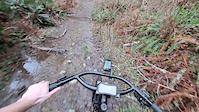
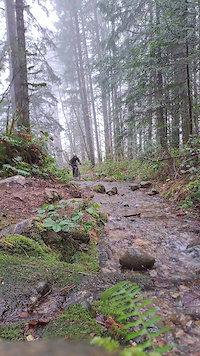
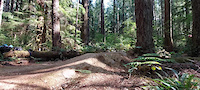
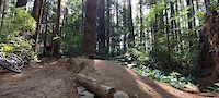
Photos of MaquinnaTrails Mountain Bike
Videos of MaquinnaTrails Mountain Bike
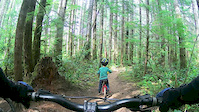
trail: Teleglobe Trail
0:09 |
21 |
Jan 28, 2024
trail: China Creek Trail
0:12 |
27 |
Jan 28, 2024
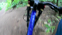
trail: Wheelhouse
0:03 |
30 |
Aug 21, 2022
trail: Wheelhouse
0:03 |
37 |
Aug 21, 2022
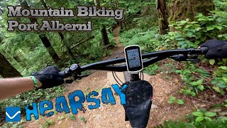
trail: Fir Baby
7:23 |
124 |
Jun 20, 2020
trail: Fir Baby
11:20 |
159 |
Jun 20, 2020
youtuber
![Indecision | Rigid Mountain Biking Port Alberni]()
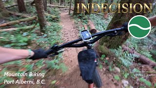
trail: Indecision
4:52 |
68 |
Jun 22, 2025 , Port Alberni
Recent Trail Reports
| status | trail | date | condition | info | user |
|---|---|---|---|---|---|
| Wheelhouse | May 9, 2026 @ 1:59pm (America/Vancouver) May 9, 2026 | Dry | Emdoubleeux | ||
| Wheelhouse | Apr 25, 2026 @ 7:56pm (America/Vancouver) Apr 25, 2026 | Ideal | calebmtb9 | ||
| Fir Baby | Mar 30, 2026 @ 9:10am (America/Vancouver) Mar 30, 2026 | Ideal | dglass ROAV | ||
| Cookies | Mar 15, 2026 @ 7:23pm (America/Vancouver) Mar 15, 2026 | Variable | dglass ROAV | ||
| Cookies Loop | Mar 11, 2026 @ 9:00am (America/Vancouver) Mar 11, 2026 | Variable | jakethesnake04 | ||
| Fir Baby/Indecision Connector | Feb 1, 2026 @ 4:10pm (America/Vancouver) Feb 1, 2026 | Wet | HarperNHleub | ||
| Bear Den Trail | Jan 25, 2026 @ 9:55am (America/Vancouver) Jan 25, 2026 | Ideal | slawsonhere | ||
| Access Road | Jan 25, 2026 @ 9:55am (America/Vancouver) Jan 25, 2026 | Ideal | slawsonhere | ||
| Log Train Trail | Jan 18, 2026 @ 4:33pm (America/Vancouver) Jan 18, 2026 | Ideal | slawsonhere | ||
| Wheelhouse | Nov 10, 2025 @ 10:11am (America/Vancouver) Nov 10, 2025 | Ideal | jakethesnake04 |
Activity Feed
| username | action | type | title | date |
|---|---|---|---|---|
| Korrectc3lHOA | wishlist | trail | activity #95647911 | May 27, 2026 @ 11:13am May 27, 2026 |
| Emdoubleeux | ridden | trail | activity #95634652 | May 27, 2026 @ 8:01am May 27, 2026 |
| Emdoubleeux | wishlist | trail | activity #95634646 and 1 more | May 27, 2026 @ 8:01am May 27, 2026 |
| NAncyBxnA6M | ridden | route | activity #95458419 | May 24, 2026 @ 5:49pm May 24, 2026 |
| twinmike | wishlist | route | activity #94845183 | May 16, 2026 @ 12:58pm May 16, 2026 |
Recent Comments
| username | type | title | comment | date |
|---|---|---|---|---|
| report | Tree still down, plus another one closer to... | Apr 13, 2026 @ 8:45am Apr 13, 2026 | ||
| report | Wrong trail, this report should be for Cookies. | Mar 12, 2026 @ 10:28pm Mar 12, 2026 | ||
| trail | So good | Apr 11, 2025 @ 8:35am Apr 11, 2025 | ||
| trail | The most feature jam packed trail in town! ... | Jun 13, 2024 @ 10:07pm Jun 13, 2024 | ||
| trail | A Port Alberni Classic. love it. | Jun 13, 2024 @ 10:05pm Jun 13, 2024 |
Nearby Areas
| name | distance | ||||
|---|---|---|---|---|---|
| Burde Trails | 1 | 1.8 km | |||
| Coombs Candy | 8 | 23 | 8 | 1 | 3.4 km |
| Sproat Lake | 6 | 11 | 2 | 7.2 km | |
| Horne Lake Caves Provincal Park | 2 | 8.6 km | |||
| Horne Lake | 1 | 2 | 1 | 9.8 km |
Local Badges
-

Completionist2 awarded
Activity Type Stats
| activitytype | trails | distance | descent | descent distance | total vertical | rating | global rank | state rank | photos | reports | routes | ridelogs |
|---|---|---|---|---|---|---|---|---|---|---|---|---|
| Mountain Bike | 49 | 33 miles | 3,570 ft | 12 miles | 1,033 ft | #2,533 | #137 | 173 | 299 | 2 | 4,679 | |
| E-Bike | 12 | 13 miles | 1,348 ft | 4 miles | 1,033 ft | #6,172 | #233 | 219 | 148 | |||
| Horse | 2 | 3 miles | 203 ft | 4,577 ft | 131 ft | 29 | 5 | |||||
| Hike | 46 | 29 miles | 3,258 ft | 11 miles | 748 ft | #5,982 | #246 | 1 | 295 | 260 | ||
| Trail Running | 43 | 28 miles | 3,238 ft | 11 miles | 741 ft | #4,891 | #169 | 3 | 295 | 793 | ||
| Dirtbike/Moto | 1 | 4,367 ft | 295 ft | 26 | 1 |
Frequently Asked Questions About MaquinnaTrails
▼
What are the highest rated mountain biking trails in MaquinnaTrails?
The highest rated mountain biking trails in MaquinnaTrails are:
- Cookies (4.4/5)
- Gordannit (4.3/5)
- Fir Baby (4.3/5)
- Ride Don’t Slide (4.3/5)
- Ship Creek Trail Climb (4.2/5)
▼
What is the best time of the year to ride in MaquinnaTrails?
Based on ride log data, the most popular months to ride in MaquinnaTrails are:
- September (59 activities)
- July (58 activities)
- October (57 activities)
▼
Where can I park to ride in MaquinnaTrails?
There are 3 parking locations listed in MaquinnaTrails. The most popular parking spots are: View all parking and trailhead locations on the map to plan your visit.
▼
What is the longest trail in MaquinnaTrails?
The longest trail in MaquinnaTrails is Log Train Trail at 3.5 km. View all trails sorted by distance.
Activities
Trails
Points of Interest
- By lugylogger & contributors
- Admins: ROAV, ROAV
- #14043 - 6,930 views
- maquinnatrails activity log | embed map of MaquinnaTrails mountain bike trails | maquinnatrails mountain biking points of interest polygons
Downloading of trail gps tracks in kml & gpx formats is enabled for MaquinnaTrails.
You must login to download files.