close
-
Layers w
- Weather Layers
- Pro
- Pro
- Pro
- Pro
- Pro
- Pro
- More Layers
- Pro
- Pro
- Pro
- Pro
-
Upgrade to

3D
Trail Conditions
- Unknown
- Snow Groomed
- Snow Packed
- Snow Covered
- Snow Cover Partial
- Freeze/thaw Cycle
- Icy
- Prevalent Mud
- Wet
- Variable
- Ideal
- Dry
- Very Dry
Trail Flow (Ridden Direction)
Trailforks scans users ridelogs to determine the most popular direction each trail is ridden. A good flowing trail network will have most trails flowing in a single direction according to their intension.
The colour categories are based on what percentage of riders are riding a trail in its intended direction.
The colour categories are based on what percentage of riders are riding a trail in its intended direction.
- > 96%
- > 90%
- > 80%
- > 70%
- > 50%
- < 50%
- bi-directional trail
- no data
Trail Last Ridden
Trailforks scans ridelogs to determine the last time a trail was ridden.
- < 2 days
- < 1 week
- < 2 weeks
- < 1 month
- < 6 months
- > 6 months
Trail Ridden Direction
The intended direction a trail should be ridden.
- Downhill Only
- Downhill Primary
- Both Directions
- Uphill Primary
- Uphill Only
- One Direction
Contribute Details
Colors indicate trail is missing specified detail.
- Description
- Photos
- Description & Photos
- Videos
Trail Popularity ?
Trailforks scans ridelogs to determine which trails are ridden the most in the last 9 months.
Trails are compared with nearby trails in the same city region with a possible 25 colour shades.
Think of this as a heatmap, more rides = more kinetic energy = warmer colors.
- most popular
- popular
- less popular
- not popular
ATV/ORV/OHV Filter
Max Vehicle Width
inches
US Cell Coverage
Legend

Radar Time
Activity Recordings
Trailforks uses anonymized public activity data.
?
Activity Recordings
Trailforks uses anonymized public activity data.
?
Personal Heatmap
▶
Activity Types
all
/
none
▶
Options
2
Date range
month
–
Winter Trails
Warning
A routing network for winter maps does not exist. Selecting trails using the winter trails layer has been disabled.
Missing Trails
Most Popular
Least Popular
Trails are colored based on popularity. The more popular a trail is, the more red. Less popular trails trend towards green.
Jump Magnitude Heatmap
Heatmap of where riders jump on trails. Zoom in to see individual jumps, click circles to view jump details.
BC Backroad Status
![map legend]()
Service Road Atlas is a free to use, community-driven service for viewing and creating reports on the numerous back-country service roads around B.C. and Alberta.

Slope Aspect
Direction the slope faces
Trails Deemphasized
Trails are shown in grey.
Only show trails with no bike usage.
Suggested Layers
Based on selected activity type
Save the current map location and zoom level as your default home location whenever this page is loaded.
Save
No description for Marathon County has been added yet!
Login or register to submit one.
Activities Click to view
- Mountain Bike
164 trails
- E-Bike
61 trails
- Horse
8 trails
- Hike
155 trails
- Trail Running
157 trails
- Snowshoe
43 trails
- Downhill Ski
56 trails
- Nordic Ski
33 trails
Region Details
- 54
- 4
- 36
- 40
- 27
- 3
Stats
- Avg Trail Rating
- Trails (view details)
- 242
- Trails Mountain Bike
- 164
- Trails E-Bike
- 61
- Trails Winter Fat Bike
- 1
- Trails Horse
- 8
- Trails Hike
- 155
- Trails Trail Running
- 157
- Trails ATV/ORV/OHV
- 1
- Trails Snowmobile
- 2
- Trails Snowshoe
- 43
- Trails Downhill Ski
- 56
- Trails Backcountry Ski
- 2
- Trails Nordic Ski
- 33
- Total Distance
- 184 miles
- Total Descent
- 14,524 ft
- Total Vertical
- 1,106 ft
- Highest Trailhead
- 1,966 ft
- Reports
- 644
- Photos
- 98
- Ridden Counter
- 17,498
Sub Regions
- Rothschild (30)
- Wausau (130)
- Big Eau Pleine County Park (13)
- Nine Mile County Forest (52)
- Ringle Trails (31)
- Sylvan Hill Park (24)
Popular Marathon County Mountain Biking Trails
• 95 ★ 4.0 • 2,559 ft • 3 ft • 511 •
Popular blue difficulty singletrack. This mountain bike primary trail can be used both directions. On average it takes 3 minutes to complete this trail.
• 95 ★ 3.7 • 1 mile • 79 ft • 505 •
Popular blue difficulty singletrack. This mountain bike primary trail can be used both directions and has a moderate overall physical rating with a 79 ft blue climb. Trail visibility is always easy to follow. On average it takes 9 minutes to complete this trail.
• 90 ★ 3.6 • 4,603 ft • 96 ft • 500 •
Popular blue difficulty singletrack. This mountain bike primary trail can be used both directions. On average it takes 8 minutes to complete this trail.
• 95 ★ 4.4 • 3,156 ft • 38 ft • 493 •
Popular blue difficulty singletrack. This mountain bike primary trail can be used both directions. On average it takes 3 minutes to complete this trail.
• 95 ★ 4.2 • 4,304 ft • 42 ft • 490 •
Popular blue difficulty singletrack. This mountain bike primary trail can be used both directions. On average it takes 5 minutes to complete this trail.
• 95 ★ 4.0 • 1 mile • 42 ft • 440 •
Popular green difficulty singletrack. This mountain bike primary trail can be used both directions and has a easy overall physical rating with a 42 ft green climb. Trail visibility is always easy to follow. On average it takes 16 minutes to complete this trail.
• 100 ★ 3.4 • 1 mile • 43 ft • 433 •
Popular blue difficulty singletrack. This mountain bike primary trail can be used both directions. On average it takes 6 minutes to complete this trail.
Marathon County Mountain Bike Routes
★ 2.5 • 12 miles • 514 ft • 13 • Loop •
Starting in front of the ski chalet, jump into enjoy a quick curvy cruise. You'll cross ski trails...
• 12 miles • 717 ft • 12 •
• 9 miles • 462 ft • 19 •
• 15 miles • 855 ft • 26 •
• 16 miles • 872 ft • 28 •
• 13 miles • 858 ft • 16 •
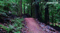
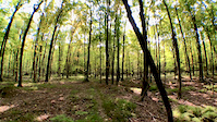
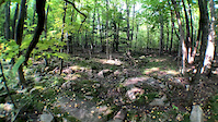
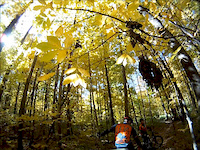
Photos of Marathon County Mountain Bike
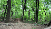
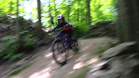
Videos of Marathon County Mountain Bike

trail: Air Style
0:23 |
134 |
Oct 13, 2023

trail: Fly on the Wall
0:12 |
93 |
Aug 14, 2023
trail: Fish Hook
0:28 |
127 |
Aug 24, 2022
trail: Air Style
0:33 |
189 |
Aug 3, 2021
trail: Fish Hook
0:19 |
401 |
Nov 26, 2020
trail: Popcorn
0:11 |
49 |
Sep 26, 2020
trail: Prudential
0:17 |
82 |
Sep 26, 2020
trail: Rebound
3:24 |
547 |
Oct 27, 2014
Recent Trail Reports
Activity Feed
| username | action | type | title | date |
|---|---|---|---|---|
| KellyCUIgQJ | wishlist | region | activity #97055135 | Jun 15, 2026 @ 11:26am Jun 15, 2026 |
| KellyCUIgQJ | wishlist | region | activity #97031551 | Jun 15, 2026 @ 4:08am Jun 15, 2026 |
| mblock | update | trail | activity #96691755 | Jun 10, 2026 @ 1:05pm Jun 10, 2026 |
| cjzanon | wishlist | region | activity #96555197 | Jun 8, 2026 @ 11:54am Jun 8, 2026 |
| cjzanon | wishlist | region | activity #96555188 | Jun 8, 2026 @ 11:53am Jun 8, 2026 |
Recent Comments
| username | type | title | comment | date |
|---|---|---|---|---|
| trail | Not maintained, heavy with Stinging Nettles,... | Jul 5, 2025 @ 11:49am Jul 5, 2025 | ||
| trail | Hard to follow and overgrown with grass. Seems... | Jun 17, 2025 @ 8:21am Jun 17, 2025 | ||
| trail | People were riding the outer loop when I was... | Jun 17, 2025 @ 8:20am Jun 17, 2025 | ||
| trail | Well made, super flowy! | Oct 13, 2023 @ 6:07pm Oct 13, 2023 | ||
| trail | Full disclosure: I also ride trials... | Oct 13, 2023 @ 3:41am Oct 13, 2023 |
Local Badges
-

Epic Mountain Bike Climb 2k0 awarded -

Mountain Biking 100k Badge0 awarded -

Climbing 10k Badge0 awarded -

Epic Ride Descent 2k0 awarded -

Completionist1 awarded -

10 Black Trails53 awarded
Bike & Skill Parks
| name | type | city | rating |
|---|---|---|---|
| Granite Peak Ski Area | bike park | Wausau | |
| Sylvan Hill Pump Track | skill park | Wausau |
Activity Type Stats
| activitytype | trails | distance | descent | descent distance | total vertical | rating | global rank | state rank | photos | reports | routes | ridelogs |
|---|---|---|---|---|---|---|---|---|---|---|---|---|
| Mountain Bike | 164 | 148 miles | 6,260 ft | 67 miles | 538 ft | 93 | 644 | 1 | 10,485 | |||
| E-Bike | 61 | 30 miles | 915 ft | 7 miles | 253 ft | 270 | 1 | 282 | ||||
| Winter Fat Bike | 1 | 9 | ||||||||||
| Horse | 8 | 23 miles | 1,033 ft | 9 miles | 292 ft | 24 | ||||||
| Hike | 155 | 166 miles | 7,251 ft | 71 miles | 1,106 ft | 1 | 611 | 699 | ||||
| Trail Running | 157 | 166 miles | 7,293 ft | 71 miles | 1,106 ft | 612 | 226 | |||||
| ATV/ORV/OHV | 1 | 2,575 ft | 26 ft | 1,818 ft | 33 ft | 24 | 1 | |||||
| Snowmobile | 2 | 5 miles | 115 ft | 2 miles | 187 ft | |||||||
| Snowshoe | 43 | 24 miles | 807 ft | 6 miles | 771 ft | 51 | 132 | |||||
| Downhill Ski | 56 | 13 miles | 6,030 ft | 10 miles | 614 ft | 336 | ||||||
| Backcountry Ski | 2 | 2,789 ft | 13 ft | 686 ft | 26 ft | 2 | ||||||
| Nordic Ski | 33 | 23 miles | 1,444 ft | 9 miles | 167 ft | 28 | 350 |
Frequently Asked Questions About Marathon County
▼
What are the best places to ride in Marathon County?
Marathon County has 9 areas to explore for mountain biking. The top rated areas are:
▼
What are the highest rated mountain biking trails in Marathon County?
The highest rated mountain biking trails in Marathon County are:
- Twisted Oak (4.3/5)
- Sylvan's Run (4.3/5)
- Ringle Trailhead (4.2/5)
- Lost 40 (4.2/5)
- Fish Hook (4.2/5)
▼
What is the best time of the year to ride in Marathon County?
Based on ride log data, the most popular months to ride in Marathon County are:
- July (159 activities)
- June (85 activities)
- August (80 activities)
▼
What is the longest trail in Marathon County?
The longest trail in Marathon County is Mountain-Bay State (Wausau - Shawano) at 46.1 miles. View all trails sorted by distance.
Activities
Trails
- By brenthillier
 NSMBA TRAILFORKS & contributors
 - Admins: MW HIKING, feardabeast, CWOCC
- #10975 - 3,484 views
- marathon county activity log | embed map of Marathon County mountain bike trails | marathon county mountain biking points of interest
Downloading of trail gps tracks in kml & gpx formats is enabled for Marathon County.
You must login to download files.