close
-
Layers w
- Weather Layers
- Pro
- Pro
- Pro
- Pro
- Pro
- Pro
- More Layers
- Pro
- Pro
- Pro
- Pro
-
Upgrade to

3D
Trail Conditions
- Unknown
- Snow Groomed
- Snow Packed
- Snow Covered
- Snow Cover Partial
- Freeze/thaw Cycle
- Icy
- Prevalent Mud
- Wet
- Variable
- Ideal
- Dry
- Very Dry
Trail Flow (Ridden Direction)
Trailforks scans users ridelogs to determine the most popular direction each trail is ridden. A good flowing trail network will have most trails flowing in a single direction according to their intension.
The colour categories are based on what percentage of riders are riding a trail in its intended direction.
The colour categories are based on what percentage of riders are riding a trail in its intended direction.
- > 96%
- > 90%
- > 80%
- > 70%
- > 50%
- < 50%
- bi-directional trail
- no data
Trail Last Ridden
Trailforks scans ridelogs to determine the last time a trail was ridden.
- < 2 days
- < 1 week
- < 2 weeks
- < 1 month
- < 6 months
- > 6 months
Trail Ridden Direction
The intended direction a trail should be ridden.
- Downhill Only
- Downhill Primary
- Both Directions
- Uphill Primary
- Uphill Only
- One Direction
Contribute Details
Colors indicate trail is missing specified detail.
- Description
- Photos
- Description & Photos
- Videos
Trail Popularity ?
Trailforks scans ridelogs to determine which trails are ridden the most in the last 9 months.
Trails are compared with nearby trails in the same city region with a possible 25 colour shades.
Think of this as a heatmap, more rides = more kinetic energy = warmer colors.
- most popular
- popular
- less popular
- not popular
ATV/ORV/OHV Filter
Max Vehicle Width
inches
US Cell Coverage
Legend

Radar Time
Activity Recordings
Trailforks uses anonymized public activity data.
?
Activity Recordings
Trailforks uses anonymized public activity data.
?
Personal Heatmap
▶
Activity Types
all
/
none
▶
Options
2
Date range
month
–
Winter Trails
Warning
A routing network for winter maps does not exist. Selecting trails using the winter trails layer has been disabled.
Missing Trails
Most Popular
Least Popular
Trails are colored based on popularity. The more popular a trail is, the more red. Less popular trails trend towards green.
Jump Magnitude Heatmap
Heatmap of where riders jump on trails. Zoom in to see individual jumps, click circles to view jump details.
BC Backroad Status
![map legend]()
Service Road Atlas is a free to use, community-driven service for viewing and creating reports on the numerous back-country service roads around B.C. and Alberta.

Slope Aspect
Direction the slope faces
Trails Deemphasized
Trails are shown in grey.
Only show trails with no bike usage.
Suggested Layers
Based on selected activity type
Save the current map location and zoom level as your default home location whenever this page is loaded.
Save
No description for Marbella has been added yet!
Login or register to submit one.
This region uses the Uk/Euro style trail grading system.
Activities Click to view
- Mountain Bike
167 trails
- E-Bike
161 trails
- Gravel Bike
7 trails
- Adaptive Bike
7 trails
- Horse
12 trails
- Hike
184 trails
- Trail Running
183 trails
Region Details
- 69
- 5
- 57
- 26
- 6
Region Status
Caution as of 1 dayStats
- Avg Trail Rating
- Trails (view details)
- 175
- Trails Mountain Bike
- 167
- Trails E-Bike
- 161
- Trails Gravel Bike
- 7
- Trails Adaptive Bike
- 7
- Trails Horse
- 12
- Trails Hike
- 184
- Trails Trail Running
- 183
- Total Distance
- 166 miles
- Total Descent
- 39,967 ft
- Total Vertical
- 5,336 ft
- Highest Trailhead
- 5,528 ft
- Reports
- 573
- Photos
- 98
- Ridden Counter
- 4,099
Sub Regions
-
Benahavis
- 2
- 5
-
Coín
- 18
- 1
-
Ojén
- 2
- 20
- 17
- 6
-
Sierra de Las Nieves
- 9
- 3
Popular Marbella Mountain Biking Trails
• 95 ★ 4.3 • 1,808 ft • 18 ft • 154 •
Short and fast trail with couple of features, nothing really big or technical, just be carefull on your first run, as usual. Terrain is mostly sandy and loose at the begining, then is hard soil with some rocks
• 95 ★ 5.0 • 2,516 ft • 25 ft • 142 •
Popular blue difficulty singletrack. This multi-use trail can be used downhill primary. It features jump, rock garden, roller coaster and skinny. Trail visibility is always easy to follow. On average it takes 3 minutes to complete this trail.
• 95 ★ 5.0 • 2,651 ft • 3 ft • 128 •
Popular blue difficulty singletrack. This multi-use trail can be used downhill primary and has a moderate overall physical rating with a 3 ft blue climb. On average it takes 2 minutes to complete this trail.
• 95 ★ 4.6 • 1 mile • 8 ft • 119 •
Known to be the best trail in the area, long, difficult, technical and with lot of features. At the end immediately links to the other known trail "Cerezal" that takes you right to the center of Ojen vIllage.
• 100 ★ 4.0 • 630 ft • 0 ft • 75 •
Popular blue difficulty singletrack. This multi-use trail can be used downhill primary and has a moderate overall physical rating with a 0 ft blue climb. It features jump and rock garden. Trail visibility is always easy to follow. On average it takes 1 minutes to complete this trail.
Marbella Mountain Bike Routes
20 miles • 4,014 ft • 0 • Loop •
Ruta por senderos y pistas por Yunquera, con visita a los miradores de Puerto del Saucillo y Luis Ceballos...
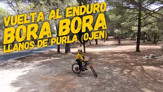
17 miles • 3,710 ft • 16 • Loop • Race •
Enduro villa de Ojén 15 y 16 de noviembre 2025 El sábado habrá entrenamientos no oficiales desde las...
★ 5.0 • 16 miles • 2,878 ft • 4 • Loop • Race •
Third day of the Endurma SunRace 2017, enjoy the best trail in the area, Juanar descent, with a mix of...
★ 5.0 • 16 miles • 3,608 ft • 14 • Loop • Race •
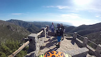
Photos of Marbella Mountain Bike
Videos of Marbella Mountain Bike
trail: Juanar hacia Ojen
4:44 |
303 |
Dec 23, 2018
trail: Juanar hacia Ojen
2:53 |
179 |
Mar 29, 2017
trail: Juanar hacia Ojen
2:50 |
308 |
Jan 30, 2017

youtuber
![♂️⛰ Tramo 3 • You & Me |...]()
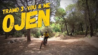
trail: Tramo 3 upper
7:43 |
57 |
Nov 11, 2025 , Marbella
youtuber
![♀️⛰ Cortijo de las Máquinas |...]()
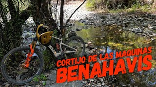
trail: Cortijo de las Máquinas
15:00 |
96 |
Sep 3, 2025 , Marbella
trail: Juanar hacia Ojen
32:44 |
141 |
Jan 12, 2025 , Marbella
Current Trail Warnings
| status | trail | date | condition | user | info |
|---|---|---|---|---|---|
| The Rugby Trail | Jun 2, 2026 @ 9:35am (Europe/Madrid) Jun 2, 2026 | Very Dry | Milan1mfIE1 | Police tape blocking entrance and a big... |
Recent Trail Reports
| status | trail | date | condition | info | user |
|---|---|---|---|---|---|
| The Abandoned House Trail | Jun 2, 2026 @ 9:44am (Europe/Madrid) Jun 2, 2026 | Unknown | Milan1mfIE1 | ||
| Nagüeles | May 31, 2026 @ 1:57pm (Europe/Madrid) May 31, 2026 | Dry | Milan1mfIE1 | ||
| Camino de Parauta a Tolox | Mar 29, 2026 @ 9:47am (Europe/Gibraltar) Mar 29, 2026 | Ideal | erDuende | ||
| Camino de las Cuevas del Moro | Mar 29, 2026 @ 9:47am (Europe/Gibraltar) Mar 29, 2026 | Ideal | erDuende | ||
| PR A 351 Mirador Puerto Saucillo | Mar 6, 2026 @ 11:34am (Europe/Madrid) Mar 6, 2026 | Snow Cover Partial | chipiao | ||
| Guadaiza | Dec 7, 2025 @ 9:28pm (Europe/Madrid) Dec 7, 2025 | Unknown | duartale | ||
| Juanar hacia Ojen | Nov 27, 2025 @ 10:37pm (Europe/Madrid) Nov 27, 2025 | Ideal | sergiogazquez | ||
| AlohaBikes Guadaiza | Aug 7, 2025 @ 4:49am Aug 7, 2025 | Very Dry | allmountrailmtb | ||
| Acceso Linarejos | Dec 27, 2024 @ 9:53am Dec 27, 2024 | Dry | ffQumR | ||
| Rockgarden Arroyo Tejar | Dec 2, 2024 @ 9:59am Dec 2, 2024 | Very Dry | RobDoubleU |
Activity Feed
| username | action | type | title | date |
|---|---|---|---|---|
| Milan1mfIE1 | add | report | activity #96066431 and 1 more | Jun 2, 2026 @ 12:35am Jun 2, 2026 |
| Milan1mfIE1 | comment | report | activity #95927515 | May 31, 2026 @ 4:57am May 31, 2026 |
| Milan1mfIE1 | add | report | activity #95927483 | May 31, 2026 @ 4:57am May 31, 2026 |
| Milan1mfIE1 | wishlist | region | activity #94557621 | May 12, 2026 @ 7:33am May 12, 2026 |
| AMG | update | trail | activity #94372560 and 6 more | May 9, 2026 @ 1:10pm May 9, 2026 |
Recent Comments
| username | type | title | comment | date |
|---|---|---|---|---|
| report | You can go around it from the left. | May 31, 2026 @ 4:57am May 31, 2026 | ||
| trail | Still unridable. Had to turn around and take a... | Nov 19, 2025 @ 7:45am Nov 19, 2025 | ||
| trail | Great trail. | Aug 28, 2025 @ 12:39pm Aug 28, 2025 | ||
| trail | Sucia, poco transitada y muy difícil de... | Aug 5, 2025 @ 11:27am Aug 5, 2025 | ||
| trail | Se sube y se baja por el mismo sitio. | Mar 29, 2025 @ 1:03pm Mar 29, 2025 |
Local Badges
-

10 Blue Trails34 awarded -

10 Black Trails0 awarded -

Epic Ride Climb 2k277 awarded -

Climbing 10k Badge31 awarded -

Climbing 100k Badge3 awarded -

Epic Ride Descent 2k290 awarded
Activity Type Stats
| activitytype | trails | distance | descent | descent distance | total vertical | rating | global rank | state rank | photos | reports | routes | ridelogs |
|---|---|---|---|---|---|---|---|---|---|---|---|---|
| Mountain Bike | 167 | 150 miles | 34,203 ft | 69 miles | 5,335 ft | #1,232 | #119 | 98 | 573 | 13 | 3,238 | |
| E-Bike | 161 | 149 miles | 33,730 ft | 68 miles | 5,335 ft | #248 | #106 | 546 | 4 | 617 | ||
| Gravel Bike | 7 | #211 | #56 | 12 | ||||||||
| Adaptive Bike | 7 | #176 | #99 | |||||||||
| Horse | 12 | 12 miles | 2,310 ft | 6 miles | 2,152 ft | #833 | #45 | 476 | ||||
| Hike | 184 | 166 miles | 39,951 ft | 76 miles | 5,335 ft | #880 | #120 | 563 | 46 | 287 | ||
| Trail Running | 183 | 166 miles | 39,951 ft | 76 miles | 5,335 ft | #647 | #121 | 563 | 62 |
Frequently Asked Questions About Marbella
▼
What are the best places to ride in Marbella?
Marbella has 5 areas to explore for mountain biking. The top rated areas are:
▼
What are the highest rated mountain biking trails in Marbella?
The highest rated mountain biking trails in Marbella are:
- Descenso Puerto Rico (cabra) (4.4/5)
- Juanar hacia Ojen (4.3/5)
- Bora Bora (4.2/5)
- Tramo 3 lower (4.2/5)
- You and me (4.2/5)
▼
What is the best time of the year to ride in Marbella?
Based on ride log data, the most popular months to ride in Marbella are:
- February (31 activities)
- December (31 activities)
- May (29 activities)
▼
Where can I park to ride in Marbella?
There are 2 parking locations listed in Marbella. The most popular parking spots are:
Activities
Trails
- By elyari
 TRAILFORKS TFSPAIN & contributors
 - Admins: AMG, juanx
- #15715 - 12,231 views
- marbella activity log | embed map of Marbella mountain bike trails | marbella mountain biking points of interest
Downloading of trail gps tracks in kml & gpx formats is enabled for Marbella.
You must login to download files.