close
-
Layers w
- Weather Layers
- Pro
- Pro
- Pro
- Pro
- Pro
- Pro
- More Layers
- Pro
- Pro
- Pro
- Pro
-
Upgrade to

3D
Trail Conditions
- Unknown
- Snow Groomed
- Snow Packed
- Snow Covered
- Snow Cover Partial
- Freeze/thaw Cycle
- Icy
- Prevalent Mud
- Wet
- Variable
- Ideal
- Dry
- Very Dry
Trail Flow (Ridden Direction)
Trailforks scans users ridelogs to determine the most popular direction each trail is ridden. A good flowing trail network will have most trails flowing in a single direction according to their intension.
The colour categories are based on what percentage of riders are riding a trail in its intended direction.
The colour categories are based on what percentage of riders are riding a trail in its intended direction.
- > 96%
- > 90%
- > 80%
- > 70%
- > 50%
- < 50%
- bi-directional trail
- no data
Trail Last Ridden
Trailforks scans ridelogs to determine the last time a trail was ridden.
- < 2 days
- < 1 week
- < 2 weeks
- < 1 month
- < 6 months
- > 6 months
Trail Ridden Direction
The intended direction a trail should be ridden.
- Downhill Only
- Downhill Primary
- Both Directions
- Uphill Primary
- Uphill Only
- One Direction
Contribute Details
Colors indicate trail is missing specified detail.
- Description
- Photos
- Description & Photos
- Videos
Trail Popularity ?
Trailforks scans ridelogs to determine which trails are ridden the most in the last 9 months.
Trails are compared with nearby trails in the same city region with a possible 25 colour shades.
Think of this as a heatmap, more rides = more kinetic energy = warmer colors.
- most popular
- popular
- less popular
- not popular
ATV/ORV/OHV Filter
Max Vehicle Width
inches
US Cell Coverage
Legend

Radar Time
Activity Recordings
Trailforks uses anonymized public activity data.
?
Activity Recordings
Trailforks uses anonymized public activity data.
?
Personal Heatmap
▶
Activity Types
all
/
none
▶
Options
2
Date range
month
–
Winter Trails
Warning
A routing network for winter maps does not exist. Selecting trails using the winter trails layer has been disabled.
Missing Trails
Most Popular
Least Popular
Trails are colored based on popularity. The more popular a trail is, the more red. Less popular trails trend towards green.
Jump Magnitude Heatmap
Heatmap of where riders jump on trails. Zoom in to see individual jumps, click circles to view jump details.
BC Backroad Status
![map legend]()
Service Road Atlas is a free to use, community-driven service for viewing and creating reports on the numerous back-country service roads around B.C. and Alberta.

Slope Aspect
Direction the slope faces
Trails Deemphasized
Trails are shown in grey.
Only show trails with no bike usage.
Suggested Layers
Based on selected activity type
Save the current map location and zoom level as your default home location whenever this page is loaded.
Save
No description for Marble Falls has been added yet!
Login or register to submit one.
Activities Click to view
- Mountain Bike
36 trails
- E-Bike
16 trails
- Horse
10 trails
- Hike
33 trails
- Trail Running
33 trails
- Dirtbike/Moto
3 trails
Region Details
- 11
- 1
- 4
- 14
- 5
- 1
Region Status
Open as of 2 daysStats
- Avg Trail Rating
- Trails (view details)
- 39
- Trails Mountain Bike
- 39
- Trails E-Bike
- 16
- Trails Horse
- 10
- Trails Hike
- 33
- Trails Trail Running
- 33
- Trails Dirtbike/Moto
- 3
- Total Distance
- 38 miles
- Total Descent
- 4,778 ft
- Total Vertical
- 650 ft
- Highest Trailhead
- 1,327 ft
- Reports
- 109
- Photos
- 25
- Ridden Counter
- 2,858
Sub Regions
-
Schaffer Bend Recreation Area
- 1
-
Station Mountain Bike Park
- 4
- 9
- 4
- 1
-
Westside Park
- 1
- 4
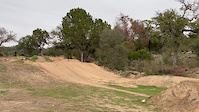
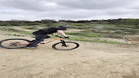
Popular Marble Falls Mountain Biking Trails
• 95 ★ 0.0 • 600 ft • 0 ft • 8 •
Popular blue difficulty singletrack. This multi-use trail can be used both directions and has a easy overall physical rating with a 0 ft green climb. It features skinny. Trail visibility is always easy to follow. On average it takes minutes to complete this trail.
• 75 ★ 0.0 • 1 mile • 31 ft • 7 •
Beautiful Park in Marble Falls. Johnson Park to Westside Park.
• 100 ★ 0.0 • 817 ft • 0 ft • 6 •
Disc golf trail with a semi pump track section
• 90 ★ 0.0 • 1,608 ft • 15 ft • 5 •
Three crosstie wide bridge. Gap between crossties makes it feel like a skinny.
• 85 ★ 0.0 • 854 ft • 10 ft • 2 •
Disc golf trail featuring big pile of dirt on one end and a creek hop on the other.
• 5 ★ 0.0 • 1,923 ft • 122 ft • 1 •
Data obtained from LCRA maps. Difficulty and suitability for mountain biking is unknown. Please comment if you have more information.
Photos of Marble Falls Mountain Bike
Videos of Marble Falls Mountain Bike
trail: 75 Hits Split 3
0:06 |
75 |
Jan 20, 2024
0:05 |
|
Nov 30, 2023

trail: El Cinco
23:30 |
103 |
Apr 10, 2025 , Marble Falls

trail: The Holder
23:30 |
74 |
Apr 10, 2025 , Marble Falls

trail: 75 Hits Split #1
23:30 |
66 |
Apr 10, 2025 , Marble Falls

trail: Nickle And Dime
23:30 |
91 |
Apr 10, 2025 , Marble Falls

trail: Your Mom
23:30 |
70 |
Apr 10, 2025 , Marble Falls

trail: The Holder
22:48 |
194 |
Feb 5, 2024 , Marble Falls
Current Trail Warnings
| status | trail | date | condition | user | info |
|---|---|---|---|---|---|
| Your Mom | Jun 19, 2026 @ 10:44am (America/Chicago) 2 days | Unknown | kingrich225 | Park closed | |
| Your Dad | Jun 19, 2026 @ 10:44am (America/Chicago) 2 days | Unknown | kingrich225 | Park closed | |
| Wide Hips | Jun 19, 2026 @ 10:44am (America/Chicago) 2 days | Unknown | kingrich225 | Park closed |
Recent Trail Reports
| status | trail | date | condition | info | user |
|---|---|---|---|---|---|
| Shuttle Road | Jun 19, 2026 @ 10:44am (America/Chicago) 2 days | Unknown | kingrich225 | ||
| Rhetts Ruts | Jun 19, 2026 @ 10:44am (America/Chicago) 2 days | Unknown | kingrich225 | ||
| Nickle And Dime | Jun 19, 2026 @ 10:44am (America/Chicago) 2 days | Unknown | kingrich225 | ||
| Murica | Jun 19, 2026 @ 10:44am (America/Chicago) 2 days | Unknown | kingrich225 | ||
| Middle Tide | Jun 19, 2026 @ 10:44am (America/Chicago) 2 days | Unknown | kingrich225 | ||
| Middle Tide | Jun 19, 2026 @ 10:44am (America/Chicago) 2 days | Unknown | kingrich225 | ||
| Marble Falls | Jun 19, 2026 @ 10:44am (America/Chicago) 2 days | Unknown | kingrich225 | ||
| Low Tide | Jun 19, 2026 @ 10:44am (America/Chicago) 2 days | Unknown | kingrich225 | ||
| High Tide | Jun 19, 2026 @ 10:44am (America/Chicago) 2 days | Unknown | kingrich225 | ||
| El Cinco | Jun 19, 2026 @ 10:44am (America/Chicago) 2 days | Unknown | kingrich225 |
Activity Feed
| username | action | type | title | date |
|---|---|---|---|---|
| kingrich225 | add | report | activity #97320793 and 23 more | Jun 19, 2026 @ 8:44am 2 days |
| lUBqqLMo | wishlist | region | activity #93361621 | Apr 25, 2026 @ 8:56am Apr 25, 2026 |
| brandonBcKEGu | wishlist | region | activity #92553840 | Apr 13, 2026 @ 12:46pm Apr 13, 2026 |
| Frozentater | wishlist | region | activity #92069758 | Apr 6, 2026 @ 12:09pm Apr 6, 2026 |
| xRLG6H | wishlist | region | activity #87509449 | Jan 19, 2026 @ 8:35pm Jan 19, 2026 |
Recent Comments
| username | type | title | comment | date |
|---|---|---|---|---|
| trail | All trails except for Dagger are green double... | Dec 27, 2022 @ 2:12pm Dec 27, 2022 |
Local Badges
-

Epic Mountain Bike Climb 2k3 awarded -

Climbing 10k Badge0 awarded -

Mountain Biking 100k Badge0 awarded -

Epic Ride Descent 2k3 awarded -

Descent 10k Badge0 awarded -

Descent 100k Badge0 awarded
Bike & Skill Parks
| name | type | city | rating |
|---|---|---|---|
| Station Mountain Bike Park | bike park | Marble Falls | |
| Station Mountain Base Jump Zone | skill park | Marble Falls | |
| Station Mountain Drop Zone | skill park | Marble Falls |
Activity Type Stats
| activitytype | trails | distance | descent | descent distance | total vertical | rating | global rank | state rank | photos | reports | routes | ridelogs |
|---|---|---|---|---|---|---|---|---|---|---|---|---|
| Mountain Bike | 36 | 13 miles | 1,877 ft | 7 miles | 650 ft | #3,281 | #1,125 | 27 | 109 | 486 | ||
| E-Bike | 16 | 4 miles | 1,099 ft | 3 miles | 315 ft | #4,679 | #1,496 | 108 | 96 | |||
| Horse | 10 | 5 miles | 174 ft | 2 miles | 190 ft | #1,990 | #1,112 | 16 | ||||
| Hike | 33 | 8 miles | 650 ft | 3 miles | 561 ft | #6,511 | #2,295 | 109 | 123 | |||
| Trail Running | 33 | 8 miles | 650 ft | 3 miles | 561 ft | #6,645 | #2,163 | 109 | 18 | |||
| Dirtbike/Moto | 3 | 25 miles | 2,900 ft | 10 miles | 354 ft | #785 | #279 | 16 | 17 |
Frequently Asked Questions About Marble Falls
▼
What are the best places to ride in Marble Falls?
Marble Falls has 6 areas to explore for mountain biking. The top rated areas are:
▼
What are the highest rated mountain biking trails in Marble Falls?
The highest rated mountain biking trails in Marble Falls are:
- 75 Hits Split 2 (4.1/5)
- Your Mom (4.1/5)
- 75 Hits Split #1 (4.1/5)
- 75 Hits Split 3 (4.1/5)
- Disc Golf Trail (0/5)
▼
What is the best time of the year to ride in Marble Falls?
Based on ride log data, the most popular months to ride in Marble Falls are:
- April (5 activities)
- March (3 activities)
- August (2 activities)
▼
Where can I park to ride in Marble Falls?
There are 5 parking locations listed in Marble Falls. The most popular parking spots are: View all parking and trailhead locations on the map to plan your visit.
Activities
Trails
Points of Interest
- By HiddenFallsAdventurePark & contributors
- Admins: ARR
- #22037 - 6,015 views
- marble falls activity log | embed map of Marble Falls mountain bike trails | marble falls mountain biking points of interest
Downloading of trail gps tracks in kml & gpx formats is enabled for Marble Falls.
You must login to download files.