close
-
Layers w
- Weather Layers
- Pro
- Pro
- Pro
- Pro
- Pro
- Pro
- More Layers
- Pro
- Pro
- Pro
- Pro
-
Upgrade to

3D
Trail Conditions
- Unknown
- Snow Groomed
- Snow Packed
- Snow Covered
- Snow Cover Partial
- Freeze/thaw Cycle
- Icy
- Prevalent Mud
- Wet
- Variable
- Ideal
- Dry
- Very Dry
Trail Flow (Ridden Direction)
Trailforks scans users ridelogs to determine the most popular direction each trail is ridden. A good flowing trail network will have most trails flowing in a single direction according to their intension.
The colour categories are based on what percentage of riders are riding a trail in its intended direction.
The colour categories are based on what percentage of riders are riding a trail in its intended direction.
- > 96%
- > 90%
- > 80%
- > 70%
- > 50%
- < 50%
- bi-directional trail
- no data
Trail Last Ridden
Trailforks scans ridelogs to determine the last time a trail was ridden.
- < 2 days
- < 1 week
- < 2 weeks
- < 1 month
- < 6 months
- > 6 months
Trail Ridden Direction
The intended direction a trail should be ridden.
- Downhill Only
- Downhill Primary
- Both Directions
- Uphill Primary
- Uphill Only
- One Direction
Contribute Details
Colors indicate trail is missing specified detail.
- Description
- Photos
- Description & Photos
- Videos
Trail Popularity ?
Trailforks scans ridelogs to determine which trails are ridden the most in the last 9 months.
Trails are compared with nearby trails in the same city region with a possible 25 colour shades.
Think of this as a heatmap, more rides = more kinetic energy = warmer colors.
- most popular
- popular
- less popular
- not popular
ATV/ORV/OHV Filter
Max Vehicle Width
inches
US Cell Coverage
Legend

Radar Time
Activity Recordings
Trailforks uses anonymized public activity data.
?
Activity Recordings
Trailforks uses anonymized public activity data.
?
Personal Heatmap
▶
Activity Types
all
/
none
▶
Options
2
Date range
month
–
Winter Trails
Warning
A routing network for winter maps does not exist. Selecting trails using the winter trails layer has been disabled.
Missing Trails
Most Popular
Least Popular
Trails are colored based on popularity. The more popular a trail is, the more red. Less popular trails trend towards green.
Jump Magnitude Heatmap
Heatmap of where riders jump on trails. Zoom in to see individual jumps, click circles to view jump details.
BC Backroad Status
![map legend]()
Service Road Atlas is a free to use, community-driven service for viewing and creating reports on the numerous back-country service roads around B.C. and Alberta.

Slope Aspect
Direction the slope faces
Trails Deemphasized
Trails are shown in grey.
Only show trails with no bike usage.
Suggested Layers
Based on selected activity type
Save the current map location and zoom level as your default home location whenever this page is loaded.
Save
No description for Maria Alm has been added yet!
Login or register to submit one.
This region uses the Uk/Euro style trail grading system.
Activities Click to view
- Mountain Bike
8 trails
- E-Bike
6 trails
- Gravel Bike
0 trails
- Adaptive Bike
0 trails
- Winter Fat Bike
0 trails
- Hike
4 trails
- Trail Running
4 trails
- Backcountry Ski
4 trails
Region Details
- 4
- 1
- 2
Region Status
Caution as of Apr 4, 2026Stats
- Avg Trail Rating
- Trails (view details)
- 12
- Trails Mountain Bike
- 8
- Trails E-Bike
- 6
- Trails Hike
- 4
- Trails Trail Running
- 4
- Trails Backcountry Ski
- 4
- Total Distance
- 14 miles
- Total Descent
- 4,708 ft
- Total Vertical
- 6,192 ft
- Highest Trailhead
- 6,543 ft
- Reports
- 20
- Photos
- 41
- Ridden Counter
- 491
Popular Maria Alm Mountain Biking Trails
• 90 ★ 4.5 • 2 miles • 200 ft • 88 •
Im ersten Abschnitt geht's ab der neuen Natrunbahn Bergstation über einen auf der Piste integrierten Trail bis zur alten Talstation. Der 2019 von Allegra umgebaute und sanierte Flow One Trail zieht sich nun neu ab der alten Bergstation...
• 100 ★ 4.8 • 810 ft • 12 ft • 78 •
250m lang ‐startet die 2019 neu gebaute Flow One Tec Sec mit einem kleinen Rockgarden gefolgt von einem Step Up. Danach finden sich zwischen den vier eher speedigen Steilwandkurven ein "Jump übers Moos" gefolgt von einem...
• 40 ★ 5.0 • 2 miles • 50 ft • 9 •
The is a nice diverse mostly machine groomed singletrack trail of medium difficulty that offers a lot of optional jump, long traverses, tighter and open fast turns, some rooty sections and all kind of features. You can reach the trail...
Maria Alm Mountain Bike Routes
63 miles • 14,770 ft • 6 • Loop •
It's a route in three legs from Maria Alm to Dienten to Mühlbach and back to Maria Alm. During the summer...
48 miles • 12,024 ft • 3 • Loop •
The light version of the Königstour, also in three legs but with the use of cable cars.
103 miles • 24,095 ft • 3 • Loop •
This is the biggest version of the Königstour and includes the whole Hochkönig region around Maria Alm,...
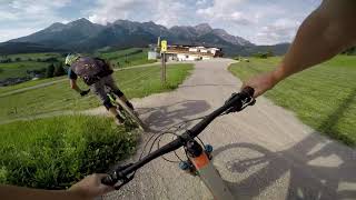
Photos of Maria Alm Mountain Bike
Videos of Maria Alm Mountain Bike
trail: Flow One Natrun - TecSec
5:52 |
494 |
Aug 13, 2019 , Maria Alm

trail: Flow One Natrun
5:52 |
1019 |
Aug 2, 2019 , Maria Alm
Recent Trail Reports
| status | trail | date | condition | info | user |
|---|---|---|---|---|---|
| Traudi Trail - Primbachsattel (intermediate - mittelschwierig) | Oct 6, 2025 @ 1:20am (America/Vancouver) Oct 6, 2025 | Variable | ChrisPosch | ||
| Uphill Natrun | Mar 22, 2025 @ 12:40pm Mar 22, 2025 | Dry | DanielyTzUFE | ||
| Flow One Natrun | Aug 5, 2022 @ 2:08am Aug 5, 2022 | Dry | SlayerHippie | ||
| Flow One Natrun - TecSec | Apr 18, 2022 @ 8:43am Apr 18, 2022 | Variable | colp |
Activity Feed
| username | action | type | title | date |
|---|---|---|---|---|
| Benni12345 | wishlist | trail | activity #96228860 | Jun 4, 2026 @ 8:13am Jun 4, 2026 |
| muerte | wishlist | route | activity #91721511 | Apr 1, 2026 @ 12:03pm Apr 1, 2026 |
| colliin | wishlist | route | activity #90545984 | Mar 14, 2026 @ 6:24am Mar 14, 2026 |
| geertb9oLQn | wishlist | trail | activity #90172797 | Mar 7, 2026 @ 9:45pm Mar 7, 2026 |
| ChrisPosch | checkin | trail | activity #81810010 | Oct 6, 2025 @ 1:20am Oct 6, 2025 |
Recent Comments
| username | type | title | comment | date |
|---|---|---|---|---|
| trail | thks. I ll let our trail crew know | Jan 22, 2021 @ 12:29pm Jan 22, 2021 | ||
| trail | This section is great fun :-) | Oct 10, 2020 @ 11:31am Oct 10, 2020 | ||
| report | Some sections are closed due trail work | Oct 20, 2019 @ 1:02pm Oct 20, 2019 |
Activity Type Stats
| activitytype | trails | distance | descent | descent distance | total vertical | rating | global rank | state rank | photos | reports | routes | ridelogs |
|---|---|---|---|---|---|---|---|---|---|---|---|---|
| Mountain Bike | 8 | 5 miles | 1,434 ft | 2 miles | 3,747 ft | #3,736 | #38 | 45 | 20 | 3 | 351 | |
| E-Bike | 6 | 3 miles | 33 ft | 712 ft | 1,447 ft | #3,395 | #52 | 13 | 3 | 161 | ||
| Hike | 4 | 3 miles | 151 ft | 2,001 ft | 1,447 ft | #5,654 | #70 | 11 | 106 | |||
| Trail Running | 4 | 3 miles | 151 ft | 2,001 ft | 1,447 ft | #5,137 | #62 | 11 | 36 | |||
| Backcountry Ski | 4 | 9 miles | 3,156 ft | 3 miles | 3,668 ft | #38 | #12 | 95 |
Frequently Asked Questions About Maria Alm
▼
What are the highest rated mountain biking trails in Maria Alm?
The highest rated mountain biking trails in Maria Alm are:
- Flow One Natrun - TecSec (4.3/5)
- Flow One Natrun (4.2/5)
- Traudi Trail - Primbachsattel (intermediate - mittelschwierig) (4.1/5)
▼
What is the best time of the year to ride in Maria Alm?
Based on ride log data, the most popular months to ride in Maria Alm are:
- July (4 activities)
- August (4 activities)
- January (2 activities)
▼
Where can I park to ride in Maria Alm?
There are 2 parking locations listed in Maria Alm. The most popular parking spots are:
▼
What is the longest trail in Maria Alm?
The longest trail in Maria Alm is Flow One Natrun at 2.1 miles. View all trails sorted by distance.
Trails
- By Demo4life
 & contributors
 - Admins: ktm-boy-69, lgs1
- #30348 - 3,629 views
- maria alm activity log | embed map of Maria Alm mountain bike trails | maria alm mountain biking points of interest
Downloading of trail gps tracks in kml & gpx formats is enabled for Maria Alm.
You must login to download files.