close
-
Layers w
- Weather Layers
- Pro
- Pro
- Pro
- Pro
- Pro
- Pro
- More Layers
- Pro
- Pro
- Pro
- Pro
-
Upgrade to

3D
Trail Conditions
- Unknown
- Snow Groomed
- Snow Packed
- Snow Covered
- Snow Cover Partial
- Freeze/thaw Cycle
- Icy
- Prevalent Mud
- Wet
- Variable
- Ideal
- Dry
- Very Dry
Trail Flow (Ridden Direction)
Trailforks scans users ridelogs to determine the most popular direction each trail is ridden. A good flowing trail network will have most trails flowing in a single direction according to their intension.
The colour categories are based on what percentage of riders are riding a trail in its intended direction.
The colour categories are based on what percentage of riders are riding a trail in its intended direction.
- > 96%
- > 90%
- > 80%
- > 70%
- > 50%
- < 50%
- bi-directional trail
- no data
Trail Last Ridden
Trailforks scans ridelogs to determine the last time a trail was ridden.
- < 2 days
- < 1 week
- < 2 weeks
- < 1 month
- < 6 months
- > 6 months
Trail Ridden Direction
The intended direction a trail should be ridden.
- Downhill Only
- Downhill Primary
- Both Directions
- Uphill Primary
- Uphill Only
- One Direction
Contribute Details
Colors indicate trail is missing specified detail.
- Description
- Photos
- Description & Photos
- Videos
Trail Popularity ?
Trailforks scans ridelogs to determine which trails are ridden the most in the last 9 months.
Trails are compared with nearby trails in the same city region with a possible 25 colour shades.
Think of this as a heatmap, more rides = more kinetic energy = warmer colors.
- most popular
- popular
- less popular
- not popular
ATV/ORV/OHV Filter
Max Vehicle Width
inches
US Cell Coverage
Legend

Radar Time
Activity Recordings
Trailforks uses anonymized public activity data.
?
Activity Recordings
Trailforks uses anonymized public activity data.
?
Personal Heatmap
▶
Activity Types
all
/
none
▶
Options
2
Date range
month
–
Winter Trails
Warning
A routing network for winter maps does not exist. Selecting trails using the winter trails layer has been disabled.
Missing Trails
Most Popular
Least Popular
Trails are colored based on popularity. The more popular a trail is, the more red. Less popular trails trend towards green.
Jump Magnitude Heatmap
Heatmap of where riders jump on trails. Zoom in to see individual jumps, click circles to view jump details.
BC Backroad Status
![map legend]()
Service Road Atlas is a free to use, community-driven service for viewing and creating reports on the numerous back-country service roads around B.C. and Alberta.

Slope Aspect
Direction the slope faces
Trails Deemphasized
Trails are shown in grey.
Only show trails with no bike usage.
Suggested Layers
Based on selected activity type
Save the current map location and zoom level as your default home location whenever this page is loaded.
Save
No description for Marina has been added yet!
Login or register to submit one.
Activities Click to view
- Mountain Bike
104 trails
- Gravel Bike
1 trails
- Adaptive Bike
0 trails
- Hike
113 trails
- Trail Running
112 trails
Region Details
- 13
- 86
- 5
Region Status
Open as of Jun 2, 2026Stats
- Avg Trail Rating
- Trails (view details)
- 105
- Trails Mountain Bike
- 113
- Trails E-Bike
- 3
- Trails Gravel Bike
- 1
- Trails Horse
- 1
- Trails Hike
- 113
- Trails Trail Running
- 112
- Total Distance
- 71 miles
- Total Descent
- 5,853 ft
- Total Vertical
- 875 ft
- Highest Trailhead
- 881 ft
- Reports
- 531
- Photos
- 39
- Ridden Counter
- 36,279
Sub Regions
-
Happy Trails
- 85
- 4
Popular Marina Mountain Biking Trails
• 100 ★ 3.0 • 3,147 ft • 64 ft • 1,117 •
Popular green difficulty singletrack. This mountain bike primary trail can be used both directions and has a easy overall physical rating with a 64 ft green climb. On average it takes 3 minutes to complete this trail.
• 95 ★ 4.0 • 703 ft • 14 ft • 876 •
Popular green difficulty singletrack. This mountain bike primary trail can be used both directions and has a easy overall physical rating with a 14 ft green climb. On average it takes minutes to complete this trail.
• 90 ★ 4.4 • 5,213 ft • 43 ft • 693 •
This is the main trail that takes you out from 8th Ave and Gigling Rd out to the Fort Ord National Monument trail system. Although it is billed as an easy trail, it can get quite sandy during the dry season and has a couple dip sections...
• 95 ★ 4.5 • 1,585 ft • 33 ft • 676 •
Popular green difficulty singletrack. This mountain bike primary trail can be used both directions and has a easy overall physical rating with a 33 ft green climb. On average it takes 1 minutes to complete this trail.
• 100 ★ 5.0 • 529 ft • 0 ft • 671 •
Popular green difficulty singletrack. This mountain bike primary trail can be used both directions and has a easy overall physical rating with a 0 ft green climb. On average it takes minutes to complete this trail.
• 75 ★ 3.0 • 2,819 ft • 121 ft • 657 •
Popular green difficulty singletrack. This mountain bike primary trail can be used both directions and has a easy overall physical rating with a 121 ft green climb. On average it takes 3 minutes to complete this trail.
• 95 ★ 5.0 • 1,061 ft • 0 ft • 613 •
Popular green difficulty singletrack. This mountain bike primary trail can be used both directions and has a easy overall physical rating with a 0 ft green climb. On average it takes minutes to complete this trail.
• 90 ★ 5.0 • 1,908 ft • 26 ft • 582 •
This is a twisty turny trail thorough the trees. It can be a fast ride down, but the brake bumps tend to roughen up the ride. There is a good size drop at the end that can hang up the new riders but is totally ridable down.
Marina Mountain Bike Routes
★ 3.5 • 8 miles • 774 ft • 7 •
Extremely fun beginner loop without any crazy long climbing, and hits some of the most fun trails in Fort...
28 miles • 2,927 ft • 21 • Loop •
A tour of most of the top singletrack at Fort Ord National Monument, including north, south, and central...
16 miles • 1,286 ft • 9 • Loop •
A loop in Fort Order that includes a nice downhill of trail 50 and 82. There is a nice climb up trail 49...
18 miles • 1,802 ft • 17 • Loop •
An 18 mile loop. 90% on numbered trails, 10% on fireroads, some gravel and asphalt.
22 miles • 2,474 ft • 25 • Loop •
A climbers dream ride through Fort Ord. Accessed near the DoD building parking lot.
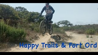
Photos of Marina Mountain Bike
Videos of Marina Mountain Bike
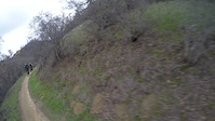
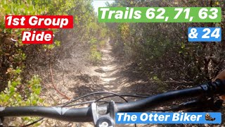
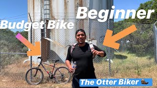
trail: Powerline Trail
2:11 |
113 |
Jan 10, 2016
trail: Powerline Trail
3:22 |
112 |
Jan 10, 2016
trail: Powerline Trail
3:17 |
196 |
Jan 10, 2016
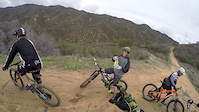
trail: Trail C-50
7:36 |
492 |
Nov 5, 2020 , Marina

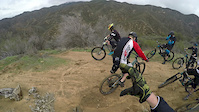
trail: Trail C-61
7:36 |
340 |
Nov 5, 2020 , Marina
trail: Old Trail 24
10:02 |
469 |
Jul 22, 2020 , Marina

trail: Trail C-49
8:37 |
655 |
May 20, 2020 , Marina
trail: Trail C-41
8:37 |
684 |
May 20, 2020 , Marina
Recent Trail Reports
| status | trail | date | condition | info | user |
|---|---|---|---|---|---|
| Tower Link Trail | Jun 2, 2026 @ 11:20am (America/Los_Angeles) Jun 2, 2026 | Ideal | haoike | ||
| Powerline Trail | Jun 1, 2026 @ 9:18am (America/Los_Angeles) Jun 1, 2026 | Very Dry | MOCOLOCALS | ||
| Parker to Anchor | Feb 21, 2026 @ 9:12am (America/Los_Angeles) Feb 21, 2026 | Variable | ABHORRANCE831 | ||
| Trail C-86 | Feb 21, 2026 @ 9:12am (America/Los_Angeles) Feb 21, 2026 | Variable | ABHORRANCE831 | ||
| Sidewalk Trail | Feb 21, 2026 @ 9:12am (America/Los_Angeles) Feb 21, 2026 | Variable | ABHORRANCE831 | ||
| Bushy Downhill | Feb 14, 2026 @ 9:20am (America/Los_Angeles) Feb 14, 2026 | Ideal | ABHORRANCE831 | ||
| Bushy Flat | Feb 14, 2026 @ 9:20am (America/Los_Angeles) Feb 14, 2026 | Ideal | ABHORRANCE831 | ||
| Lion's Revenge Road | Feb 14, 2026 @ 9:20am (America/Los_Angeles) Feb 14, 2026 | Ideal | ABHORRANCE831 | ||
| Trail 16 East | Feb 14, 2026 @ 9:20am (America/Los_Angeles) Feb 14, 2026 | Ideal | ABHORRANCE831 | ||
| Ranger Trail | Feb 14, 2026 @ 9:20am (America/Los_Angeles) Feb 14, 2026 | Ideal | ABHORRANCE831 |
Activity Feed
| username | action | type | title | date |
|---|---|---|---|---|
| EdwardP41QB6 | comment | trail | activity #96760880 | Jun 11, 2026 @ 2:16pm Jun 11, 2026 |
| EdwardP41QB6 | comment | trail | activity #96695686 | Jun 10, 2026 @ 2:16pm Jun 10, 2026 |
| haoike | add | report | activity #96165842 | Jun 3, 2026 @ 10:33am Jun 3, 2026 |
| MOCOLOCALS | add | report | activity #96101137 | Jun 2, 2026 @ 12:02pm Jun 2, 2026 |
| l0sts1gnal | add | route | activity #96025326 | Jun 1, 2026 @ 10:04am Jun 1, 2026 |
Recent Comments
| username | type | title | comment | date |
|---|---|---|---|---|
| trail | From Bushie flat. This is guttedit out.... | Jun 11, 2026 @ 2:16pm Jun 11, 2026 | ||
| trail | Beautiful views overlooking canyon | Jun 10, 2026 @ 2:17pm Jun 10, 2026 | ||
| trail | Not gravel road this is a trail | Jun 10, 2026 @ 2:16pm Jun 10, 2026 | ||
| trail | good info | May 5, 2026 @ 8:10pm May 5, 2026 | ||
| report | This trail was just freshly worked on very... | Jan 26, 2026 @ 3:53pm Jan 26, 2026 |
Local Badges
-

10 Green Trails338 awarded -

Epic Ride Climb 2k4 awarded -

Climbing 10k Badge10 awarded -

Climbing 100k Badge0 awarded -

Epic Ride Descent 2k4 awarded -

Descent 10k Badge10 awarded
Bike & Skill Parks
| name | type | city | rating |
|---|---|---|---|
| Marina Pump Track | skill park | Marina |
Activity Type Stats
| activitytype | trails | distance | descent | descent distance | total vertical | rating | global rank | state rank | photos | reports | routes | ridelogs |
|---|---|---|---|---|---|---|---|---|---|---|---|---|
| Mountain Bike | 104 | 70 miles | 5,686 ft | 33 miles | 876 ft | #660 | #246 | 45 | 542 | 18 | 5,902 | |
| E-Bike | 3 | 1 mile | 184 ft | 4,767 ft | 269 ft | 4 | 511 | 3 | 264 | |||
| Gravel Bike | 1 | #617 | #1,143 | 1 | 30 | |||||||
| Horse | 1 | 53 | 1 | 1 | ||||||||
| Hike | 113 | 71 miles | 5,853 ft | 34 miles | 876 ft | #3,293 | #1,158 | 542 | 1 | 342 | ||
| Trail Running | 112 | 70 miles | 5,686 ft | 33 miles | 876 ft | #2,731 | #776 | 542 | 1 | 773 |
Frequently Asked Questions About Marina
▼
What are the best places to ride in Marina?
Marina has 1 areas to explore for mountain biking. The top rated areas are:
▼
What are the highest rated mountain biking trails in Marina?
The highest rated mountain biking trails in Marina are:
- Trail C-49 (4.3/5)
- Trail C-55 (4.1/5)
- Trail C-60 (4.1/5)
- Trail C-51 Spur (4.1/5)
- Trail C-48 (4.1/5)
▼
What is the best time of the year to ride in Marina?
Based on ride log data, the most popular months to ride in Marina are:
- July (41 activities)
- June (40 activities)
- October (39 activities)
▼
Where can I park to ride in Marina?
There are 1 parking locations listed in Marina. The most popular parking spots are:
- By brenthillier
 NSMBA TRAILFORKS & contributors
 - Admins: MORCA, SOC
- #14077 - 6,228 views
- marina activity log | embed map of Marina mountain bike trails | marina mountain biking points of interest
Downloading of trail gps tracks in kml & gpx formats is enabled for Marina.
You must login to download files.