close
-
Layers w
- Weather Layers
- Pro
- Pro
- Pro
- Pro
- Pro
- Pro
- More Layers
- Pro
- Pro
- Pro
- Pro
-
Upgrade to

3D
Trail Conditions
- Unknown
- Snow Groomed
- Snow Packed
- Snow Covered
- Snow Cover Partial
- Freeze/thaw Cycle
- Icy
- Prevalent Mud
- Wet
- Variable
- Ideal
- Dry
- Very Dry
Trail Flow (Ridden Direction)
Trailforks scans users ridelogs to determine the most popular direction each trail is ridden. A good flowing trail network will have most trails flowing in a single direction according to their intension.
The colour categories are based on what percentage of riders are riding a trail in its intended direction.
The colour categories are based on what percentage of riders are riding a trail in its intended direction.
- > 96%
- > 90%
- > 80%
- > 70%
- > 50%
- < 50%
- bi-directional trail
- no data
Trail Last Ridden
Trailforks scans ridelogs to determine the last time a trail was ridden.
- < 2 days
- < 1 week
- < 2 weeks
- < 1 month
- < 6 months
- > 6 months
Trail Ridden Direction
The intended direction a trail should be ridden.
- Downhill Only
- Downhill Primary
- Both Directions
- Uphill Primary
- Uphill Only
- One Direction
Contribute Details
Colors indicate trail is missing specified detail.
- Description
- Photos
- Description & Photos
- Videos
Trail Popularity ?
Trailforks scans ridelogs to determine which trails are ridden the most in the last 9 months.
Trails are compared with nearby trails in the same city region with a possible 25 colour shades.
Think of this as a heatmap, more rides = more kinetic energy = warmer colors.
- most popular
- popular
- less popular
- not popular
ATV/ORV/OHV Filter
Max Vehicle Width
inches
US Cell Coverage
Legend

Radar Time
Activity Recordings
Trailforks uses anonymized public activity data.
?
Activity Recordings
Trailforks uses anonymized public activity data.
?
Personal Heatmap
▶
Activity Types
all
/
none
▶
Options
2
Date range
month
–
Winter Trails
Warning
A routing network for winter maps does not exist. Selecting trails using the winter trails layer has been disabled.
Missing Trails
Most Popular
Least Popular
Trails are colored based on popularity. The more popular a trail is, the more red. Less popular trails trend towards green.
Jump Magnitude Heatmap
Heatmap of where riders jump on trails. Zoom in to see individual jumps, click circles to view jump details.
BC Backroad Status
![map legend]()
Service Road Atlas is a free to use, community-driven service for viewing and creating reports on the numerous back-country service roads around B.C. and Alberta.

Slope Aspect
Direction the slope faces
Trails Deemphasized
Trails are shown in grey.
Only show trails with no bike usage.
Suggested Layers
Based on selected activity type
Save the current map location and zoom level as your default home location whenever this page is loaded.
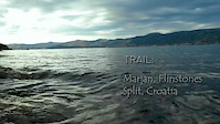
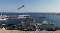
SaveMarjan is a hill on the peninsula of the city of Split, largest city of Croatia's Dalmatia region. It is covered in a dense Mediterranean pine forest and completely surrounded by the city and the sea, making it a unique sight. Originally used as a park by the citizens as early as the 3rd century, it is a favorite weekend excursion destination and a recreational center for the city. It is also the setting for numerous beaches and jogging trails as well as tennis courts and the city Zoo, all surrounded by the scenic forest. The tip of the peninsula houses the Institute of Oceanography and Fisheries.
Marjan is 178 m tall and offers a view of the entire city, the surrounding islands, and the nearby mountains of Mosor and Kozjak.
Marjan is 178 m tall and offers a view of the entire city, the surrounding islands, and the nearby mountains of Mosor and Kozjak.
Primary Trail Type: Cross-Country
Land Status: Community Forest
 google parking directions
This region uses the Uk/Euro style trail grading system.
Activities Click to view
- Mountain Bike
22 trails
- Hike
21 trails
- Trail Running
21 trails
Region Details
- 5
- 2
- 12
- 1
- 1
Region Status
Open as of Mar 8, 2026Stats
- Avg Trail Rating
- Trails (view details)
- 22
- Trails Mountain Bike
- 22
- Trails E-Bike
- 1
- Trails Winter Fat Bike
- 1
- Trails Hike
- 21
- Trails Trail Running
- 21
- Total Distance
- 11 miles
- Total Descent
- 3,319 ft
- Total Vertical
- 503 ft
- Highest Trailhead
- 511 ft
- Reports
- 48
- Photos
- 21
- Ridden Counter
- 1,386
Popular Marjan Mountain Biking Trails
• 65 ★ 4.2 • 4,463 ft • 149 ft • 80 •
Highly rated moderately popular blue difficulty singletrack. This mountain bike primary trail can be used downhill primary and has a moderate overall physical rating with a 149 ft blue climb. On average it takes 8 minutes to complete this trail.
• 90 ★ 0.0 • 2,294 ft • 42 ft • 77 •
Popular blue difficulty singletrack. This mountain bike primary trail can be used downhill primary and has a easy overall physical rating with a 42 ft black diamond climb. It features jump. On average it takes 3 minutes to complete this trail.
• 80 ★ 4.0 • 2,770 ft • 53 ft • 70 •
Popular blue difficulty wilderness trail. This mountain bike primary trail can be used downhill primary and has a moderate overall physical rating. It features rock face. On average it takes 4 minutes to complete this trail.
• 60 ★ 4.5 • 2,772 ft • 108 ft • 68 •
Moderately popular blue difficulty singletrack. This mountain bike primary trail can be used downhill primary and has a moderate overall physical rating with a 108 ft blue climb. On average it takes 7 minutes to complete this trail.
• ★ 4.0 • 1,860 ft • 7 ft • 58 •
Blue difficulty wilderness trail. This mountain bike primary trail can be used downhill only and has a moderate overall physical rating. On average it takes 7 minutes to complete this trail.
• ★ 4.4 • 4,510 ft • 36 ft • 51 •
Green difficulty singletrack. This mountain bike primary trail can be used downhill primary and has a easy overall physical rating. On average it takes 8 minutes to complete this trail.
• ★ 0.0 • 1,674 ft • 30 ft • 45 •
Green difficulty singletrack. This mountain bike primary trail can be used downhill primary and has a easy overall physical rating. It features drop, jump and pump track. On average it takes 2 minutes to complete this trail.
Photos of Marjan Mountain Bike
Videos of Marjan Mountain Bike
trail: Flinstones
2:19 |
1104 |
Apr 22, 2014
trail: Girometta
2:01 |
439 |
Jan 20, 2013
Recent Trail Reports
| status | trail | date | condition | info | user |
|---|---|---|---|---|---|
| Flinstones | Mar 8, 2026 @ 3:49pm (Europe/Zagreb) Mar 8, 2026 | Dry | TomaCube | ||
| Voćkina - Južna transfer | Sep 25, 2024 @ 9:29am Sep 25, 2024 | Wet | jeffnelson19784 | ||
| Voćkina | Sep 25, 2024 @ 9:29am Sep 25, 2024 | Wet | jeffnelson19784 | ||
| Đumbirova | Sep 25, 2024 @ 9:29am Sep 25, 2024 | Wet | jeffnelson19784 | ||
| Vatrogasni | Sep 25, 2024 @ 9:29am Sep 25, 2024 | Wet | jeffnelson19784 | ||
| Vrata - Vrh | Apr 8, 2023 @ 7:31am Apr 8, 2023 | Ideal | milanZg | ||
| Sedlo - Vrh | Oct 11, 2022 @ 2:29pm Oct 11, 2022 | Dry | virtujozo | ||
| Do druge vode | Oct 5, 2022 @ 12:53am Oct 5, 2022 | Ideal | Flow-24 | ||
| Labirint | Oct 5, 2022 @ 12:53am Oct 5, 2022 | Ideal | Flow-24 | ||
| Girometta | Oct 5, 2022 @ 12:53am Oct 5, 2022 | Ideal | Flow-24 |
Activity Feed
| username | action | type | title | date |
|---|---|---|---|---|
| Felixzjd0mG | wishlist | trail | activity #97793897 | Jun 25, 2026 @ 2:36pm 2 days |
| redguy13 | difficultyvote | trail | activity #95190815 | May 21, 2026 @ 11:40am May 21, 2026 |
| KerstinwSBVA1 | vote | trail | activity #91580957 | Mar 30, 2026 @ 5:45am Mar 30, 2026 |
| KerstinwSBVA1 | vote | trail | activity #91543253 | Mar 29, 2026 @ 12:44pm Mar 29, 2026 |
| TimoPucher | wishlist | region | activity #91281661 | Mar 25, 2026 @ 1:17pm Mar 25, 2026 |
Recent Comments
| username | type | title | comment | date |
|---|---|---|---|---|
| trail | There are a few older dirt jumps on this trail... | Oct 7, 2023 @ 8:36am Oct 7, 2023 | ||
| trail | Nice trail, Rocky, downhill only. Some steep... | Aug 11, 2020 @ 2:53pm Aug 11, 2020 | ||
| trail | Black diamond only if you are begginer on xc... | Jan 20, 2017 @ 11:28pm Jan 20, 2017 |
Nearby Areas
| name | distance | ||||
|---|---|---|---|---|---|
| Kozjak | 1 | 1 | 3.8 km | ||
| Perun | 2 | 5 | 1 | 1 | 12.3 km |
| Poljička Planina | 1 | 1 | 12.4 km | ||
| Hvar | 4 | 1 | 26.9 km | ||
| Komiža | 2 | 36.2 km |
Activity Type Stats
| activitytype | trails | distance | descent | descent distance | total vertical | rating | global rank | state rank | photos | reports | routes | ridelogs |
|---|---|---|---|---|---|---|---|---|---|---|---|---|
| Mountain Bike | 22 | 11 miles | 3,320 ft | 6 miles | 502 ft | #1,659 | #11 | 21 | 47 | 3,121 | ||
| E-Bike | 1 | 38 | 448 | |||||||||
| Winter Fat Bike | 1 | #4,819 | #15 | 1 | ||||||||
| Hike | 21 | 10 miles | 3,140 ft | 6 miles | 502 ft | #1,903 | #18 | 45 | 160 | |||
| Trail Running | 21 | 10 miles | 3,140 ft | 6 miles | 502 ft | #1,193 | #17 | 45 | 351 |
Frequently Asked Questions About Marjan
▼
What are the highest rated mountain biking trails in Marjan?
The highest rated mountain biking trails in Marjan are:
- To the sea (4.2/5)
- Vinkova Oputina (4.1/5)
- Dobra (4.1/5)
- Institut (4.1/5)
- Do druge vode (4.1/5)
▼
What is the best time of the year to ride in Marjan?
Based on ride log data, the most popular months to ride in Marjan are:
- October (15 activities)
- July (13 activities)
- August (11 activities)
▼
Where can I park to ride in Marjan?
▼
What is the longest trail in Marjan?
The longest trail in Marjan is Institut at 1.4 km. View all trails sorted by distance.
- By Mitsuoka & contributors
- Admins: apply
- #10033 - 12,544 views
- marjan activity log | embed map of Marjan mountain bike trails | marjan mountain biking points of interest
Downloading of trail gps tracks in kml & gpx formats is enabled for Marjan.
You must login to download files.